Waukegan (/wɔːˈkiːɡən/), is the most populous city in and the county seat of Lake County, Illinois, United States. An industrial suburb of Chicago, Waukegan is situated approximately 26 miles (42 km) north of Chicago’s city limits. As of the 2020 census, the population of the city was 89,321, ranking it the seventh most populous city within the Chicago metropolitan area, and the tenth most populous city in Illinois.
Waukegan has a significant working-class population, as well as some poor areas within the city. Additionally, Waukegan has a moderately sized middle-class community that exists within the city.
| Name: | Waukegan city |
|---|---|
| LSAD Code: | 25 |
| LSAD Description: | city (suffix) |
| State: | Illinois |
| County: | Lake County |
| Founded: | 1829 |
| Elevation: | 715 ft (218 m) |
| Land Area: | 24.22 sq mi (62.72 km²) |
| Water Area: | 0.26 sq mi (0.66 km²) 0.99% |
| Population Density: | 3,688.36/sq mi (1,424.06/km²) |
| Area code: | 847 & 224 |
| FIPS code: | 1779293 |
| Website: | www.waukeganil.gov |
Online Interactive Map
Click on ![]() to view map in "full screen" mode.
to view map in "full screen" mode.
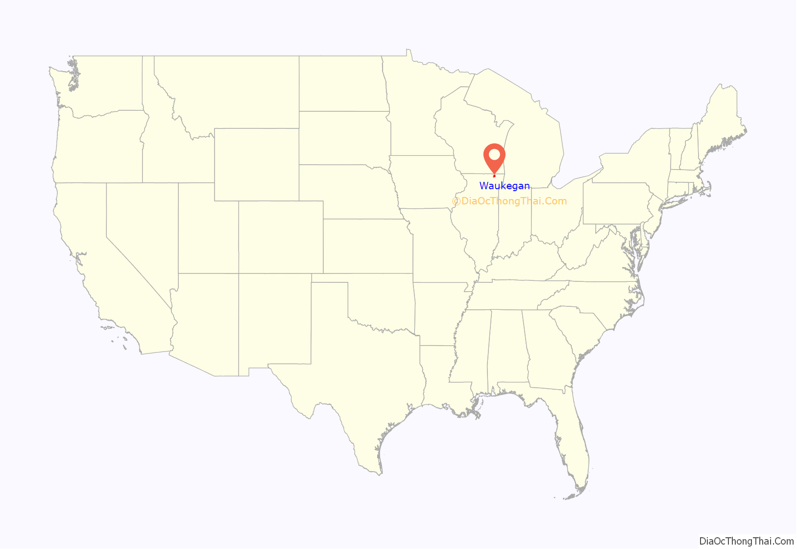
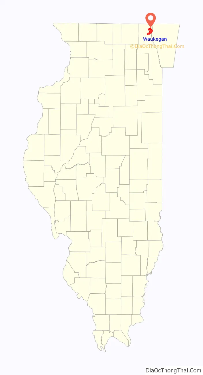
Waukegan location map. Where is Waukegan city?
History
Founding and 19th century
The site of present-day Waukegan was recorded as Rivière du Vieux Fort (“Old Fort River”) and Wakaygagh on a 1778 map by Thomas Hutchins. By the 1820s, the French name had become “Small Fort River” in English, and the settlement was known as “Little Fort”. The name “Waukegance” and then “Waukegan” (meaning “little fort”; cf. Potawatomi wakaigin “fort” or “fortress”) was created by John H. Kinzie and Solomon Juneau, and the new name was adopted on March 31, 1849.
Waukegan had an abolitionist community dating to these early days. In 1853, residents commemorated the anniversary of emancipation of slaves in the British Empire with a meeting. Waukegan arguably has the distinction of being the only place where Abraham Lincoln failed to finish a speech; when he campaigned in the town in 1860, a fire alarm rang, and the man soon-to-be president had his words interrupted.
During the middle of the 19th century, Waukegan was becoming an important industrial hub. Industries included: ship and wagon building, flour milling, sheep raising, pork packing, and dairying. William Besley’s Waukegan Brewing Company was one of the most successful of these businesses, being able to sell beyond America. The construction of the Chicago and Milwaukee Railway through Waukegan by 1855 stimulated the growth and rapid transformation and development of the city’s industry, so much that nearly one thousand ships were visiting Waukegan harbor every year. During the 1860s, a substantial German population began to grow inside the city
Waukegan’s development began in many ways with the arrival of industries such as United States Sugar Refinery, which opened in 1890, Washburn & Moen, a barbed-wire manufacturer that prompted both labor migration and land speculation beginning in 1891, U.S. Starch Works, and Thomas Brass and Iron Works. Immigrants followed, mostly from southeastern Europe and Scandinavia, with especially large groups from Sweden, Finland, and Lithuania. The town also became home to a considerable Armenian population. One member of this community, Monoog Curezhin, even became embroiled in an aborted plot to assassinate Sultan Abdul Hamid II, reviled for his involvement in massacres of Armenians in the Ottoman Empire. Curezhin lost two fingers on his right hand while testing explosives for this purpose in Waukegan in 1904.
20th Century
By the 1920s and 1930s, African-Americans began to migrate to the city, mostly from the south. The town was no stranger to racial strife. In June 1920, an African-American boy allegedly hit the car of an off-duty sailor from nearby Great Lakes Naval Base with a rock, and hundreds of white sailors gathered at Sherman House, a hotel reserved for African-Americans. Although newspaper reports and rumors suggested that the officer’s wife was hit with glass from the broken windshield, subsequent reports revealed that the officer was not married. The sailors cried “lynch ’em,” but were successfully kept back by the intervention of the police.
Marines and sailors renewed their attack on the hotel several days later. The Sherman’s residents fled for their lives as the military members carried torches, gasoline, and the American flag. The Waukegan police once again turned them away, but not before firing and wounding two members of the crowd. The police were not always so willing to protect Waukegan’s citizens. The chief of police and the state’s attorney in the 1920s, for example, were avowed members of the Ku Klux Klan, facts that came to light when a wrongfully convicted African-American war veteran was released from prison on appeal after 25 years. Labor unrest also occurred regularly. In 1919, a strike at the US Steel and Wire Company – which had acquired Washburn & Moen – led to a call for intervention from the state militia.
Noted organized crime boss Johnny Torrio served time in Waukegan’s Lake County jail in 1925. He installed bulletproof covers on the windows of his cell at his own expense for fear of assassination attempts.
The Waukegan urban area developed independently of Chicago, before being officially incorporated into the Chicago metropolitan area during the 2000 census. This inclusion took place as a result of suburban sprawl, affectively dissolving the region’s identity as self-standing. Despite this, Waukegan has retained a distinct industrial character in contrast to many of the residential suburbs along Chicago’s North Shore. The financial disparity created by the disappearance of manufacturing from the city in part contributed to the Waukegan riot of 1966. Central to this event and the remainder of Waukegan’s 20th century history was Robert Sabonjian, who served as mayor for 24 years, and earned the nickname the “Mayor Daley of Waukegan” for his personal and sometimes controversial style of politics.
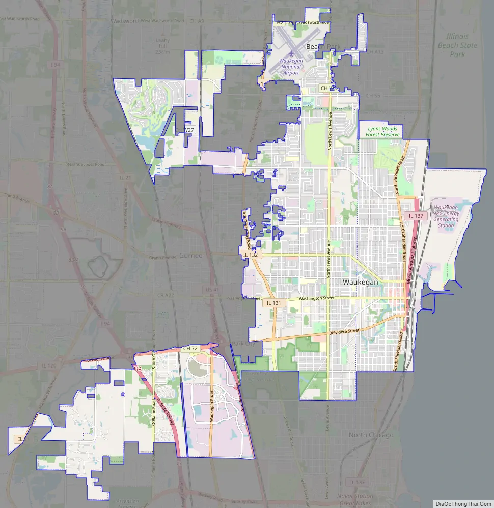
Waukegan Road Map
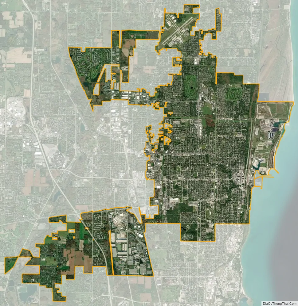
Waukegan city Satellite Map
Geography
Waukegan is located at 42°22′13″N 87°52′16″W / 42.37028°N 87.87111°W / 42.37028; -87.87111 (42.3703140, −87.8711404). Waukegan is on the shore of Lake Michigan, about 11 miles (18 km) south of the border with Wisconsin and 37 miles (60 km) north of Downtown Chicago at an elevation of about 650 feet (200 m) above sea level. Chicago has two major streets that venture north to Waukegan, one being Sheridan Road, which extends north from Diversey Parkway in Lincoln Park. The second street is Milwaukee Avenue, which starts at the intersection of Desplaines street and Kinzie street in Downtown Chicago.
According to the 2010 census, Waukegan has a total area of 24.50 square miles (63.45 km), of which 24.26 square miles (62.83 km) are land and 0.24 square miles (0.62 km), or 0.99%, are water.
Major streets
- Skokie Highway
- Waukegan Road
- Belvidere Road
- Green Bay Road
- Grand Avenue
- Sheridan Road/Amstutz Expressway
- Lewis Avenue
- Washington Street
- Genesee Street
Climate
Waukegan is located within the humid continental climate zone (Köppen: Dfa) with warm to hot (and often humid) summers, and cold and snowy winters. The record high temperature is 108 °F (42 °C), which was set in July 1934, while the record low is −27 °F (−33 °C), set in January 1985. Waukegan’s proximity to Lake Michigan helps cool the city throughout the year.
Superfund sites
Waukegan contains three Superfund sites of hazardous substances that are on the National Priorities List.
In 1975, PCBs were discovered in Waukegan Harbor sediments. Investigation revealed that during manufacturing activities at Outboard Marine Corporation (OMC), hydraulic fluids containing PCBs had been discharged through floor drains at the OMC plant, directly to Waukegan Harbor and into ditches discharging into Lake Michigan. The OMC plants were subsequently added to the National Priorities List, and was designated as one of 43 Great Lakes Areas of Concern. Cleanup of the site began in 1990, with OMC providing $20–25 million in funding. During the OMC cleanup, additional soil contaminants were found at the location of the former Waukegan Manufactured Gas and Coke company. Soil removal was completed at the Coke site in 2005, and cleanup of that soil will continue for several years.
The Johns Manville site is located one mile (1.6 km) north of the OMC site. In 1988, asbestos contamination found in groundwater and air prompted listing on the National Priorities List and subsequent cleanup. In 1991, the soil cover of the asbestos was completed. However, additional asbestos contamination was found outside the Johns-Manville property which will require further cleanup.
The Yeoman Creek Landfill is a Superfund site located 1.5 miles (2.4 km) west of the Johns Manville site. The site operated as a landfill from 1959 to 1969. In 1970, it was discovered that the lack of a bottom liner in the landfill had allowed leachate to enter groundwater, contaminating the water with volatile organic compounds and PCBs, and releasing gases that presented an explosion hazard. All major cleanup construction activities were completed in 2005, and monitoring of local water and air continues.
The book Lake Effect by Nancy Nichols gives an account of the effects of PCBs on Waukegan residents. Johns Manville is a site that was cited due to its high concentration of PCBs and Asbestos.
See also
Map of Illinois State and its subdivision:- Adams
- Alexander
- Bond
- Boone
- Brown
- Bureau
- Calhoun
- Carroll
- Cass
- Champaign
- Christian
- Clark
- Clay
- Clinton
- Coles
- Cook
- Crawford
- Cumberland
- De Kalb
- De Witt
- Douglas
- Dupage
- Edgar
- Edwards
- Effingham
- Fayette
- Ford
- Franklin
- Fulton
- Gallatin
- Greene
- Grundy
- Hamilton
- Hancock
- Hardin
- Henderson
- Henry
- Iroquois
- Jackson
- Jasper
- Jefferson
- Jersey
- Jo Daviess
- Johnson
- Kane
- Kankakee
- Kendall
- Knox
- La Salle
- Lake
- Lake Michigan
- Lawrence
- Lee
- Livingston
- Logan
- Macon
- Macoupin
- Madison
- Marion
- Marshall
- Mason
- Massac
- McDonough
- McHenry
- McLean
- Menard
- Mercer
- Monroe
- Montgomery
- Morgan
- Moultrie
- Ogle
- Peoria
- Perry
- Piatt
- Pike
- Pope
- Pulaski
- Putnam
- Randolph
- Richland
- Rock Island
- Saint Clair
- Saline
- Sangamon
- Schuyler
- Scott
- Shelby
- Stark
- Stephenson
- Tazewell
- Union
- Vermilion
- Wabash
- Warren
- Washington
- Wayne
- White
- Whiteside
- Will
- Williamson
- Winnebago
- Woodford
- Alabama
- Alaska
- Arizona
- Arkansas
- California
- Colorado
- Connecticut
- Delaware
- District of Columbia
- Florida
- Georgia
- Hawaii
- Idaho
- Illinois
- Indiana
- Iowa
- Kansas
- Kentucky
- Louisiana
- Maine
- Maryland
- Massachusetts
- Michigan
- Minnesota
- Mississippi
- Missouri
- Montana
- Nebraska
- Nevada
- New Hampshire
- New Jersey
- New Mexico
- New York
- North Carolina
- North Dakota
- Ohio
- Oklahoma
- Oregon
- Pennsylvania
- Rhode Island
- South Carolina
- South Dakota
- Tennessee
- Texas
- Utah
- Vermont
- Virginia
- Washington
- West Virginia
- Wisconsin
- Wyoming


