Antioch is a village in the U.S. state of Illinois. Antioch is part of the larger Antioch Township within Lake County. As of the 2020 census, the population was 14,622. The village is nestled into the Chain O’Lakes waterway system and borders the state of Wisconsin. Part of the Chicago metropolitan area, Antioch is located approximately halfway between the major cities of Chicago (60 miles south) and Milwaukee (50 miles north).
| Name: | Antioch village |
|---|---|
| LSAD Code: | 47 |
| LSAD Description: | village (suffix) |
| State: | Illinois |
| County: | Lake County |
| Total Area: | 8.63 sq mi (22.35 km²) |
| Land Area: | 8.24 sq mi (21.34 km²) |
| Water Area: | 0.39 sq mi (1.01 km²) |
| Total Population: | 14,622 |
| Population Density: | 1,774.30/sq mi (685.05/km²) |
| Area code: | 847 |
| FIPS code: | 1701595 |
| Website: | www.antioch.il.gov |
Online Interactive Map
Click on ![]() to view map in "full screen" mode.
to view map in "full screen" mode.
Antioch location map. Where is Antioch village?


History
Native American history
The Pottawatomi Tribe historically inhabited in the area of present-day Antioch prior to European settlement. The tribe was pushed to the west by European/American encroachment in the 1830s although remnants can still be found today.
European settlement
The first permanent European settlements in the region were along the creek, named as “Sequoit” which means “winding” in Indian. Darius and Thomas Gage brothers built the first cabin. After building a sawmill by Hiram Buttrick on Sequoit Creek, a tributary of the Fox River, the region became a center of commerce. In 1843, new settlers gave a biblical name “Antioch” to the region and started a school. The town grew as new settlers, primarily of English and German descent, established farms and businesses. In 1976, a replica of Buttrick’s mill was built a few hundred feet downstream from where it once stood. Today, many local businesses and organizations as well as Antioch Community High School use the name “Sequoit”.
Partly due to being a regional center of the abolitionist movement, Antioch is noted as having sent a disproportionately high number of its young men to the Union Army. By the late 1800s, Antioch became a popular vacation spot for Chicagoans and tourism grew quickly once the rail line to Chicago was laid in 1886. Fire destroyed much of downtown in 1891, 1903, and 1904. During Prohibition, Al Capone owned a summer home on nearby Bluff Lake. Following World War II, Antioch continued to see a steady population and economic increase, and an industrial park was created in the 1970s.
Today, Antioch serves as a bedroom community within the Chicago metropolitan and Milwaukee metropolitan area.
Antioch Road Map

Antioch city Satellite Map
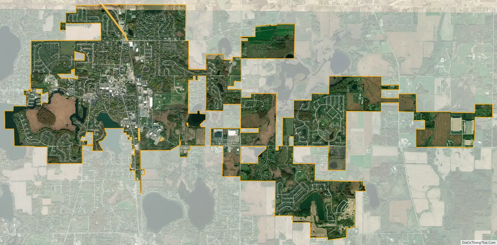
Geography
Antioch is approximately halfway between Chicago and Milwaukee at 42°28′45″N 88°5′27″W / 42.47917°N 88.09083°W / 42.47917; -88.09083 (42.479069, -88.090878).
According to the 2010 census, Antioch has an area of 8.595 square miles (22.26 km), of which 8.21 square miles (21.26 km) (or 95.52%) is land and 0.385 square miles (1.00 km) (or 4.48%) water.
The village lies in a gently rolling moraine landscape, dominated by lakes of glacial origin. Among these are the Antioch Lake, south of the village center, Lake Marie, west of the village center and the Redwing Slough Lake, east of the village center. There are several smaller lakes and ponds, and a complement of wetlands.
Climate
Like Chicago, Antioch lies in a humid continental climate zone and experiences four distinct seasons. Antioch receives an average of 36.74 inches (933 mm) of precipitation each year.
See also
Map of Illinois State and its subdivision:- Adams
- Alexander
- Bond
- Boone
- Brown
- Bureau
- Calhoun
- Carroll
- Cass
- Champaign
- Christian
- Clark
- Clay
- Clinton
- Coles
- Cook
- Crawford
- Cumberland
- De Kalb
- De Witt
- Douglas
- Dupage
- Edgar
- Edwards
- Effingham
- Fayette
- Ford
- Franklin
- Fulton
- Gallatin
- Greene
- Grundy
- Hamilton
- Hancock
- Hardin
- Henderson
- Henry
- Iroquois
- Jackson
- Jasper
- Jefferson
- Jersey
- Jo Daviess
- Johnson
- Kane
- Kankakee
- Kendall
- Knox
- La Salle
- Lake
- Lake Michigan
- Lawrence
- Lee
- Livingston
- Logan
- Macon
- Macoupin
- Madison
- Marion
- Marshall
- Mason
- Massac
- McDonough
- McHenry
- McLean
- Menard
- Mercer
- Monroe
- Montgomery
- Morgan
- Moultrie
- Ogle
- Peoria
- Perry
- Piatt
- Pike
- Pope
- Pulaski
- Putnam
- Randolph
- Richland
- Rock Island
- Saint Clair
- Saline
- Sangamon
- Schuyler
- Scott
- Shelby
- Stark
- Stephenson
- Tazewell
- Union
- Vermilion
- Wabash
- Warren
- Washington
- Wayne
- White
- Whiteside
- Will
- Williamson
- Winnebago
- Woodford
- Alabama
- Alaska
- Arizona
- Arkansas
- California
- Colorado
- Connecticut
- Delaware
- District of Columbia
- Florida
- Georgia
- Hawaii
- Idaho
- Illinois
- Indiana
- Iowa
- Kansas
- Kentucky
- Louisiana
- Maine
- Maryland
- Massachusetts
- Michigan
- Minnesota
- Mississippi
- Missouri
- Montana
- Nebraska
- Nevada
- New Hampshire
- New Jersey
- New Mexico
- New York
- North Carolina
- North Dakota
- Ohio
- Oklahoma
- Oregon
- Pennsylvania
- Rhode Island
- South Carolina
- South Dakota
- Tennessee
- Texas
- Utah
- Vermont
- Virginia
- Washington
- West Virginia
- Wisconsin
- Wyoming


