Libertyville is a village in Lake County, Illinois, United States, and a northern suburb of Chicago. It is located 5 miles (8 km) west of Lake Michigan along the Des Plaines River. The 2020 census population was 20,579. It is part of Libertyville Township, which includes the village, neighboring Green Oaks, and portions of Vernon Hills, Mundelein, unincorporated Waukegan and Lake Forest, and part of Knollwood CDP. Libertyville neighbors these communities as well as Gurnee to the north and Grayslake to the northwest. Libertyville is about 40 miles north of the Chicago Loop and is part of the United States Census Bureau’s Chicago combined statistical area (CSA).
| Name: | Libertyville village |
|---|---|
| LSAD Code: | 47 |
| LSAD Description: | village (suffix) |
| State: | Illinois |
| County: | Lake County |
| Elevation: | 699 ft (213 m) |
| Total Area: | 9.16 sq mi (23.72 km²) |
| Land Area: | 8.81 sq mi (22.81 km²) |
| Water Area: | 0.35 sq mi (0.90 km²) 3.83% |
| Total Population: | 20,579 |
| Population Density: | 2,336.40/sq mi (902.10/km²) |
| Area code: | 847/224 |
| FIPS code: | 1743250 |
| GNISfeature ID: | 412036 |
| Website: | www.libertyville.com |
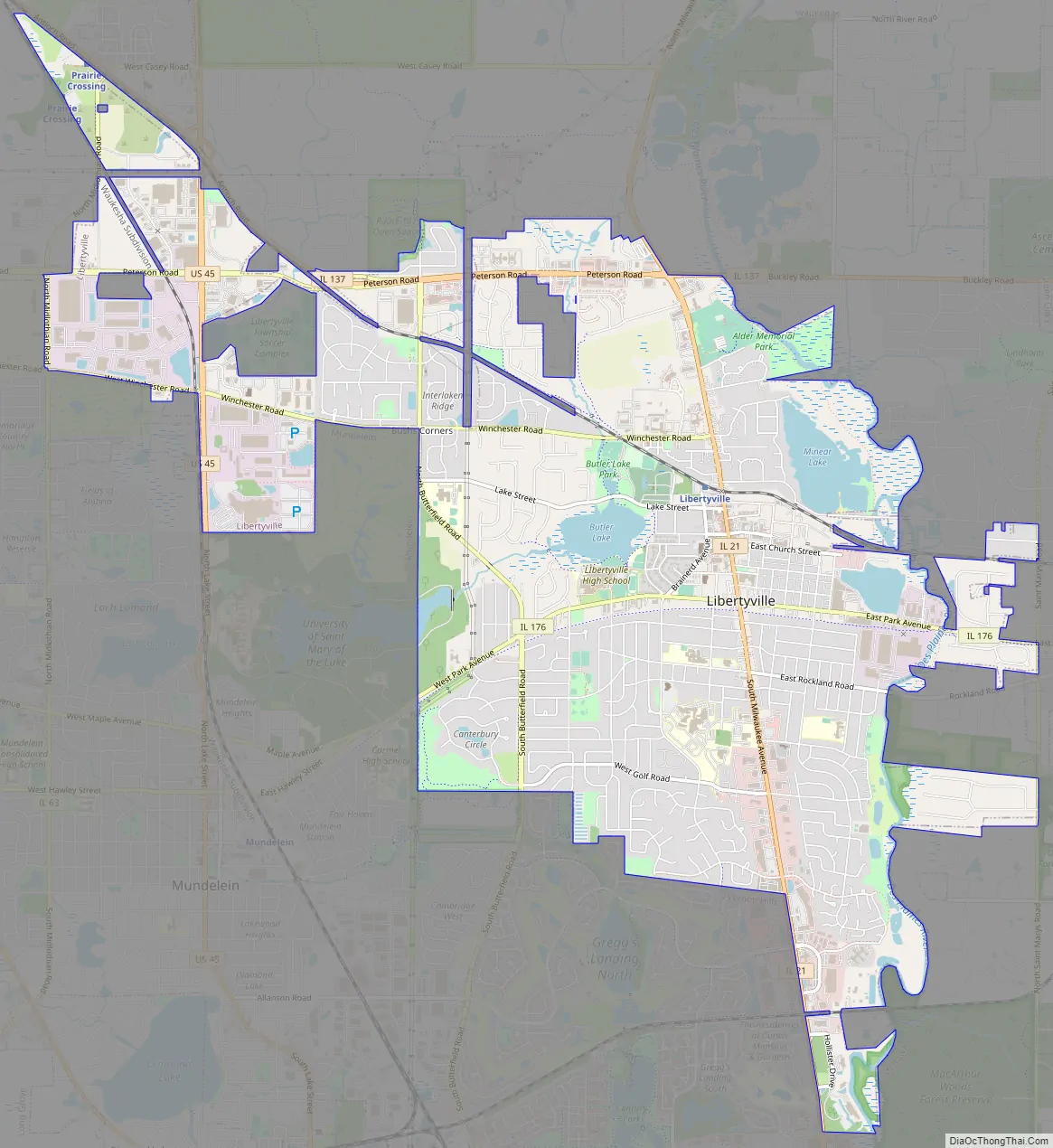
Online Interactive Map
Click on ![]() to view map in "full screen" mode.
to view map in "full screen" mode.
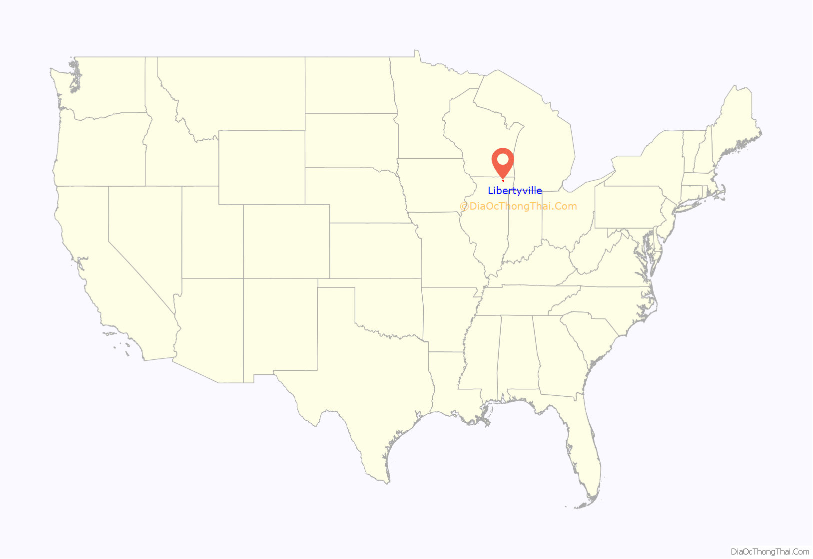
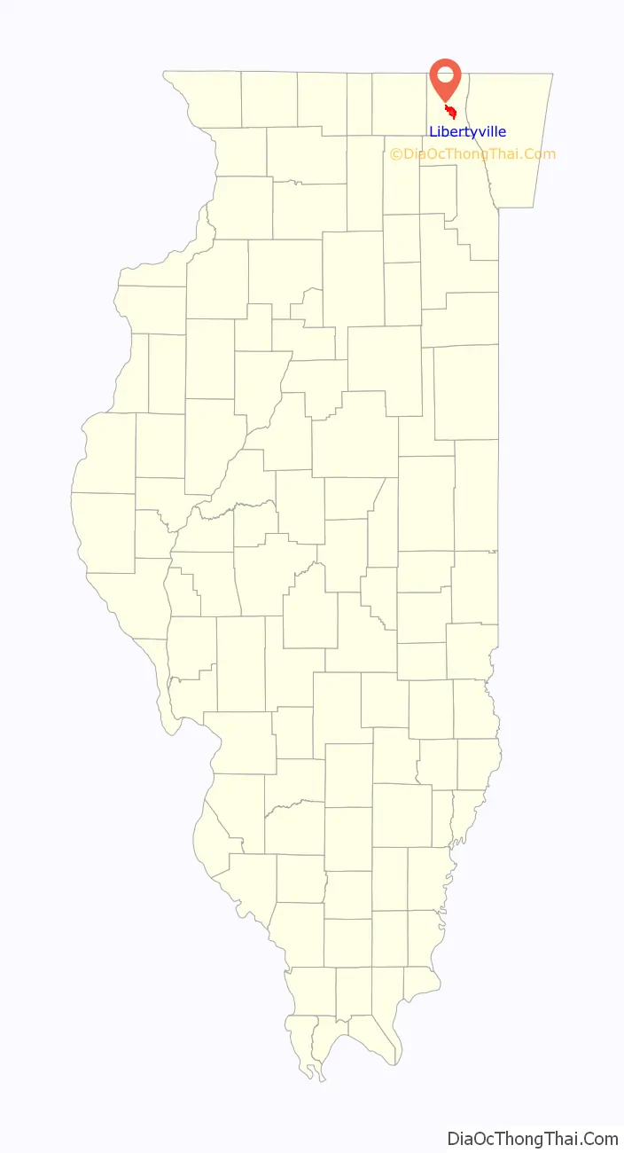
Libertyville location map. Where is Libertyville village?
History
The land that is now Libertyville was the property of the Illinois River Potawatomi Indians until August 1829, when economic and resource pressures forced the tribe to sell much of their land in northern Illinois to the U.S. government for $12,000 cash, an additional $12,000 in goods, plus an annual delivery of 50 barrels of salt.
Pursuant to the treaty, the Potawatomi left their lands by the mid-1830s, and by 1835 the future Libertyville had its first recorded non-indigenous resident, George Vardin. Said to be a “well-educated” English immigrant with a wife and a young daughter, Vardin lived in a cabin located where the Cook Park branch of the Cook Memorial Public Library District stands today. Though he apparently moved on to the west that same year, the settlement that grew up around his cabin was initially known as Vardin’s Grove.
In 1836, during the celebrations that marked the 60th anniversary of the U.S. Declaration of Independence, the community voted to name itself Independence Grove. 1837 brought the town’s first practicing physician, Jesse Foster, followed quickly by its first lawyer, Horace Butler, for whom Butler Lake is named. The professionals needed services, so a post office opened, necessitating a third name change, because another Independence Grove existed elsewhere in the state. On April 16, 1837, the new post office was registered under the name Libertyville.
The town’s name changed again two years later to Burlington when it became the county seat of Lake County. When the county seat moved to Little Fort (now Waukegan) in 1841, the name reverted to Libertyville, without further changes.
Libertyville’s most prominent building, the Cook Mansion, was built in 1879 by Ansel Brainerd Cook, very close to the spot where Vardin’s cabin was built in the 1830s. Cook, a teacher and stonemason, became a prominent Chicago builder and politician, providing flagstones for the city’s sidewalks and taking part in rebuilding after the Great Chicago Fire of 1871. The two-story Victorian mansion served as Cook’s summer home as well as the center of his horse farm, which provided animals for Chicago’s horsecar lines. The building was remodeled in 1921, when it became the town library, gaining a Colonial-style facade with a pillared portico. The building is now a museum with furnishings of the period and other relevant displays. It is operated by the Libertyville-Mundelein Historical Society.
The community expanded rapidly with a spur of the Milwaukee Road train line (now a Metra commuter line) reaching Libertyville in 1881, resulting in the incorporation of the Village of Libertyville in 1882, with John Locke its first village president.
Libertyville’s downtown area was largely destroyed by fire in 1895, and the village board mandated brick to be used for reconstruction, resulting in a village center whose architecture is substantially unified by both period and building material. The National Trust for Historic Preservation, which gave Libertyville a Great American Main Street Award, called the downtown “a place with its own sense of self, where people still stroll the streets on a Saturday night, and where the tailor, the hometown bakery, and the vacuum cleaner repair shop are shoulder to shoulder with gourmet coffee vendors and a microbrewery. If it’s Thursday between 7 a.m. and 1 p.m., it’s Farmer’s Market time (June–October) on Church Street across from Cook Park — a tradition for more than three decades.”
Samuel Insull, founder of Commonwealth Edison, began purchasing land south of Libertyville in 1906. He eventually acquired 4,445 acres (17.99 km), a holding that he named Hawthorn-Mellody Farms. He also bought the Chicago & Milwaukee Electric line (later the Chicago, North Shore & Milwaukee), which built a spur from Lake Bluff to Libertyville in 1903. When Insull was ruined by the Great Depression, parts of his estate were bought by prominent Chicagoans Adlai Stevenson and John F. Cuneo. The home Cuneo built is now the Cuneo Museum.
From 1970 until 2013, Libertyville was the resting place of the only European monarch buried on American soil, Peter II of Yugoslavia, who died in exile in Denver. On 22 January 2013, Peter II’s remains were removed from his tomb at St. Sava Serbian Orthodox Monastery and sent to Serbia in a ceremony attended by the Serbian Prime Minister Ivica Dačić, Peter’s son Alexander with his family, and Serbian Patriarch Irinej. Peter II lay in state in the Royal Chapel in Dedinje before his burial in the Royal Family Mausoleum at Oplenac on May 26, 2013.
Libertyville Road Map
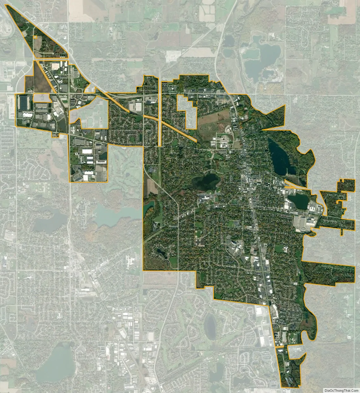
Libertyville city Satellite Map
Geography
Libertyville is located at 42°17′03″N 87°57′38″W / 42.284222°N 87.960673°W / 42.284222; -87.960673Coordinates: 42°17′03″N 87°57′38″W / 42.284222°N 87.960673°W / 42.284222; -87.960673.
According to the 2010 census, the village has a total area of 9.15 square miles (23.7 km), of which 8.81 square miles (22.8 km) (or 96.28%) is land and 0.34 square miles (0.88 km) (or 3.72%) is water.
The Des Plaines River forms much of the eastern boundary of the village. Other bodies of water include Butler Lake, Liberty Lake, and Lake Minear.
Libertyville’s main street is Milwaukee Avenue (Illinois Route 21). The main automobile route to Chicago is via Interstate 94 (the Tri-State Tollway and the Edens Expressway); Chicago’s Loop is approximately 45 minutes away. The main Metra rail station sits at the northern edge of downtown off Milwaukee Avenue, and serves the Milwaukee District/North Line running from Union Station in Chicago to Fox Lake. The same line is served by another Metra station at Prairie Crossing, near the boundary of Libertyville and Grayslake. The Prairie Crossing station also serves Metra’s North Central Line, with service from Union Station to Antioch.
Major streets
- Tri-State Tollway
- Milwaukee Avenue
- Lake Street
- Buckley Road/Peterson Road
- Park Avenue
- Midlothian Road
- Winchester Road
- Butterfield Road
- St. Mary’s Road
Surrounding areas
See also
Map of Illinois State and its subdivision:- Adams
- Alexander
- Bond
- Boone
- Brown
- Bureau
- Calhoun
- Carroll
- Cass
- Champaign
- Christian
- Clark
- Clay
- Clinton
- Coles
- Cook
- Crawford
- Cumberland
- De Kalb
- De Witt
- Douglas
- Dupage
- Edgar
- Edwards
- Effingham
- Fayette
- Ford
- Franklin
- Fulton
- Gallatin
- Greene
- Grundy
- Hamilton
- Hancock
- Hardin
- Henderson
- Henry
- Iroquois
- Jackson
- Jasper
- Jefferson
- Jersey
- Jo Daviess
- Johnson
- Kane
- Kankakee
- Kendall
- Knox
- La Salle
- Lake
- Lake Michigan
- Lawrence
- Lee
- Livingston
- Logan
- Macon
- Macoupin
- Madison
- Marion
- Marshall
- Mason
- Massac
- McDonough
- McHenry
- McLean
- Menard
- Mercer
- Monroe
- Montgomery
- Morgan
- Moultrie
- Ogle
- Peoria
- Perry
- Piatt
- Pike
- Pope
- Pulaski
- Putnam
- Randolph
- Richland
- Rock Island
- Saint Clair
- Saline
- Sangamon
- Schuyler
- Scott
- Shelby
- Stark
- Stephenson
- Tazewell
- Union
- Vermilion
- Wabash
- Warren
- Washington
- Wayne
- White
- Whiteside
- Will
- Williamson
- Winnebago
- Woodford
- Alabama
- Alaska
- Arizona
- Arkansas
- California
- Colorado
- Connecticut
- Delaware
- District of Columbia
- Florida
- Georgia
- Hawaii
- Idaho
- Illinois
- Indiana
- Iowa
- Kansas
- Kentucky
- Louisiana
- Maine
- Maryland
- Massachusetts
- Michigan
- Minnesota
- Mississippi
- Missouri
- Montana
- Nebraska
- Nevada
- New Hampshire
- New Jersey
- New Mexico
- New York
- North Carolina
- North Dakota
- Ohio
- Oklahoma
- Oregon
- Pennsylvania
- Rhode Island
- South Carolina
- South Dakota
- Tennessee
- Texas
- Utah
- Vermont
- Virginia
- Washington
- West Virginia
- Wisconsin
- Wyoming


