Morris County (standard abbreviation: MR) is a county located in the U.S. state of Kansas. As of the 2020 census, the county population was 5,386. The largest city and county seat is Council Grove.
| Name: | Morris County |
|---|---|
| FIPS code: | 20-127 |
| State: | Kansas |
| Founded: | February 11, 1859 |
| Named for: | Thomas Morris |
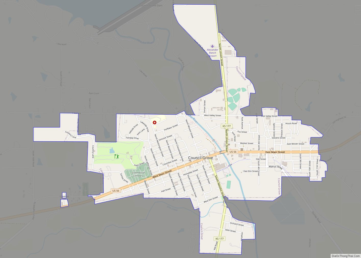
| Seat: | Council Grove |
| Largest city: | Council Grove |
| Total Area: | 703 sq mi (1,820 km²) |
| Land Area: | 695 sq mi (1,800 km²) |
| Total Population: | 5,386 |
| Population Density: | 7.7/sq mi (3.0/km²) |
| Time zone: | UTC−6 (Central) |
| Summer Time Zone (DST): | UTC−5 (CDT) |
| Website: | MorrisCountyKS.org |
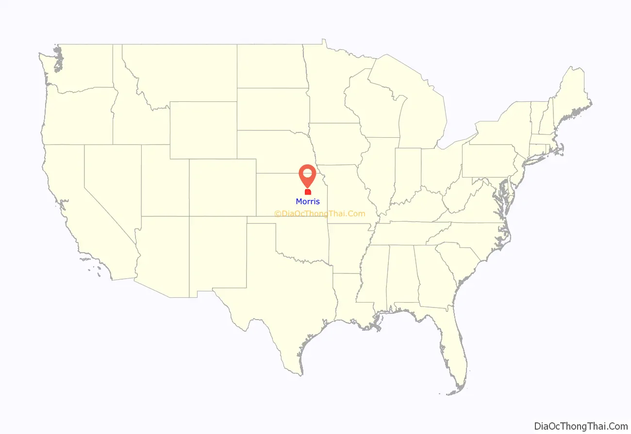
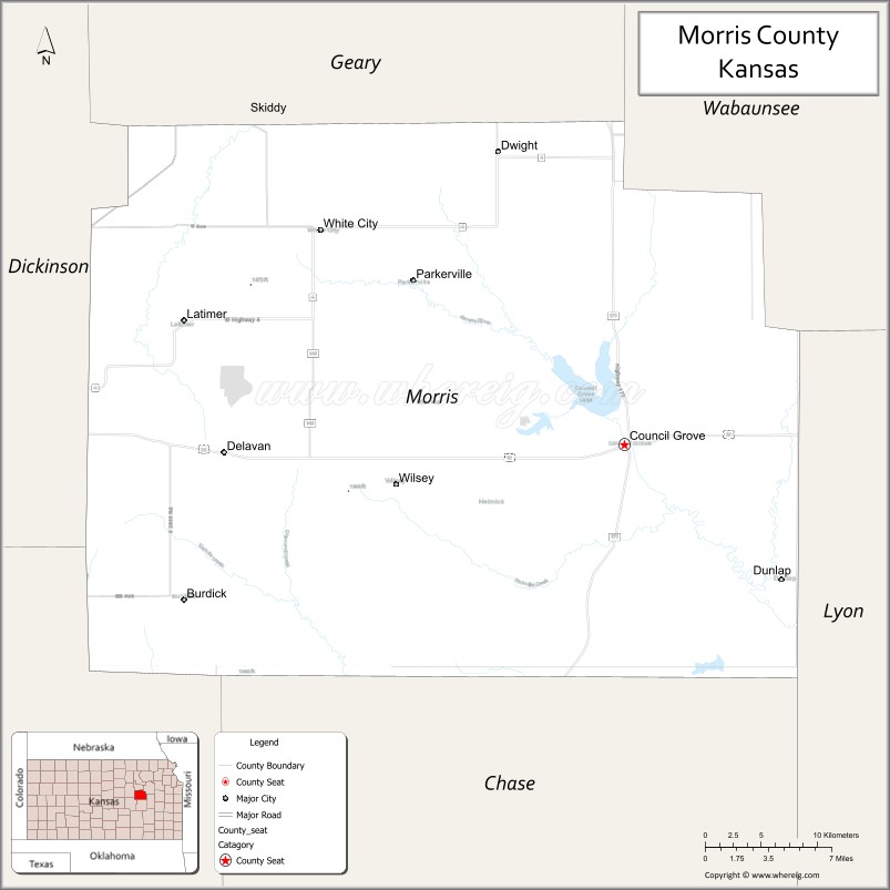
Morris County location map. Where is Morris County?
History
Early history
For many millennia, the Great Plains of North America was inhabited by nomadic Native Americans. From the 16th century to 18th century, the Kingdom of France claimed ownership of large parts of North America. In 1762, after the French and Indian War, France secretly ceded New France to Spain, per the Treaty of Fontainebleau. In 1802, Spain returned most of the land to France, but keeping title to about 7,500 square miles.
In 1803, most of the land for modern day Kansas was acquired by the United States from France as part of the 828,000 square mile Louisiana Purchase for 2.83 cents per acre. In 1848, after the Mexican–American War, the Treaty of Guadalupe Hidalgo with Mexico brought into the United States all or part of land for ten future states, including southwest Kansas. In 1854, the Kansas Territory was organized, then in 1861 Kansas became the 34th U.S. state.
19th century
The county was established on ancient grounds of the Kaw American Indian tribe. Settlers and the Kaw lived in increasingly uneasy relationship as settlers encroached on native lands.
Council Grove, established by European Americans in 1825, was an important supply station on the Santa Fe Trail. The town was also the site of an encampment by John C. Fremont in 1845 and in 1849 the Overland Mail established a supply headquarters there.
From 1821 to 1866, the Santa Fe Trail was active across Morris County.
The county was originally organized as Wise County in 1855. The county was named for Virginia Governor Henry A. Wise. When Wise presided over the hanging of abolitionist John Brown at Harpers Ferry in 1859, abolition supporters renamed it to Morris County in honor of Thomas Morris, a former United States Senator from Ohio who was an opponent of slavery.
From 1846 to 1873, a Kaw Indian Reservation was centered around Council Grove, Kansas on 20 square miles of land. In 1851, the Methodist Church established an Indian Mission in Morris County.
Between 1877 and 1879, Benjamin “Pap” Singleton, a former slave who escaped to freedom in 1846, staked out a settlement in Morris County for freedmen known as “Exodusters”. Thousands of families migrated from the post-Reconstruction South to seek more opportunities and better living conditions in the Midwest.
In 1887, the Chicago, Kansas and Nebraska Railway built a main line from Topeka to Herington. This main line connected Topeka, Valencia, Willard, Maple Hill, Vera, Paxico, McFarland, Alma, Volland, Alta Vista, Dwight, White City, Latimer, Herington. The Chicago, Kansas and Nebraska Railway was foreclosed in 1891 and taken over by Chicago, Rock Island and Pacific Railway, which shut down in 1980 and reorganized as Oklahoma, Kansas and Texas Railroad, merged in 1988 with Missouri Pacific Railroad, merged in 1997 with Union Pacific Railroad. Most locals still refer to this railroad as the “Rock Island”.
In 1887, Atchison, Topeka and Santa Fe Railway built a branch line from Neva (3 miles west of Strong City) to Superior, Nebraska. This branch line connected Strong City, Neva, Rockland, Diamond Springs, Burdick, Lost Springs, Jacobs, Hope, Navarre, Enterprise, Abilene, Talmage, Manchester, Longford, Oak Hill, Miltonvale, Aurora, Huscher, Concordia, Kackley, Courtland, Webber, Superior. At some point, the line from Neva to Lost Springs was pulled but the right of way has not been abandoned. This branch line was originally called “Strong City and Superior line” but later the name was shortened to the “Strong City line”. In 1996, the Atchison, Topeka and Santa Fe Railway merged with Burlington Northern Railroad and renamed to the current BNSF Railway.
20th century
The National Old Trails Road, also known as the Ocean-to-Ocean Highway, was established in 1912, and was routed through Herington, Delavan, Council Grove.
Morris County Road Map
Geography
According to the U.S. Census Bureau, the county has a total area of 703 square miles (1,820 km), of which 695 square miles (1,800 km) is land and 7.6 square miles (20 km) (1.1%) is water.
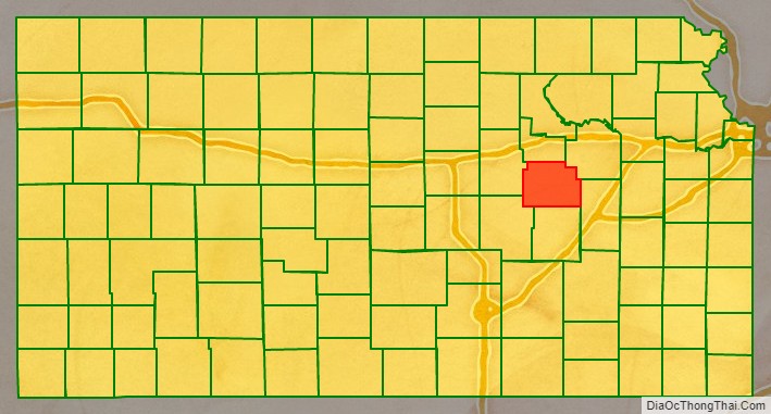
Adjacent counties
- Geary County (north)
- Wabaunsee County (northeast)
- Lyon County (southeast)
- Chase County (south)
- Marion County (southwest)
- Dickinson County (west)
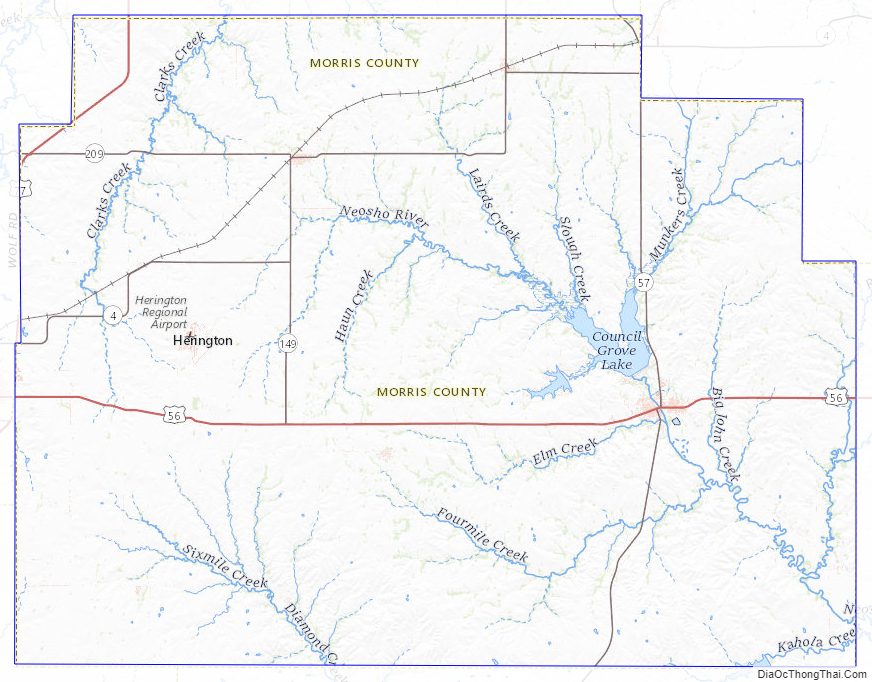
Morris County Topographic Map
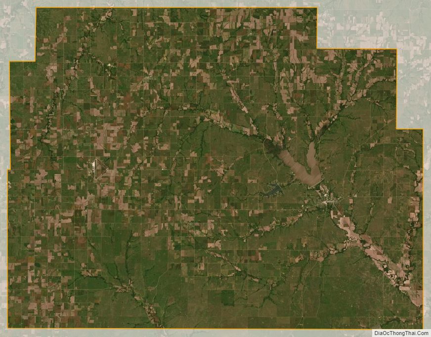
Morris County Satellite Map
Morris County Outline Map