Council Grove is a city and county seat in Morris County, Kansas, United States. As of the 2020 census, the population of the city was 2,140. It was named after an agreement between American settlers and the Osage Nation allowing settlers’ wagon trains to pass westward through the area on the Santa Fe Trail. Pioneers gathered at a grove of trees so that wagons could band together for their trip west.
| Name: | Council Grove city |
|---|---|
| LSAD Code: | 25 |
| LSAD Description: | city (suffix) |
| State: | Kansas |
| County: | Morris County |
| Incorporated: | 1887 |
| Elevation: | 1,234 ft (376 m) |
| Total Area: | 2.06 sq mi (5.32 km²) |
| Land Area: | 2.04 sq mi (5.29 km²) |
| Water Area: | 0.01 sq mi (0.03 km²) |
| Total Population: | 2,140 |
| Population Density: | 1,000/sq mi (400/km²) |
| ZIP code: | 66846, 66873 |
| Area code: | 620 |
| FIPS code: | 2015925 |
| Website: | cityofcouncilgrove.com |
Online Interactive Map
Click on ![]() to view map in "full screen" mode.
to view map in "full screen" mode.
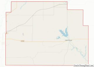
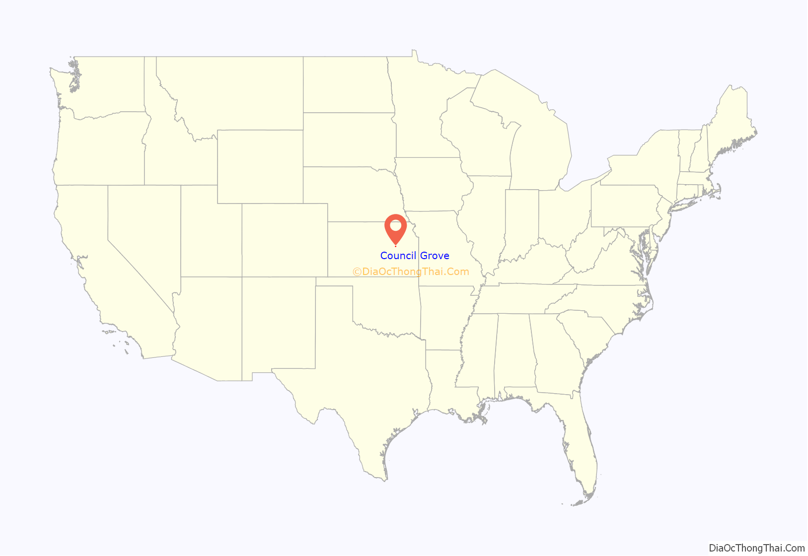
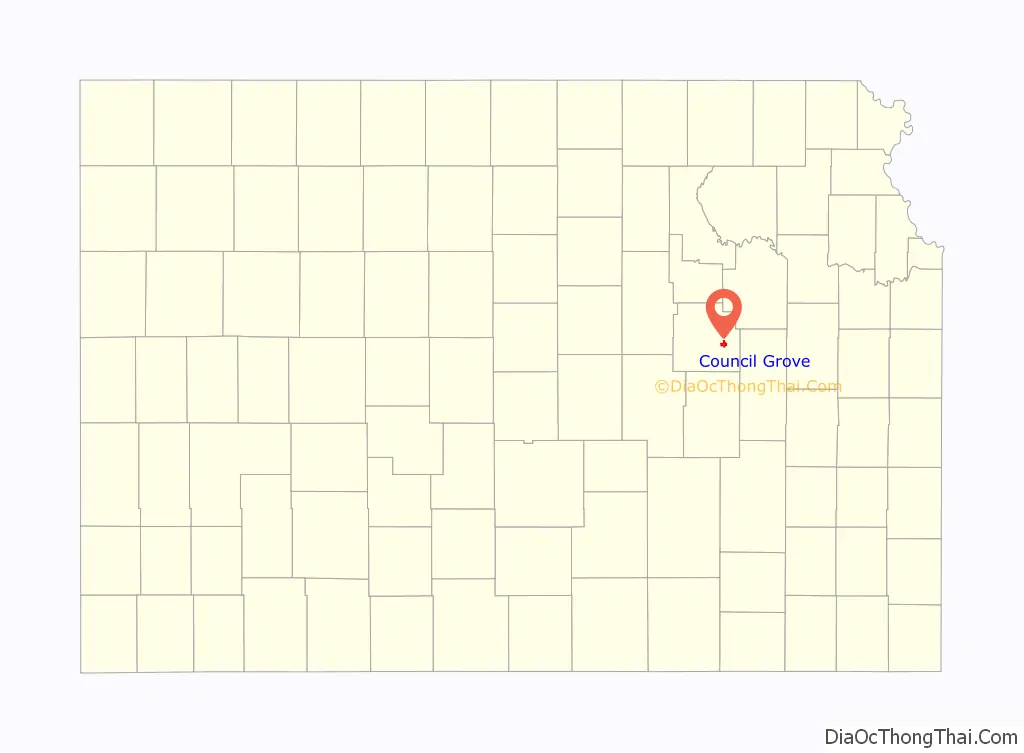
Council Grove location map. Where is Council Grove city?
History
Council Grove was a stop on the Santa Fe Trail. The first European-American settler was Seth M. Hays, who came to the area in 1847 to trade with the Kaw tribe, which had a reservation established in the area in 1846. Hays was a great grandson of Daniel Boone.
The Main street in Council Grove is the old Santa Fe Trail. The Rawlinson-Terwilliger Home, 803 West Main Street, is the oldest stone home on the Santa Fe Trail and houses the Trail Days Cafe & Museum.
A post office was established in Council Grove on February 26, 1855.
In 1858, the town was officially incorporated by the legislature. Hays also opened a restaurant in 1857, the Hays House, which is said to be the oldest continuously operating restaurant west of the Mississippi River.
The town has 15 sites listed on the National Register of Historic Places. One is the Post Office Oak. Travelers left their mail in this designated tree to be picked up by others going in the right direction. General Custer of the United States Army slept here with his troops during the American Civil War, under a large tree known now as the Custer Elm.
The National Old Trails Road, also known as the Ocean-to-Ocean Highway, was established in 1912, and was routed through Herington, Delavan, Council Grove.
In 1943, German and Italian prisoners of World War II were brought to Kansas and other Midwest states as a means of solving the labor shortage caused by American men serving in the war effort. Large internment camps were established in Kansas: Camp Concordia, Camp Funston (at Fort Riley), Camp Phillips (at Salina under Fort Riley). Fort Riley established 12 smaller branch camps, including Council Grove.
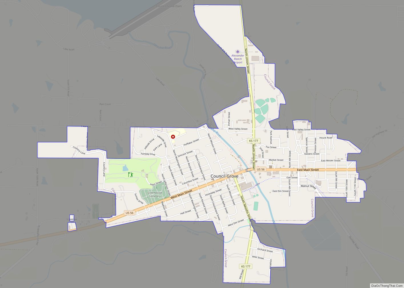
Council Grove Road Map
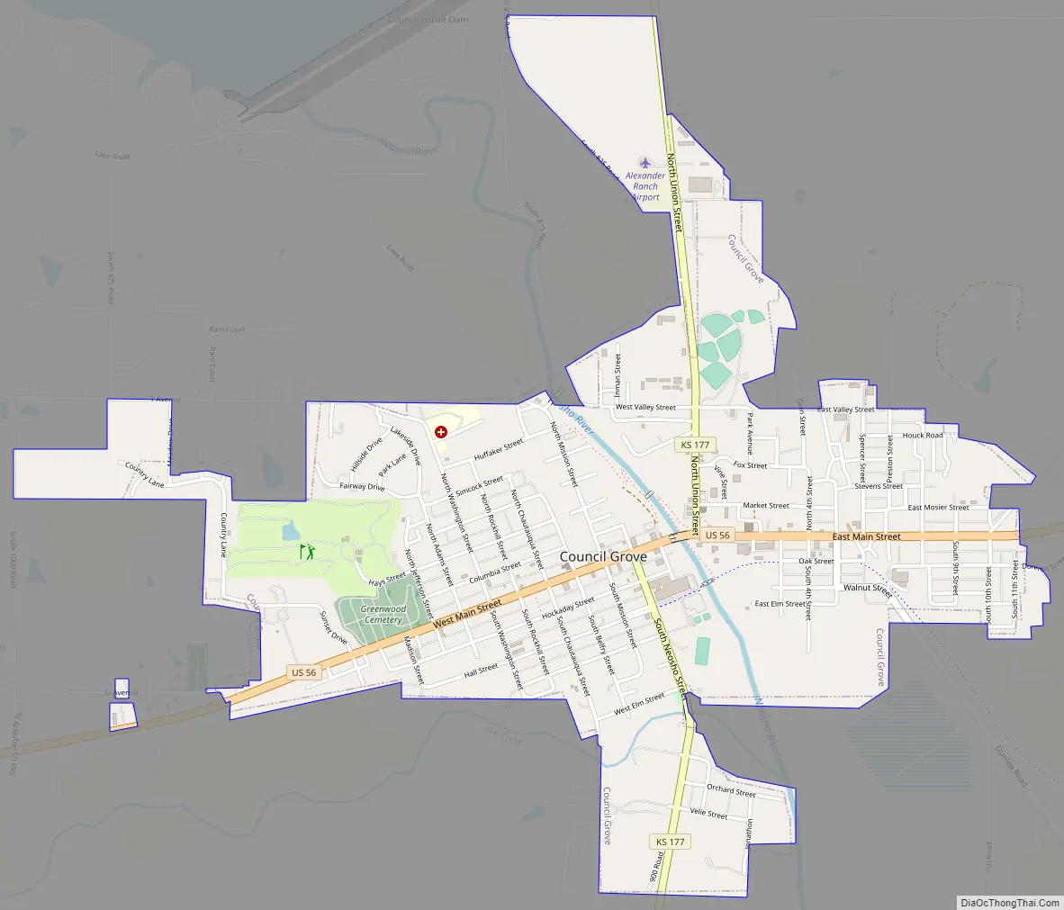
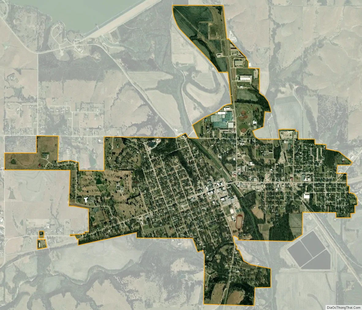
Council Grove city Satellite Map
Geography
According to the United States Census Bureau, the city has a total area of 2.01 square miles (5.21 km), of which, 1.99 square miles (5.15 km) is land and 0.02 square miles (0.05 km) is water. The city is fifty-five miles southwest of Topeka.
Climate
The climate in this area is characterized by hot, humid summers and generally mild to cool winters. According to the Köppen Climate Classification system, Council Grove has a humid subtropical climate, abbreviated “Cfa” on climate maps.
See also
Map of Kansas State and its subdivision:- Allen
- Anderson
- Atchison
- Barber
- Barton
- Bourbon
- Brown
- Butler
- Chase
- Chautauqua
- Cherokee
- Cheyenne
- Clark
- Clay
- Cloud
- Coffey
- Comanche
- Cowley
- Crawford
- Decatur
- Dickinson
- Doniphan
- Douglas
- Edwards
- Elk
- Ellis
- Ellsworth
- Finney
- Ford
- Franklin
- Geary
- Gove
- Graham
- Grant
- Gray
- Greeley
- Greenwood
- Hamilton
- Harper
- Harvey
- Haskell
- Hodgeman
- Jackson
- Jefferson
- Jewell
- Johnson
- Kearny
- Kingman
- Kiowa
- Labette
- Lane
- Leavenworth
- Lincoln
- Linn
- Logan
- Lyon
- Marion
- Marshall
- McPherson
- Meade
- Miami
- Mitchell
- Montgomery
- Morris
- Morton
- Nemaha
- Neosho
- Ness
- Norton
- Osage
- Osborne
- Ottawa
- Pawnee
- Phillips
- Pottawatomie
- Pratt
- Rawlins
- Reno
- Republic
- Rice
- Riley
- Rooks
- Rush
- Russell
- Saline
- Scott
- Sedgwick
- Seward
- Shawnee
- Sheridan
- Sherman
- Smith
- Stafford
- Stanton
- Stevens
- Sumner
- Thomas
- Trego
- Wabaunsee
- Wallace
- Washington
- Wichita
- Wilson
- Woodson
- Wyandotte
- Alabama
- Alaska
- Arizona
- Arkansas
- California
- Colorado
- Connecticut
- Delaware
- District of Columbia
- Florida
- Georgia
- Hawaii
- Idaho
- Illinois
- Indiana
- Iowa
- Kansas
- Kentucky
- Louisiana
- Maine
- Maryland
- Massachusetts
- Michigan
- Minnesota
- Mississippi
- Missouri
- Montana
- Nebraska
- Nevada
- New Hampshire
- New Jersey
- New Mexico
- New York
- North Carolina
- North Dakota
- Ohio
- Oklahoma
- Oregon
- Pennsylvania
- Rhode Island
- South Carolina
- South Dakota
- Tennessee
- Texas
- Utah
- Vermont
- Virginia
- Washington
- West Virginia
- Wisconsin
- Wyoming