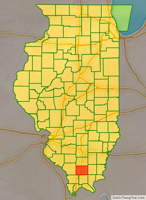
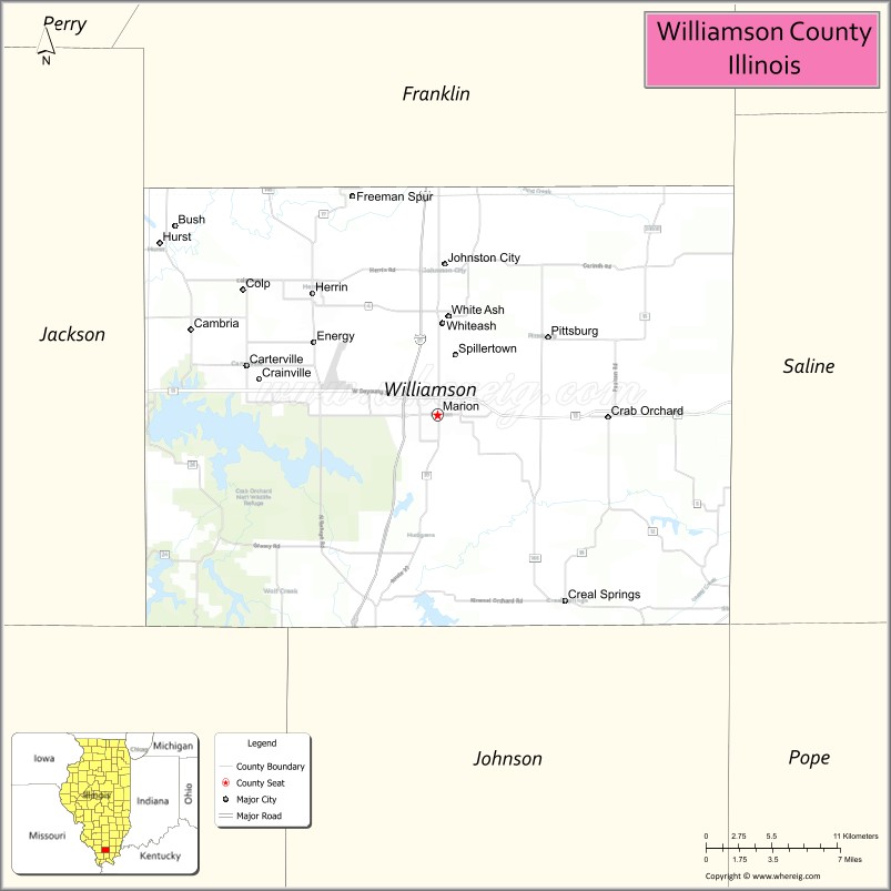
Williamson County is a county in Southern Illinois. At the 2020 census, it had a population of 67,153. The largest city and county seat is Marion.
Williamson County is included in the Carbondale-Marion, IL Metropolitan Statistical Area. This area of Southern Illinois is known locally as “Little Egypt”.
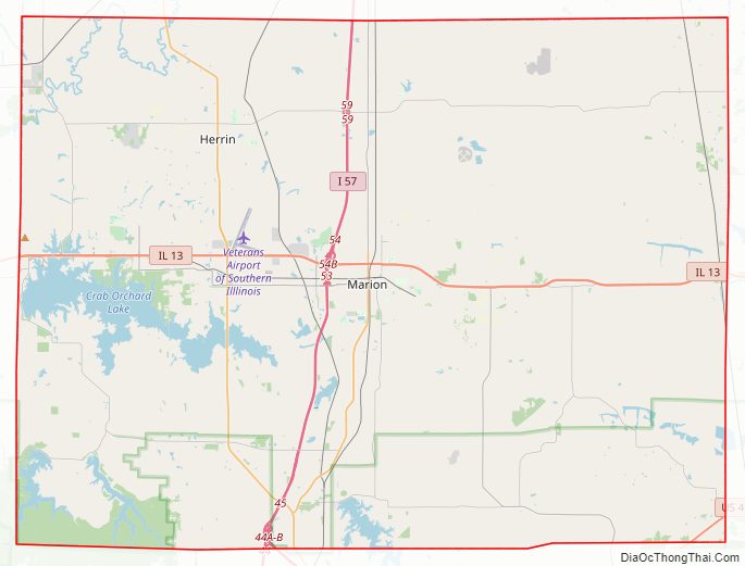
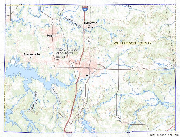
Williamson is in the Metro Lakeland area, 88 miles (142 km) southeast of St. Louis, Missouri. Via the nearby intersection of Interstates 57 and 24, and Illinois Route 13, a primary east–west four-lane expressway, the city has access to the major communities of Murphysboro, Carbondale, Carterville, Herrin, Marion and Harrisburg.
The Metro Lakeland area of Jackson-Williamson counties has a total of 120,000 residents. Carbondale (14 miles west), Herrin and Marion are the key urban areas in Metro Lakeland, with a combined population of more than 65,000. Over 235,000 people live within 35 miles (56 km).
| Name: | Williamson County |
|---|---|
| FIPS code: | 17-199 |
| State: | Illinois |
| Founded: | February 28, 1839 |
| Named for: | Williamson County, Tennessee |
| Seat: | Marion |
| Largest city: | Marion |
| Total Area: | 444 sq mi (1,150 km²) |
| Land Area: | 420 sq mi (1,100 km²) |
| Total Population: | 67,153 |
| Population Density: | 150/sq mi (60/km²) |
| Time zone: | UTC−6 (Central) |
| Summer Time Zone (DST): | UTC−5 (CDT) |
| Website: | www.williamsoncountyil.gov |
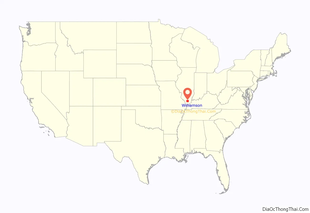
Williamson County location map. Where is Williamson County?
History
Williamson County was formed from Franklin County on February 28, 1839, and was named for Williamson County, Tennessee. Many of its settlers were from the Uplands South, traveling via the Ohio River from Kentucky and Virginia.
Williamson County at the time of its creation in 1839
It became a center of coal mining, attracting numerous European immigrants in the late 19th and early 20th centuries. Labor tensions rose as workers sought to unionize and improve their wages and conditions. Mine owners resisted and several episodes of violence resulted during strikes and other work actions. resulted in several episodes of violence. Williamson County is often referred to as “Bloody Williamson,” due to several outbreaks of violence that have few parallels in American history.
These include the Bloody Vendetta (1876), armed confrontation between families and associates during the waning days of Reconstruction; the Carterville Massacre (1899), a Coal Strike (1906), the Herrin Massacre (1922), the Klan War (1924–1926), and the Birger/Shelton Gang War (1926).
During the so-called Klan War, a mob of perhaps 1,300 men were deputized by the local sheriff. Starting on 1 February 1924, the posse began raiding the homes of local mine workers, mostly Italian immigrants. The Klan was inspired by both nativist and Prohibitionist fervor. Violence continued sporadically between bootleggers and the Klan. Twenty people were killed before peace was restored.
In June 1915, a Sicilian miner accused of the fatal shooting of a wealthy local resident was lynched in Johnston City, Illinois by a mob. The Illinois National Guard was deployed to prevent rioting between the miner’s supporters and opponents. They were also later ordered to various locations repeatedly during the 1920s to separate warring parties and attempt to keep order.
The northwest section of the county suffered extensive damage during the Tri-State Tornado of 1925. The county was also struck by two tornadoes on May 29, 1982, which killed 10 people in the Marion, Illinois tornado outbreak. On May 8, 2009, the cities of Carterville, Herrin, and Marion were severely damaged by the May 2009 Southern Midwest derecho.
Williamson County Road Map
Geography
According to the U.S. Census Bureau, the county has a total area of 444 square miles (1,150 km), of which 420 square miles (1,100 km) is land and 24 square miles (62 km) (5.4%) is water.
Adjacent counties
- Franklin County (north)
- Saline County (east)
- Pope County (southeast)
- Johnson County (south)
- Union County (southwest)
- Jackson County (west)
National protected area
- Crab Orchard National Wildlife Refuge (part)
Major highways
- Interstate 24
- Interstate 57
- U.S. Highway 45
- Illinois Route 13
- Illinois Route 37
- Illinois Route 148
- Illinois Route 149
- Illinois Route 166
Transit
- List of intercity bus stops in Illinois
Airport
Veterans Airport of Southern Illinois in Marion is the local airport.
Williamson County Topographic Map
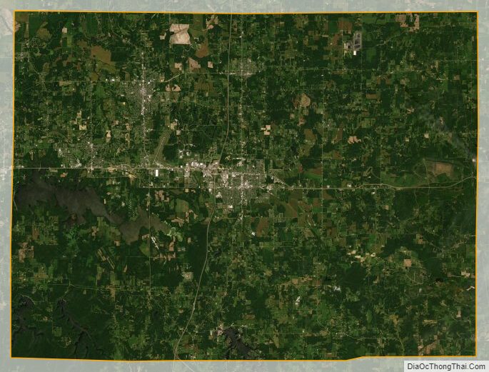
Williamson County Satellite Map
Williamson County Outline Map