Herrin is a city in Williamson County, Illinois. The population was 12,352 at the 2020 census. The city is part of the Marion-Herrin Micropolitan Area and is a part of the Carbondale–Marion-Herrin, Illinois Combined Statistical Area with 123,272 residents, the sixth most populous Combined statistical area in Illinois.
| Name: | Herrin city |
|---|---|
| LSAD Code: | 25 |
| LSAD Description: | city (suffix) |
| State: | Illinois |
| County: | Williamson County |
| Elevation: | 420 ft (130 m) |
| Total Area: | 9.92 sq mi (25.69 km²) |
| Land Area: | 9.67 sq mi (25.05 km²) |
| Water Area: | 0.24 sq mi (0.64 km²) |
| Total Population: | 12,352 |
| Population Density: | 1,276.96/sq mi (493.05/km²) |
| ZIP code: | 62948 |
| Area code: | 618 |
| FIPS code: | 1734358 |
| GNISfeature ID: | 2394365 |
| Website: | www.cityofherrin.com |
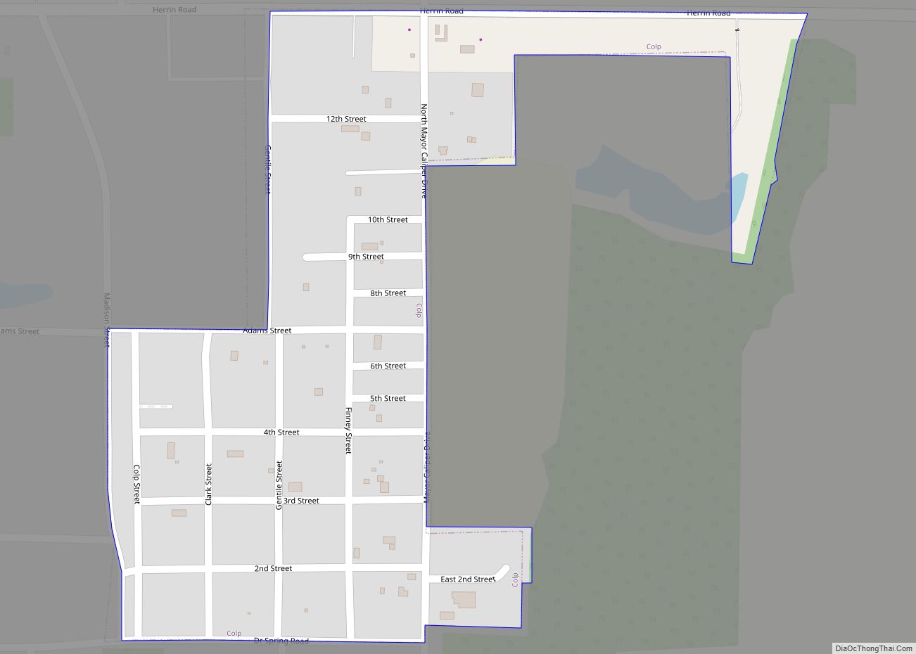
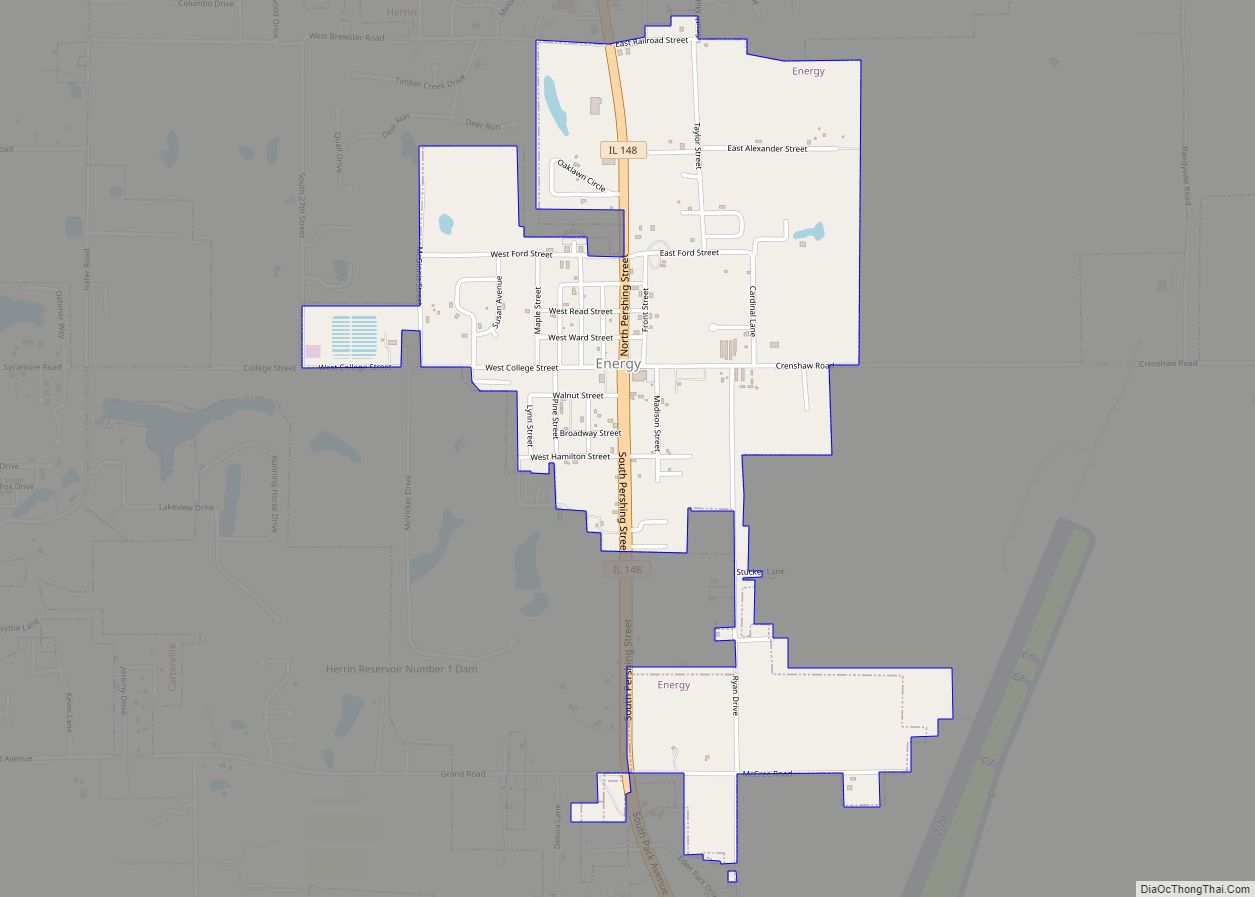
Online Interactive Map
Click on ![]() to view map in "full screen" mode.
to view map in "full screen" mode.
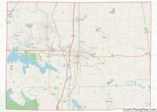
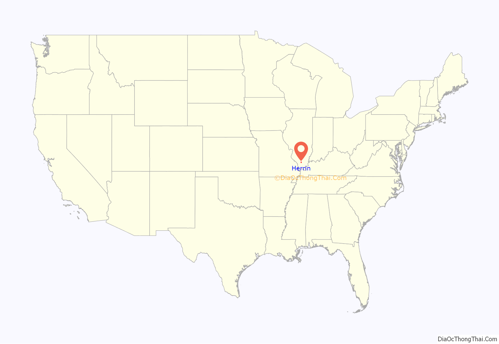
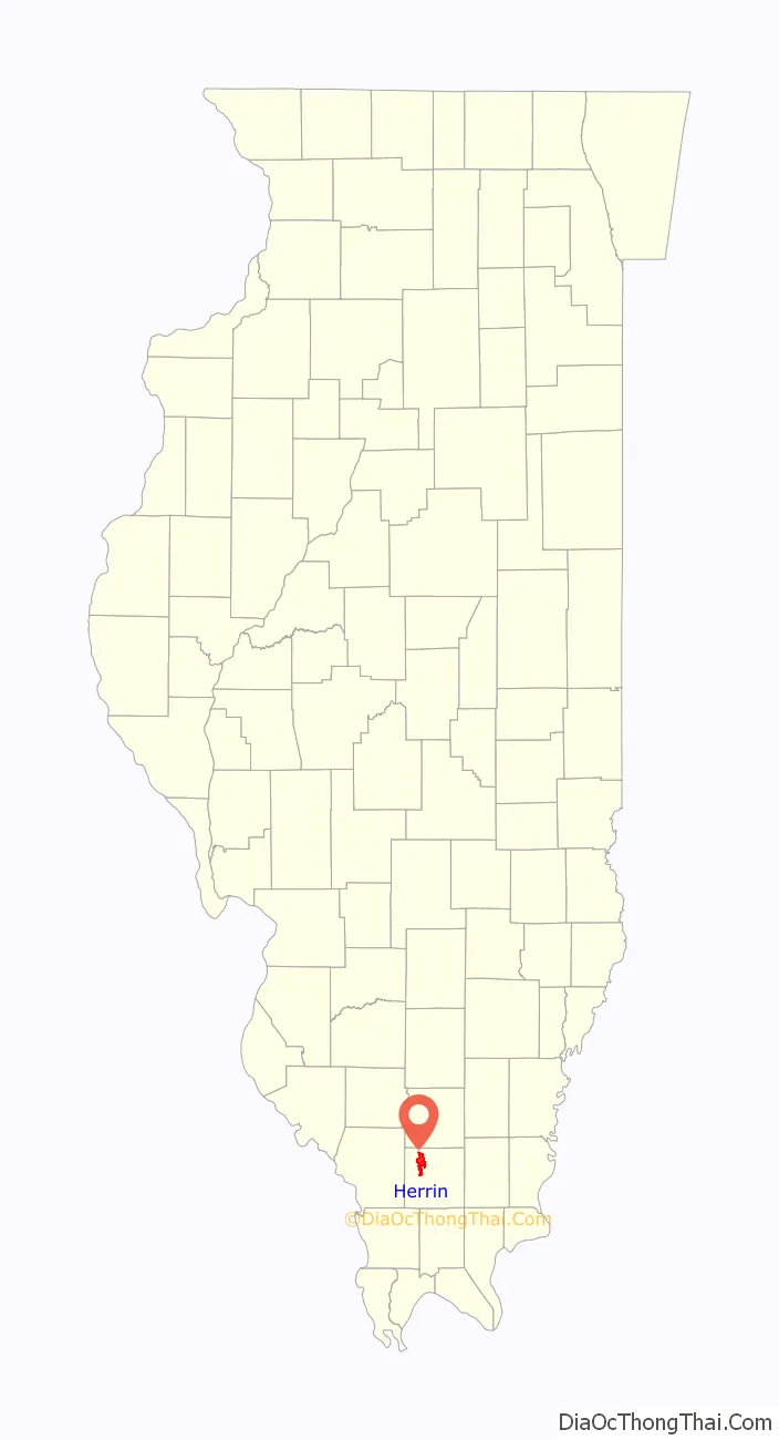
Herrin location map. Where is Herrin city?
History
The settlement of Herrin started out as scattered settlers on Herring’s Prairie named for the first permanent settler Isaac Herring, a Baptist preacher. Later, his son-in-law David Herrin arrived and the similarity in names led to the eventual shortening of the name to just Herrin’s Prairie. The trails from Jordan’s fort to Humphreys’ ford on the Big Muddy River intersected the old trail from Lusk’s ferry at modern-day Golconda to Kaskaskia, which was first settled by French colonists.
Isaac Herring entered the first land in what became Herrin on 4 November 1816, two years before Illinois became a state. He paid $2 an acre for the 160 acres (65 ha). At the time he lived to the west in Jackson County, the land entry was the northeast quarter off Section 30, Township 8 South, Range 2 East of the Third Principal Meridian. Today that area runs between 17th and 27th streets, and from West Cherry Street on the north to West Stotlar Street on the south.
David Ruffin Harrison started storekeeping on the prairie in 1858. During the Civil War, he built a frame store building and secured a fourth class post office that opened on May 26 1864. After coal was discovered and mining began in nearby Carterville, Harrison, and his cousins Ephraim Snyder Herrin and Mrs. Williams in 1892 prospected for coal beginning at the southwest corner of Williams’ farm, identified in 1939 as the corner of Legion Blvd and E Herrin St. (Legion Blvd no longer appears on the maps, but the reference indicates the intersection was the North and North East public roads. The 1908 county atlas shows North East Public Road two blocks east of Park Avenue which would make it North 13th Street). “The men put up the cash, Mrs. Williams boarded the workers. A fine vein of coal was found at 185 feet.”
In 1895, the Chicago and Carbondale Railroad organized to lay tracks between the Illinois Central Railroad at Carbondale and connect with the new Chicago, Paducah and Memphis Railroad that had opened up in 1894, going through the central part of the county. (This one later became the Chicago and Eastern Illinois Railroad). Herrin convinced the developers to take their line between Carbondale and Johnston City through Herrin. Soon after it opened, the line was sold to the Chicago and Texas Railroad in the fall of 1895.
The following spring on May 8 1896, the post office changed to Herrin post office. Cousins Harrison and Herrin, great-grandsons of Isaac Herring, made plans for a new town. They platted a 40-acre site divided by the line between Sections 19 and 30 of the township. They filed the plat 4 December 1896. The community incorporated as a village on March 21 1898, and as a city two years later on April 17 1900.
Herrin was the site of the 1922 Herrin massacre, resulting in the deaths of 23 miners and guards.
When mining made the town prosperous, Herrin had a recreational park known as White City Park. It opened on Memorial Day 1924 with 5000 in attendance. It had a salt water swimming pool, rides, and a theater. Touring big bands played here. The Dorsey Brothers and Frank Sinatra played bocce ball and performed there.
President Harry S Truman came to Herrin in September 1948. Three future presidents came to Herrin during campaigns: Richard Nixon, John F. Kennedy and Ronald Reagan. Gerald Ford came to the Herrin-Marion airport in the 1970s.
At one time Herrin had 10 hotels, many clothing stores, grocery stores as well as department stores. Of the grocery stores Herrin has had over the years, not including national chains, Louie’s P&R is the only local store to remain open.
Herrin Road Map
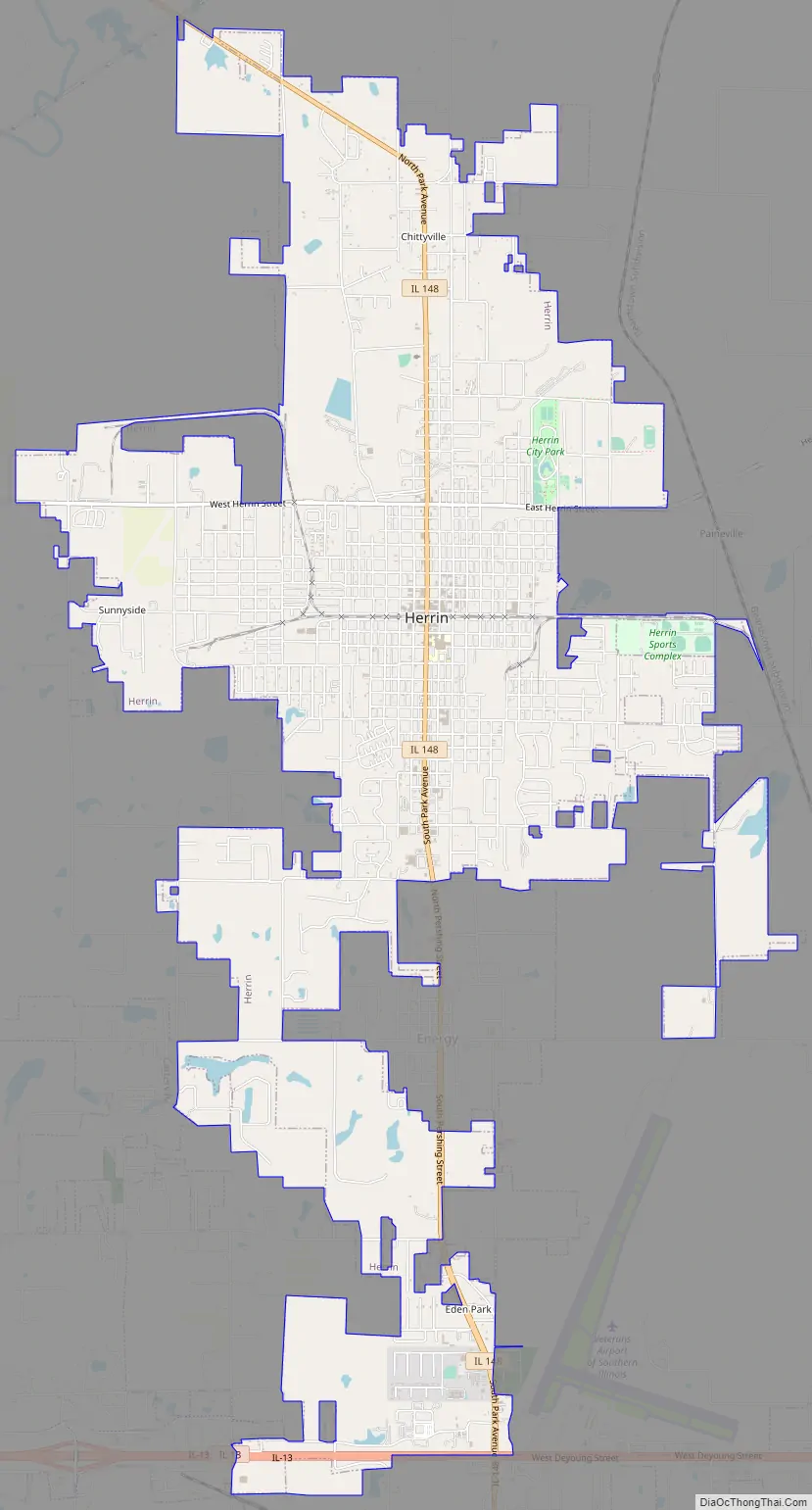
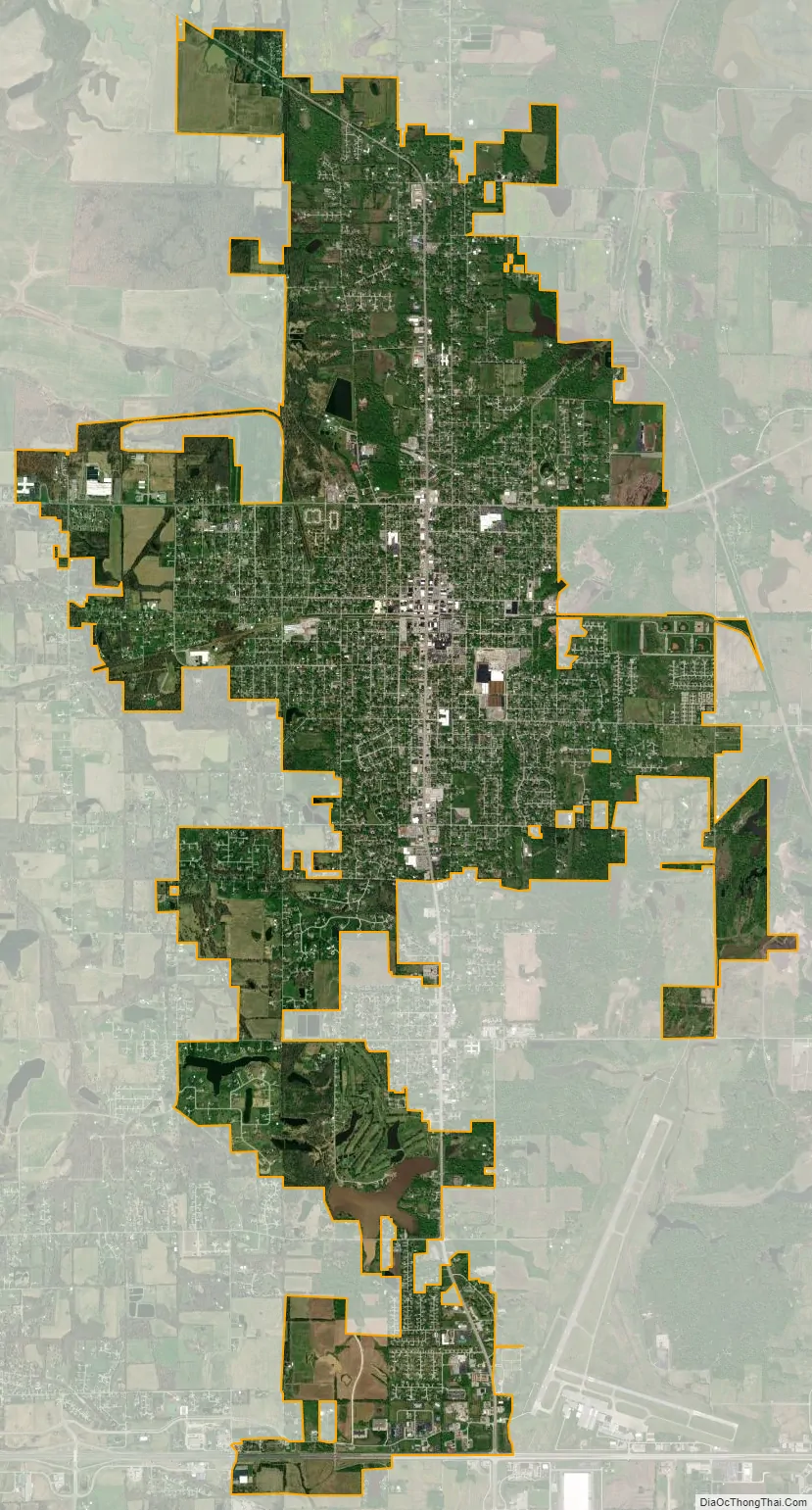
Herrin city Satellite Map
Geography
Herrin is located at 37°48′9″N 89°1′41″W / 37.80250°N 89.02806°W / 37.80250; -89.02806 (37.802412, -89.028093).
According to the 2010 census, Herrin has a total area of 9.461 square miles (24.50 km), of which 9.23 square miles (23.91 km) (or 97.56%) is land and 0.231 square miles (0.60 km) (or 2.44%) is water.
See also
Map of Illinois State and its subdivision:- Adams
- Alexander
- Bond
- Boone
- Brown
- Bureau
- Calhoun
- Carroll
- Cass
- Champaign
- Christian
- Clark
- Clay
- Clinton
- Coles
- Cook
- Crawford
- Cumberland
- De Kalb
- De Witt
- Douglas
- Dupage
- Edgar
- Edwards
- Effingham
- Fayette
- Ford
- Franklin
- Fulton
- Gallatin
- Greene
- Grundy
- Hamilton
- Hancock
- Hardin
- Henderson
- Henry
- Iroquois
- Jackson
- Jasper
- Jefferson
- Jersey
- Jo Daviess
- Johnson
- Kane
- Kankakee
- Kendall
- Knox
- La Salle
- Lake
- Lake Michigan
- Lawrence
- Lee
- Livingston
- Logan
- Macon
- Macoupin
- Madison
- Marion
- Marshall
- Mason
- Massac
- McDonough
- McHenry
- McLean
- Menard
- Mercer
- Monroe
- Montgomery
- Morgan
- Moultrie
- Ogle
- Peoria
- Perry
- Piatt
- Pike
- Pope
- Pulaski
- Putnam
- Randolph
- Richland
- Rock Island
- Saint Clair
- Saline
- Sangamon
- Schuyler
- Scott
- Shelby
- Stark
- Stephenson
- Tazewell
- Union
- Vermilion
- Wabash
- Warren
- Washington
- Wayne
- White
- Whiteside
- Will
- Williamson
- Winnebago
- Woodford
- Alabama
- Alaska
- Arizona
- Arkansas
- California
- Colorado
- Connecticut
- Delaware
- District of Columbia
- Florida
- Georgia
- Hawaii
- Idaho
- Illinois
- Indiana
- Iowa
- Kansas
- Kentucky
- Louisiana
- Maine
- Maryland
- Massachusetts
- Michigan
- Minnesota
- Mississippi
- Missouri
- Montana
- Nebraska
- Nevada
- New Hampshire
- New Jersey
- New Mexico
- New York
- North Carolina
- North Dakota
- Ohio
- Oklahoma
- Oregon
- Pennsylvania
- Rhode Island
- South Carolina
- South Dakota
- Tennessee
- Texas
- Utah
- Vermont
- Virginia
- Washington
- West Virginia
- Wisconsin
- Wyoming