Johnston City is a city in Williamson County, Illinois, United States. The population was 3,348 at the 2020 census. This was a center of coal mining in the early 20th century, having a peak of population in the 1920s. The mining jobs attracted many immigrants from Europe.
| Name: | Johnston City city |
|---|---|
| LSAD Code: | 25 |
| LSAD Description: | city (suffix) |
| State: | Illinois |
| County: | Williamson County |
| Elevation: | 440 ft (130 m) |
| Total Area: | 2.17 sq mi (5.63 km²) |
| Land Area: | 2.12 sq mi (5.48 km²) |
| Water Area: | 0.06 sq mi (0.15 km²) |
| Total Population: | 3,384 |
| Population Density: | 1,599.24/sq mi (617.47/km²) |
| ZIP code: | 62951 |
| Area code: | 618 |
| FIPS code: | 1738544 |
| GNISfeature ID: | 2395475 |
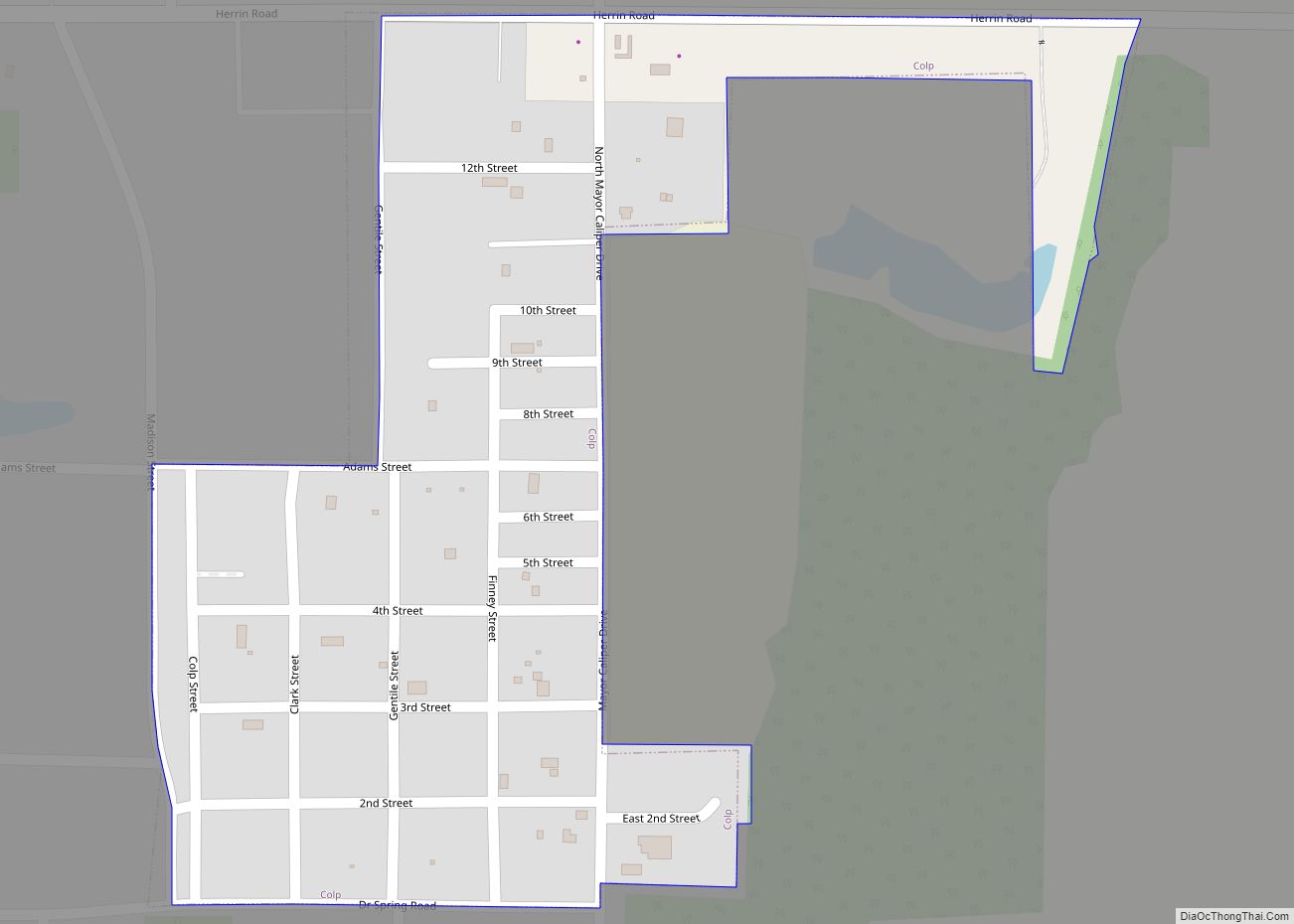
Online Interactive Map
Click on ![]() to view map in "full screen" mode.
to view map in "full screen" mode.
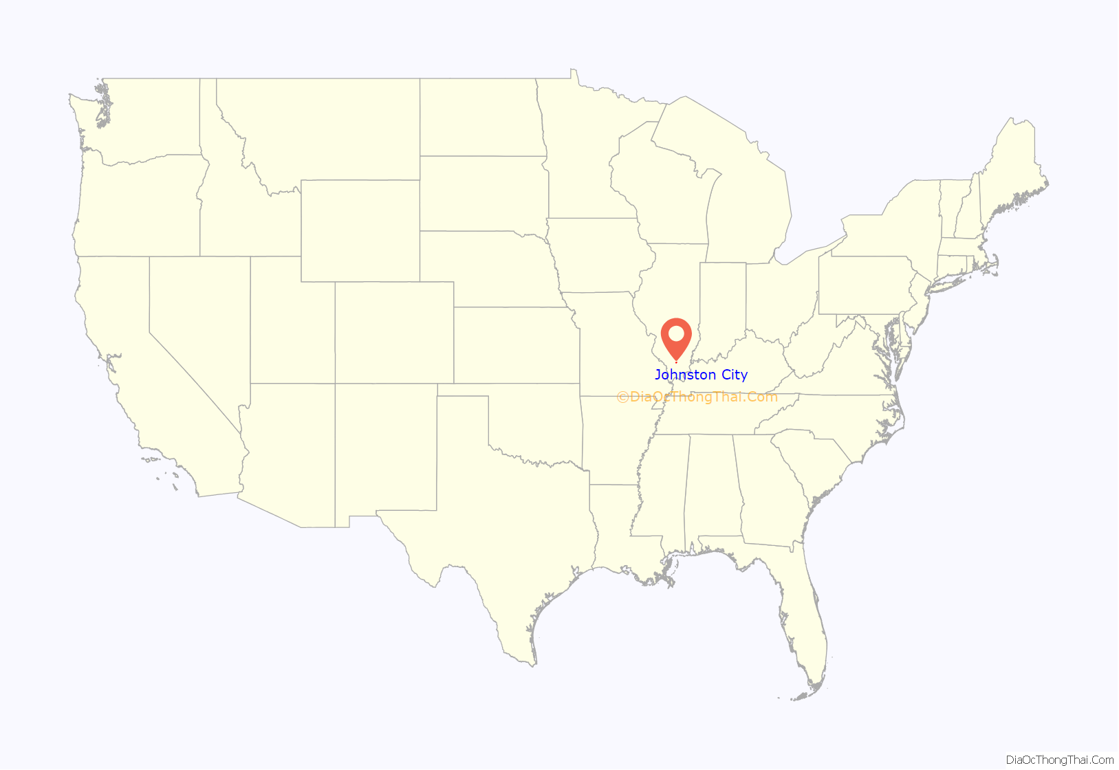
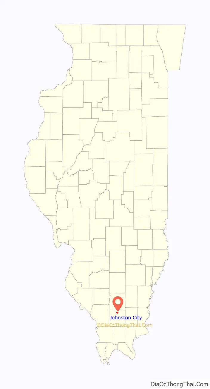
Johnston City location map. Where is Johnston City city?
History
Johnston City was founded in 1894 as a stop along the Chicago, Paducah and Memphis Railroad (later part of the Chicago and Eastern Illinois), and named for the contracting firm that constructed the railroad.
The eastern part of the city was originally known as Jeffersonville. It was surveyed in 1853. During the American Civil War it was a prosperous village. The post office was established in 1852 under the name Lake Creek. It was moved to Johnston City in 1903 but it was not until several years after that that Jeffersonville was fully amalgamated into Johnston City.
In the late 19th and early 20th centuries, a number of immigrant miners from Italy, Wales and other areas arrived to work in the coal mines. There were tensions among the different ethnic groups, especially when miners went out on strike for better wages and conditions.
On June 10, 1915, the city was the site of the lynching of Joe Strando, an Italian immigrant miner from Sicily, by a mob of 300 American men. He was taken from the jail where he was held as a suspect in the murder of Edward Chapman, a wealthy local citizen, and wounding of his daughter. Sicilians were outraged and gathered reinforcements; Americans were arrayed against them. The governor sent in three companies of militia to suppress violence. Six years later, immigrant Settino de Santis confessed to the murder of Chapman, saying that the man was accidentally shot while visiting at the home of mine foreman Ben Schull. De Santis and two other men shot at Schull in retaliation for having been fired. De Santis confessed before he was executed in another capital case.
With the decline of mining, the number of jobs fell. By 1940 the city’s population was just under 4,000. For 2015 the US Census estimated the population at 3500.
In the 1960s a decline in coal miners occurred due to safety standards in the coal mines.
Johnston City Road Map
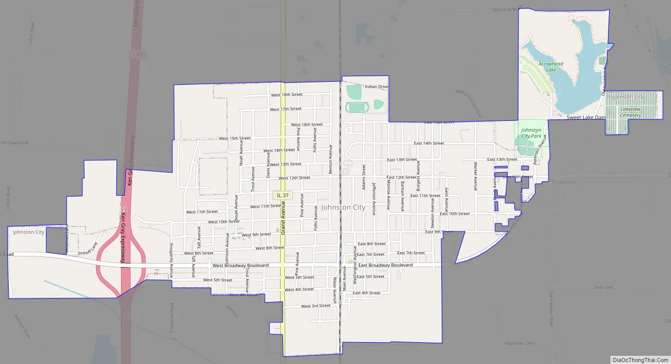
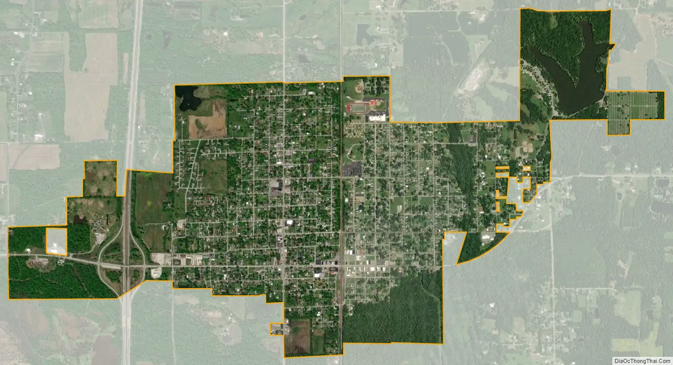
Johnston City city Satellite Map
Geography
Johnston City is located at 37°49′15″N 88°55′39″W / 37.820747°N 88.927529°W / 37.820747; -88.927529.
According to the 2010 census, Johnston City has a total area of 2.12 square miles (5.49 km), of which 2.06 square miles (5.34 km) (or 97.17%) is land and 0.06 square miles (0.16 km) (or 2.83%) is water.
See also
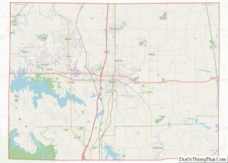
Map of Illinois State and its subdivision:- Adams
- Alexander
- Bond
- Boone
- Brown
- Bureau
- Calhoun
- Carroll
- Cass
- Champaign
- Christian
- Clark
- Clay
- Clinton
- Coles
- Cook
- Crawford
- Cumberland
- De Kalb
- De Witt
- Douglas
- Dupage
- Edgar
- Edwards
- Effingham
- Fayette
- Ford
- Franklin
- Fulton
- Gallatin
- Greene
- Grundy
- Hamilton
- Hancock
- Hardin
- Henderson
- Henry
- Iroquois
- Jackson
- Jasper
- Jefferson
- Jersey
- Jo Daviess
- Johnson
- Kane
- Kankakee
- Kendall
- Knox
- La Salle
- Lake
- Lake Michigan
- Lawrence
- Lee
- Livingston
- Logan
- Macon
- Macoupin
- Madison
- Marion
- Marshall
- Mason
- Massac
- McDonough
- McHenry
- McLean
- Menard
- Mercer
- Monroe
- Montgomery
- Morgan
- Moultrie
- Ogle
- Peoria
- Perry
- Piatt
- Pike
- Pope
- Pulaski
- Putnam
- Randolph
- Richland
- Rock Island
- Saint Clair
- Saline
- Sangamon
- Schuyler
- Scott
- Shelby
- Stark
- Stephenson
- Tazewell
- Union
- Vermilion
- Wabash
- Warren
- Washington
- Wayne
- White
- Whiteside
- Will
- Williamson
- Winnebago
- Woodford
- Alabama
- Alaska
- Arizona
- Arkansas
- California
- Colorado
- Connecticut
- Delaware
- District of Columbia
- Florida
- Georgia
- Hawaii
- Idaho
- Illinois
- Indiana
- Iowa
- Kansas
- Kentucky
- Louisiana
- Maine
- Maryland
- Massachusetts
- Michigan
- Minnesota
- Mississippi
- Missouri
- Montana
- Nebraska
- Nevada
- New Hampshire
- New Jersey
- New Mexico
- New York
- North Carolina
- North Dakota
- Ohio
- Oklahoma
- Oregon
- Pennsylvania
- Rhode Island
- South Carolina
- South Dakota
- Tennessee
- Texas
- Utah
- Vermont
- Virginia
- Washington
- West Virginia
- Wisconsin
- Wyoming