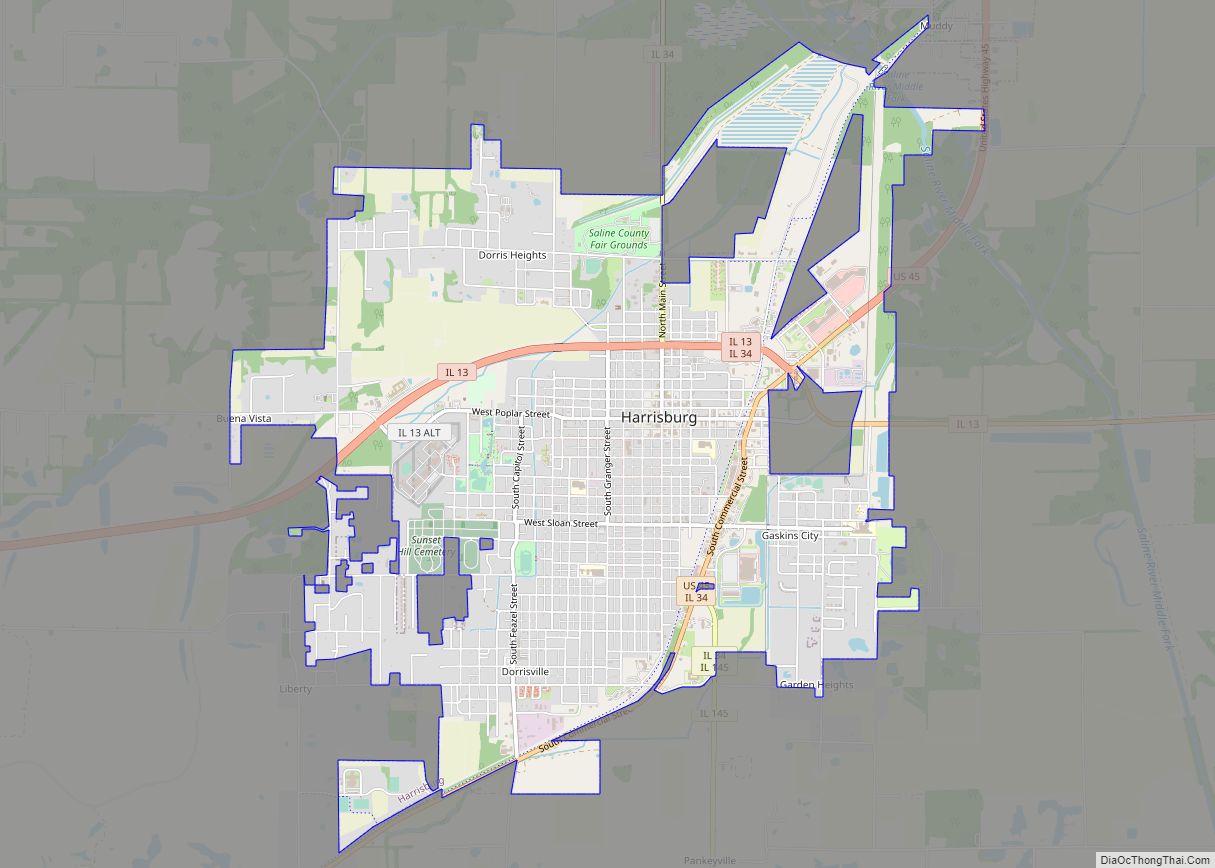
Harrisburg (/ˈhærɪsbɜːrɡ, ˈhɛərz-/) is a city in and the county seat of Saline County, Illinois, United States. It is located about 57 miles (92 kilometers) southwest of Evansville, Indiana, and 111 mi (179 km) southeast of St. Louis, Missouri. Its 2020 population was 8,219, and the surrounding Harrisburg Township had a population of 10,037, including the city residents. Harrisburg is included in the Illinois–Indiana–Kentucky tri-state area and is the principal city in the Harrisburg micropolitan statistical area with a combined population of 24,913.
Located at the concurrency of U.S. Route 45, Illinois Route 13, Illinois Route 145, and Illinois Route 34, Harrisburg is known as the “Gateway to the Shawnee National Forest”, and is also known for the Ohio River flood of 1937, the old Crenshaw House (also known as the Old Slave House), the Tuttle Bottoms Monster, prohibition-era gangster Charlie Birger, and the 2012 EF4 tornado. A Cairo and Vincennes Railroad boomtown, the city was one of the leading bituminous coal-mining distribution hubs of the American Midwest between 1900 and 1937.
At its peak, Harrisburg’s population reached 16,000 by the early 1930s. The city had one of the largest downtown districts in Southern Illinois. The city was the 20th-most populated city in Illinois outside the Chicago metropolitan area and the most-populous city in Southern Illinois outside the Metro East in 1930. However, the city has seen an economic decline due to the decreased demand for high-sulfur coal, the removal of the New York Central railroad, and tributary lowlands leaving, much area around the city unfit for growth due to flood risks.
| Name: | Harrisburg city |
|---|---|
| LSAD Code: | 25 |
| LSAD Description: | city (suffix) |
| State: | Illinois |
| County: | Saline County |
| Founded: | 1853 |
| Incorporated: | 1889 |
| Elevation: | 397 ft (121 m) |
| Total Area: | 6.81 sq mi (17.63 km²) |
| Land Area: | 6.61 sq mi (17.12 km²) |
| Water Area: | 0.20 sq mi (0.51 km²) 3.11% |
| Total Population: | 8,219 |
| Population Density: | 1,243.04/sq mi (479.97/km²) |
| ZIP code: | 62946 |
| Area code: | 618 |
| FIPS code: | 1733136 |
| Website: | www.thecityofharrisburgil.com |
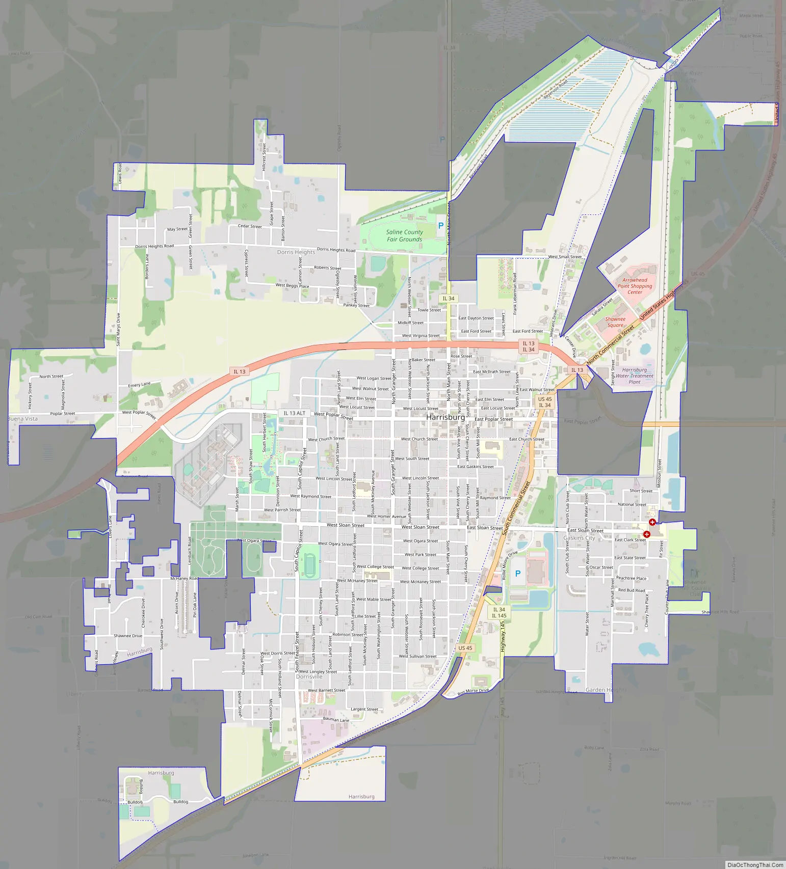
Online Interactive Map
Click on ![]() to view map in "full screen" mode.
to view map in "full screen" mode.
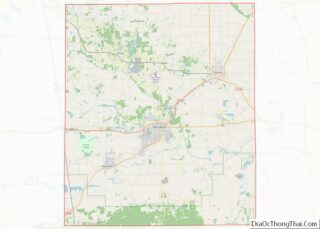
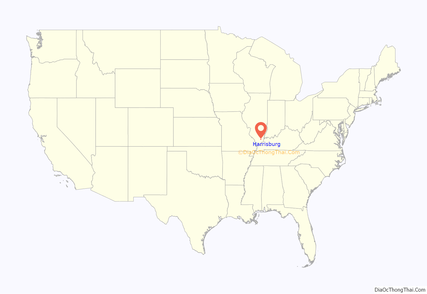
Harrisburg location map. Where is Harrisburg city?
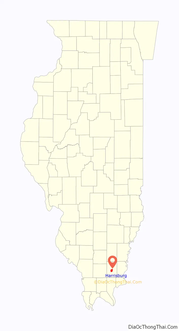
Harrisburg Road Map
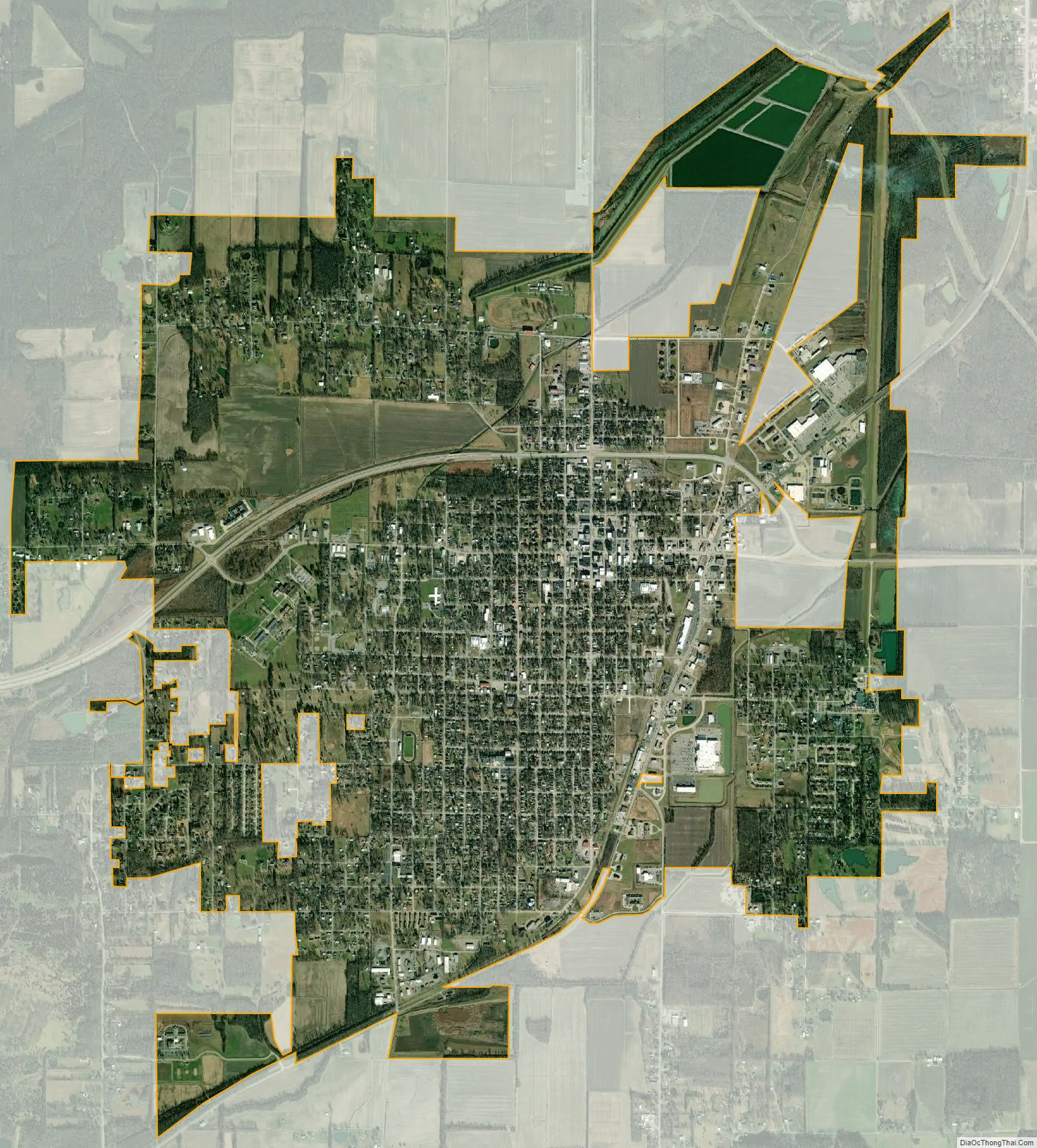
Harrisburg city Satellite Map
Geography
Harrisburg is located at 37°44′2″N 88°32′45″W / 37.73389°N 88.54583°W / 37.73389; -88.54583 (37.733765, −88.545873). According to the 2010 census, Harrisburg has a total area of 6.759 square miles (17.51 km), of which 6.55 square miles (16.96 km) (or 96.91%) is land and 0.209 square miles (0.54 km) (or 3.09%) is water. The square in the center of town, as well as Dorrisville and Gaskins City, stand on top of a series of sandstone bluffs that were once islands rising above natural lowlands, 338 feet (103 m) above sea level, dredged by the middle fork of the Saline River. The Saline River was a navigable river used by early settlers for transportation to and from Salt Works just east of Harrisburg. The Saline flowed towards the Ohio and flooded every spring in events called Freshets. The locals called the island “Crusoe’s Island”. When the area was drained, homes and businesses were built in the floodplain, and it became prone to serious flooding for years to come. The town square in the center of town is a sandstone bluff 410 feet (125 m) above sea level, one of the first that start the Shawnee Hills to the south. Topographic maps show the bluffs that rise from the Saline River that wraps the northeast part of the city. Harrisburg is located at the ending point of the Laurentide Ice Sheet, which covered about 85 percent of Illinois. The edge of Illinoian ice sheet(s) lay further south than the southernmost extent, i.e. Douglas County, Kansas, of any of the Pre-Illinoian ice sheets.
Cottage Grove Fault System
After the 5.5 Richter Scale magnitude 1968 Illinois earthquake, scientists realized that there was a previously unknown fault under Saline County, just north of Eldorado near Harrisburg. This fault is called the Cottage Grove Fault, a small tear in the Earth’s rock running west–east, in the Southern Illinois Basin. The fault is connected to the north–south trending Wabash Valley Fault System at its eastern end. Seismographic mapping completed by geologists reveal that monoclines, anticlines, and synclines are present within the region; these signs suggest deformation during the Paleozoic era coincident to strike-slip faulting nearby.
A focal mechanism solution of the earthquake confirmed two nodal planes both striking north–south and dipping approximately 45 degrees to the east and to the west. This faulting suggests dip-slip reverse motion, and to a horizontal east–west axis of confining stress. The rupture also occurred partially on the New Madrid Fault, responsible for the great New Madrid earthquakes in 1812, consisting of the most powerful earthquakes to hit the contiguous United States.
Cityscape
During the early 20th century, urbanization of the city due to the geographical feature of “Cruesoe’s Island” and surrounding coal mining property created a density not seen in many cities of its size. The city at the time with a population nearing 10,000 was forced to tightly cram homes and businesses upon the sandstone outcropping less than a square mile in diameter leading many to build their buildings with multiple stories around the town square. The Saline County courthouse and square have gone through many transformations within the past 100 years. In the 19th century, the town had dirt streets with a large Greek Revival courthouse with Doric columns built by Swiss-born, Evansville, Indiana Architect J. K. Frick & Co in 1861. The courthouse was replaced in 1906 with a larger building designed by then well-known architect John W. Gaddis of Vincennes, Indiana. The structure was an identical model to the Perry County Courthouse at Perryville, Missouri, both built the same year. A smaller version of the central clock tower of the courthouse, including the original clock, manufactured by the Howard Clock Company, of Boston Massachusetts in 1904 was recreated in 1996, and placed in a small lot behind the Clearwave Building’s parking lot. The Howard clock company was notable for manufacturing large clocks in such buildings as the Wrigley Building in Chicago, and the Ferry Building in San Francisco, California. The town square was completely surrounded by brick streets in 1906. Harrisburg had 25 miles (40 km) of brick streets, but now only a few blocks are left.
Harrisburg has not yet begun a National Trust for Historic Preservation, Main Street historical preservation program. Saline County is within a recognized historical district, the “Ohio River Route Where Illinois Began”. Two buildings in Harrisburg are currently listed on the National Register of Historic Places, those being the City Hall and the Saline County Poor Farm.
The square itself held an array of coal mining offices, privately owned business, grocery and department stores, pharmacies and bars. During the closing of the coal mining era, most of the businesses left the square and moved to the main drag of Rt. 45, constructed in 1926. The courthouse built by John W. Gaddis was replaced with a modern, more efficient building in 1967 after the older building was condemned. Over the years, the architecture that graced Harrisburg square has slowly turned to rotting older structures mixed in with a hodge-podge of newer updated buildings. Currently there are a few privately owned downtown renovation projects in progress on and around the square.
The Harrisburg Mitchell-Carnegie Library, located on Church Street south of the square and built with a grant from Andrew Carnegie, was built in 1908 and opened to the public in 1909. The building served the community until 2000 when the library was moved to a new building on north Main Street. During the 1937 flood, the library was used as a makeshift hospital until the water boiler burst. The building now serves as a church.
Harrisburg has three city parks. Memorial Park, Gaskins City Park, and Dorris Heights Park. Memorial Park, on the west end of town, is the largest with the city park pool and a large lagoon snaking through the center, founded in 1935.
The Sunset Lawn Cemetery is the largest in the county, founded in 1880, connected to the west edge of the city. The cemetery contains ornate tombstones and crypts, within which are the remains of most of the city’s original founders and prominent residents. Sunset Lawn contained the 90-year-old Sunset Mausoleum. The crypt had marble floors, with 75 persons buried inside. The structure was condemned in 2008 and there were plans of removal of the bodies and reburial within the cemetery, but due to problems finding many of the family members, has not came to fruition.
In May 2010, on 301 N. Granger Street, the 1895 home of city bricklayer and early proprietor Robert King was set to be demolished. The homeowners donated it to Saline County Habitat for Humanity last year hoping that the organization might be able to restore it. The home was considered “unrestorable”. In 2012, Harrisburg High School was placed on the Landmark Illinois endangered buildings list. Two seniors at Harrisburg High School were preparing a nomination of the building for listing in the National Register of Historic Places, and they helped to distribute a petition through social media to help save the school.
Harrisburg neighborhoods
Harrisburg is split up into several small neighborhoods that were annexed into the city limits over time, from north to south.
- Dorris Heights – A subdivision established in 1923 on land owned by W.S. and Bertha Dorris. Annexed in 1979. Sits to the direct north of Harrisburg with the Dorris Heights Street being the main road through the area. The Saline County Fair Grounds sits to between Dorris Heights St. and the Levee to the north. Small Street heads east from Dorris Heights towards the Arrow Head Point shopping center.
- Buena Vista – Situated to the south and north of Route 13 (Poplar Street), and west of the main village. It holds the newer town water tower and several homes. It is bordered by Liberty to the south.
- Wilmoth Addition – Is an area of prominently African American residents north of Old Harrisburg, and just south of Dorris Heights. A good portion of the Wilmoth Addition was slowly abandoned and torn down when the Rt. 13 bypass was built in 2008.
- Old Harrisburg Village – The streets that surround the town square. It includes everything on Main street north and south, and Poplar street from the levee to the east and the town park to the west. It also includes the High School, the old Junior High, West and East Side schools, the Courthouse, the town park and cemetery to the west, and the main shopping strip on Route 45. This part of the city is the oldest, and is recognized mainly by the densely packed gilded age houses and structures lined on narrow brick streets. Most of this area is located on “Crusoe’s Island”, and was built during a pre-automobile-centric Harrisburg.
- Gaskins City – Includes a small village annexed in 1905, named for the Gaskins family of Harrisburg, prominent business owners and coal entrepreneurs of the Egyptian Coal Company, later sold to O’Gara. Gaskins City is a series of several blocks that exists to the east of the Harrisburg Levee and Route 45. Sloan Street crosses Route 45, runs straight into the center of Gaskins City and terminates at the Harrisburg Medical Center. It contains Gaskins City Baptist Church, Shawnee Hills Country Club, and is an upper-class neighborhood. It used to have its own school at one time. A large part of Gaskins City was obliterated by the 2012 EF4 Tornado. Part of Harrisburg Medical Center was also heavily damaged.
- Garden Heights – Slightly south of Gaskins City. Connects it with Route 34 and Pankyville.
- Dorrisville – Straight south of Harrisburg, and established in 1905 with a post office, and annexed by the city in 1923. Dorrisville holds the Dorrisville Baptist Church, the Saline County Area Historical Museum, and “Pauper Farm Crossing”, which is on the crossroads of Feazel Street and Route 45. Most people recognize Dorrisville as the first 5–6 blocks north, west, and east of the Feazel Street and Barnett Street 4-way stop. A large part of Dorrisville along the Barnett Street corridor and south of Main Street was destroyed in the tornado. Many houses were destroyed or had lost their roofs.
- Liberty – Was a smaller rural community to the far southwest of Harrisburg along Liberty Road. It included Liberty Church and cemetery. In 1873, designer of the Cairo and Vincennes Railroad, Green Berry Raum of Harrisburg, opened a slope mine on the south side of the rails near Liberty. It became the first in the county to ship coal by rail-car. The mine was called Ledford Slope, and the spot was called Liberty Crossing. Liberty is bordered by the old mining community of Ledford 3 miles (4.8 km) south of Harrisburg, Dorrisville to the west, and Buena Vista to the north. Liberty holds the new Junior High building.
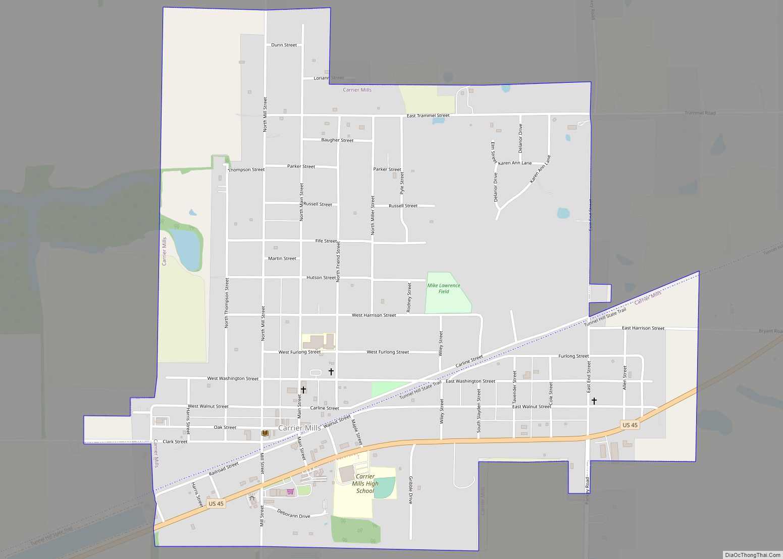
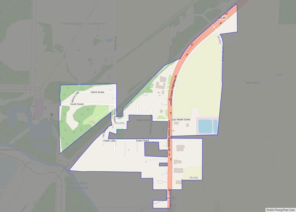
- Ledford – Ledford had been a complete town unto itself. It was the home ground of Charles Birger, and had several stores, its own school system, and a post office. Ledford was a coal mining community set up by mostly Hungarians during the 19th century. It holds a large cemetery, an historic Hungarian cemetery, and the Ledford Baptist Church. Ledford is spread across a 4-mile (6.4 km) span of land along Route 45 between Carrier Mills and Harrisburg, with several roads branching off to the left and right of the highway. It is all considered “Ledford”.
See also
Map of Illinois State and its subdivision:- Adams
- Alexander
- Bond
- Boone
- Brown
- Bureau
- Calhoun
- Carroll
- Cass
- Champaign
- Christian
- Clark
- Clay
- Clinton
- Coles
- Cook
- Crawford
- Cumberland
- De Kalb
- De Witt
- Douglas
- Dupage
- Edgar
- Edwards
- Effingham
- Fayette
- Ford
- Franklin
- Fulton
- Gallatin
- Greene
- Grundy
- Hamilton
- Hancock
- Hardin
- Henderson
- Henry
- Iroquois
- Jackson
- Jasper
- Jefferson
- Jersey
- Jo Daviess
- Johnson
- Kane
- Kankakee
- Kendall
- Knox
- La Salle
- Lake
- Lake Michigan
- Lawrence
- Lee
- Livingston
- Logan
- Macon
- Macoupin
- Madison
- Marion
- Marshall
- Mason
- Massac
- McDonough
- McHenry
- McLean
- Menard
- Mercer
- Monroe
- Montgomery
- Morgan
- Moultrie
- Ogle
- Peoria
- Perry
- Piatt
- Pike
- Pope
- Pulaski
- Putnam
- Randolph
- Richland
- Rock Island
- Saint Clair
- Saline
- Sangamon
- Schuyler
- Scott
- Shelby
- Stark
- Stephenson
- Tazewell
- Union
- Vermilion
- Wabash
- Warren
- Washington
- Wayne
- White
- Whiteside
- Will
- Williamson
- Winnebago
- Woodford
- Alabama
- Alaska
- Arizona
- Arkansas
- California
- Colorado
- Connecticut
- Delaware
- District of Columbia
- Florida
- Georgia
- Hawaii
- Idaho
- Illinois
- Indiana
- Iowa
- Kansas
- Kentucky
- Louisiana
- Maine
- Maryland
- Massachusetts
- Michigan
- Minnesota
- Mississippi
- Missouri
- Montana
- Nebraska
- Nevada
- New Hampshire
- New Jersey
- New Mexico
- New York
- North Carolina
- North Dakota
- Ohio
- Oklahoma
- Oregon
- Pennsylvania
- Rhode Island
- South Carolina
- South Dakota
- Tennessee
- Texas
- Utah
- Vermont
- Virginia
- Washington
- West Virginia
- Wisconsin
- Wyoming