Lyons is a city in and the county seat of Rice County, Kansas, United States. As of the 2020 census, the population of the city was 3,611.
| Name: | Lyons city |
|---|---|
| LSAD Code: | 25 |
| LSAD Description: | city (suffix) |
| State: | Kansas |
| County: | Rice County |
| Founded: | 1870 |
| Incorporated: | 1880 |
| Elevation: | 1,680 ft (510 m) |
| Total Area: | 2.58 sq mi (6.70 km²) |
| Land Area: | 2.58 sq mi (6.70 km²) |
| Water Area: | 0.00 sq mi (0.00 km²) |
| Total Population: | 3,611 |
| Population Density: | 1,400/sq mi (540/km²) |
| ZIP code: | 67554 |
| Area code: | 620 |
| FIPS code: | 2043525 |
| Website: | lyonsks.org |
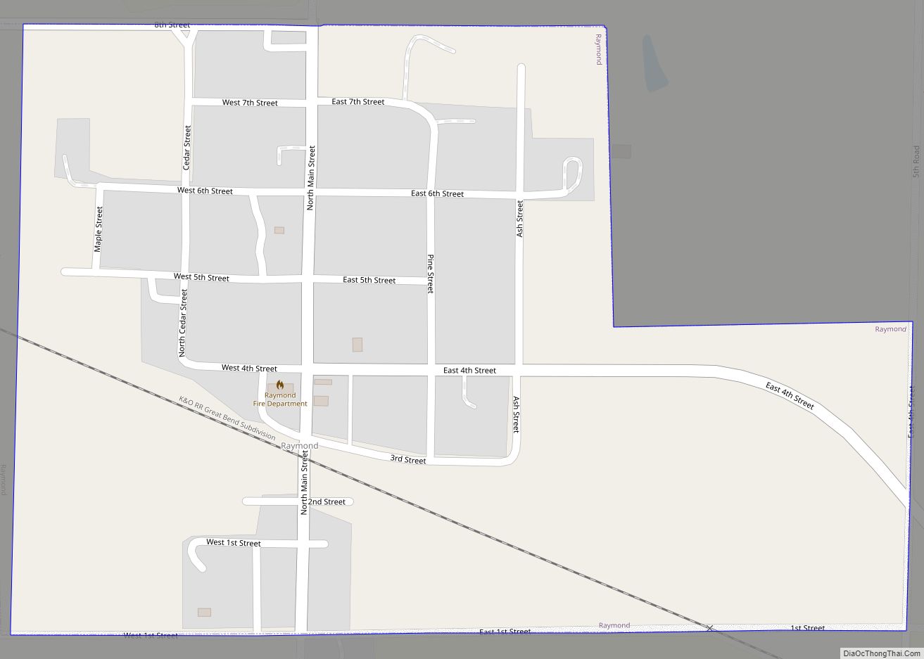
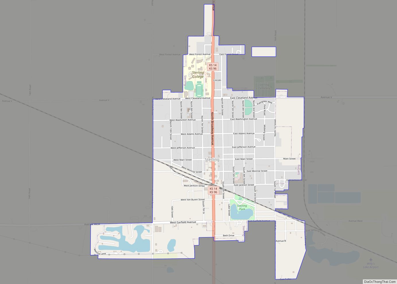
Online Interactive Map
Click on ![]() to view map in "full screen" mode.
to view map in "full screen" mode.
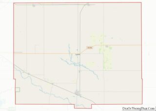
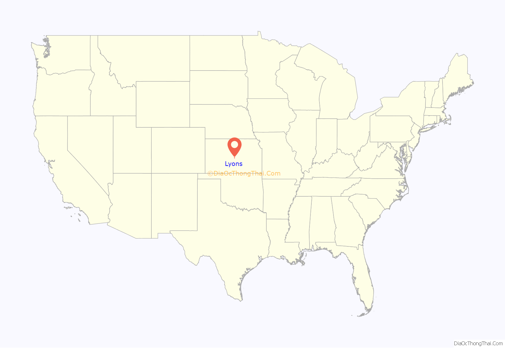
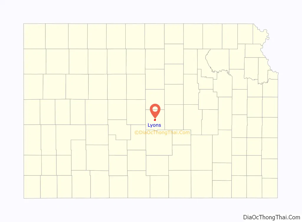
Lyons location map. Where is Lyons city?
History
For millennia, the land now known as Kansas was inhabited by Native Americans.
Although Coronado’s exact route across the plains is uncertain and has been widely disputed, his men and he are thought to have camped near the present location of Lyons on their quest for Quivira, a Native American place that Indians to the southwest had told them was fabulously wealthy in gold.
West of Lyons is a cross commemorating Juan de Padilla, a member of Coronado’s expedition, who returned the following year as a missionary. He was killed in 1542 by Native Americans after establishing a church in the area, and is considered the first Christian martyr in North America.
In 1803, most of modern Kansas was secured by the United States as part of the Louisiana Purchase.
Lyons Main Street (U.S. Highway 56) is based on the Santa Fe Trail.
In 1854, the Kansas Territory was organized, then in 1861 Kansas became the 34th U.S. state. In 1867, Rice County was founded.
Lyons was originally called Atlanta, and under the latter name was founded in 1870. It was renamed Lyons in 1876, in honor of Freeman J. Lyons.
In 1878, Atchison, Topeka and Santa Fe Railway and parties from Marion County and McPherson County chartered the Marion and McPherson Railway Company. In 1879, a branch line was built from Florence to McPherson, in 1880, it was extended to Lyons, and in 1881, it was extended to Ellinwood. The line was leased and operated by the Atchison, Topeka and Santa Fe Railway. The line from Florence to Marion, was abandoned in 1968. In 1992, the line from Marion to McPherson was sold to Central Kansas Railway. In 1993, after heavy flood damage, the line from Marion to McPherson was abandoned. The original branch line connected Florence, Marion, Canada, Hillsboro, Lehigh, Canton, Galva, McPherson, Conway, Windom, Little River, Mitchell, Lyons, Chase, and Ellinwood.
Lyons was incorporated as a city in 1880, the same year the railroad was built through it.
In 1890, the Western Salt Company put down its first shaft to mine salt in Lyons.
In the 1970s, the federal government was interested in using a local site for the burial of high-level nuclear waste.
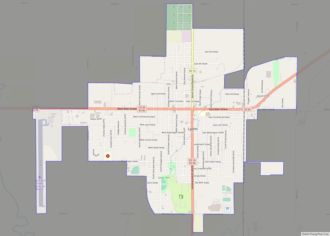
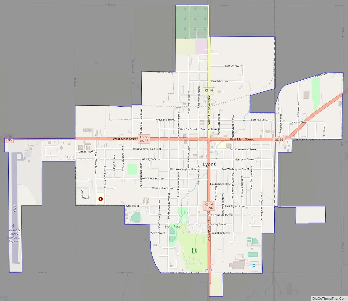
Lyons Road Map
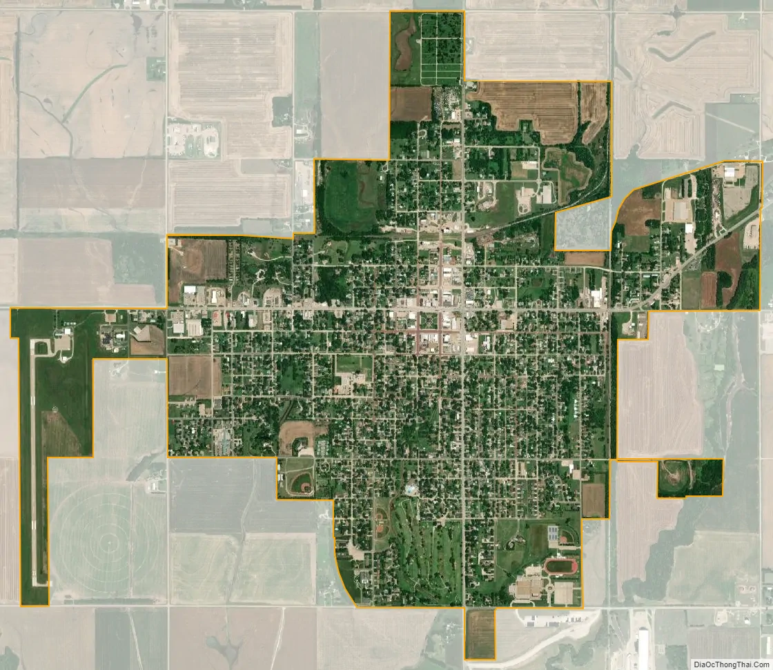
Lyons city Satellite Map
Geography
Lyons is located at 38°20′42″N 98°12′9″W / 38.34500°N 98.20250°W / 38.34500; -98.20250 (38.344962, -98.202493). According to the United States Census Bureau, the city has a total area of 2.36 square miles (6.11 km), all land.
Climate
According to the Köppen climate classification, Lyons has a humid continental climate, Dfa on climate maps.
See also
Map of Kansas State and its subdivision:- Allen
- Anderson
- Atchison
- Barber
- Barton
- Bourbon
- Brown
- Butler
- Chase
- Chautauqua
- Cherokee
- Cheyenne
- Clark
- Clay
- Cloud
- Coffey
- Comanche
- Cowley
- Crawford
- Decatur
- Dickinson
- Doniphan
- Douglas
- Edwards
- Elk
- Ellis
- Ellsworth
- Finney
- Ford
- Franklin
- Geary
- Gove
- Graham
- Grant
- Gray
- Greeley
- Greenwood
- Hamilton
- Harper
- Harvey
- Haskell
- Hodgeman
- Jackson
- Jefferson
- Jewell
- Johnson
- Kearny
- Kingman
- Kiowa
- Labette
- Lane
- Leavenworth
- Lincoln
- Linn
- Logan
- Lyon
- Marion
- Marshall
- McPherson
- Meade
- Miami
- Mitchell
- Montgomery
- Morris
- Morton
- Nemaha
- Neosho
- Ness
- Norton
- Osage
- Osborne
- Ottawa
- Pawnee
- Phillips
- Pottawatomie
- Pratt
- Rawlins
- Reno
- Republic
- Rice
- Riley
- Rooks
- Rush
- Russell
- Saline
- Scott
- Sedgwick
- Seward
- Shawnee
- Sheridan
- Sherman
- Smith
- Stafford
- Stanton
- Stevens
- Sumner
- Thomas
- Trego
- Wabaunsee
- Wallace
- Washington
- Wichita
- Wilson
- Woodson
- Wyandotte
- Alabama
- Alaska
- Arizona
- Arkansas
- California
- Colorado
- Connecticut
- Delaware
- District of Columbia
- Florida
- Georgia
- Hawaii
- Idaho
- Illinois
- Indiana
- Iowa
- Kansas
- Kentucky
- Louisiana
- Maine
- Maryland
- Massachusetts
- Michigan
- Minnesota
- Mississippi
- Missouri
- Montana
- Nebraska
- Nevada
- New Hampshire
- New Jersey
- New Mexico
- New York
- North Carolina
- North Dakota
- Ohio
- Oklahoma
- Oregon
- Pennsylvania
- Rhode Island
- South Carolina
- South Dakota
- Tennessee
- Texas
- Utah
- Vermont
- Virginia
- Washington
- West Virginia
- Wisconsin
- Wyoming