Whitestown is a town in Boone County, Indiana, United States. The population was 10,187 at the 2020 census. The town is located near Interstate 65, approximately 22 miles (35 km) northwest of Downtown Indianapolis, and about 7 miles (11 km) from the northern city limits of Indianapolis, between exits 130 and 133. Since 2010, Whitestown has been the fastest-growing municipality in Indiana; its population increased more than threefold between the 2010 and 2020 Census tabulations.
| Name: | Whitestown town |
|---|---|
| LSAD Code: | 43 |
| LSAD Description: | town (suffix) |
| State: | Indiana |
| County: | Boone County |
| Elevation: | 938 ft (286 m) |
| Total Area: | 14.02 sq mi (36.32 km²) |
| Land Area: | 14.02 sq mi (36.32 km²) |
| Water Area: | 0.00 sq mi (0.00 km²) |
| Total Population: | 10,178 |
| Population Density: | 725.81/sq mi (280.23/km²) |
| ZIP code: | 46075 |
| Area code: | 317 |
| FIPS code: | 1884014 |
| GNISfeature ID: | 0445978 |
| Website: | whitestown.in.gov |
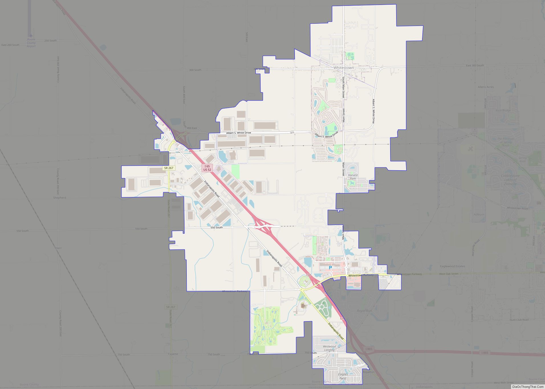
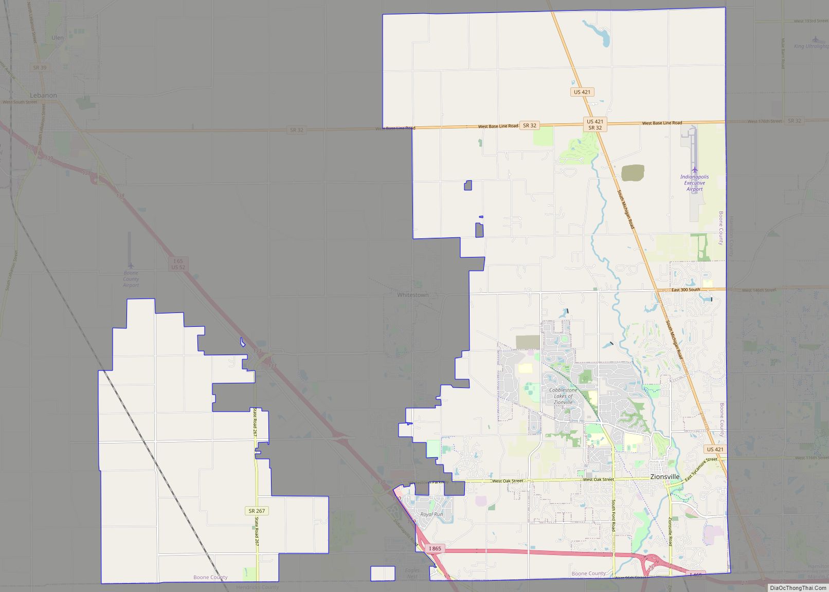
Online Interactive Map
Click on ![]() to view map in "full screen" mode.
to view map in "full screen" mode.
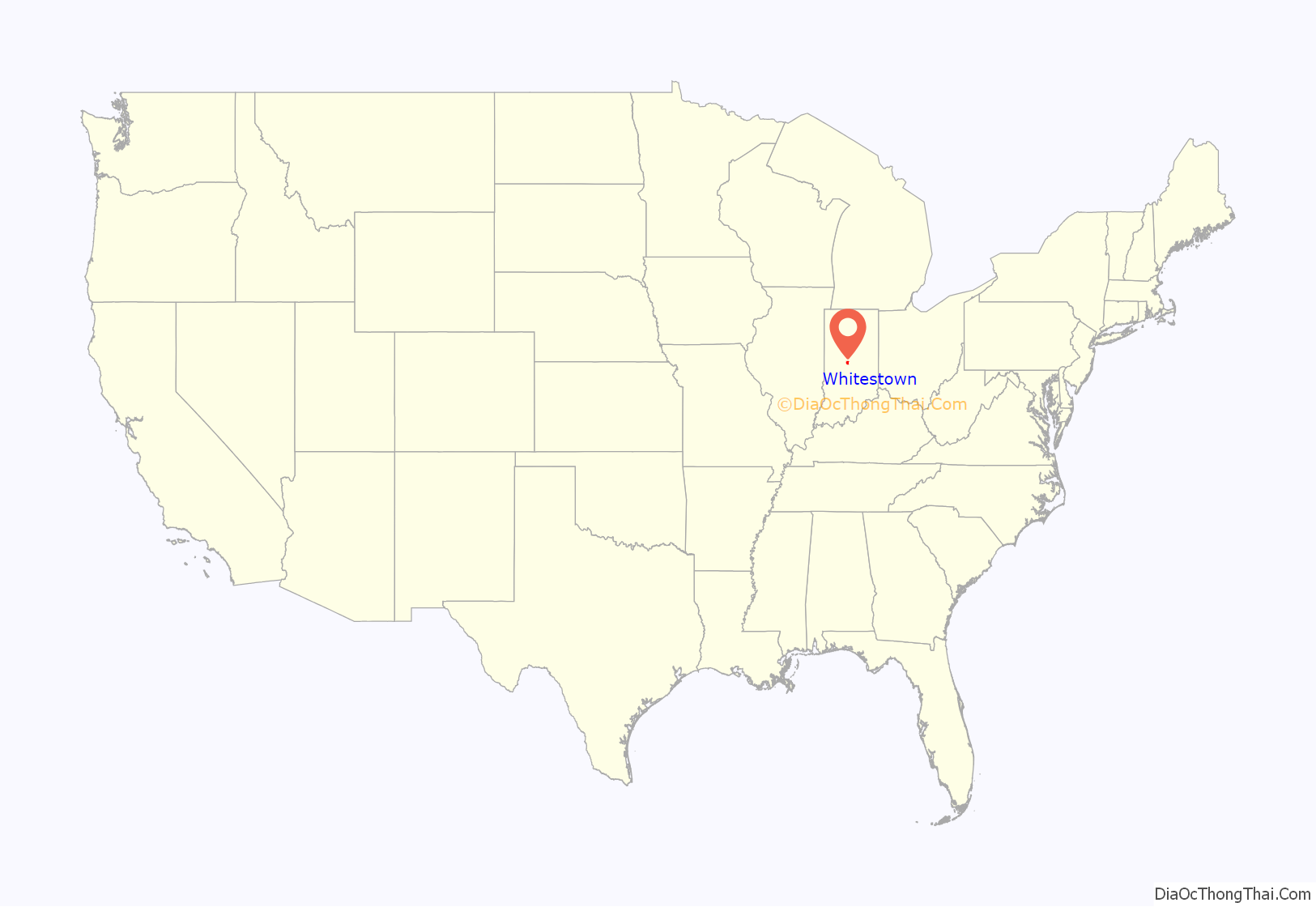
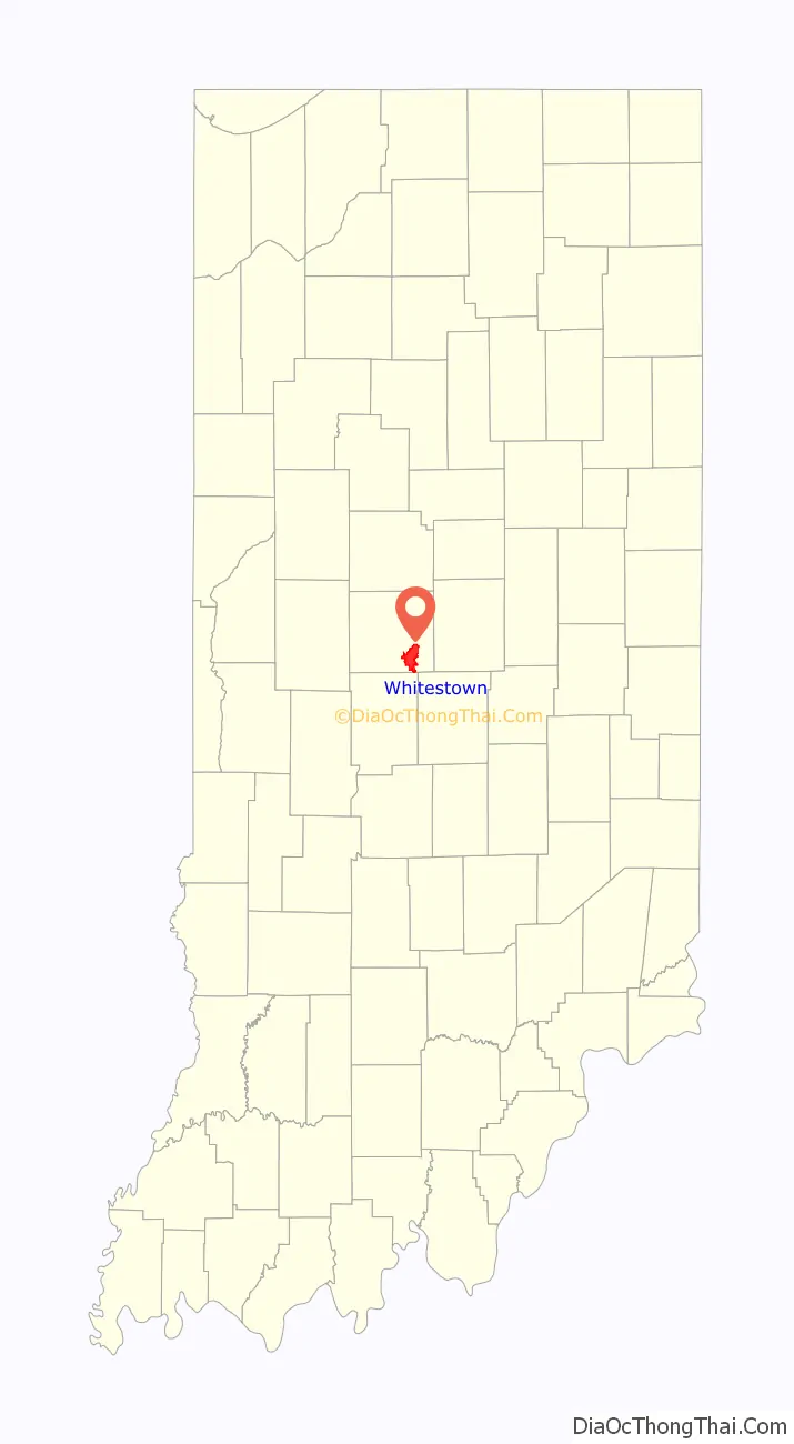
Whitestown location map. Where is Whitestown town?
History
Whitestown was laid out in 1851 when the railroad was extended to that point. It was named for Albert Smith White, a U.S. Senator from Indiana. The name of the town has at points been noted for being easily perceived as having historical ties to racism in Indiana, despite Albert S. White being known as a leading abolitionist. The first post office in Whitestown was established in 1853.
In the late 2000s, Whitestown annexed 6,500 acres south of the historic downtown district. A master planned, mixed-use development named for U.S. Army officer and Boone County native Anson Mills was established in this area in 2005. The Great Recession adversely impacted the Anson project’s original construction schedule, but residential, retail, and commercial growth gained momentum starting in 2011 and continues to this day. The Anson development now features a large selection of retail, including a Meijer supercenter, a Lowe’s home improvement store, and several fashion and lifestyle stores including Burlington, Shoe Dept. Encore, TJ Maxx, Hobby Lobby, and Five Below.
From 2010 until current day, Whitestown has been the fastest-growing municipality in Indiana, more than doubling in population between 2010 and 2017.
Whitestown is the home of the Little League Central Region headquarters. In 2021, a new complex opened, including the Central Region Headquarters administration building, a gift shop, and a Little League field with stadium seating, bleachers, a press box, and lights. The complex hosts both the Little League Softball Central Region and the Great Lakes and Midwest Region tournaments.
Whitestown Road Map
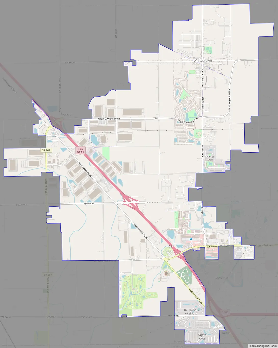
Whitestown city Satellite Map

Geography
Whitestown is located at 39°59′46″N 86°20′41″W / 39.99611°N 86.34472°W / 39.99611; -86.34472 (39.996136, -86.344612).
According to the 2010 census, the town has a total area of 10.46 square miles (27.1 km), all land.
See also
Map of Indiana State and its subdivision:- Adams
- Allen
- Bartholomew
- Benton
- Blackford
- Boone
- Brown
- Carroll
- Cass
- Clark
- Clay
- Clinton
- Crawford
- Daviess
- De Kalb
- Dearborn
- Decatur
- Delaware
- Dubois
- Elkhart
- Fayette
- Floyd
- Fountain
- Franklin
- Fulton
- Gibson
- Grant
- Greene
- Hamilton
- Hancock
- Harrison
- Hendricks
- Henry
- Howard
- Huntington
- Jackson
- Jasper
- Jay
- Jefferson
- Jennings
- Johnson
- Knox
- Kosciusko
- LaGrange
- Lake
- Lake Michigan
- LaPorte
- Lawrence
- Madison
- Marion
- Marshall
- Martin
- Miami
- Monroe
- Montgomery
- Morgan
- Newton
- Noble
- Ohio
- Orange
- Owen
- Parke
- Perry
- Pike
- Porter
- Posey
- Pulaski
- Putnam
- Randolph
- Ripley
- Rush
- Saint Joseph
- Scott
- Shelby
- Spencer
- Starke
- Steuben
- Sullivan
- Switzerland
- Tippecanoe
- Tipton
- Union
- Vanderburgh
- Vermillion
- Vigo
- Wabash
- Warren
- Warrick
- Washington
- Wayne
- Wells
- White
- Whitley
- Alabama
- Alaska
- Arizona
- Arkansas
- California
- Colorado
- Connecticut
- Delaware
- District of Columbia
- Florida
- Georgia
- Hawaii
- Idaho
- Illinois
- Indiana
- Iowa
- Kansas
- Kentucky
- Louisiana
- Maine
- Maryland
- Massachusetts
- Michigan
- Minnesota
- Mississippi
- Missouri
- Montana
- Nebraska
- Nevada
- New Hampshire
- New Jersey
- New Mexico
- New York
- North Carolina
- North Dakota
- Ohio
- Oklahoma
- Oregon
- Pennsylvania
- Rhode Island
- South Carolina
- South Dakota
- Tennessee
- Texas
- Utah
- Vermont
- Virginia
- Washington
- West Virginia
- Wisconsin
- Wyoming