Sacramento (Spanish for ‘sacrament’) (/ˌsækrəˈmɛntoʊ/ SAK-rə-MEN-toh; Spanish: [sakɾaˈmento]) is the capital city of the U.S. state of California and the seat and largest city of Sacramento County. Located at the confluence of the Sacramento and American River in Northern California’s Sacramento Valley, Sacramento’s 2020 population of 524,943 makes it the fourth-largest city in Northern California, sixth-largest city in California, and the ninth-largest capital in the United States. Sacramento is the seat of the California Legislature and the Governor of California, making it the state’s political center and a hub for lobbying and think tanks. It features the California State Capitol Museum.
Sacramento is also the cultural and economic core of the Greater Sacramento area, which at the 2020 census had a population of 2,680,831, the fourth-largest metropolitan area in California.
Before the arrival of the Spanish, the area was inhabited by the Nisenan, Maidu, and other indigenous peoples of California. Spanish cavalryman Gabriel Moraga surveyed and named the Río del Santísimo Sacramento (Sacramento River) in 1808, after the Blessed Sacrament. In 1839, Juan Bautista Alvarado, Mexican governor of Alta California, granted the responsibility of colonizing the Sacramento Valley to Swiss-born Mexican citizen John Augustus Sutter, who subsequently established Sutter’s Fort and the settlement at the Rancho Nueva Helvetia. Following the American Conquest of California and the 1848 Treaty of Guadalupe-Hidalgo, the waterfront developed by Sutter began to be developed and incorporated in 1850 as the City of Sacramento.
Sacramento is the fastest-growing major city in California, owing to its status as a notable political center on the West Coast and as a major educational hub, home of Sacramento State, and UC Davis. Similarly, Sacramento is a major center for the California healthcare industry, as the seat of Sutter Health, the world-renowned UC Davis Medical Center, and the UC Davis School of Medicine. It is a tourist destination, featuring the California Museum, Crocker Art Museum, California State Railroad Museum, California Hall of Fame, and Old Sacramento State Historic Park. It is also a global city, designated at the “Gamma”-level.
Sacramento is known for its evolving contemporary culture, even being dubbed the fourth most “hipster city” in the United States in one 2016 poll. In 2002, the Harvard University Civil Rights Project conducted for Time magazine ranked Sacramento as “America’s Most Diverse City”.
| Name: | Sacramento city |
|---|---|
| LSAD Code: | 25 |
| LSAD Description: | city (suffix) |
| State: | California |
| County: | Sacramento County |
| Incorporated: | February 27, 1850 |
| Elevation: | 26 ft (8 m) |
| Land Area: | 97.68 sq mi (253.00 km²) |
| Water Area: | 2.09 sq mi (5.41 km²) 2.19% |
| Population Density: | 5,374.11/sq mi (2,074.87/km²) |
| ZIP code: | 942xx, 958xx |
| Area code: | 916 and 279 |
| FIPS code: | 0664000 |
| Website: | cityofsacramento.org |
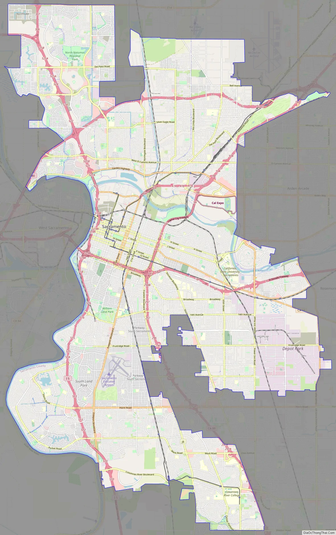
Discover Sacramento with a clickable map that highlights the city’s highways, roads, places of interest, and things to do. Explore the city’s vibrant neighborhoods, history, and landmarks all on one map. Get acquainted with Sacramento, the capital city of California, and explore its best places and attractions with an interactive map.
Online Interactive Map
Click on ![]() to view map in "full screen" mode.
to view map in "full screen" mode.
This interactive map is the perfect tool to explore the city of Sacramento. Browse around and discover the hidden gems, foodie hotspots, and must-see attractions with ease. With the interactive map of Sacramento, you can find the perfect place for your next outing. Whether you’re looking for a new home, planning a visit, or just want to explore your city, our map is your key to getting around.
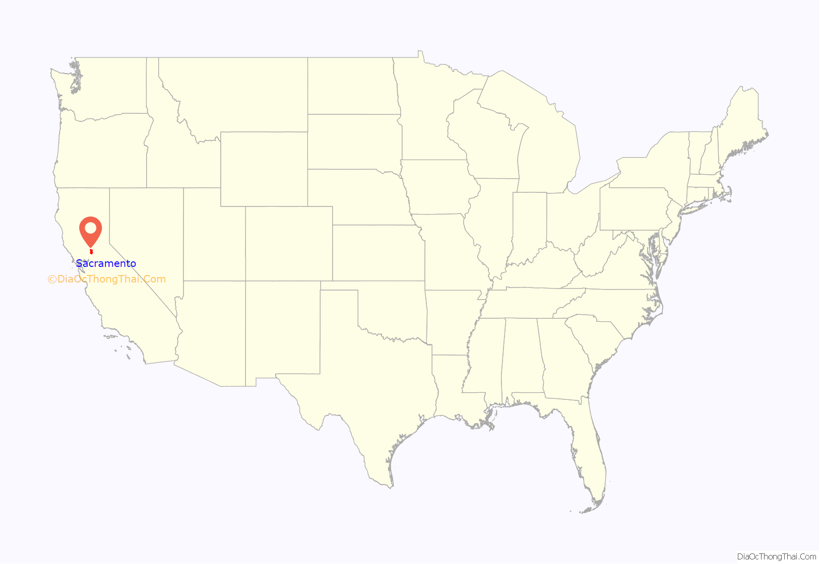
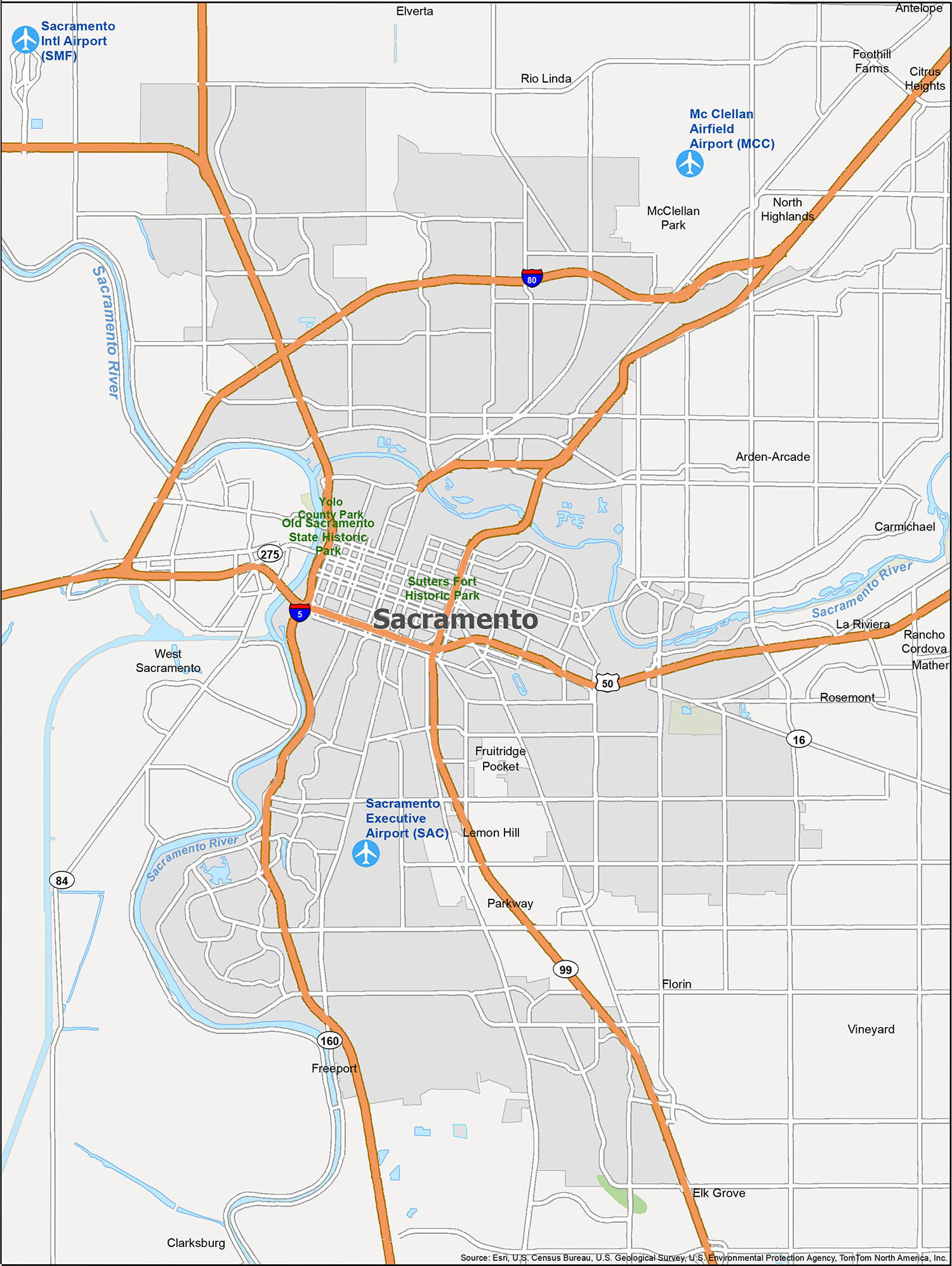
Sacramento location map. Where is Sacramento city?
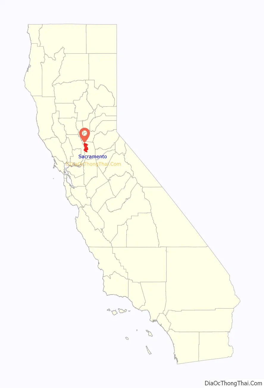
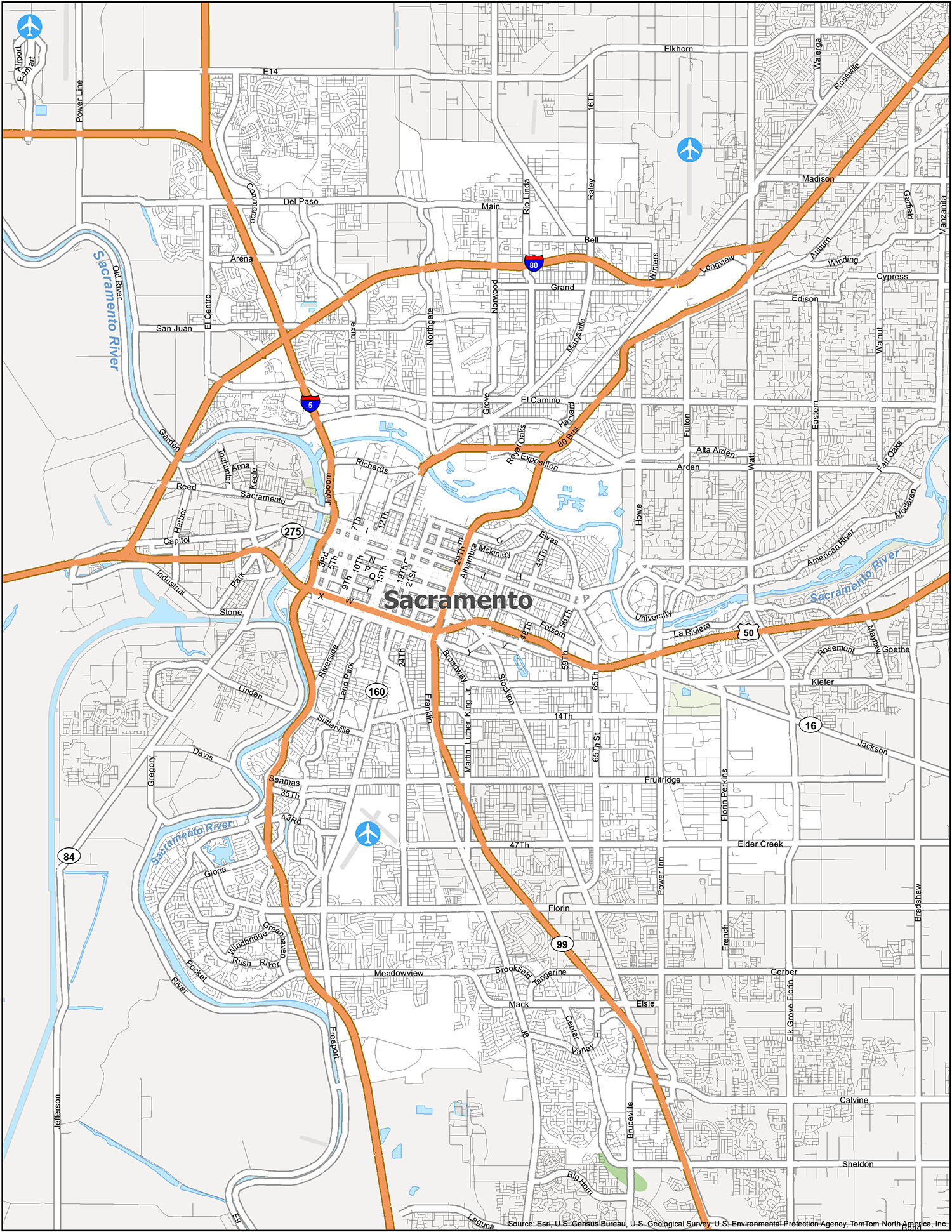
Sacramento Road Map
Exploring Sacramento doesn’t have to be a hassle. Our map of Sacramento provides an easy way to visualize the city and its surrounding areas. It includes major highways and roads, and is color-coded for easier navigation. With this map, you can plan your day and find the perfect place to enjoy it. For any travel outside of Sacramento, you will want to use a California road map to navigate around the state.
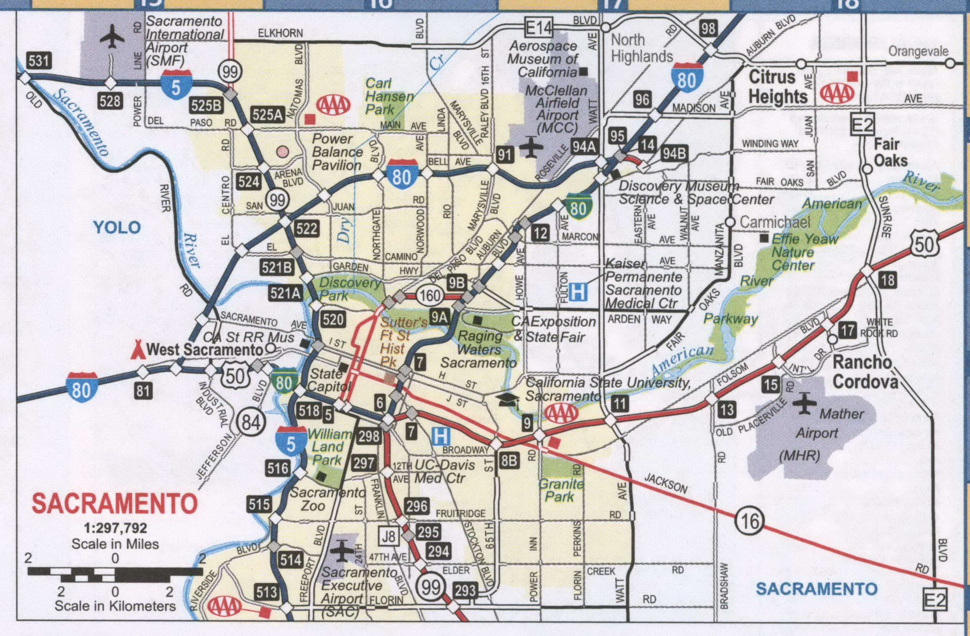
Looking to explore Sacramento and its surrounding cities? Whether you’re a local or a first-time visitor, our reference map will show you all the essential information you need to know, from parks and natural landmarks to points of interest. Get inspired and discover a new favorite place in Sacramento by exploring the city like a local. With so much to see and do, you’re sure to experience all the sights and sounds that Sacramento has to offer.
Airports: Sacramento International Airport (SMF)
Cities: Citrus Heights, Elk Grove, Rancho Cordova, Sacramento, West Sacramento
Census-designated place (CDP): Arden-Arcade, Carmichael, Clarksburg, Elverta, Florin, Foothill Farms, Freeport, Fruitridge Pocket, La Riviera, Lemon Hill, Mather, McClellan Park, North Highlands, Parkway, Rio Linda, Rosemont, Vineyard
Forests/Parks: Old Sacramento State Historic Park, Sutter’s Fort Historic Park, Yolo County Park
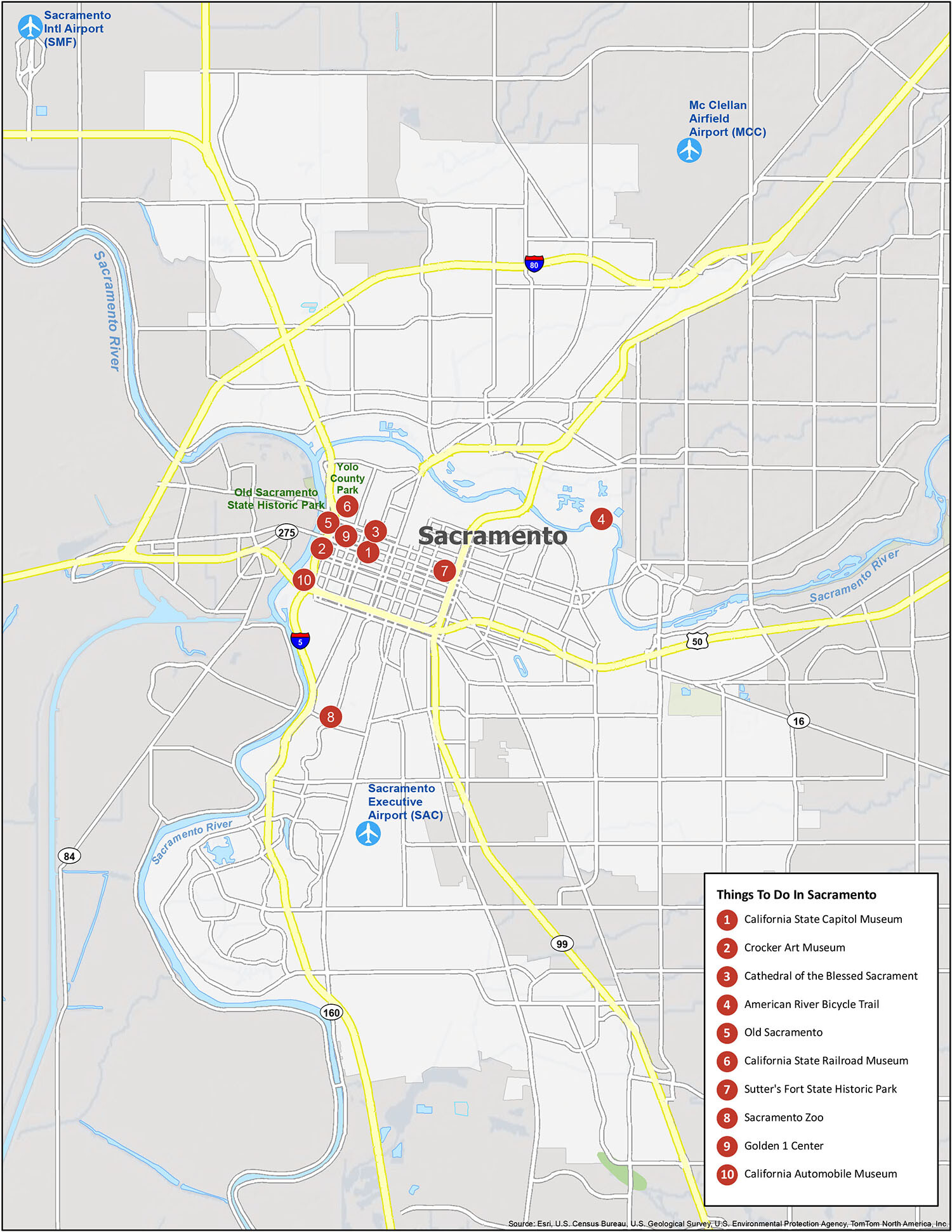
10 things to do in Sacramento city
Exploring Sacramento doesn’t have to be a hassle. Our map of Sacramento provides an easy way to visualize the city and its surrounding areas. It includes major highways and roads, and is color-coded for easier navigation. With this map, you can plan your day and find the perfect place to enjoy it. For any travel outside of Sacramento, you will want to use a California road map to navigate around the state.
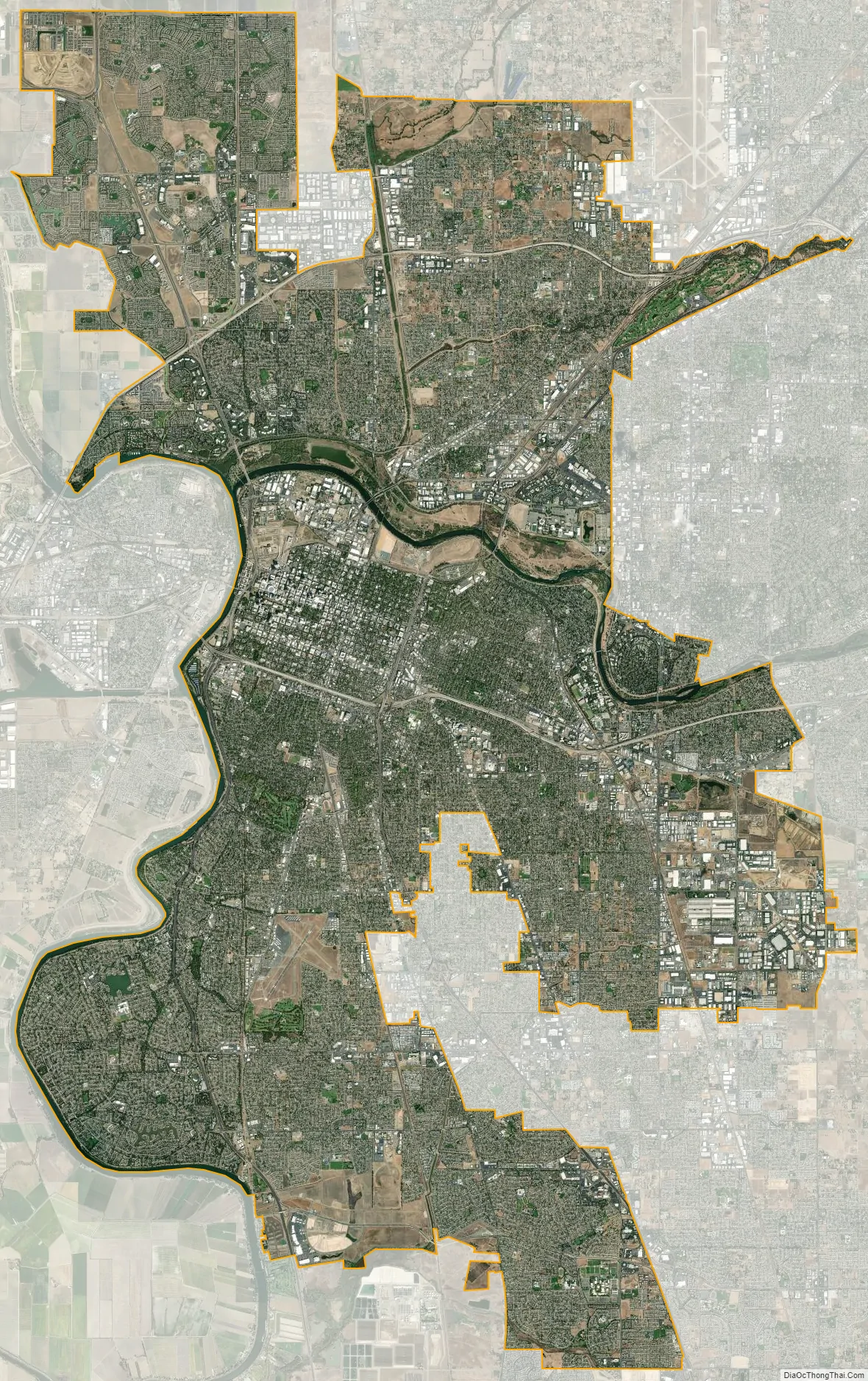
Sacramento city Satellite Map
Geography
According to the United States Census Bureau, the city covers 100.1 square miles (259 km). 97.81% of it is land, and 2.19% of it is water.
Depth to groundwater is typically about 30 feet (9 m). Much of the land to the west of the city (in Yolo County) is permanently reserved for a vast flood control basin (the Yolo Bypass), due to the city’s historical vulnerability to floods. As a result, the contiguous urban area sprawls only four miles (6.4 km) west of downtown (as West Sacramento, California) but 30 miles (48 km) northeast and east, into the Sierra Nevada foothills, and 10 miles (16 km) to the south into valley farmland.
The city is at the confluence of the Sacramento River and the American River and has a deep-water port connected to the San Francisco Bay by a channel through the Sacramento–San Joaquin River Delta. It is the shipping and rail center for the Sacramento Valley.
Trees
Sacramento has long been known as the “City of Trees” owing to its abundant urban forest. The city has more trees per capita than anywhere else in the world. The first recorded use of the term was in 1855, and it was popular by the early 20th century. It was not always so: it was at first called the “City of Plains” because of the lack of trees, but soon afterward there were cottonwood trees planted, and eucalyptus varieties were imported to dry out swampland. Later, locust trees, and willows were planted along streets, then elms, then palm trees, then fruit trees in the late 1910s. It was the first US city to be designated a City of Trees by the Arbor Day Foundation in 1978.
In the early 21st century, the tree cover is well above that of the average tree cover of other major cities in the United States and the rest of the world, with the main species being the London plane. Other species are being introduced to increase diversity and to help cope with the effects of climate change on vegetation in the future. Treepedia, a project run by MIT using Google Maps’ street-view data to calculate tree coverage in cities, ranked Sacramento the greenest city of 15 studied in the US, and third globally, after Vancouver and Singapore.
A prominent water tower bore the slogan “City of Trees” until 2017 when it was repainted with the words “America’s Farm-to-Fork Capital” (referring to the farm-to-fork movement, which promotes the consumption of locally-grown food). After 4,000 displeased citizens signed a petition protesting the change, officials agreed to include both slogans on the water tower.
Cityscape
The city groups most of its neighborhoods into four areas:
- Area One: Alkali Flat, Boulevard Park, Campus Commons, Sacramento State, Dos Rios Triangle, Downtown, East Sacramento, Fab Forties, Mansion Flats, Marshall School, Midtown, New Era Park, McKinley Village, Newton Booth, Old Sacramento, Poverty Ridge, Richards, Richmond Grove, River Park, Elmhurst, Sierra Oaks, Southside Park.
- Area Two: Airport, Carleton Tract, Freeport Manor, Golf Course Terrace, Greenhaven, Curtis Park, Hollywood Park, Land Park, Little Pocket, Mangan Park, Meadowview, Parkway, Pocket, Sacramento City College, South Land Park, Valley Hi / North Laguna, Z’Berg Park.
- Area Three: Alhambra Triangle, Avondale, Brentwood, Carleton Tract, Colonial Heights, Colonial Manor, Curtis Park, Elmhurst, Fairgrounds, Florin, Fruitridge Manor, Glen Elder, Glenbrook, Granite Regional Park, Industrial Park, Lawrence Park, Med Center, North City Farms, Oak Park, Packard Bell, South City Farms, Southeast Village, Tahoe Park, Tahoe Park East, Tahoe Park South, Tallac Village, Vintage Park, Churchill Downs, and Woodbine.
- Area Four: Ben Ali, Del Paso Heights, Gardenland, Hagginwood, McClellan Heights West, Natomas (north, south, west), North Sacramento, Northgate, Robla, Swanston Estates, Terrace Manor, Valley View Acres, and Woodlake.
Additional prominent regions and neighborhoods in the city include American River Parkway, Arden-Arcade, Arden Fair, Cal Expo, Capital Avenue, Coffing, College Glen, College Greens, Cordova, Creekside, East Fruitridge, Elder Creek, Elkhorn, Elvas, Erikson Industrial Park, Excelsior Sunrise, Foothill Farms, Franklin, Frates Ranch, Gateway Center, Gateway West, Glenwood Meadows, Hansen Park, Heritage Park, Johnson Business Park, Johnson Heights, Mayhew, Metro Center, Mills, Natomas Corporate Center, Natomas Creek, Natomas Crossing, Natomas Park, Newton Booth, Noralto, Northpointe, Norwood, Oak Knoll, Old North Sacramento, Parker Homes, Point West, Raley Industrial Park, Regency Park, Richardson Village, Richmond Grove, Rosemont, Sierra Oaks, Sports Complex, Strawberry Manor, Sundance Lake, Swanston Palms, Town and Country Village, Upper Land Park, Village 5, Village 7, Village 12, Village 14, Village Green, Walerga, Walsh Station, West Del Paso Heights, Westlake, Willowcreek, Wills Acres, Winn Park, Woodside, and Youngs Heights.
Climate
Sacramento has a hot-summer Mediterranean climate (Köppen Csa), characterized by hot, dry summers and cool winters with a decent amount of rainfall. The wet season is generally October through April, though there may be a day or two of light rainfall in June or September. The normal annual mean temperature is 61.8 °F (16.6 °C), with the monthly daily average temperature ranging from 47.3 °F (8.5 °C) in December to 75.9 °F (24.4 °C) in July. Summer heat is sometimes moderated by a sea breeze known as the “delta breeze” which comes through the Sacramento–San Joaquin River Delta from the San Francisco Bay, and temperatures cool down sharply at night.
The foggiest months are December and January. Tule fog can be extremely dense, lowering visibility to less than 100 feet (30 m) and making driving conditions extremely hazardous. Chilling tule fog events have been known to last for several consecutive days or weeks. During Tule fog events, temperatures do not exceed 50 °F (10 °C).
Snowfall is rare in Sacramento, which is only 25 ft (8 m) above sea level. In the downtown area, only three significant snow accumulations have occurred since 1900, the last one being in 1976. During especially cold winter and spring storms, intense showers do occasionally produce a significant amount of hail, which can create hazardous driving conditions. Snowfall in the city often melts upon ground contact, with traceable amounts occurring in some years. Significant annual snow accumulations occur in the foothills 40 mi (64 km) east of the city, which had brief and traceable amounts of snowfall in January 2002, December 2009, and February 2011. The greatest snowfall ever recorded in Sacramento was 3 inches (7.6 cm) on January 5, 1888. On average, there are 76 days with a high of 90 °F (32 °C)+, and 14 days with a high of 100 °F (38 °C)+; On the other extreme, there are 8.5 days where the temperature remains below 50 °F (10 °C), and 15 freezing nights per year. Official temperature extremes range from 18 °F (−7.8 °C) on December 22, 1990, to 116 °F (46.7 °C) on September 6, 2022; a station around 5 mi (8.0 km) east-southeast of the city dipped to 17 °F (−8.3 °C) on December 11, 1932.
The average annual precipitation is 18.14 inches (461 mm). On average, precipitation falls on 58 days each year in Sacramento, and nearly all of this falls during the winter months. Average January rainfall is 3.66 in (93 mm), and measurable precipitation is rare during the summer months. In February 1992, Sacramento had 16 consecutive days of rain, resulting in an accumulation of 6.41 in (163 mm) for the period. On rare occasions, monsoonal moisture surges from the Desert Southwest can bring upper-level moisture to the Sacramento region, leading to increased summer cloudiness, humidity, and even light showers and thunderstorms. Monsoon clouds do occur, usually during late July through early September. Sacramento is the second most flood-susceptible city in the United States after New Orleans.
Sacramento has been noted as being the sunniest location on the planet for four months of the year, from May through August. It holds the distinction as the sunniest month, in terms of the percentage of possible sunshine, of anywhere in the world; July in Sacramento averages 14 hours and 12 minutes of sunshine per day, amounting to approximately 100% of possible sunshine.
Since 2010, statewide droughts in California have further strained Sacramento’s water security.
See also
Map of California State and its subdivision:- Alameda
- Alpine
- Amador
- Butte
- Calaveras
- Colusa
- Contra Costa
- Del Norte
- El Dorado
- Fresno
- Glenn
- Humboldt
- Imperial
- Inyo
- Kern
- Kings
- Lake
- Lassen
- Los Angeles
- Madera
- Marin
- Mariposa
- Mendocino
- Merced
- Modoc
- Mono
- Monterey
- Napa
- Nevada
- Orange
- Placer
- Plumas
- Riverside
- Sacramento
- San Benito
- San Bernardino
- San Diego
- San Francisco
- San Joaquin
- San Luis Obispo
- San Mateo
- Santa Barbara
- Santa Clara
- Santa Cruz
- Shasta
- Sierra
- Siskiyou
- Solano
- Sonoma
- Stanislaus
- Sutter
- Tehama
- Trinity
- Tulare
- Tuolumne
- Ventura
- Yolo
- Yuba
- Alabama
- Alaska
- Arizona
- Arkansas
- California
- Colorado
- Connecticut
- Delaware
- District of Columbia
- Florida
- Georgia
- Hawaii
- Idaho
- Illinois
- Indiana
- Iowa
- Kansas
- Kentucky
- Louisiana
- Maine
- Maryland
- Massachusetts
- Michigan
- Minnesota
- Mississippi
- Missouri
- Montana
- Nebraska
- Nevada
- New Hampshire
- New Jersey
- New Mexico
- New York
- North Carolina
- North Dakota
- Ohio
- Oklahoma
- Oregon
- Pennsylvania
- Rhode Island
- South Carolina
- South Dakota
- Tennessee
- Texas
- Utah
- Vermont
- Virginia
- Washington
- West Virginia
- Wisconsin
- Wyoming


