Cherokee County is the westernmost county in the U.S. state of North Carolina. It borders Tennessee to its west and Georgia to its south. As of the 2020 census, the population was 28,774. The county seat is Murphy, elevation 1604 ft.
| Name: | Cherokee County |
|---|---|
| FIPS code: | 37-039 |
| State: | North Carolina |
| Founded: | 1839 |
| Named for: | Cherokee Indians |
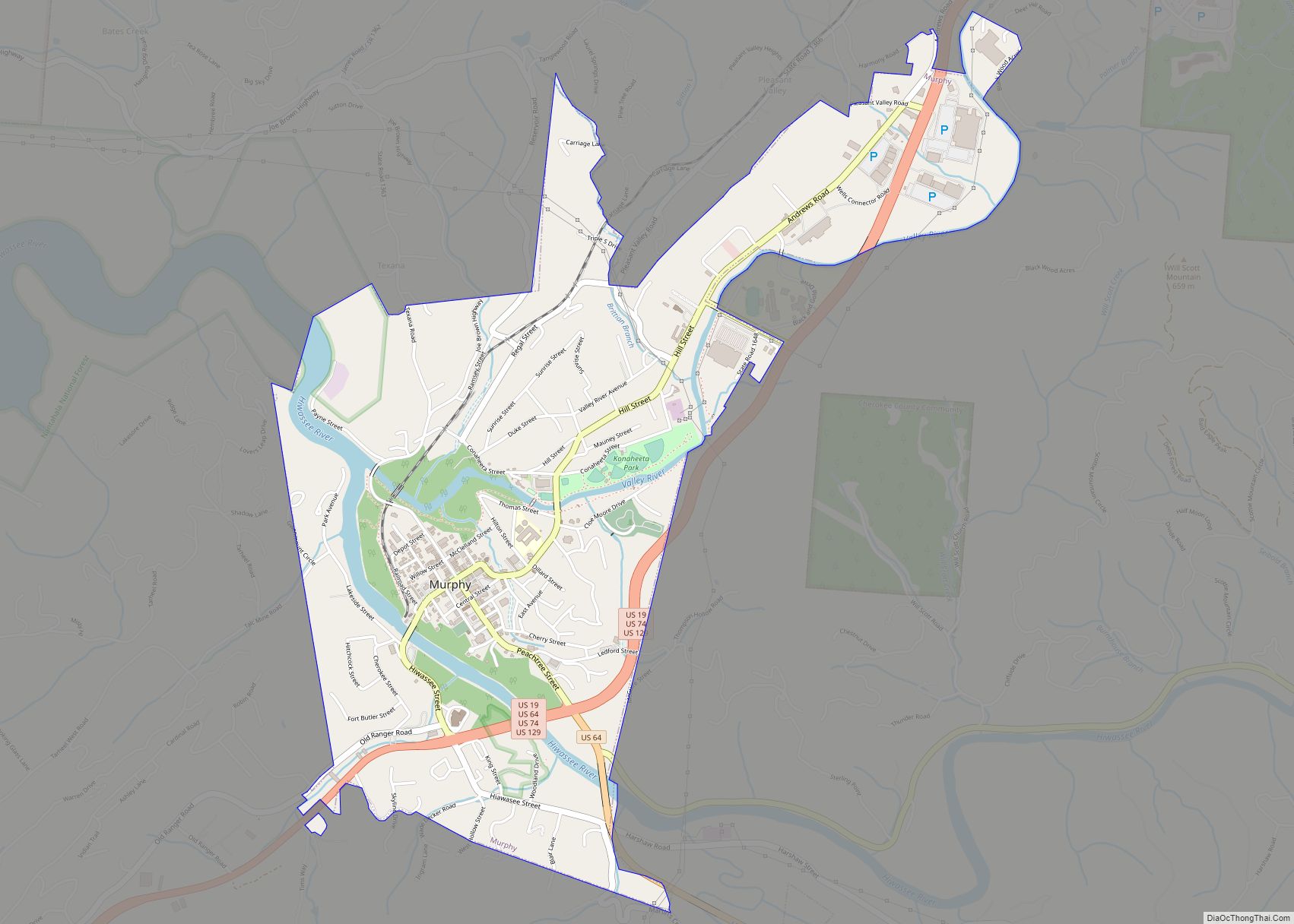
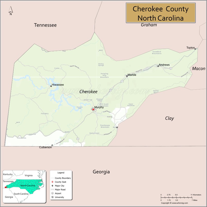
| Seat: | Murphy |
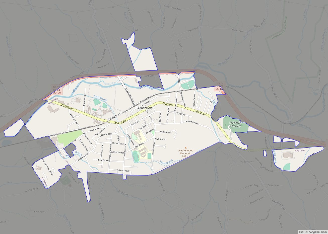
| Largest town: | Andrews |
| Total Area: | 467 sq mi (1,210 km²) |
| Land Area: | 455 sq mi (1,180 km²) |
| Total Population: | 29,167 |
| Population Density: | 64.1/sq mi (24.7/km²) |
| Time zone: | UTC−5 (Eastern) |
| Summer Time Zone (DST): | UTC−4 (EDT) |
| Website: | www.cherokeecounty-nc.gov |
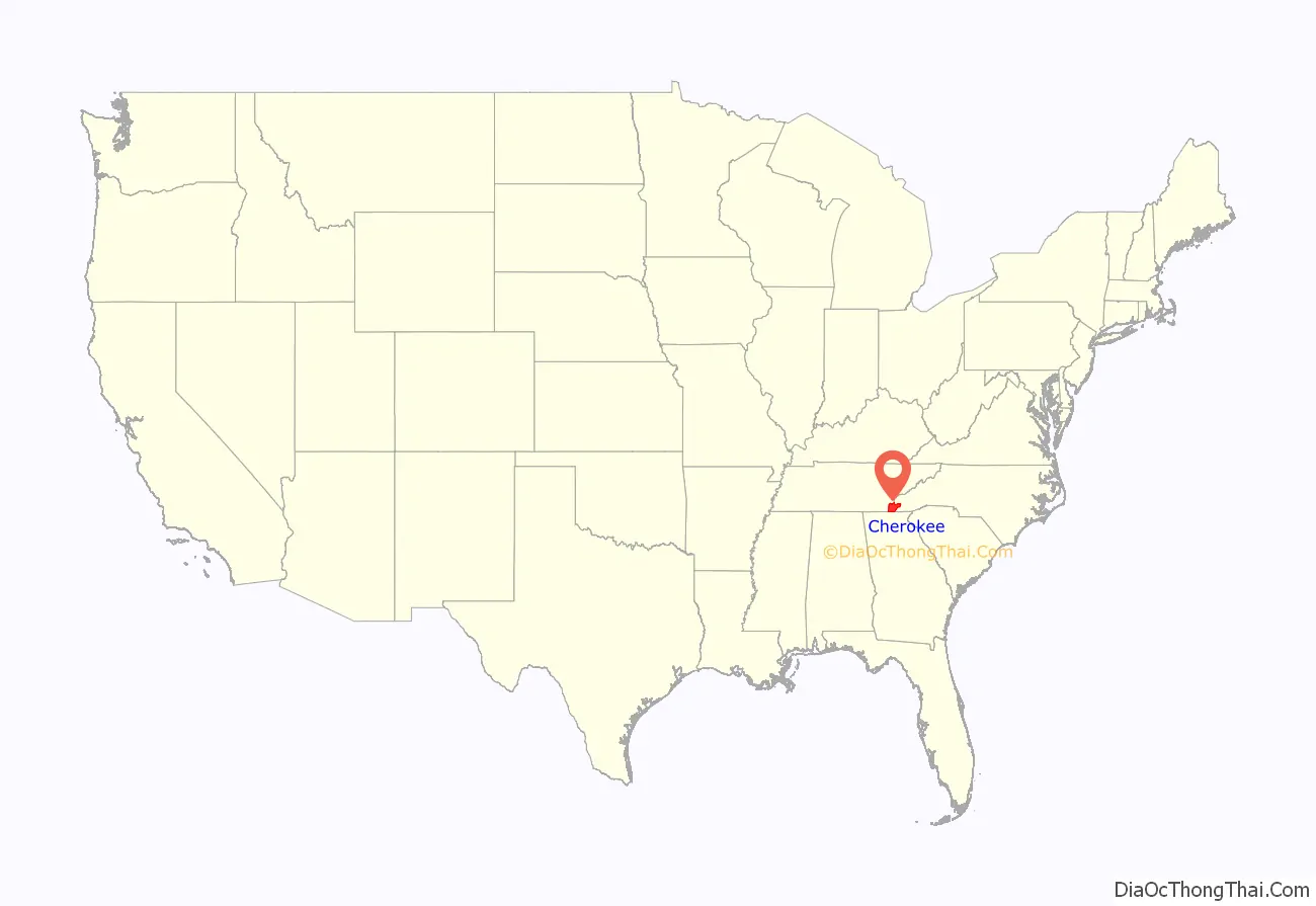
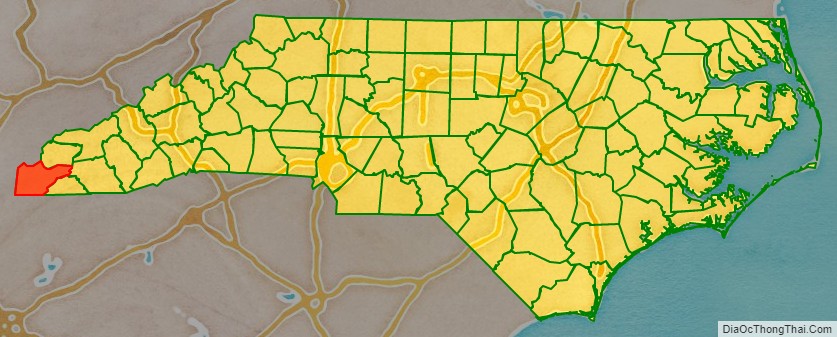
Cherokee County location map. Where is Cherokee County?
History
This area was occupied for thousands of years by indigenous peoples who settled in the river valleys. It was part of the historic Cherokee homelands, a large territory composed of areas of what are now western Virginia, western North and South Carolina, eastern Tennessee, and northeastern Georgia.
The county was formed in 1839 from the western part of Macon County in the year that the United States removed most of the Cherokee from the Southeast on what became known as the Trail of Tears. The county was named for the Cherokee Native Americans. It is near the Qualla Boundary, now lands of the federally recognized Eastern Band of Cherokee Indians. This is the only such recognized tribe in North Carolina. The tribe is primarily composed of descendants of Cherokee who remained in North Carolina at the time of removal.
As European-American population increased in the area in the 19th century, the state legislature created new counties. In 1861 the southeastern part of Cherokee County became Clay County. In 1872, its northeastern part was separated and organized as Graham County.
In the late 19th century, there was widespread interest in Native American cultures. In the 1870s, the Valentine brothers of Richmond, Virginia, caused extensive damage to at least eight ancient mounds in Cherokee, Haywood, Jackson, and Swain counties. They roughly excavated and looted them, seeking artifacts for the museum of their father, Mann S. Valentine, which he operated in Richmond.
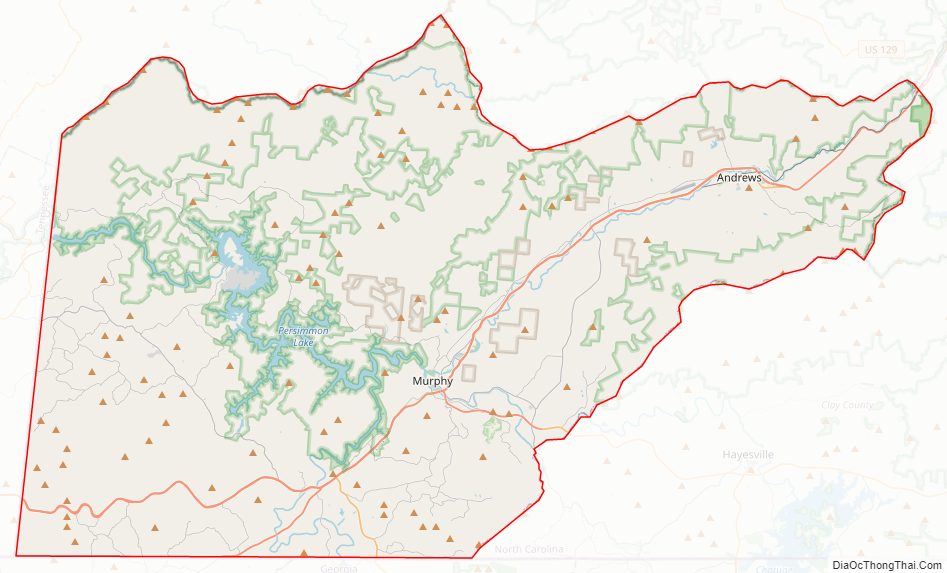
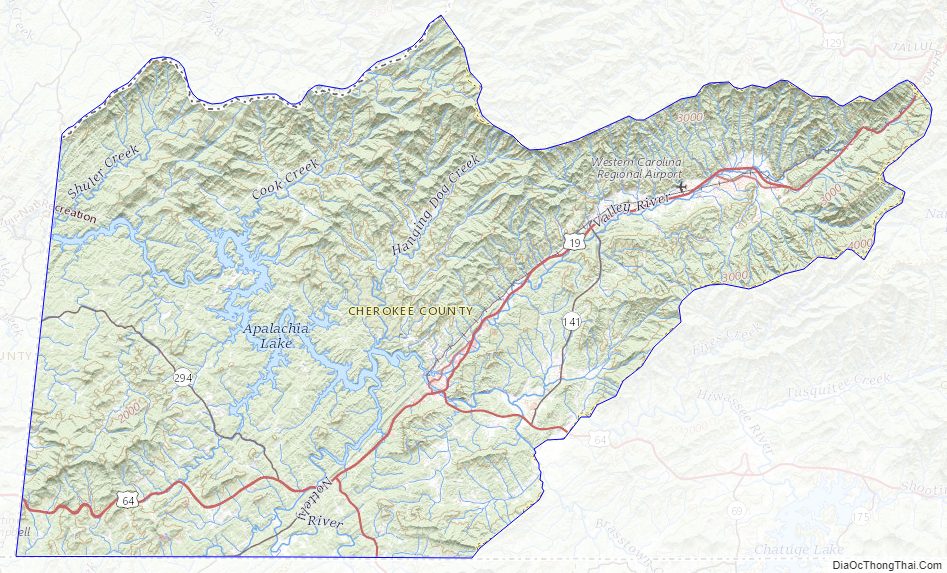
Cherokee County Road Map
Geography
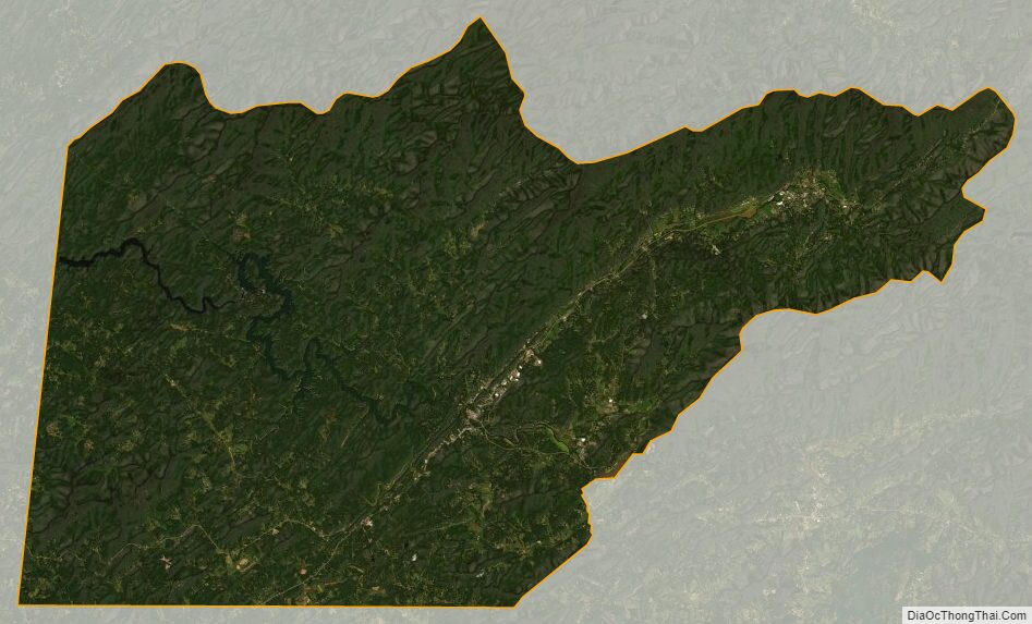
According to the U.S. Census Bureau, the county has a total area of 467 square miles (1,210 km), of which 455 square miles (1,180 km) is land and 11 square miles (28 km) (2.4%) is water.
Located in the southern Appalachian Mountains, Cherokee County contains a varied natural landscape. Portions of the county fall within the boundaries of the Nantahala National Forest. The Hiwassee River flows into Tennessee after passing through this county from southeast to northwest; it is a tributary of the Tennessee River. Both rivers are known to have had several historic Cherokee towns and villages located along their banks.
In April 1974, parts of Cherokee County were affected by a historic weather event, the 1974 Super Outbreak of tornadoes. This affected parts of 13 states and was the second-largest such event to be recorded in the U.S.
Indian reservation
Portions of the Qualla Boundary, also known as the Eastern Cherokee Indian Reservation, are located in Cherokee County. These are non-contiguous and are separate from the main part of the Qualla Boundary, which is in Swain and Jackson counties. The land is exclusive territory of the federally recognized Eastern Band of Cherokee Indians and is protected by their Tribal Police. Following the success of Harrah’s Cherokee Tribal Casino in Cherokee, the EBCI opened a second tribal casino in 2015 on a plot of their land here, located within the Murphy city limits.
National protected area
- Nantahala National Forest (part)
State and local protected areas
- Cherokee Lake Recreation Area
- Fires Creek Wildlife Management Area (part)
- Hanging Dog Recreation Area
Major water bodies
- Appalachia Lake
- Harold Wells Lake
- Hiwassee Lake
- Hiwassee River
- Junaluska Creek
- Little Tennessee River
- Moccasin Creek
- Peachtree Creek
- Valley River
- Welch Mill Creek
Adjacent counties
- Graham County – north
- Clay County – east
- Macon County – east
- Fannin County, Georgia – southwest
- Union County, Georgia – south
- Polk County, Tennessee – west
- Monroe County, Tennessee – northwest
Major highways
US 64, the longest highway in North Carolina, and a cross-country highway, passes through the county from east–west. US 74, which links Chattanooga, Asheville, Charlotte, and Wilmington, is a major 4-lane highway through the county. US 19 and US 129 also pass through the county, providing connections to Atlanta to the south and Knoxville to the north. There is also a plan to extend Interstate 24 from Chattanooga, to Charlotte.
- US 19
- US 19 Bus. (Andrews)
- US 19 Bus. (Murphy)
- US 64
- US 74
- US 129
- NC 60
- NC 141
- NC 294
Major Infrastrure
- Western Carolina Regional Airport
Cherokee County Topographic Map
Cherokee County Satellite Map
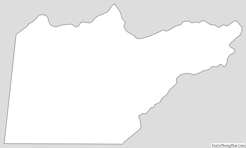
Cherokee County Outline Map