Knoxville is a city in and the county seat of Knox County, Tennessee, United States. As of the 2020 United States census, Knoxville’s population was 190,740, making it the largest city in the East Tennessee Grand Division and the state’s third largest city after Nashville and Memphis. It is the principal city of the Knoxville metropolitan area, which had a population of 879,773 in 2020.
First settled in 1786, Knoxville was the first capital of Tennessee. The city struggled with geographic isolation throughout the early 19th century; the arrival of the railroad in 1855 led to an economic boom. The city was bitterly divided over the issue of secession during the American Civil War and was occupied alternately by Confederate and Union armies, culminating in the Battle of Fort Sanders in 1863. Following the war, Knoxville grew rapidly as a major wholesaling and manufacturing center. The city’s economy stagnated after the 1920s as the manufacturing sector collapsed, the downtown area declined and city leaders became entrenched in highly partisan political fights. Hosting the 1982 World’s Fair helped reinvigorate the city, and revitalization initiatives by city leaders and private developers have had major successes in spurring growth in the city, especially the downtown area.
Knoxville is the home of the flagship campus of the University of Tennessee, whose sports teams, the Tennessee Volunteers, are popular in the surrounding area. Knoxville is also home to the headquarters of the Tennessee Valley Authority, the Tennessee Supreme Court’s courthouse for East Tennessee, and the corporate headquarters of several national and regional companies. As one of the largest cities in the Appalachian region, Knoxville has positioned itself in recent years as a repository of Appalachian culture and is one of the gateways to the Great Smoky Mountains National Park.
| Name: | Knoxville city |
|---|---|
| LSAD Code: | 25 |
| LSAD Description: | city (suffix) |
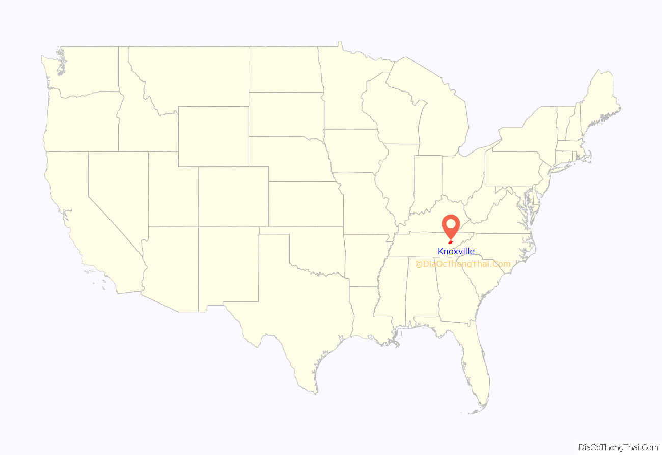
| State: | Tennessee |
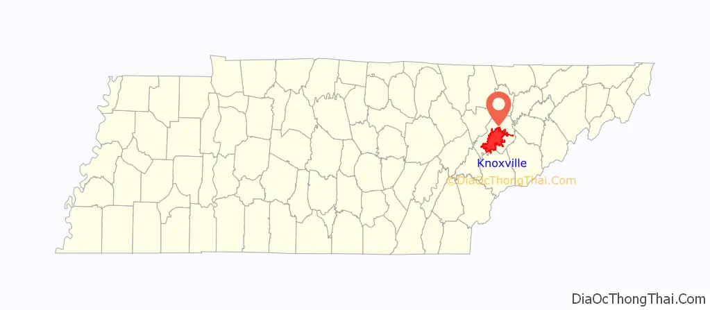
| County: | Knox County |
| Founded: | 1791 |
| Incorporated: | 1815 |
| Elevation: | 886 ft (270 m) |
| Land Area: | 98.73 sq mi (255.72 km²) |
| Water Area: | 5.52 sq mi (14.30 km²) 5.4% |
| Population Density: | 1,931.90/sq mi (745.91/km²) |
| Area code: | 865 |
| FIPS code: | 4740000 |
| GNISfeature ID: | 1648562 |
| Website: | www.knoxvilletn.gov |
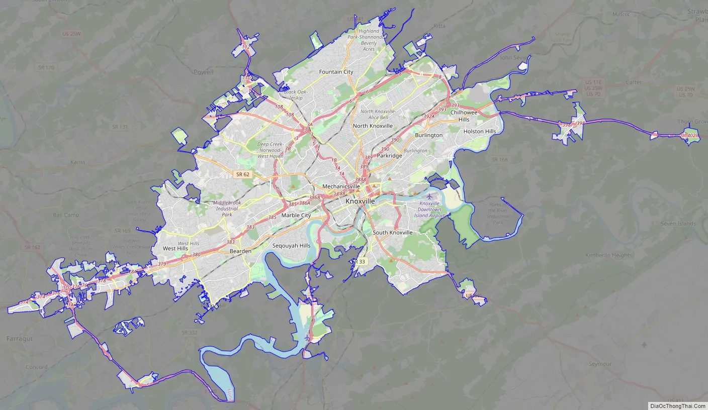
Knoxville Map Collection features highways, roads, things to do, and reference information. Knoxville, Tennessee is located in East Tennessee, along the Tennessee River. It is the third most populous city in Tennessee (after Memphis and Nashville) and is located next to the Great Smoky Mountains to the east. Knoxville is a beautiful place to visit and explore, with so much to see and do. Whether you’re looking for a quick getaway or a longer vacation, get started planning your trip to Knoxville today.
Online Interactive Map
Click on ![]() to view map in "full screen" mode.
to view map in "full screen" mode.
The city is home to many parks and green spaces, including the Arboretum, the Botanical Gardens, and Zoo Knoxville. With this map, you’ll always know where the best attractions and restaurants are in your area. Whether you’re planning a vacation or a business trip, this map is your go-to with the latest updated information.
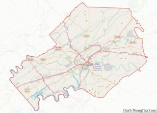
Knoxville location map. Where is Knoxville city?
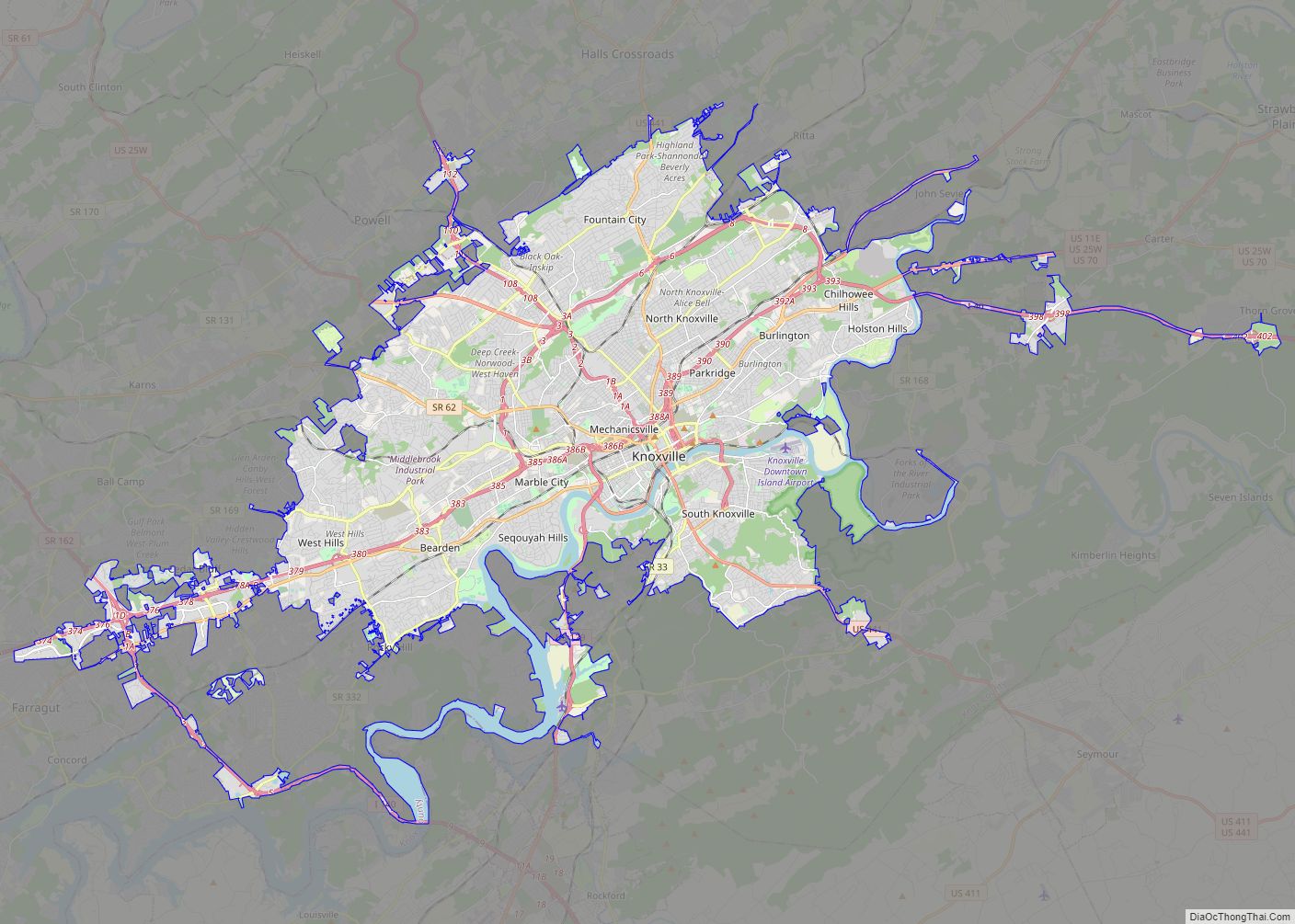
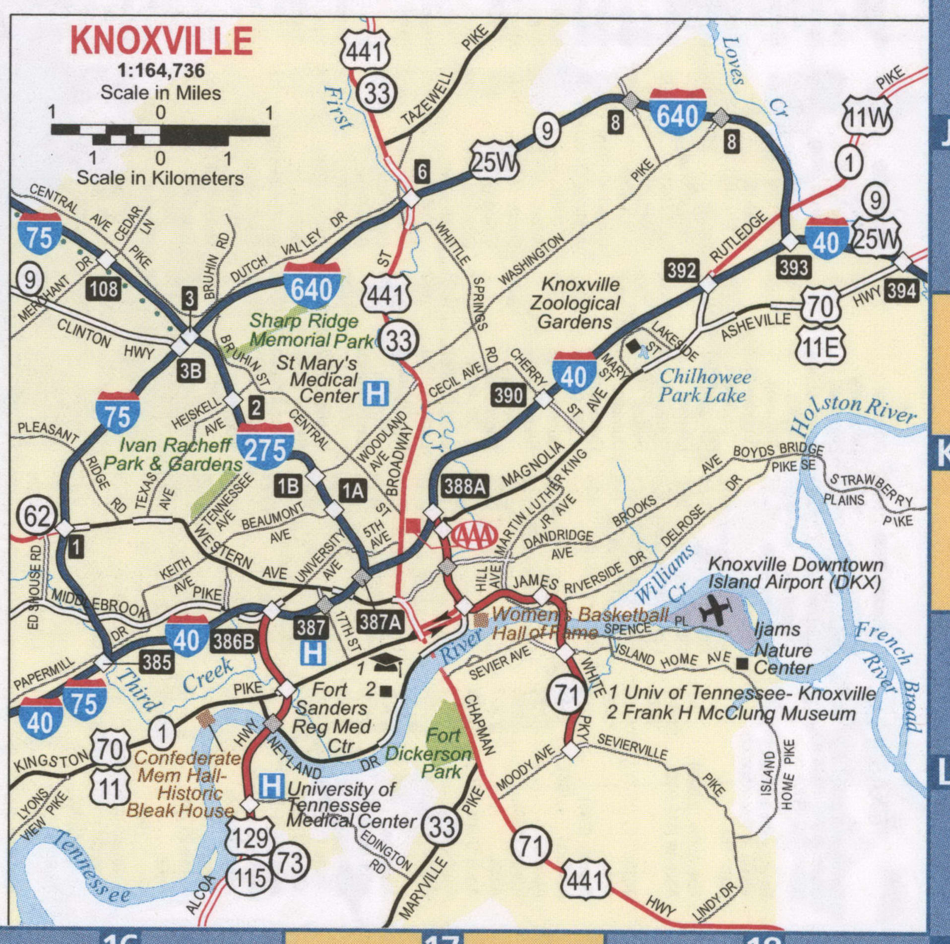
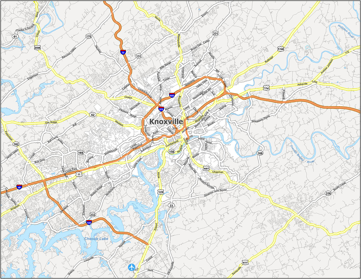
Knoxville Road Map
Knoxville, Tennessee is a vibrant city filled with fun activities and beautiful natural sights. For travelers looking for a convenient way to navigate the city, a Knoxville Tennessee road map is the perfect tool. Our map provides detailed information on the interstates like I-40, I-75, I-140, I-275, I-640, highways, and other roads. If you are planning a trip outside the city, you can also check out the Tennessee road map for statewide information.
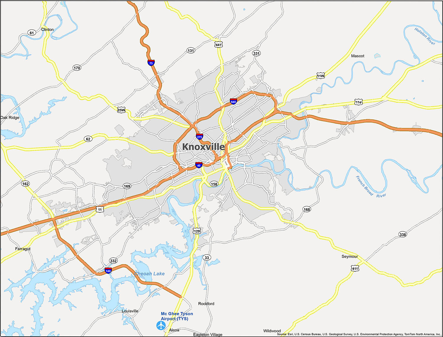
Visiting Knoxville? Check out this map for an overview of the city and all the great places to explore. From airports to cities, CDPs to towns, and water features to points of interest, you’ll be able to find your way around with ease.
This interactive map of Knoxville offers reference information such as airports, cities, census-designated places (CDPs), towns, and water features. Whether you’re planning a trip or just exploring the city, this map will help you find your way around with ease. Check out the McGhee Tyson Airport (TYS), cities like Alcoa, Clinton, Knoxville, Louisville, Oak Ridge, and Rockford, CDPs like Eagleton Village, Mascot, Seymour, and Wildwood, towns like Farragut, and water features like Cheoah Lake, French Broad River, and Holston River.
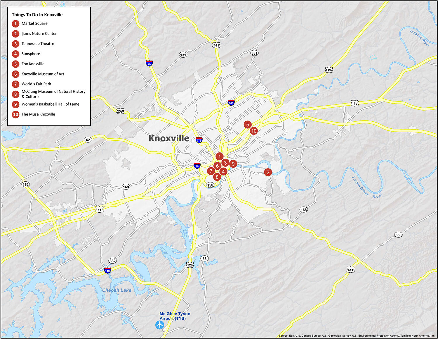
10 things to do in Knoxville city
Knoxville, Tennessee, is a great place to explore and experience the sights and sounds of the city. With a variety of festivals, nature preserves, and music venues, there’s something for everyone. Whether you’re a visitor or a local, this map will show you the best places to visit in Knoxville and the surrounding area. From Market Square and Ijams Nature Center to the Tennessee Theatre and Sunsphere, you’ll find plenty of ways to enjoy the city. And, if you’re looking for something a bit more cultural, check out the Knoxville Museum of Art, the World’s Fair Park, and the McClung Museum of Natural History & Culture. Finally, if you’re a sports fan, don’t forget to visit the Women’s Basketball Hall of Fame and The Muse Knoxville.
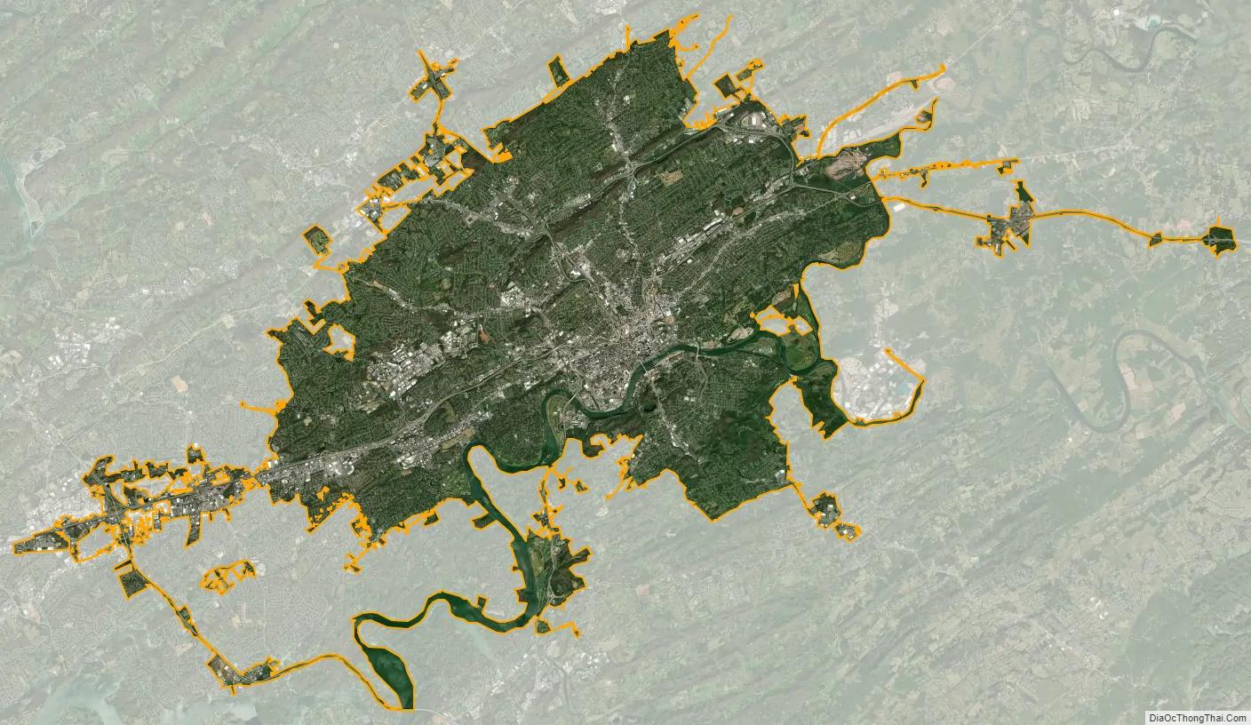
Knoxville city Satellite Map
Geography
Topography
According to the United States Census Bureau, the city has a total area of 104.2 square miles (269.8 km), of which 98.5 square miles (255.2 km) is land and 5.6 square miles (14.6 km), or 5.42%, is water. Elevations range from just over 800 feet (240 m) along the riverfront to just over 1,000 feet (300 m) on various hilltops in West Knoxville, with the downtown area resting at just over 900 feet (270 m). High points include Sharp’s Ridge in North Knoxville at 1,391 feet (424 m) and Brown Mountain in South Knoxville at 1,260 feet (380 m). House Mountain, the highest point in Knox County at 2,064 feet (629 m), is located east of the city near Mascot.
Knoxville is situated in the Great Appalachian Valley (known locally as the Tennessee Valley), about halfway between the Great Smoky Mountains to the east and the Cumberland Plateau to the west. The Great Valley is part of a sub-range of the Appalachian Mountains known as the Ridge-and-Valley Appalachians, which is characterized by long, narrow ridges, flanked by broad valleys. Prominent Ridge-and-Valley structures in the Knoxville area include Sharp’s Ridge and Beaver Ridge in the northern part of the city, Brown Mountain in South Knoxville, parts of Bays Mountain just south of the city, and parts of McAnnally Ridge in the northeastern part of the city.
The Tennessee River, which slices through the downtown area, is formed in southeastern Knoxville at the confluence of the Holston River, which flows southwest from Virginia, and the French Broad River, which flows west from North Carolina. The section of the Tennessee River that passes through Knoxville is part of Fort Loudoun Lake, an artificial reservoir created by TVA’s Fort Loudoun Dam about 30 miles (48 km) downstream in Lenoir City. Notable tributaries of the Tennessee in Knoxville include First Creek and Second Creek, which flow through the downtown area, Third Creek, which flows west of U.T., and Sinking Creek, Ten Mile Creek, and Turkey Creek, which drain West Knoxville.
Climate
Knoxville falls in the humid subtropical climate (Köppen: Cfa). Summers are hot and humid, with the daily average temperature in July at 78.4 °F (25.8 °C), and an average of 36 days per year with temperatures reaching 90 °F (32 °C). Winters are generally much cooler and less stable, with occasional small amounts of snow. January has a daily average temperature of 38.2 °F (3.4 °C), although in most years there is at least one day (average 5.3) where the high remains at or below freezing. The record high for Knoxville is 105 °F (41 °C) on June 30 and July 1, 2012, while the record low is −24 °F (−31 °C) on January 21, 1985. Annual precipitation averages just under 48 in (1,220 mm), and normal seasonal snowfall is 4.6 in (12 cm). Usually no snow occurs outside of January and February. The one-day record for snowfall is 17.5 in (44 cm), which occurred on February 13, 1960.
Metropolitan Area
Knoxville is the central city in the Knoxville Metropolitan Area, an Office of Management and Budget (OMB)-designated metropolitan statistical area (MSA) that covers Knox, Anderson, Blount, Campbell, Grainger, Loudon, Morgan, Roane and Union counties. MSAs consist of a core urban center and the outlying communities and rural areas with which it maintains close economic ties. They are not administrative divisions, and should not be confused with a consolidated city-county government, which Knoxville and Knox County is absent of.
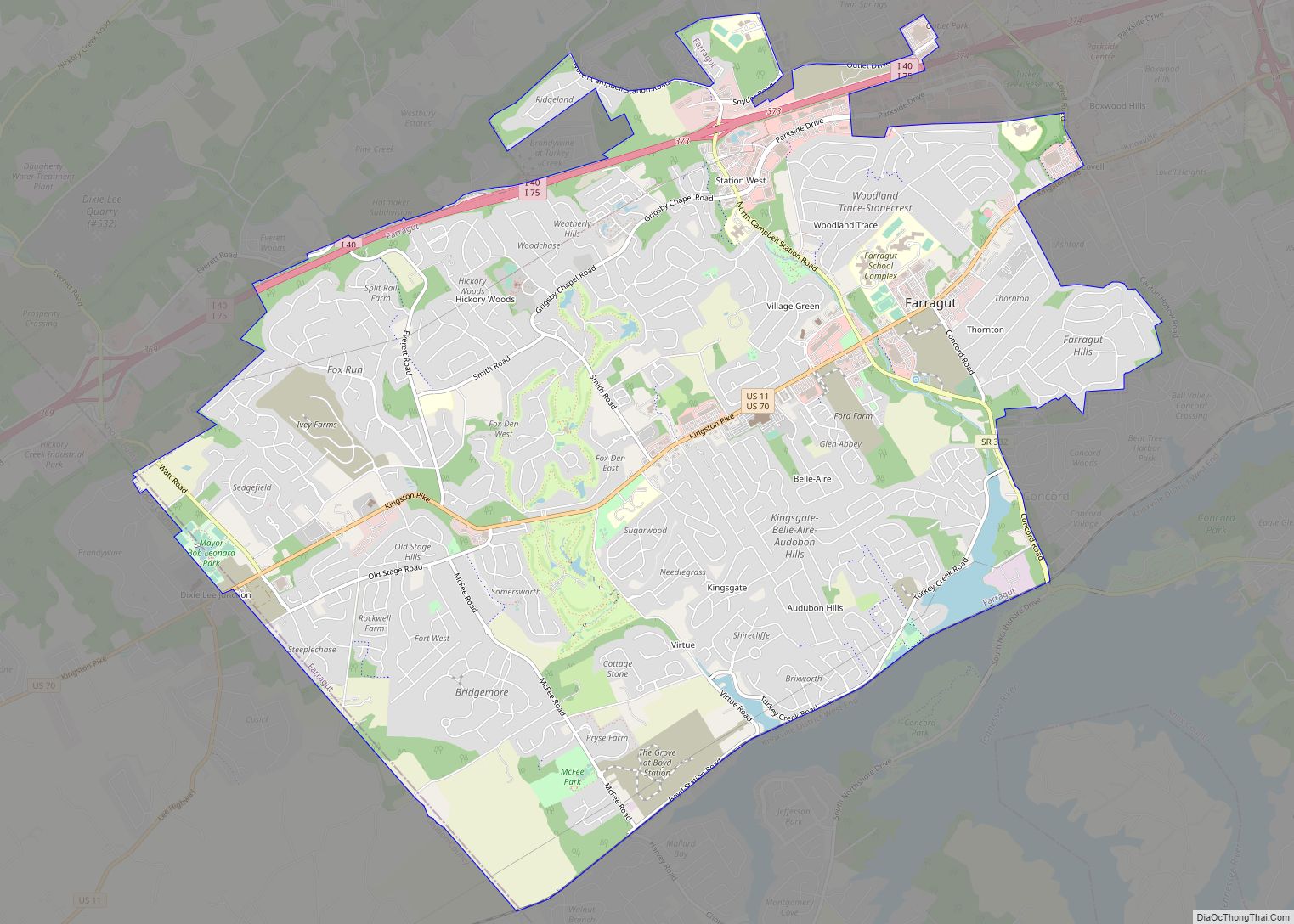
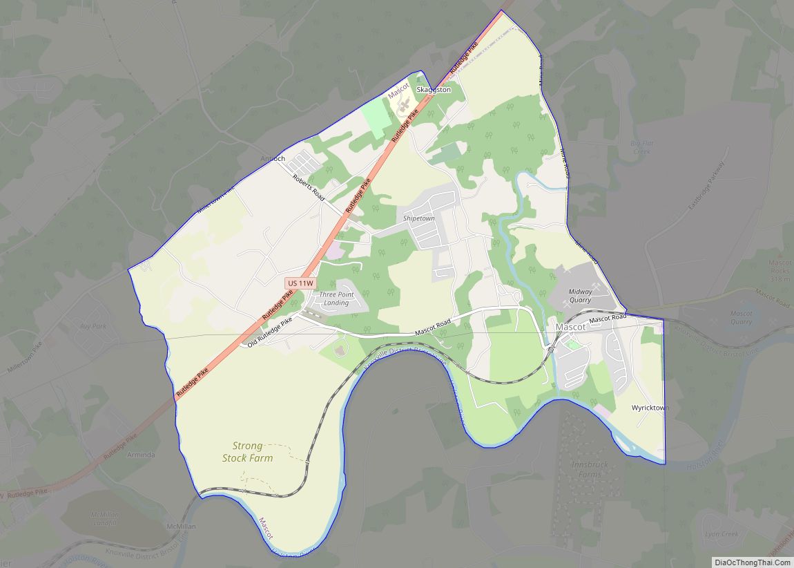
The Knoxville Metropolitan area includes unincorporated communities such as Halls Crossroads, Powell, Karns, Corryton, Concord, and Mascot, which are located in Knox County outside of Knoxville’s city limits. Along with Knoxville, major municipalities in the Knoxville Metropolitan Area include Alcoa, Blaine, Maryville, Lenoir City, Loudon, Farragut, Oak Ridge, Rutledge, Clinton, Bean Station, and Maynardville. As of 2012, the population of the Knoxville Metropolitan Area was 837,571.
Additionally, the Knoxville MSA is the chief component of the larger OMB-designated Knoxville-Sevierville-La Follette TN Combined Statistical Area (CSA). The CSA also includes the Morristown Metropolitan Statistical Area (Hamblen, Grainger, and Jefferson counties) and the Sevierville (Sevier County), La Follette (Campbell County), Harriman (Roane County), and Newport (Cocke County) Micropolitan Statistical Areas. Municipalities in the CSA, but not the Knoxville MSA, include Morristown, Rutledge, Dandridge, Jefferson City, Sevierville, Gatlinburg, Pigeon Forge, LaFollette, Jacksboro, Harriman, Kingston, Rockwood, and Newport. The combined population of the CSA as of the 2000 Census was 935,659. Its estimated 2008 population was 1,041,955.
Georgia Tech researchers have mapped the Knoxville Metropolitan area as one of the 18 ‘Major Cities’ in the Piedmont Atlantic Megaregion.
See also
Map of Tennessee State and its subdivision:- Anderson
- Bedford
- Benton
- Bledsoe
- Blount
- Bradley
- Campbell
- Cannon
- Carroll
- Carter
- Cheatham
- Chester
- Claiborne
- Clay
- Cocke
- Coffee
- Crockett
- Cumberland
- Davidson
- Decatur
- DeKalb
- Dickson
- Dyer
- Fayette
- Fentress
- Franklin
- Gibson
- Giles
- Grainger
- Greene
- Grundy
- Hamblen
- Hamilton
- Hancock
- Hardeman
- Hardin
- Hawkins
- Haywood
- Henderson
- Henry
- Hickman
- Houston
- Humphreys
- Jackson
- Jefferson
- Johnson
- Knox
- Lake
- Lauderdale
- Lawrence
- Lewis
- Lincoln
- Loudon
- Macon
- Madison
- Marion
- Marshall
- Maury
- McMinn
- McNairy
- Meigs
- Monroe
- Montgomery
- Moore
- Morgan
- Obion
- Overton
- Perry
- Pickett
- Polk
- Putnam
- Rhea
- Roane
- Robertson
- Rutherford
- Scott
- Sequatchie
- Sevier
- Shelby
- Smith
- Stewart
- Sullivan
- Sumner
- Tipton
- Trousdale
- Unicoi
- Union
- Van Buren
- Warren
- Washington
- Wayne
- Weakley
- White
- Williamson
- Wilson
- Alabama
- Alaska
- Arizona
- Arkansas
- California
- Colorado
- Connecticut
- Delaware
- District of Columbia
- Florida
- Georgia
- Hawaii
- Idaho
- Illinois
- Indiana
- Iowa
- Kansas
- Kentucky
- Louisiana
- Maine
- Maryland
- Massachusetts
- Michigan
- Minnesota
- Mississippi
- Missouri
- Montana
- Nebraska
- Nevada
- New Hampshire
- New Jersey
- New Mexico
- New York
- North Carolina
- North Dakota
- Ohio
- Oklahoma
- Oregon
- Pennsylvania
- Rhode Island
- South Carolina
- South Dakota
- Tennessee
- Texas
- Utah
- Vermont
- Virginia
- Washington
- West Virginia
- Wisconsin
- Wyoming