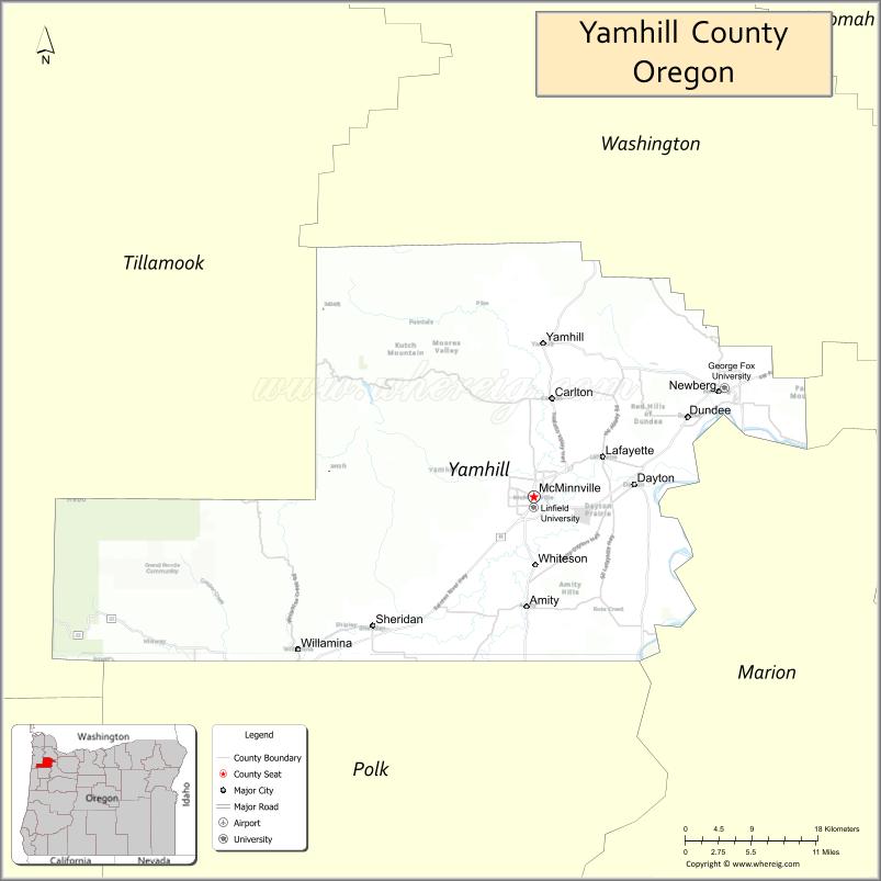
Yamhill County is one of the 36 counties in the U.S. state of Oregon. As of the 2020 census, the population was 107,722. The county seat is McMinnville. Yamhill County was named after the Yamhelas, members of the Kalapuya Tribe.
Yamhill County is part of the Portland–Vancouver–Hillsboro, OR-WA Metropolitan Statistical Area. It is in the Willamette Valley.
| Name: | Yamhill County |
|---|---|
| FIPS code: | 41-071 |
| State: | Oregon |
| Founded: | July 5, 1843 |
| Named for: | Yamhela people of the Kalapuya |
| Seat: | McMinnville |
| Largest city: | McMinnville |
| Total Area: | 718 sq mi (1,860 km²) |
| Land Area: | 716 sq mi (1,850 km²) |
| Total Population: | 107,722 |
| Population Density: | 139/sq mi (54/km²) |
| Time zone: | UTC−8 (Pacific) |
| Summer Time Zone (DST): | UTC−7 (PDT) |
| Website: | www.co.yamhill.or.us |
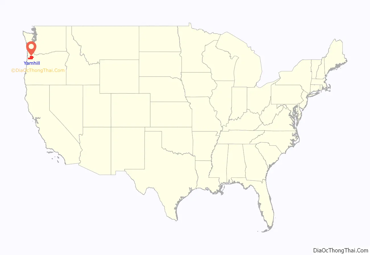
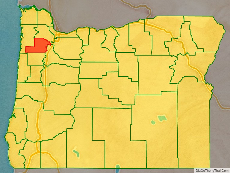
Yamhill County location map. Where is Yamhill County?
History
The earliest known inhabitants of the area were the Yamhill (Yamhelas Indian Tribe, part of the Kalapooian family) Indians, who have inhabited the area for over 8,000 years. They are one of the tribes incorporated into the Confederated Tribes of the Grand Ronde. In 1857 they were forced to migrate to the Grand Ronde Indian Reservation created in Oregon’s Coastal Range two years earlier.
The earliest non-native settlers were employees of the various fur companies operating in Oregon Country, who started settling there around 1814. But it was the establishment of the Oregon Trail that led to significant migration to the area.
Yamhill District (later county) was created on July 5, 1843, five years before the Oregon Territory was established. It was one of the original four districts created by Oregon’s first Provisional Legislature, along with Twality (later Washington), Clackamas, and Champooick (later Marion) counties. The district was originally spread over 12,000 square miles (31,000 km), an area that was broken up into twelve present-day counties.
Lafayette, the principal trading center of the western Willamette Valley in early Oregon history, was made the county seat in 1847. The county government was later (1889) moved to McMinnville where it remains today.
The Mount Hebo Air Force Station was a Cold War air defense installation from 1956 to 1980. Located next to Tillamook County, at the top of 3,154-foot (961 m) high Mount Hebo, Air Force radars operated by the 689th Radar Squadron and the 14th Missile Warning Squadron were essential parts of the nation’s integrated air defenses. The large radomes protecting the radars from adverse weather effects could be seen silhouetted against the sky from many parts of Yamhill County.
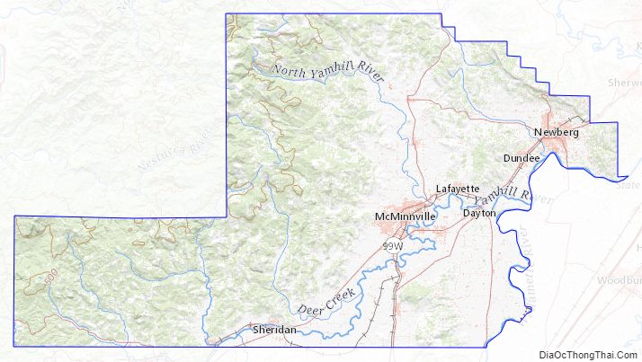
Lock and dam on the Yamhill River
In 1900 the Yamhill River lock and dam was completed about 1.5 miles (2.4 km) downriver from Lafayette, Oregon. The lock was decommissioned in 1954. The dam was demolished in 1963 to allow better passage for salmon on the river. The site of the lock and dam is now a county park.
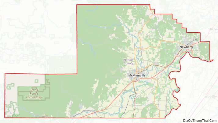
Yamhill County Road Map
Geography
According to the United States Census Bureau, the county has a total area of 718 square miles (1,860 km), of which 716 square miles (1,850 km) is land and 2.5 square miles (6.5 km) (0.3%) is water. It is the fifth-smallest county in Oregon by area.
The tallest mountain in the county is Trask Mountain in the northwest corner of the county.
Adjacent counties
- Washington County (north)
- Clackamas County (east)
- Marion County (southeast)
- Polk County (south)
- Tillamook County (west)
National protected areas
- Siuslaw National Forest (part)
- Tualatin River National Wildlife Refuge (part)
Yamhill County Topographic Map
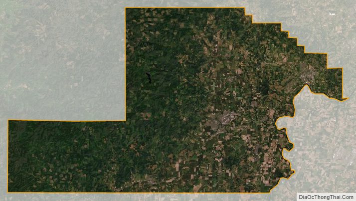
Yamhill County Satellite Map
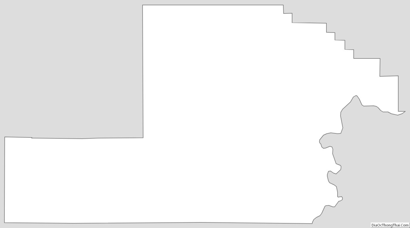
Yamhill County Outline Map