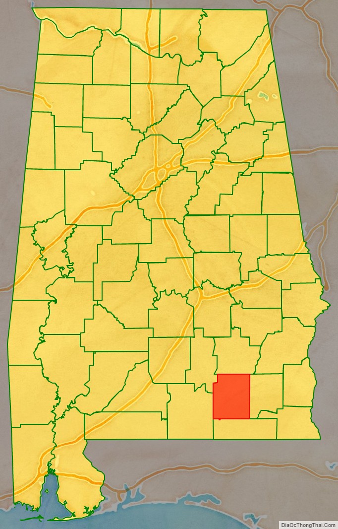
Coffee County is a county located in the southeastern part of the U.S. state of Alabama. As of the 2020 census, the population was 53,465. Its name is in honor of General John Coffee.
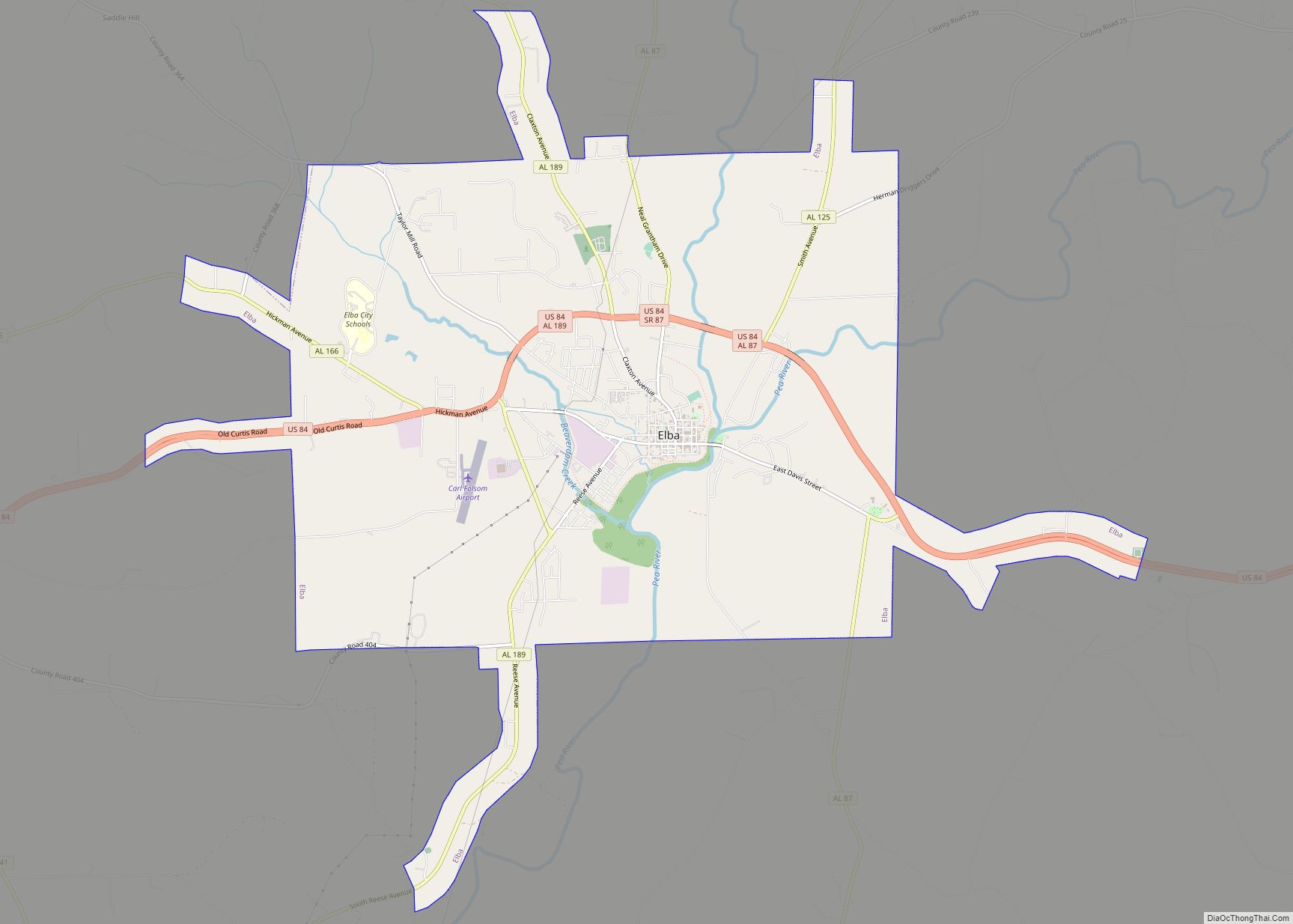
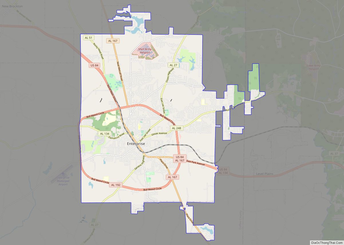
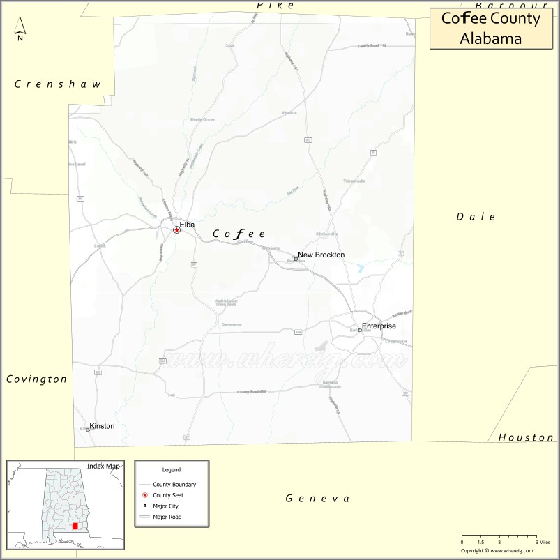
Coffee County comprises the Enterprise, Micropolitan Statistical Area, which was originally Enterprise–Ozark micropolitan area in 2010 censuses before being split off. It was originally included in the Dothan-Enterprise-Ozark, Combined Statistical Area in its 2012 statistics but the area in its recent years has been separated from the Dothan metropolitan area and Ozark micropolitan area in later censuses and is its own primary statistical area now. Despite the census change of the statistics by the United States Census Bureau, the county still remains culturally connected alongside the two core based areas as it is commonly described as part of what is called the Wiregrass region together and also it shares its locations of United States army base, Fort Rucker. The county seat is mostly known as Elba, although Enterprise contains a second county courthouse as well.
| Name: | Coffee County |
|---|---|
| FIPS code: | 01-031 |
| State: | Alabama |
| Founded: | December 29, 1841 |
| Named for: | John Coffee |
| Seat: | Elba (de facto) Enterprise (annex) |
| Largest city: | Enterprise |
| Total Area: | 680 sq mi (1,800 km²) |
| Land Area: | 679 sq mi (1,760 km²) |
| Total Population: | 53,465 |
| Population Density: | 79/sq mi (30/km²) |
| Time zone: | UTC−6 (Central) |
| Summer Time Zone (DST): | UTC−5 (CDT) |
| Website: | www.coffeecounty.us |
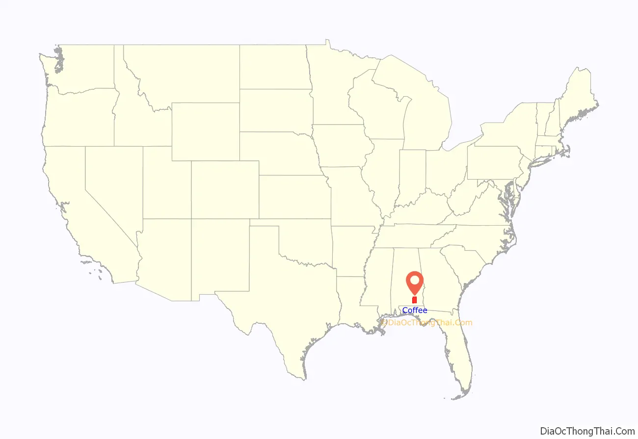
Coffee County location map. Where is Coffee County?
History
The land in Coffee County was originally part of Dale County, which was incorporated in 1824. Coffee County was formed from the western part of Dale County on December 29, 1841. It was named after John R. Coffee, a soldier in the Creek War of 1813—14. The first county seat was in Wellborn. After the courthouse was destroyed by fire in 1851, the county seat was moved to Elba.
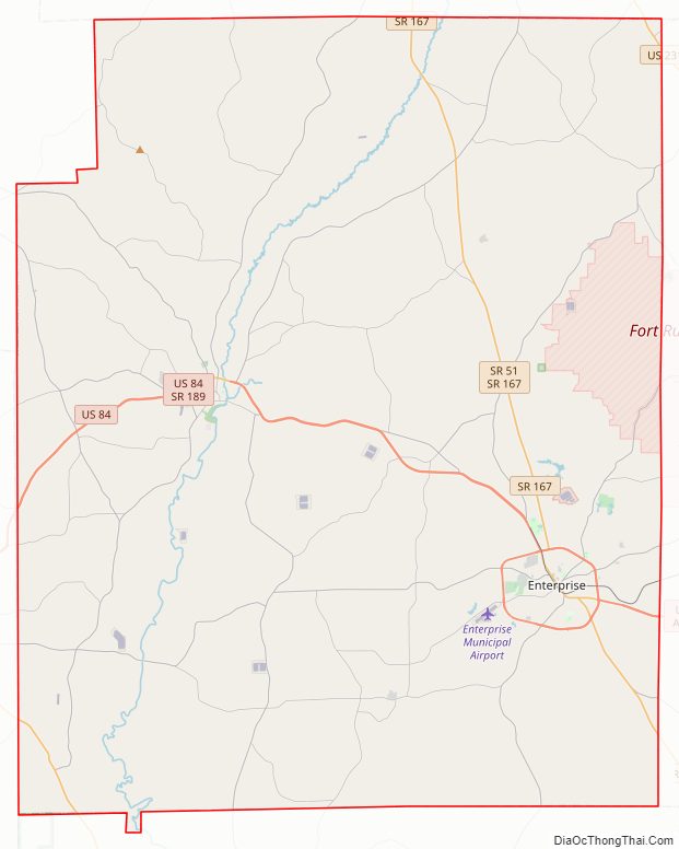
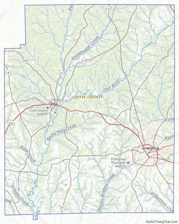
Coffee County Road Map
Geography
According to the United States Census Bureau, the county has a total area of 680 square miles (1,800 km), of which 679 square miles (1,760 km) is land and 1.5 square miles (3.9 km) (0.2%) is water. The county is located in the Wiregrass region of southeast Alabama.
Major highways
- U.S. Highway 84
- U.S. Highway 231
- State Route 27
- State Route 51
- State Route 87
- State Route 88
- State Route 92
- State Route 134
- State Route 189
- State Route 192
Adjacent counties
- Pike County (north)
- Dale County (east)
- Geneva County (south)
- Covington County (west)
- Crenshaw County (northwest)
Coffee County Topographic Map
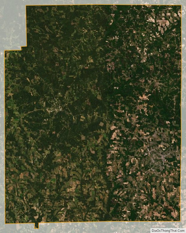
Coffee County Satellite Map
Coffee County Outline Map