| Name: | El Paso County |
|---|---|
| FIPS code: | 08-041 |
| State: | Colorado |
| Founded: | November 1, 1861 |
| Named for: | Spanish name for The Pass |
| Seat: | Colorado Springs |
| Largest city: | Colorado Springs |
| Total Area: | 2,130 sq mi (5,500 km²) |
| Land Area: | 2,127 sq mi (5,510 km²) |
| Total Population: | 730,395 |
| Population Density: | 340/sq mi (130/km²) |
| Time zone: | UTC−7 (Mountain) |
| Summer Time Zone (DST): | UTC−6 (MDT) |
| Website: | www.elpasoco.com |
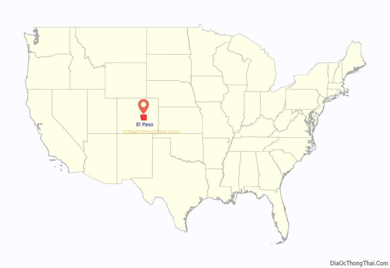
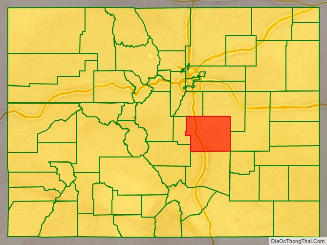
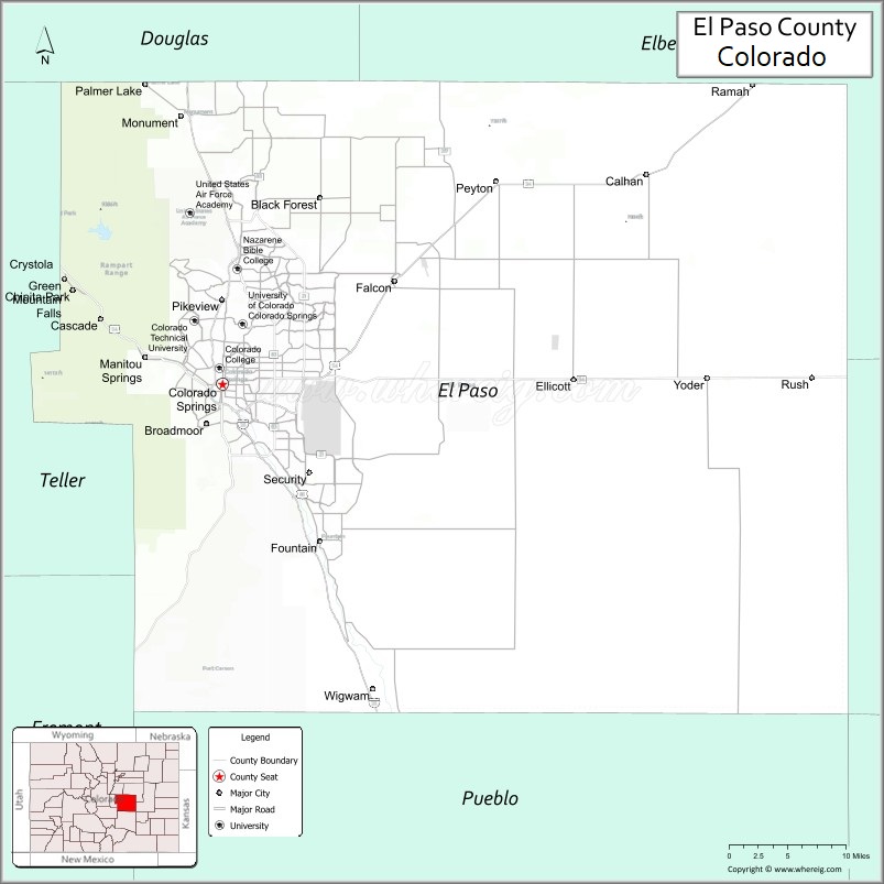
El Paso County location map. Where is El Paso County?
History
In July 1858, gold was discovered along the South Platte River in Arapahoe County, Kansas Territory. This discovery precipitated the Pike’s Peak Gold Rush. Many residents of the mining region felt disconnected from the remote territorial governments of Kansas and Nebraska, so they voted to form their own Territory of Jefferson on October 24, 1859. The following month, the Jefferson Territorial Legislature organized 12 counties for the new territory including El Paso County. El Paso County was named for the Spanish language name for Ute Pass north of Pikes Peak. Colorado City served as the county seat of El Paso County.
The Jefferson Territory never received federal sanction, but on February 28, 1861, U.S. President James Buchanan signed an act organizing the Territory of Colorado. El Paso County was one of the original 17 counties created by the Colorado legislature on November 1, 1861. Part of its western territory was broken off to create Teller County in 1899. Originally based in Old Colorado City (now part of Colorado Springs, not today’s Colorado City between Pueblo and Walsenburg), El Paso County’s county seat was moved to Colorado Springs in 1873.
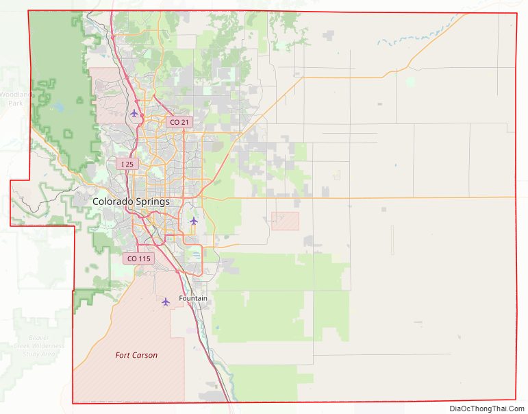
El Paso County Road Map
Geography
According to the U.S. Census Bureau, the county has a total area of 2,130 square miles (5,500 km), of which 2,127 square miles (5,510 km) are land and 2.7 square miles (7.0 km) (0.1%) are covered by water.
Adjacent counties
- Douglas County – north
- Elbert County – northeast
- Lincoln County – east
- Crowley County – southeast
- Pueblo County – south
- Fremont County – west
- Teller County – west
Major highways
- Interstate 25
- I-25 BL (Nevada Avenue)
- U.S. Highway 24
- U.S. Highway 85
- State Highway 16 (Mesa Ridge Parkway)
- State Highway 21 (Powers Boulevard)
- State Highway 83 (In El Paso County, CO SH-83 begins with the intersection of CO SH-21)
- State Highway 94
- State Highway 105
- State Highway 115
National protected area
- Pike National Forest
State protected area
- Cheyenne Mountain State Park
Historic sites
- Pikes Peak National Historic Landmark
- USAFA Cadet Area National Historic District
- Old Colorado City (National Register of Historic Districts)
- Manitou Springs (National Register of Historic Districts)
Trails
- American Discovery Trail
- Barr National Recreation Trail
- Bear Creek Cañon Park
- Bear Creek Regional Park and Nature Center
- Calhan Paint Mines
- Fountain Creek Nature Center
- The Incline
- New Santa Fe Trail
- Pikes Peak Greenway
- White House Ranch National Recreation Trail
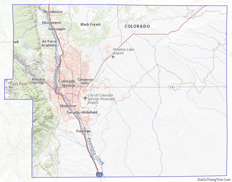
El Paso County Topographic Map
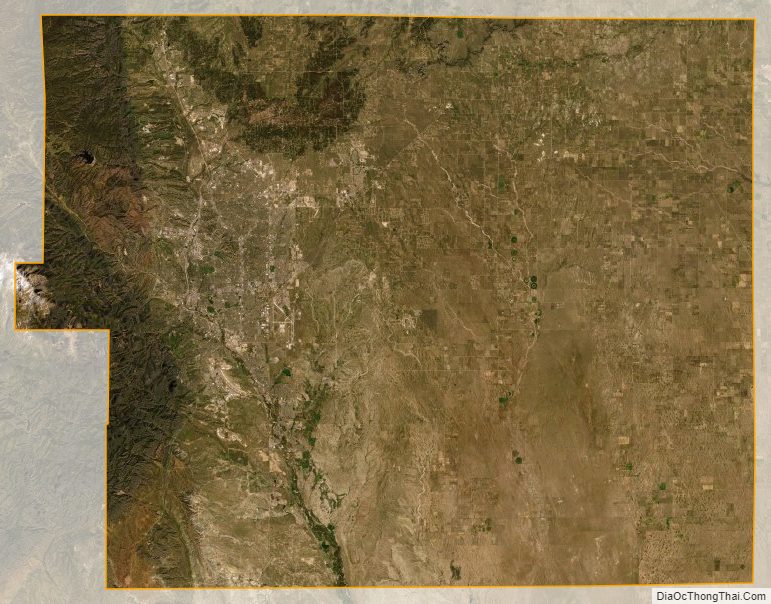
El Paso County Satellite Map
El Paso County Outline Map