Fayette County is a county in the Commonwealth of Pennsylvania. It is located in southwestern Pennsylvania, adjacent to Maryland and West Virginia. As of the 2020 census, the population was 128,804. Its county seat is Uniontown. The county was created on September 26, 1783, from part of Westmoreland County and named after the Marquis de Lafayette.
Fayette County is part of the Pittsburgh, PA Metropolitan Statistical Area. The southern border of Fayette County is the southern border of Pennsylvania at both the Pennsylvania–Maryland state line (the Mason–Dixon line) and the Pennsylvania–West Virginia state line.
| Name: | Fayette County |
|---|---|
| FIPS code: | 42-051 |
| State: | Pennsylvania |
| Founded: | September 26, 1783 |
| Named for: | Marquis de Lafayette |
| Seat: | Uniontown |
| Largest city: | Uniontown |
| Total Area: | 798 sq mi (2,070 km²) |
| Land Area: | 790 sq mi (2,000 km²) |
| Total Population: | 128,804 |
| Population Density: | 163/sq mi (63/km²) |
| Time zone: | UTC−5 (Eastern) |
| Summer Time Zone (DST): | UTC−4 (EDT) |
| Website: | www.co.fayette.pa.us |
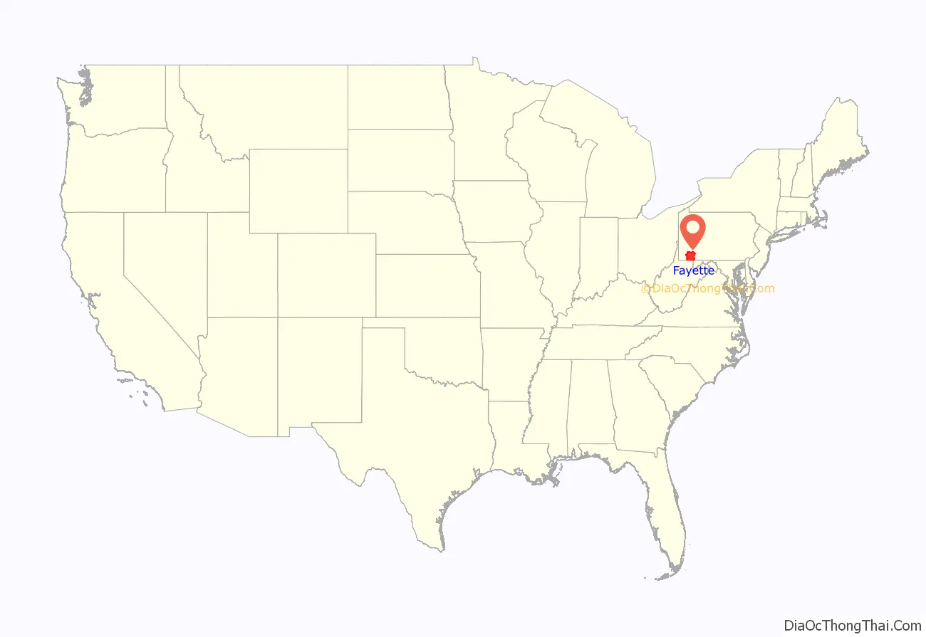
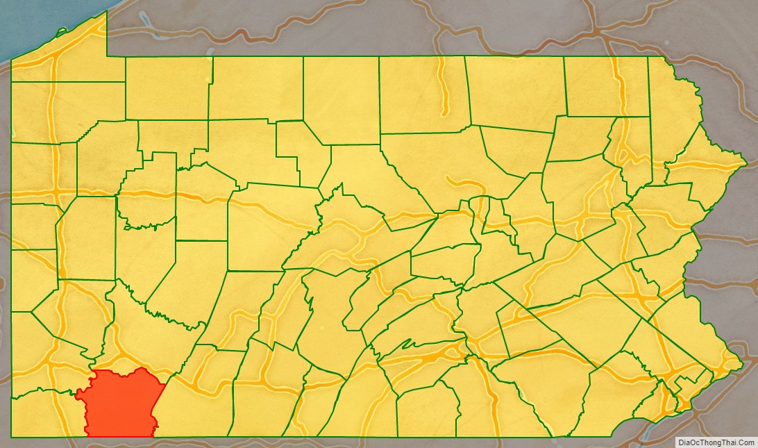
Fayette County location map. Where is Fayette County?
History
The first Europeans in Fayette County were explorers, who had used an ancient American Indian trail that bisected the county on their journey across the Appalachian Mountains. In 1754, when control of the area was still in dispute between France and Great Britain, 22-year-old George Washington fought against the French at the Battle of Jumonville Glen and Fort Necessity. British forces under Washington and General Edward Braddock improved roads throughout the region, making the future Fayette County an important supply route.
During the Revolutionary War, Fayette County was plagued by attacks from British-allied Indians and remained isolated as a frontier region. Also retarding settlement was a border dispute with Virginia; Virginia’s District of West Augusta and Pennsylvania’s Westmoreland County both claimed the area. In 1780 the dispute was settled by the federal government in favor of Pennsylvania, and Fayette County was formed from Westmoreland County in 1783.
Fayette County settlers provided the new United States government with an early test of authority in the 1793 Whiskey Rebellion, when farmers rebelled against tax collectors to protest a new liquor tax. President George Washington called out the militias to restore order. However, they were talked out of any violent action by owner of Friendship Hill and future Secretary of the Treasury, Albert Gallatin. Fayette County continued to be important to travelers in the early 1800s. The National Road provided a route through the mountains of the county for settlers heading west. The shipyards in Brownsville on the Monongahela River built ships for both the domestic and international trade.
As Pittsburgh developed its industries in the mid-19th century, Fayette County became a center of coal mining and coke production. From the 1880s to the early 1900s, the area’s great expansion in steel production became nationally important, and labor unions shaped national policies. Both new European immigrants and African Americans in the Great Migration from the rural South were attracted to the Pittsburgh area for industrial jobs. The historic Scottish and German farming communities established in the earlier 19th century were soon overshadowed by the wave of immigrants from Southern and Eastern Europe. The region’s wealth has been concentrated largely among the old English and Scottish families who had established businesses and political power in Pittsburgh prior to and in the advent of industrialization, often building the new manufacturing concerns, as did Andrew Carnegie.
By World War II, Fayette County had a new unionized working class that enjoyed increased prosperity. In the 1950s, however, the coal industry fell into decline. In the 1970s, the restructuring and collapse of American steel resulted in a massive loss of industrial jobs and hard times in the area. The population has declined since the peak in 1940, as residents have had to move elsewhere for work. The loss of union jobs caused many working families to drop out of the middle class. Only a few mines are being worked in the 21st century, but natural resources remain crucial to the local economy. The region is slowly transitioning toward the service sector, with an increase in jobs in fields such as telemarketing.
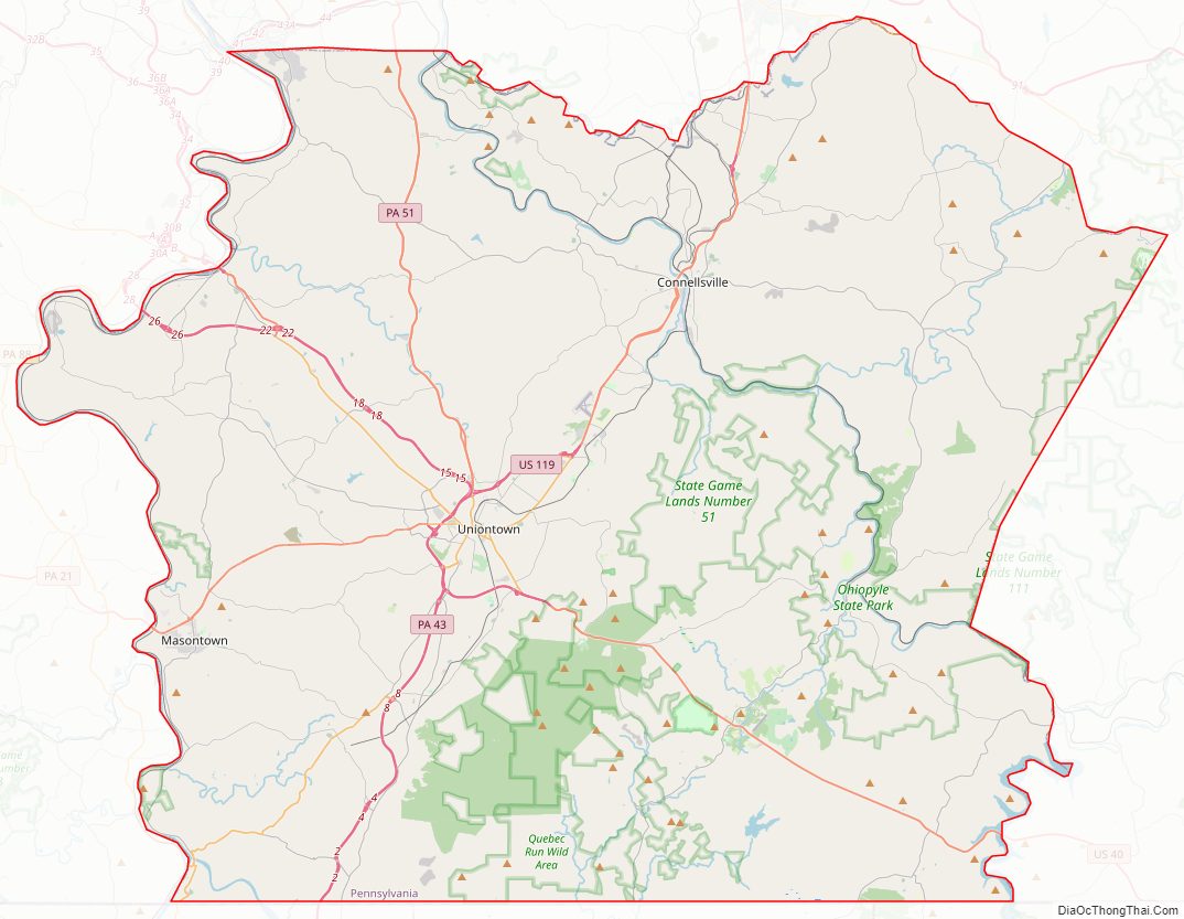
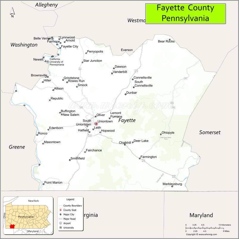
Fayette County Road Map
Geography
According to the U.S. Census Bureau, the county has a total area of 798 square miles (2,070 km), of which 790 square miles (2,000 km) is land and 8.0 square miles (21 km) (1.0%) is water. The western portion of the county contains rolling foothills and two valleys along the Monongahela and Youghiogheny rivers. The eastern portion of the county is highly mountainous and forested. Many coal mines are located within the area.
Adjacent counties
- Westmoreland County (north)
- Somerset County (east)
- Garrett County, Maryland (southeast)
- Preston County, West Virginia (south)
- Monongalia County, West Virginia (southwest)
- Greene County (west)
- Washington County (northwest)
National protected areas
- Fort Necessity National Battlefield
- Friendship Hill National Historic Site
Climate
Fayette has a humid continental climate (Dfa/Dfb).
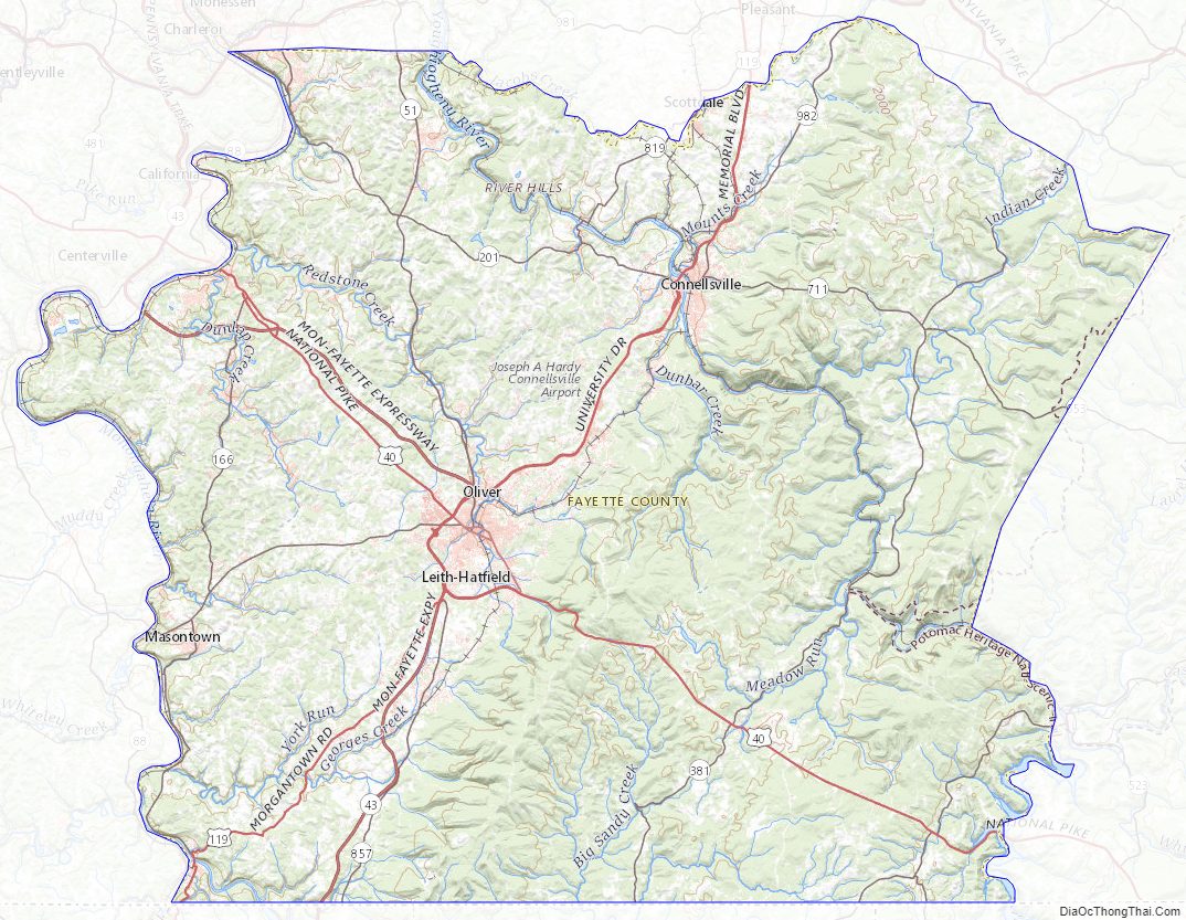
Fayette County Topographic Map
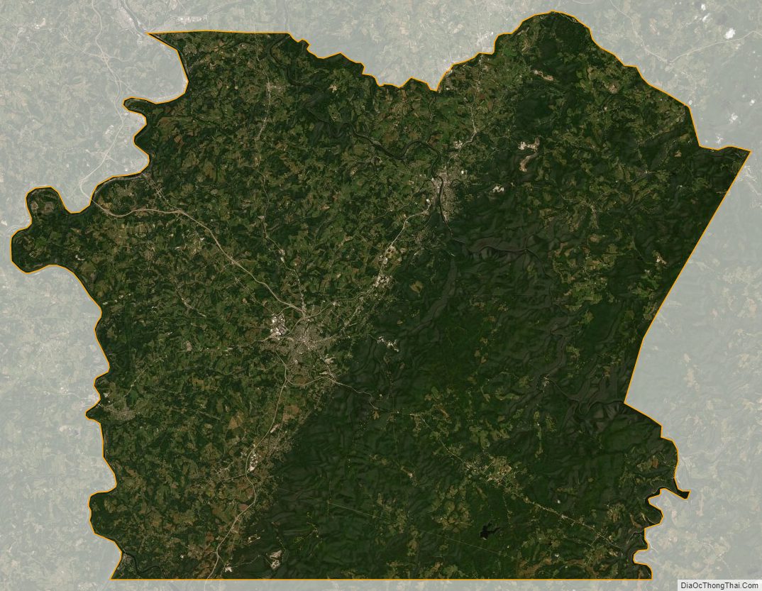
Fayette County Satellite Map
Fayette County Outline Map