Uniontown is the largest city in and county seat of Fayette County, Pennsylvania, United States, 46 miles (74 km) southeast of Pittsburgh. The population was 9,984 at the 2020 census. It is part of the Pittsburgh metropolitan area.
| Name: | Uniontown city |
|---|---|
| LSAD Code: | 25 |
| LSAD Description: | city (suffix) |
| State: | Pennsylvania |
| County: | Fayette County |
| Elevation: | 999 ft (304 m) |
| Total Area: | 2.05 sq mi (5.32 km²) |
| Land Area: | 2.05 sq mi (5.32 km²) |
| Water Area: | 0.00 sq mi (0.00 km²) |
| Total Population: | 9,984 |
| Population Density: | 4,731.74/sq mi (1,827.24/km²) |
| ZIP code: | 15401 |
| Area code: | 724, 878 |
| FIPS code: | 4278528 |
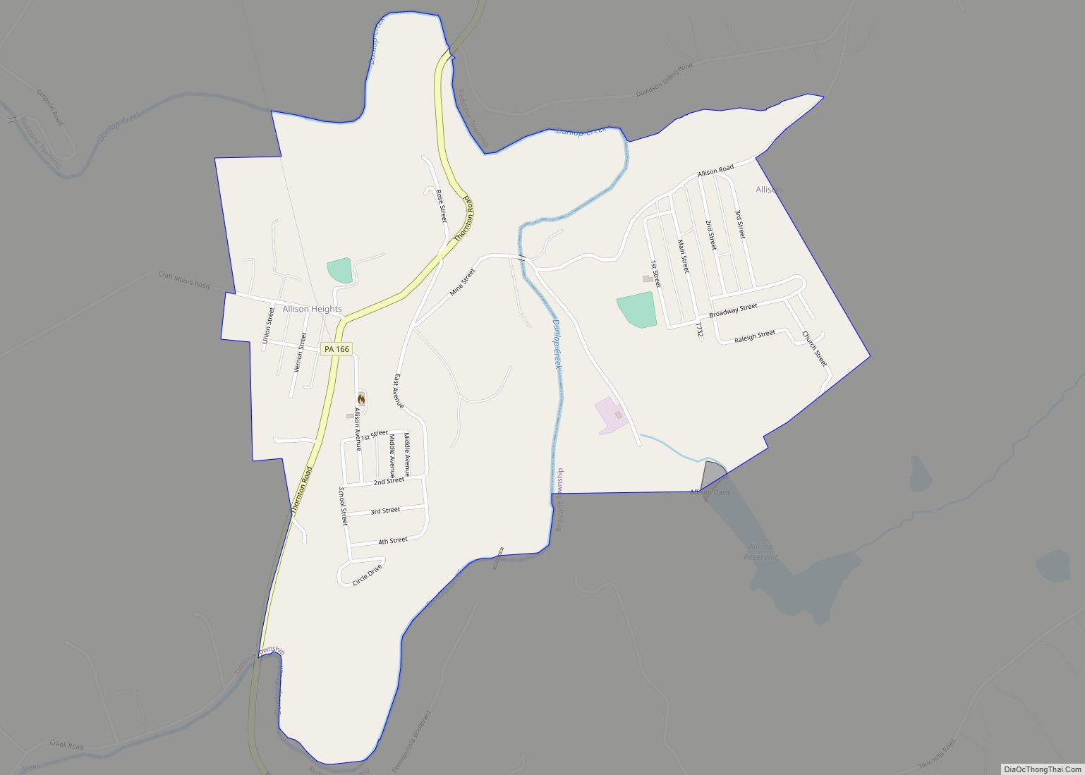
Online Interactive Map
Click on ![]() to view map in "full screen" mode.
to view map in "full screen" mode.
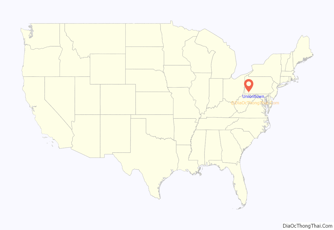
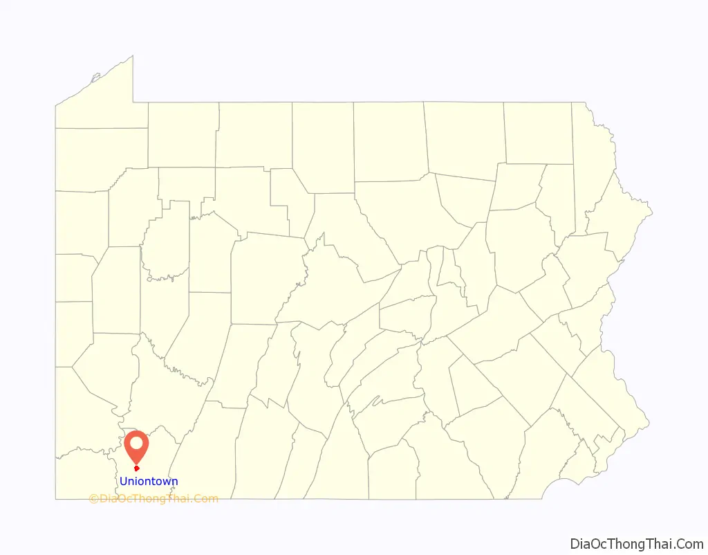
Uniontown location map. Where is Uniontown city?
History
10 miles (16 km) southeast of Uniontown is Fort Necessity, built by George Washington during the French and Indian War (part of the international Seven Years’ War) as well as the site of the Battle of Jumonville Glen, where the North American branch of the war began.
Uniontown was founded in 1776 as “the Town of Union” by Henry Beeson, a Quaker born in Virginia in 1743 who had settled in the area in 1768, buying tracts of land and running a sawmill. On July 4 (coincidentally, the same date the United States Declaration of Independence was adopted), Beeson published a plat of quarter-acre plots near his mill to be allocated by lottery on 20 July to purchasers prepared to build houses on them. In early years the town was sometimes unofficially called “Beesonstown”, though not by Beeson. In 1783 Fayette County was erected and divided into townships, of which Union Township contained the namesake town. The town was incorporated as a borough in 1796 under the name Uniontown and separated from Union Township, which was split in 1851 into North Union and South Union Townships.
The National Road, also known as the Cumberland Road, was routed through Uniontown in the early 19th century, and the town grew along with the road (now US 40). Uniontown’s role in the Underground Railroad in the antebellum years is commemorated by a marker on the corner of East Main Street and Baker Alley. Residents helped slaves escaping from the South to freedom.
In the late nineteenth century, the town grew based on the development of coal mines and the steel industry. Uniontown was the site of violent clashes between striking coal miners and guards at the local coke works during the bituminous coal miners’ strike of 1894. Fifteen guards armed with carbines and machine guns held off an attack by 1,500 strikers, killing five and wounding eight.
The Columbia Rolling Mill, an iron and steel works, was located in Uniontown from 1887 to 1895. The mill was the town’s top industry at that time. During the Coal Boom of the early part of the 20th century, Uniontown was home to at least 13 millionaires, the most (per capita) of any city in the United States. “Coal barons” and Carl Laemmle, the president of Universal Films, sponsored the famous Uniontown Speedway board track from 1916 to 1922. It was a mile and a quarter raceway.
As with most of Western Pennsylvania, Uniontown’s economy waned during the region’s deindustrialization of the late 20th century, when the steel industry restructured and many jobs went elsewhere, including offshore. This decline continued into the 21st century, and the population is about half its peak of 1940.
The only United States Navy ship named for the city was USS Uniontown (PF-65), a Tacoma-class frigate renamed from Chattanooga on 16 August 1944.
In 1967, Uniontown was the birthplace of the McDonald’s Big Mac sandwich. In 2007, the Big Mac Museum was opened in North Huntingdon Township in Westmoreland County, to the disappointment of some Uniontown residents. According to a McDonald’s spokesperson, the decision was based on logistics and access, but Uniontown residents complained in an article that was published in The Herald-Standard.
The Uniontown Downtown Historic District, Gallatin School, John S. Douglas House, John P. Conn House, and Adam Clarke Nutt Mansion are listed on the National Register of Historic Places.
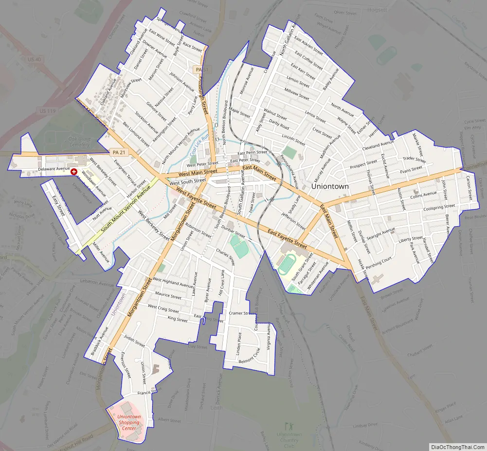
Uniontown Road Map
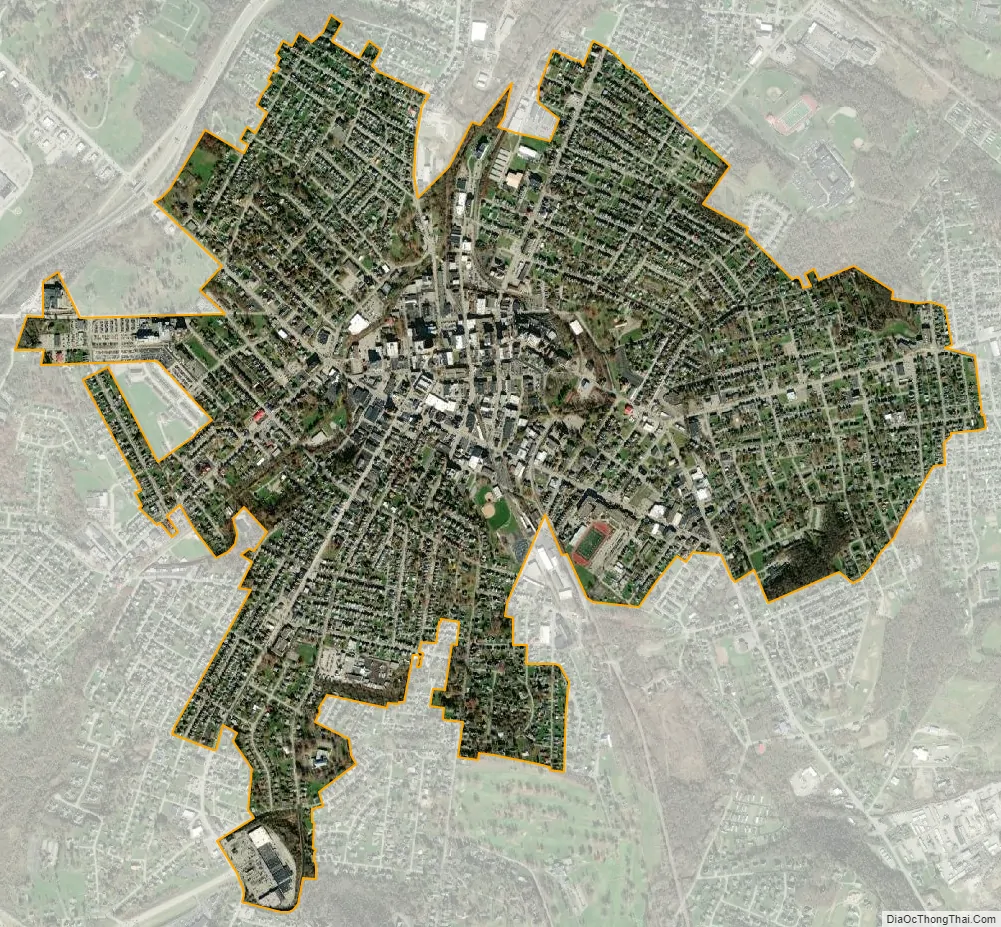
Uniontown city Satellite Map
Geography
Uniontown is located slightly west of the center of Fayette County at 39°54’0″ North, 79°43’28” West (39.900040, -79.724478).
According to the United States Census Bureau, the city has a total area of 2.04 square miles (5.29 km), all land. The city is 999 feet (304 m) above sea level and rests at the base of Chestnut Ridge, the westernmost ridge of the Appalachian Mountains to the east. The National Pike or Cumberland Road crossed over the mountains and passed through the area which became the center of Uniontown. The route is now Business Route 40, as the mainline of US 40 bypasses the city center to the south and west as a freeway loop called the George Marshall Parkway.
Climate
Uniontown is located in a transition between a humid continental climate (Köppen Dfb) and a humid subtropical climate (Köppen Cfa) with cold (sometimes freezing cold) to mild winters, owing its location near the mountains with average daytime temperatures running in the 30s to 40s °F (0-10°C) and warm to hot and humid summers with average daytime temperatures running in the 70s to 80s °F (20-30°C).
See also
Map of Pennsylvania State and its subdivision:- Adams
- Allegheny
- Armstrong
- Beaver
- Bedford
- Berks
- Blair
- Bradford
- Bucks
- Butler
- Cambria
- Cameron
- Carbon
- Centre
- Chester
- Clarion
- Clearfield
- Clinton
- Columbia
- Crawford
- Cumberland
- Dauphin
- Delaware
- Elk
- Erie
- Fayette
- Forest
- Franklin
- Fulton
- Greene
- Huntingdon
- Indiana
- Jefferson
- Juniata
- Lackawanna
- Lancaster
- Lawrence
- Lebanon
- Lehigh
- Luzerne
- Lycoming
- Mc Kean
- Mercer
- Mifflin
- Monroe
- Montgomery
- Montour
- Northampton
- Northumberland
- Perry
- Philadelphia
- Pike
- Potter
- Schuylkill
- Snyder
- Somerset
- Sullivan
- Susquehanna
- Tioga
- Union
- Venango
- Warren
- Washington
- Wayne
- Westmoreland
- Wyoming
- York
- Alabama
- Alaska
- Arizona
- Arkansas
- California
- Colorado
- Connecticut
- Delaware
- District of Columbia
- Florida
- Georgia
- Hawaii
- Idaho
- Illinois
- Indiana
- Iowa
- Kansas
- Kentucky
- Louisiana
- Maine
- Maryland
- Massachusetts
- Michigan
- Minnesota
- Mississippi
- Missouri
- Montana
- Nebraska
- Nevada
- New Hampshire
- New Jersey
- New Mexico
- New York
- North Carolina
- North Dakota
- Ohio
- Oklahoma
- Oregon
- Pennsylvania
- Rhode Island
- South Carolina
- South Dakota
- Tennessee
- Texas
- Utah
- Vermont
- Virginia
- Washington
- West Virginia
- Wisconsin
- Wyoming