Fonda is a village in and the county seat of Montgomery County, New York, United States. The population was 795 at the 2010 census. The village is named after Douw Fonda, a Dutch-American settler who was killed and scalped in 1780, during a Mohawk raid in the Revolutionary War, when the tribe was allied with the British.
The Village of Fonda is in the Town of Mohawk and is west of Amsterdam. In 1993, the Mohawk people bought land here to re-establish the Kanatsiohareke community formerly at this site.
The Fonda Fair is an annual agricultural event that takes place in August.
| Name: | Fonda village |
|---|---|
| LSAD Code: | 47 |
| LSAD Description: | village (suffix) |
| State: | New York |
| County: | Montgomery County |
| Incorporated: | 1850 |
| Elevation: | 295 ft (90 m) |
| Total Area: | 0.61 sq mi (1.58 km²) |
| Land Area: | 0.54 sq mi (1.40 km²) |
| Water Area: | 0.07 sq mi (0.18 km²) |
| Total Population: | 668 |
| Population Density: | 1,239.33/sq mi (478.27/km²) |
| ZIP code: | 12068 |
| Area code: | 518 |
| FIPS code: | 3626462 |
| GNISfeature ID: | 0950363 |
| Website: | villagefonda.digitaltowpath.org:10193/content |
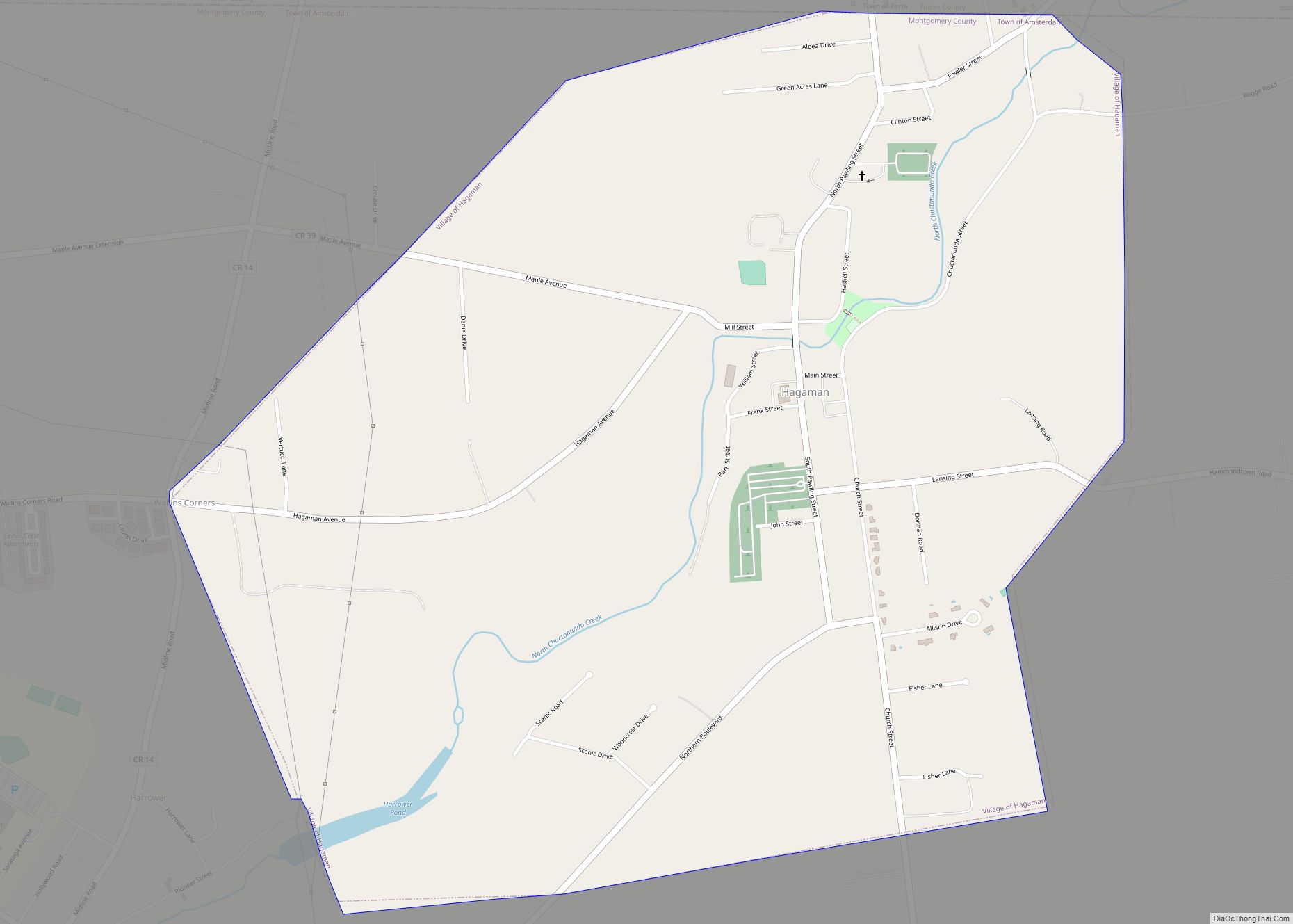
Online Interactive Map
Click on ![]() to view map in "full screen" mode.
to view map in "full screen" mode.
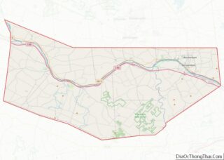
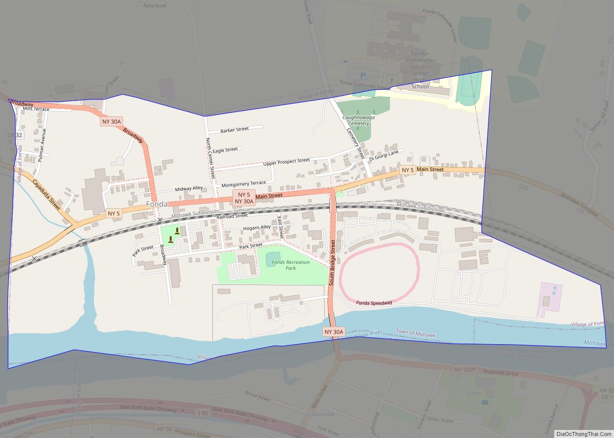
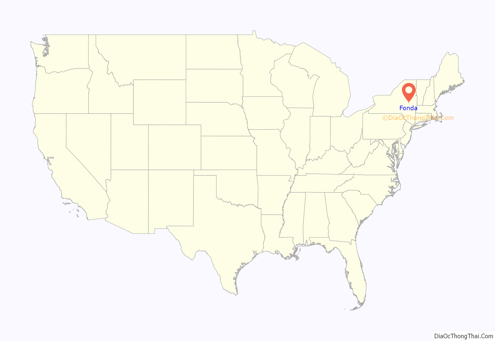
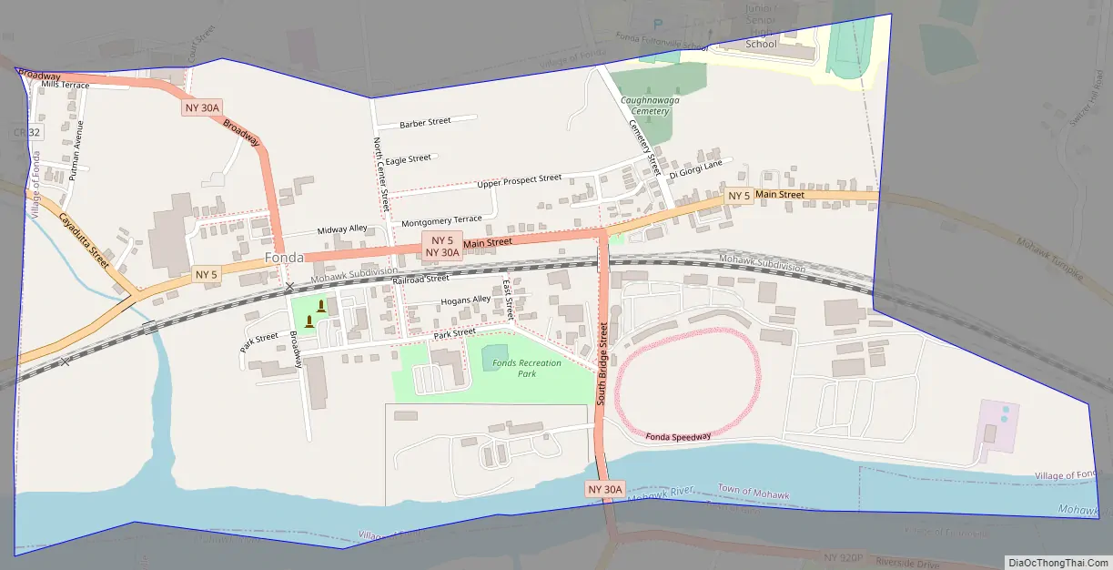
Fonda location map. Where is Fonda village?
History
The village of Fonda developed near the site of the former Mohawk village of Caughnawaga, also known as Kanatsiohareke. Here the Mohawk had cultivated corn in the floodplain on the north side of the Mohawk River.
In the late 17th-century, Kateri Tekakwitha resettled here. She was a Mohawk girl who had converted to Catholicism and became renowned for her piety. She lived here with relatives after her parents died in a smallpox epidemic. She had survived it but was marked by scars. The village has a national Catholic shrine devoted to her; she is the first Native American saint. After French attacked the village in the late 17th century, Kateri and many other Catholic Mohawk moved to the Jesuit mission village of Kahnawake, established on the south side of the St. Lawrence River, opposite Montreal in Quebec, or New France.
European settlers, mostly German and English, officially organized the present-day village in 1751 at the former site of Kanatsiohareke. The settlement was later named for Douw Fonda, a Dutch-American settler who was scalped in a Mohawk raid during the Revolutionary War. His family were ancestors of the American actors Henry Fonda, Jane Fonda and Peter Fonda. Henry Fonda wrote about them in his 1981 autobiography, as follows:
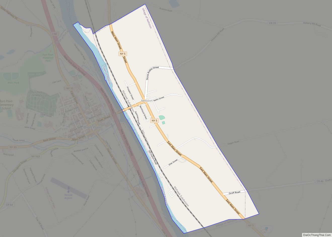
Fonda Road Map
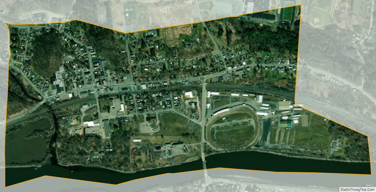
Fonda city Satellite Map
Geography
Fonda is located at 42°57′16″N 74°22′32″W / 42.95444°N 74.37556°W / 42.95444; -74.37556 (42.954342, -74.375424).
According to the United States Census Bureau, the village has a total area of 0.6 square miles (1.6 km), of which 0.5 square miles (1.3 km) is land and 0.1 square miles (0.26 km) (11.48%) is water.
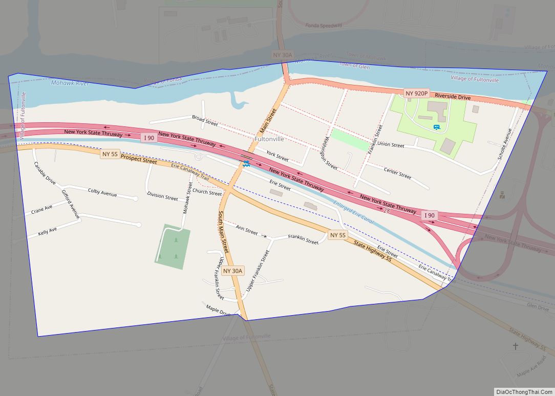
Fonda is on the northern bank of the Mohawk River, opposite the Village of Fultonville.
New York State Route 5, New York State Route 30A, and New York State Route 334 all serve Fonda, with NY 334 having its southern terminus at NY 5 at the western end. Amtrak’s Empire Corridor passes through the village, though it has no station here. Travelers have to go to Troy to get the train.
See also
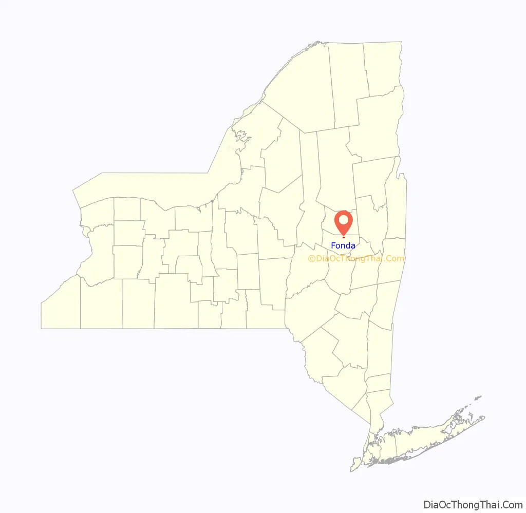
Map of New York State and its subdivision:- Albany
- Allegany
- Bronx
- Broome
- Cattaraugus
- Cayuga
- Chautauqua
- Chemung
- Chenango
- Clinton
- Columbia
- Cortland
- Delaware
- Dutchess
- Erie
- Essex
- Franklin
- Fulton
- Genesee
- Greene
- Hamilton
- Herkimer
- Jefferson
- Kings
- Lake Ontario
- Lewis
- Livingston
- Madison
- Monroe
- Montgomery
- Nassau
- New York
- Niagara
- Oneida
- Onondaga
- Ontario
- Orange
- Orleans
- Oswego
- Otsego
- Putnam
- Queens
- Rensselaer
- Richmond
- Rockland
- Saint Lawrence
- Saratoga
- Schenectady
- Schoharie
- Schuyler
- Seneca
- Steuben
- Suffolk
- Sullivan
- Tioga
- Tompkins
- Ulster
- Warren
- Washington
- Wayne
- Westchester
- Wyoming
- Yates
- Alabama
- Alaska
- Arizona
- Arkansas
- California
- Colorado
- Connecticut
- Delaware
- District of Columbia
- Florida
- Georgia
- Hawaii
- Idaho
- Illinois
- Indiana
- Iowa
- Kansas
- Kentucky
- Louisiana
- Maine
- Maryland
- Massachusetts
- Michigan
- Minnesota
- Mississippi
- Missouri
- Montana
- Nebraska
- Nevada
- New Hampshire
- New Jersey
- New Mexico
- New York
- North Carolina
- North Dakota
- Ohio
- Oklahoma
- Oregon
- Pennsylvania
- Rhode Island
- South Carolina
- South Dakota
- Tennessee
- Texas
- Utah
- Vermont
- Virginia
- Washington
- West Virginia
- Wisconsin
- Wyoming