Creedmoor is a city in Granville County, North Carolina, United States. The population was 4,124 at the 2010 census.
| Name: | Creedmoor city |
|---|---|
| LSAD Code: | 25 |
| LSAD Description: | city (suffix) |
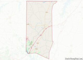
| State: | North Carolina |
| County: | Granville County |
| Founded: | April 10, 1885 |
| Incorporated: | 1905 |
| Elevation: | 374 ft (114 m) |
| Total Area: | 5.59 sq mi (14.48 km²) |
| Land Area: | 5.35 sq mi (13.85 km²) |
| Water Area: | 0.24 sq mi (0.63 km²) |
| Total Population: | 4,866 |
| Population Density: | 910.21/sq mi (351.44/km²) |
| ZIP code: | 27522, 27564 |
| Area code: | 919 |
| FIPS code: | 3715320 |
| GNISfeature ID: | 1019853 |
| Website: | www.cityofcreedmoor.org |
Online Interactive Map
Click on ![]() to view map in "full screen" mode.
to view map in "full screen" mode.
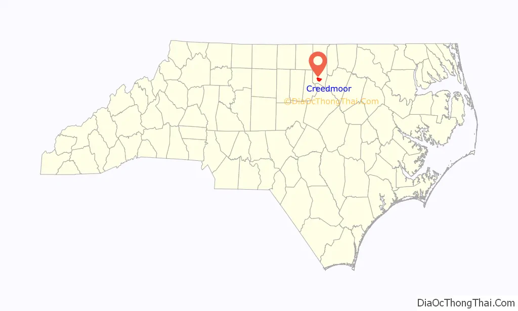
Creedmoor location map. Where is Creedmoor city?

History
In 1885, a group of 25 taxpayers of Granville County, including Civil War Confederate veteran Robert Fleming, appeared before the Board of Commissioners for the County of Granville with a petition from the Dutchville Township. The petition made a proposition to subscribe ten thousand dollars to the capital stock of the Oxford and Clarksville Railroad Company. Under the provisions of the act of the General Assembly of North Carolina which was entitled “An Act to Incorporate”, the Oxford and Clarksville Railroad Company was notified on 28 February 1885. The proposal was thereby approved under the provisions of the General Assembly of North Carolina. As a result, it was ordered that the election of subscribing the said sum of ten thousand dollars to the capital stock of the said railroad company be submitted to the qualified voters of the Dutchville Township and that an election be held in the said township at the proper voting place therein on 8 October 1887.
Over the next few years, Creedmoor served as a railroad depot between the Clarksville and Oxford Railroad and the Raleigh and Gaston Railroad. In 1886, Thomas B. Lyon applied to the Postal Department for a post office to be located in Creedmoor. Lyon’s request was granted on 10 April 1886. John Harmon was appointed as the first postmaster. In September of that same year, Samuel C. Lyon, son of Thomas B. Lyon, was appointed postmaster.
In 1888 Lyon sold part of his land to the Durham and Northern Railroad for track to run through the town. Linking Creedmoor to Henderson and Durham was a major cause of growth of this town. The old Seaboard train depot building still stands at its location on Elm Street, making it over 120 years old. Also previously located on Elm Street was the original First Baptist Church of Creedmoor, built in 1895. The present church building from 1950 stands on Main Street. Lyon’s body is entombed on the grounds of the original cemetery for the church, whereas Robert Fleming’s body is entombed in a small family plot on Fleming Street, a road named for the founder, adjacent to Elm Street.
Creedmoor was incorporated in 1905, having previously been known as “Creedmore”. The first mayor was Joseph L. Peed (1859–1936). The street Joe Peed Road located on southbound US-15 leaving the city is named in his honor. The first Commissioners were J.F. Sanderford, Isaac Bullock, S.C. Lyon, and Claude Garner. In 1917, electricity came to Creedmoor when G. H. Dove and F. J. McDuffy flipped a switch in their plant on Railroad Street.
Although the town is rich with history (home to four buildings on the National Register of Historic Places), it does not hold the title of a Historic District unlike nearby Oxford and Wake Forest.
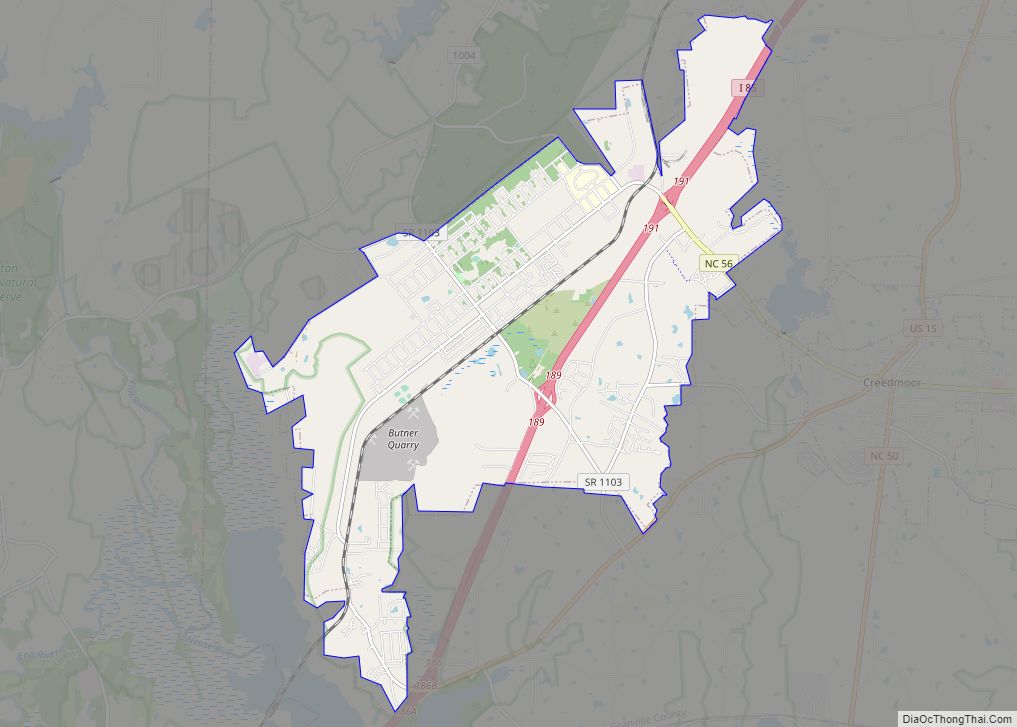
Creedmoor Road Map
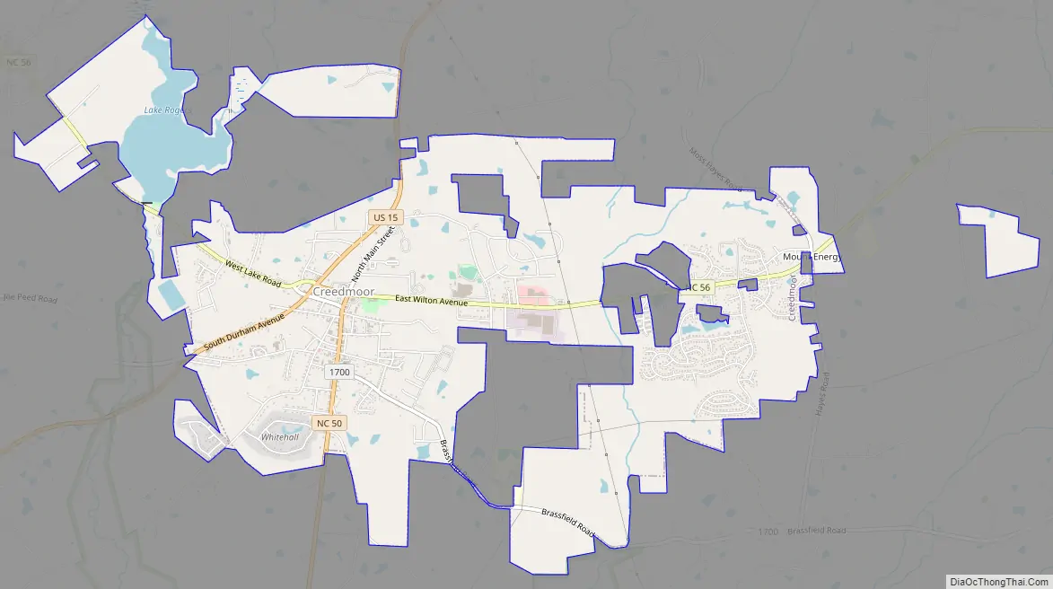
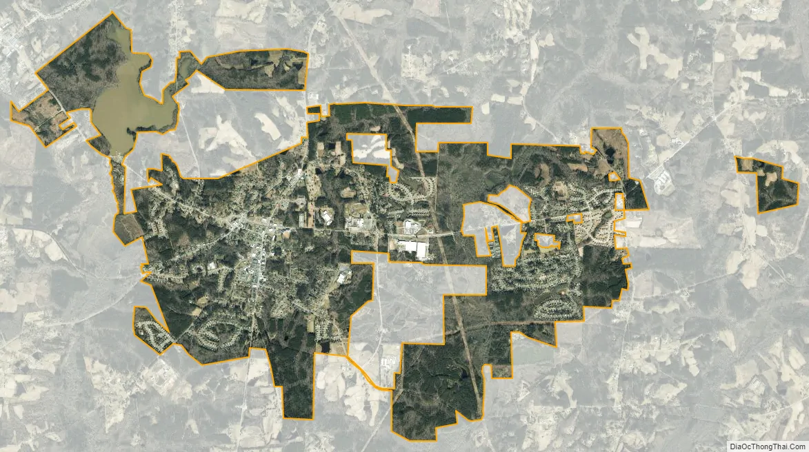
Creedmoor city Satellite Map
Geography
Creedmoor is located in southern Granville County at 36°7′23″N 78°41′0″W / 36.12306°N 78.68333°W / 36.12306; -78.68333 (36.123081, -78.683252). It is bordered to the west by the town of Butner.
U.S. Route 15 passes through Creedmoor as Durham Avenue, leading north 14 miles (23 km) to Oxford, the Granville County seat, and southwest 16 miles (26 km) to Durham. North Carolina Highway 56 crosses US 15 just west of the center of town. To the east, as Wilton Avenue, it leads 13 miles (21 km) to Franklinton, and to the west, as Lake Road, it leads 2.5 miles (4.0 km) to Interstate 85 and 5 miles (8 km) to the center of Butner. Interstate 85 leads southwest to Durham and northeast 112 miles (180 km) to Petersburg, Virginia.
According to the United States Census Bureau, Creedmoor has a total area of 4.8 square miles (12.4 km), of which 4.6 square miles (11.9 km) is land and 0.23 square miles (0.6 km), or 4.66%, is water.
Lake Rogers, a 175-acre (0.71 km) lake that offers picnicking, fishing, playground and boating accommodations, is in the northwest part of the city. Creedmoor is within the Neuse River watershed.
See also
Map of North Carolina State and its subdivision:- Alamance
- Alexander
- Alleghany
- Anson
- Ashe
- Avery
- Beaufort
- Bertie
- Bladen
- Brunswick
- Buncombe
- Burke
- Cabarrus
- Caldwell
- Camden
- Carteret
- Caswell
- Catawba
- Chatham
- Cherokee
- Chowan
- Clay
- Cleveland
- Columbus
- Craven
- Cumberland
- Currituck
- Dare
- Davidson
- Davie
- Duplin
- Durham
- Edgecombe
- Forsyth
- Franklin
- Gaston
- Gates
- Graham
- Granville
- Greene
- Guilford
- Halifax
- Harnett
- Haywood
- Henderson
- Hertford
- Hoke
- Hyde
- Iredell
- Jackson
- Johnston
- Jones
- Lee
- Lenoir
- Lincoln
- Macon
- Madison
- Martin
- McDowell
- Mecklenburg
- Mitchell
- Montgomery
- Moore
- Nash
- New Hanover
- Northampton
- Onslow
- Orange
- Pamlico
- Pasquotank
- Pender
- Perquimans
- Person
- Pitt
- Polk
- Randolph
- Richmond
- Robeson
- Rockingham
- Rowan
- Rutherford
- Sampson
- Scotland
- Stanly
- Stokes
- Surry
- Swain
- Transylvania
- Tyrrell
- Union
- Vance
- Wake
- Warren
- Washington
- Watauga
- Wayne
- Wilkes
- Wilson
- Yadkin
- Yancey
- Alabama
- Alaska
- Arizona
- Arkansas
- California
- Colorado
- Connecticut
- Delaware
- District of Columbia
- Florida
- Georgia
- Hawaii
- Idaho
- Illinois
- Indiana
- Iowa
- Kansas
- Kentucky
- Louisiana
- Maine
- Maryland
- Massachusetts
- Michigan
- Minnesota
- Mississippi
- Missouri
- Montana
- Nebraska
- Nevada
- New Hampshire
- New Jersey
- New Mexico
- New York
- North Carolina
- North Dakota
- Ohio
- Oklahoma
- Oregon
- Pennsylvania
- Rhode Island
- South Carolina
- South Dakota
- Tennessee
- Texas
- Utah
- Vermont
- Virginia
- Washington
- West Virginia
- Wisconsin
- Wyoming