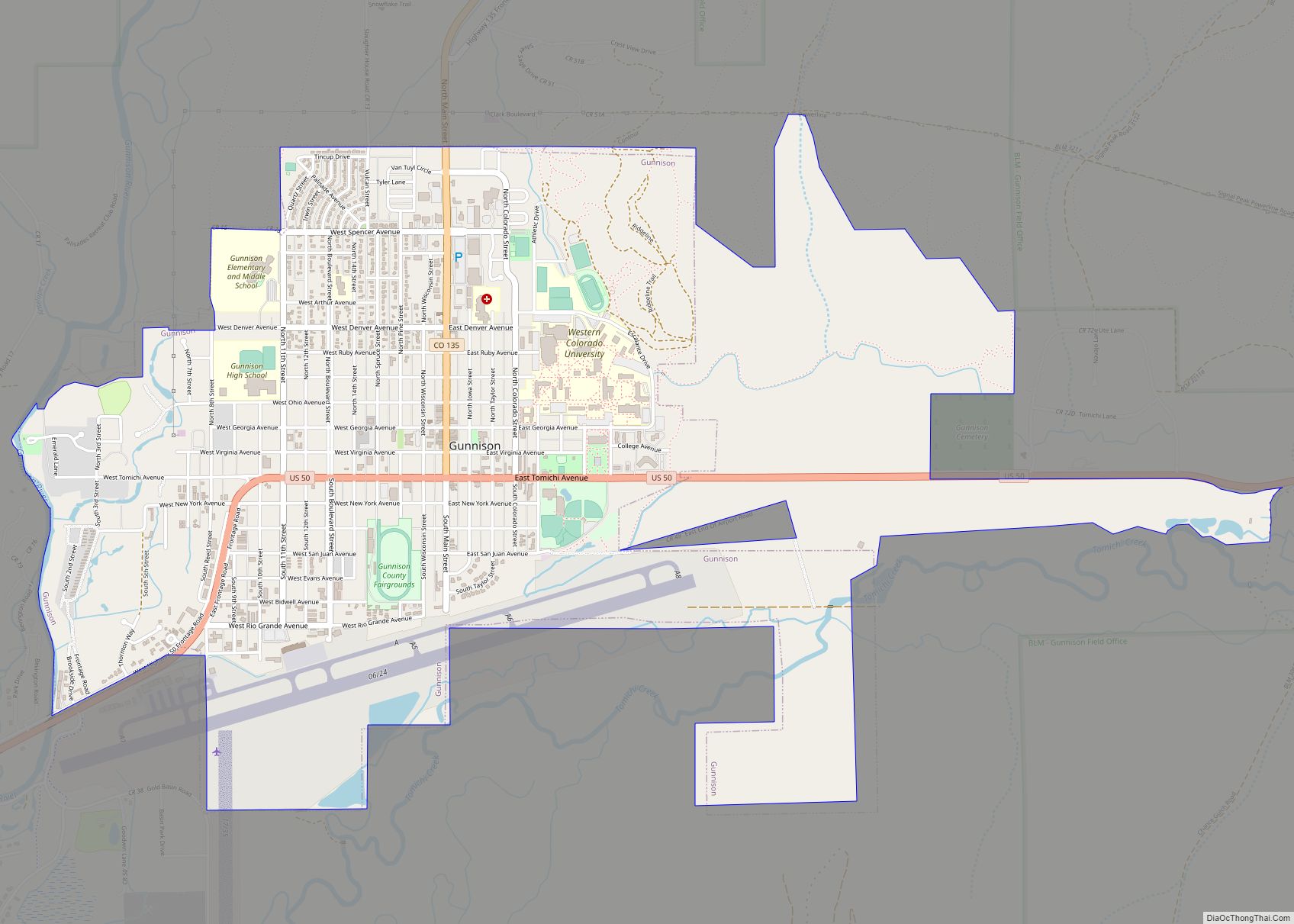
Gunnison is a home rule municipality that is the county seat and the most populous municipality of Gunnison County, Colorado. The city population was 6,560 at the 2020 United States Census. Gunnison was named in honor of John W. Gunnison, a United States Army officer who surveyed for a transcontinental railroad in 1853.
| Name: | Gunnison city |
|---|---|
| LSAD Code: | 25 |
| LSAD Description: | city (suffix) |
| State: | Colorado |
| County: | Gunnison County |
| Incorporated: | March 1, 1880 |
| Elevation: | 7,703 ft (2,347 m) |
| Total Area: | 4.849 sq mi (12.558 km²) |
| Land Area: | 4.849 sq mi (12.558 km²) |
| Water Area: | 0.000 sq mi (0.000 km²) |
| Total Population: | 6,560 |
| Population Density: | 1,353/sq mi (522/km²) |
| ZIP code: | 81230-81231 and 81247 |
| Area code: | 970 |
| FIPS code: | 0833640 |
| GNISfeature ID: | 2410674 |
| Website: | www.gunnisonco.gov |
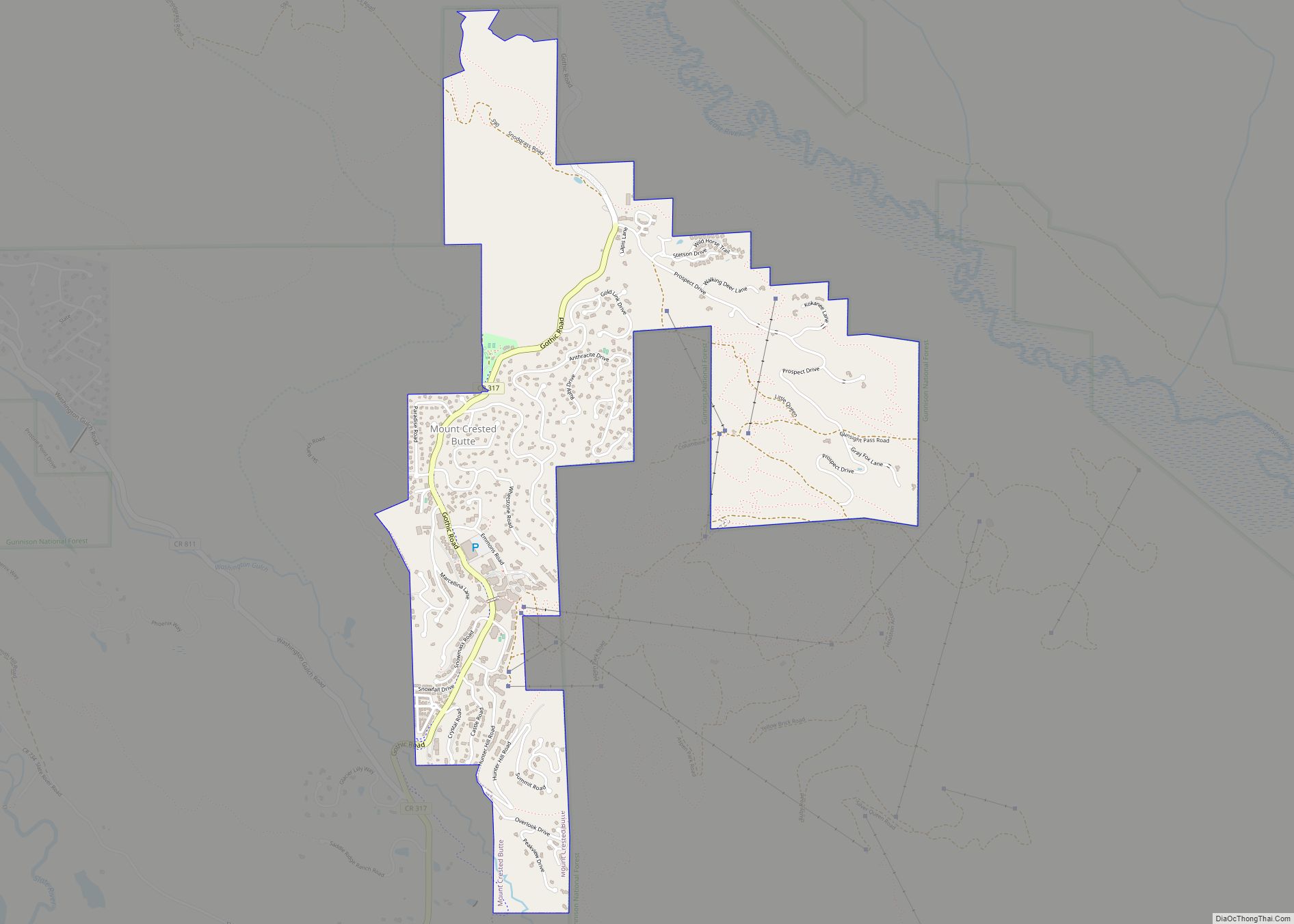
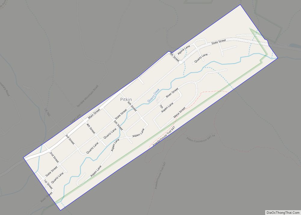
Online Interactive Map
Click on ![]() to view map in "full screen" mode.
to view map in "full screen" mode.
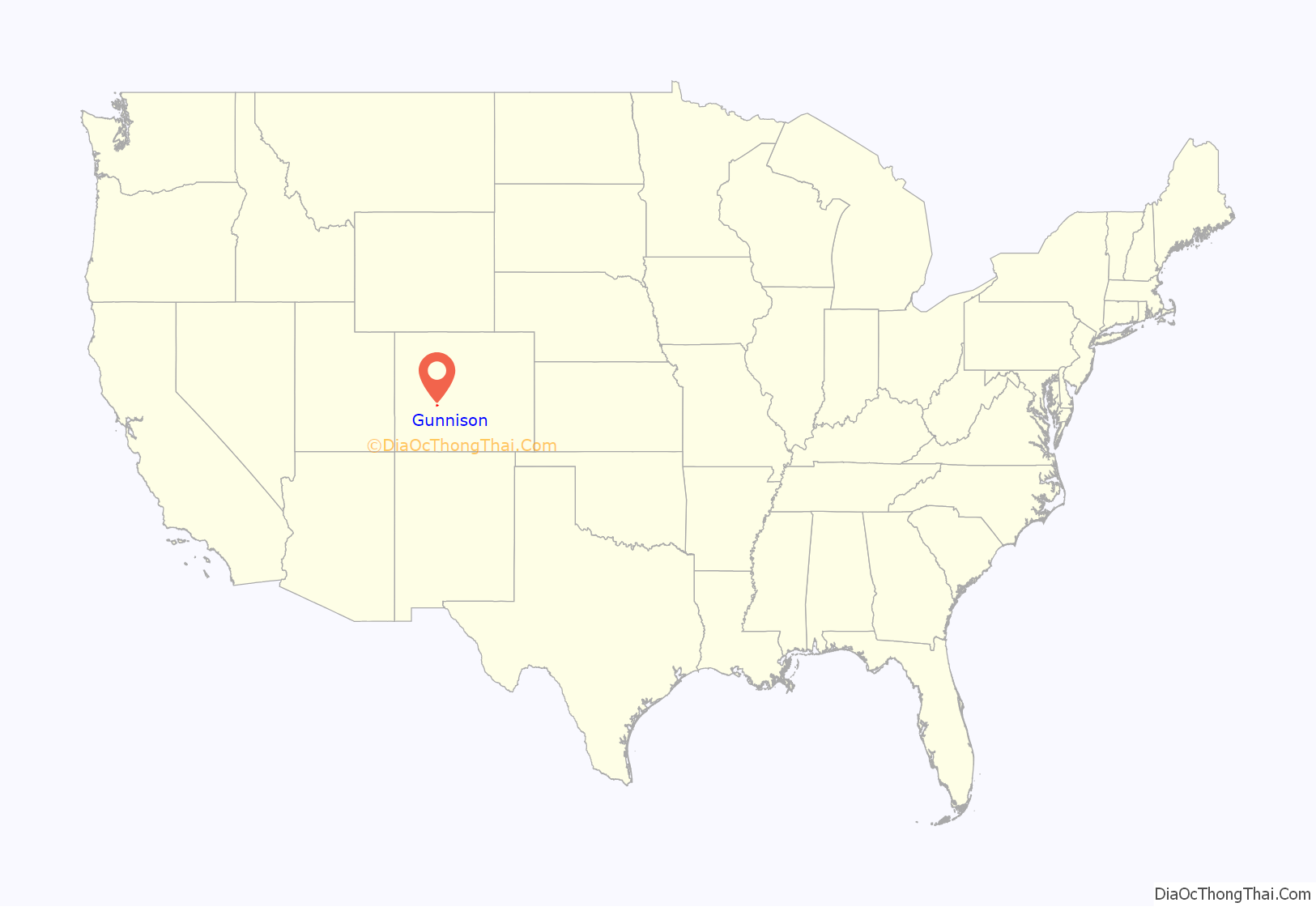
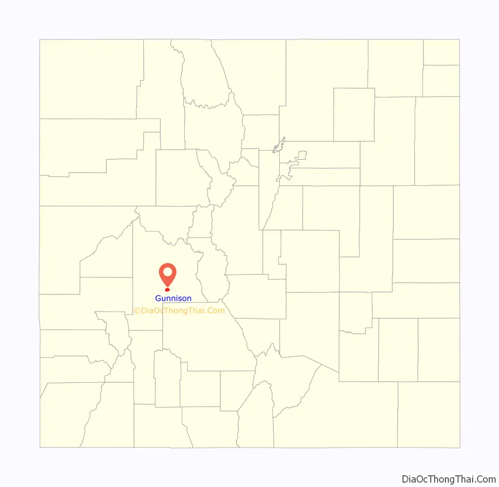
Gunnison location map. Where is Gunnison city?
History
The City of Gunnison got its name from the first known European-American explorer of the area, John W. Gunnison. He was searching for a route for the transcontinental railroad in 1853 and only stayed for three days before traveling west to Utah. Gunnison saw its first population increase in the 1870s, due to the mining surge throughout the state. The railroad arrived soon after in 1880 to appreciative miners, ranchers, and farmers.
In the early 1800s, the groups moving into the Gunnison area were mainly fur trappers and mountain men, trying to make a living for themselves in the rocky mountain terrain. But a drop in fur prices in the 1840s essentially cut out the need for their jobs.
The late 1850s saw the start of people joining the hunt for gold in Gunnison county. Miners were in search of placer gold, but with the growing numbers of white men in the area, this brought conflict between the Ute tribes still around the county. At least several miners were killed by these tribes and this caused some of the miners to flee the area, caring more for their lives than potential gold bonanzas.
With the mining boom, Gunnison began to see an increase of people around the 1870s. Along with the miners coming in, ranchers and farmers were among the others that led to the Ute people becoming forced out of the area. The mining camps in Gunnison and around the county reportedly produced about 130,000 ounces of gold from the beginning of the gold rush through 1959. At the start this was mostly from placer deposits, but the largest amounts were from a by-product of silver-lead ore. The largest deposits were found along the Taylor River, as well as the Tincup and the Washington Gulch districts.
Before the railroad reached Gunnison in 1880, there was a debate as to which railroad line would claim the town as their territory. The D&RG and DSP&P were both battling for control over the area. This split the town into two sides, both disagreeing as to where the railroad depots should be placed in town. The “old” and “new” sides of town ended up agreeing to disagree and were happy to have any railroad come through town. Both lines ended up coming through town anyway, although the DSP&P shortly discontinued service to Gunnison. The D&RG was later reorganized as the D&RGW railroad and was a prominent line to Gunnison for about seventy years; it served as the primary means of transportation for the townspeople into the 1950s.
Also in 1880, the cattle industry in Gunnison was established. Realizing the poor conditions for farming (with only about eleven inches of rainfall annually and the short growing season due to the high elevation and alpine environment) the local farmers turned to ranching and began breeding cattle. To do this effectively, they had to clear and level fields for grazing purposes. Irrigation ditches also had to be cut into the ground to properly irrigate the fields in order to grow hay for the horses and cattle. Many of these practices are still in use, which can be seen while driving through and around the town to the various ranches that are still in operation.
John and William Outcalt were among the earliest settlers of Gunnison. They started their own ranch just north of town along the southeast bank of the Gunnison river. The brothers hailed from New Jersey, but decided to make the trip west for the sake of adventure and the prospect of making money. The eldest brother, John, built the irrigation system for their ranch and quickly began growing hay and other various grains. When the railroad came through town, he convinced them to expand more and ended up paying for and building the rail that ran through his property. Naming this stop Hay Spur, they produced enough hay to ship out over 800 carloads each year, which mainly headed north to the settlers of which is now the town of Crested Butte, helping feed their mules. Along with the hay, carloads of potatoes and other vegetables from the Gunnison area were being sent to Crested Butte to supply the miners with food and also to support their animals. John Outcalt is also known to be one of the most famous men in the town. He helped build the Paragon School, which is still standing today in the Gunnison Pioneer Society museum on the east end of town. Originally a shipbuilder and carpenter in New Jersey, he incorporated his skills in the building of the school which is why it is still standing today. John was also praised by the local natives; when he first arrived in town he worked as a carpenter on the Los Pinos Indian reservation, and was considered the most trusted White man in the area. This helped in the long run because, according to legend, they saved his life on numerous occasions.
Gunnison residents isolated themselves from the surrounding area during the Spanish Influenza epidemic for two months at the end of 1918. All highways were barricaded near the county lines. Train conductors warned all passengers that if they stepped outside of the train in Gunnison, they would be arrested and quarantined for five days. This served as partial inspiration for the novel The Last Town on Earth (2006) by Thomas Mullen. The isolation was ultimately unsuccessful, as townspeople became restless after a few months, and the isolation was lifted in February 1919 only to have the flu arrive a month later, killing several.
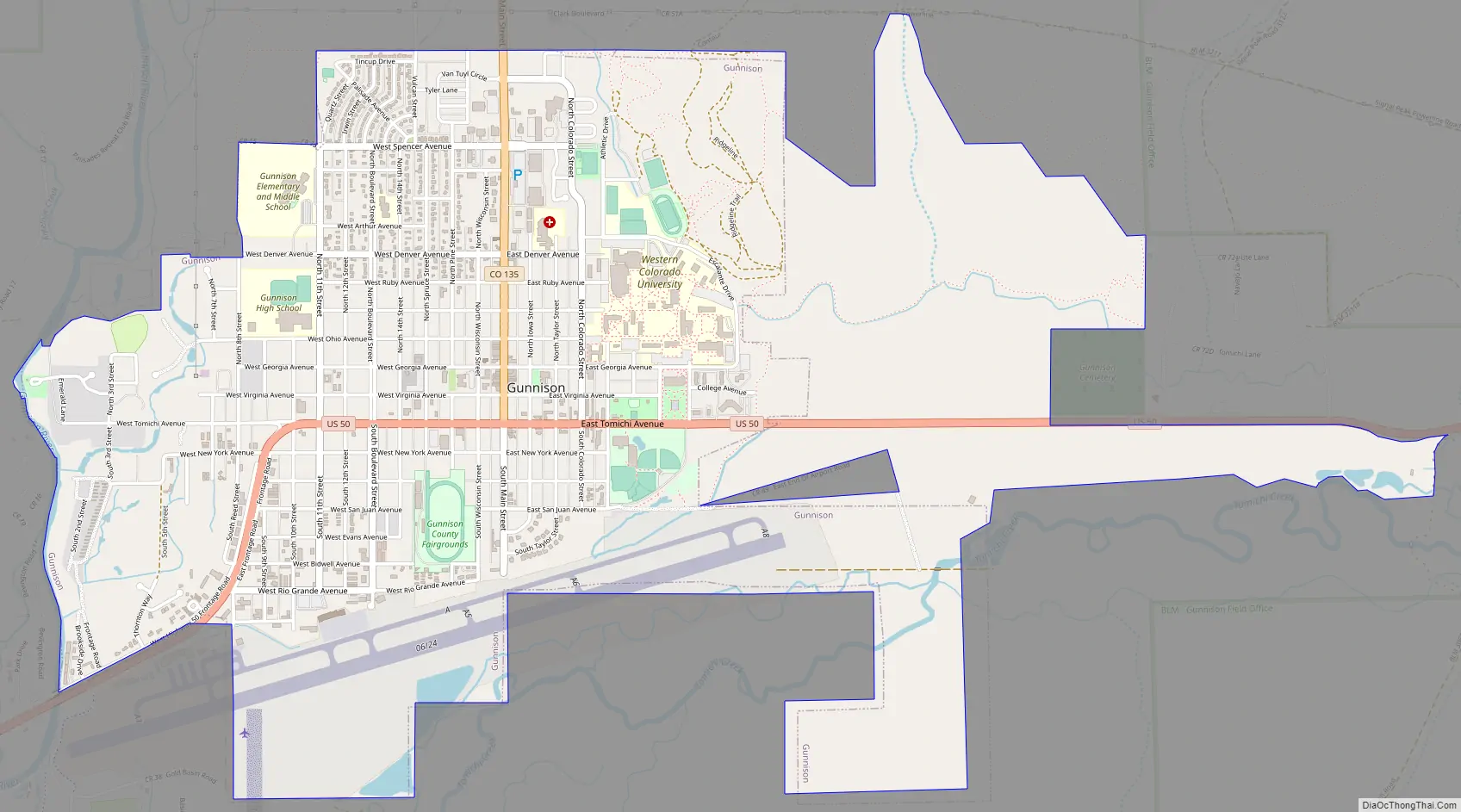
Gunnison Road Map
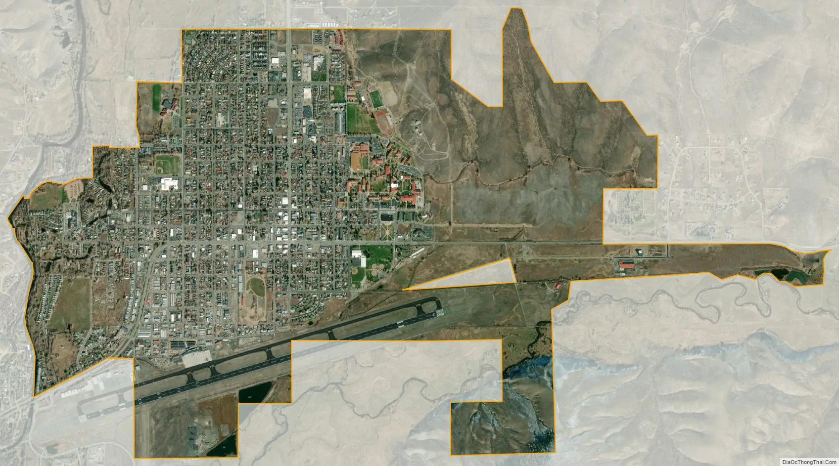
Gunnison city Satellite Map
Geography
Gunnison is situated at an altitude of 7,703 feet (2,348 m).
At the 2020 United States Census, the town had a total area of 3,103 acres (12.558 km), all of it land. Gunnison is near Blue Mesa Reservoir. Primary access to Gunnison is from Salida to the east via Monarch Pass or from Montrose, Colorado, to the west via Cerro Summit on U.S. Highway 50. U.S. Highway 50 is the main east-west thoroughfare through the town. There are numerous other ways to get to Gunnison, some of which are subject to seasonal closures (Kebler Pass, Cottonwood Pass). At the 2010 Census there was a population of 15,324 within the county.
Climate
Gunnison is located at the bottom of a valley. Due to its location in the Rocky Mountains, cold air in all the valleys settles into Gunnison at night, making it one of the coldest places in winter in the United States, especially when snowpack is present.
The city typically experiences moderate snowfalls, with an average of 45.5 inches (116 cm) per year. Early fall and late spring snows are not uncommon, and snow can remain on the ground in town from as early as November to as late as April. Surrounding mountains experience very heavy snowfall with longer periods of snow on the ground. Many locations average 300–400 inches (760–1,020 cm) of snow annually. The snow is welcome to the area, as it is beneficial to water supplies and local ski resorts. Total liquid precipitation averages 10.6 inches (270 mm) per year in the city of Gunnison, while surrounding mountains may receive anywhere from 15 to over 40 inches (380 to 1,000 mm) annually, depending upon elevation and local topography.
According to the Köppen Climate Classification system, Gunnison has a warm-summer humid continental climate, abbreviated “Dfb” on climate maps. The hottest temperature recorded in Gunnison was 105 °F (41 °C) on August 3, 1894, while the coldest temperature recorded was −47 °F (−44 °C) on December 25, 1924.
See also
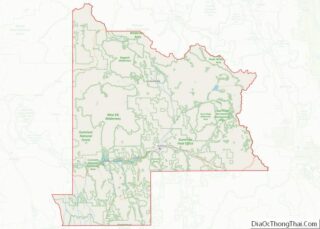
Map of Colorado State and its subdivision:- Adams
- Alamosa
- Arapahoe
- Archuleta
- Baca
- Bent
- Boulder
- Broomfield
- Chaffee
- Cheyenne
- Clear Creek
- Conejos
- Costilla
- Crowley
- Custer
- Delta
- Denver
- Dolores
- Douglas
- Eagle
- El Paso
- Elbert
- Fremont
- Garfield
- Gilpin
- Grand
- Gunnison
- Hinsdale
- Huerfano
- Jackson
- Jefferson
- Kiowa
- Kit Carson
- La Plata
- Lake
- Larimer
- Las Animas
- Lincoln
- Logan
- Mesa
- Mineral
- Moffat
- Montezuma
- Montrose
- Morgan
- Otero
- Ouray
- Park
- Phillips
- Pitkin
- Prowers
- Pueblo
- Rio Blanco
- Rio Grande
- Routt
- Saguache
- San Juan
- San Miguel
- Sedgwick
- Summit
- Teller
- Washington
- Weld
- Yuma
- Alabama
- Alaska
- Arizona
- Arkansas
- California
- Colorado
- Connecticut
- Delaware
- District of Columbia
- Florida
- Georgia
- Hawaii
- Idaho
- Illinois
- Indiana
- Iowa
- Kansas
- Kentucky
- Louisiana
- Maine
- Maryland
- Massachusetts
- Michigan
- Minnesota
- Mississippi
- Missouri
- Montana
- Nebraska
- Nevada
- New Hampshire
- New Jersey
- New Mexico
- New York
- North Carolina
- North Dakota
- Ohio
- Oklahoma
- Oregon
- Pennsylvania
- Rhode Island
- South Carolina
- South Dakota
- Tennessee
- Texas
- Utah
- Vermont
- Virginia
- Washington
- West Virginia
- Wisconsin
- Wyoming