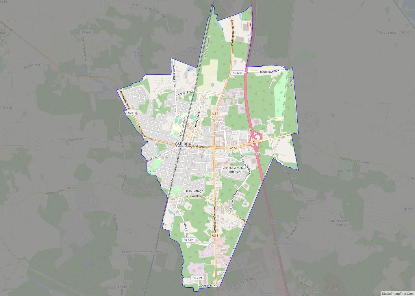
Ashland is a town in Hanover County, Virginia, United States, located 16 miles (26 km) north of Richmond along Interstate 95 and U.S. Route 1. As of the 2020 census it had a population of 7,565, up from 7,225 at the 2010 census.
Ashland is named after the Lexington, Kentucky estate of Hanover County native and statesman Henry Clay. It is the only incorporated town in Hanover County. Although comprising only one square mile when originally incorporated in 1858, today Ashland has grown through several annexations to a size of 7.16 square miles (18.5 km), one of Virginia’s larger towns in terms of land area.
| Name: | Ashland town |
|---|---|
| LSAD Code: | 43 |
| LSAD Description: | town (suffix) |
| State: | Virginia |
| County: | Hanover County |
| Founded: | 1858 |
| Elevation: | 213 ft (65 m) |
| Total Area: | 7.23 sq mi (18.7 km²) |
| Land Area: | 7.20 sq mi (18.6 km²) |
| Water Area: | 0.03 sq mi (0.08 km²) |
| Total Population: | 7,565 |
| ZIP code: | 23005 |
| Area code: | 804 |
| FIPS code: | 5103368 |
| GNISfeature ID: | 1492492 |
| Website: | ashlandva.gov |
Online Interactive Map
Click on ![]() to view map in "full screen" mode.
to view map in "full screen" mode.
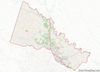
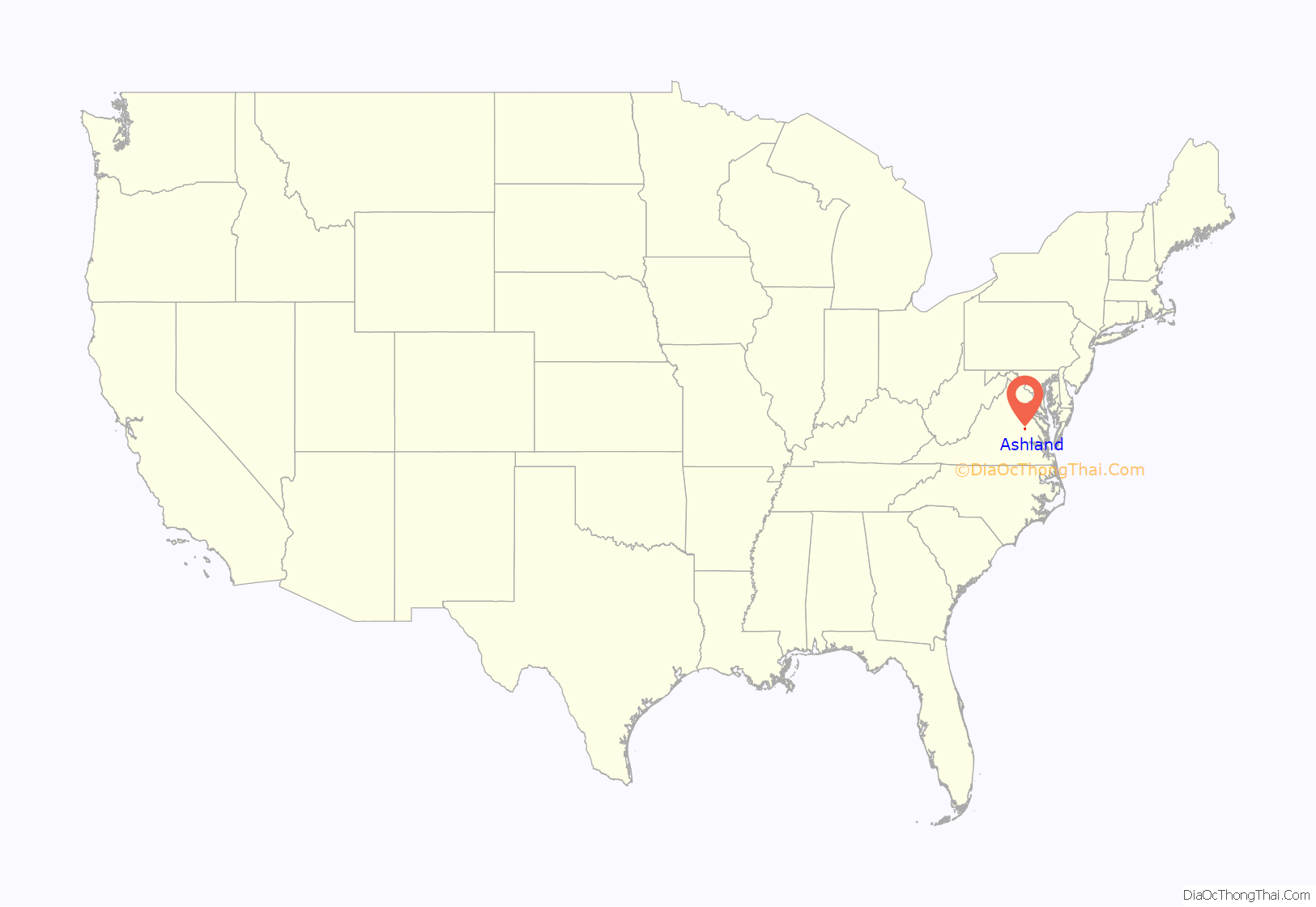
Ashland location map. Where is Ashland town?

History
The Richmond, Fredericksburg and Potomac Railroad initially developed the town in the 1840s as a mineral springs resort with a racetrack. The town was named “Ashland” after native son Henry Clay’s estate in Kentucky and was officially incorporated on February 19, 1858. The area had been known as “The Slashes”, sometimes translated as “swamp”, but which also reflected the small ravines that formed in the sandy clay soil after hard rains.
Confederate troops trained on the former racetrack early in the American Civil War, but the war and its aftermath devastated Ashland. Randolph–Macon College (founded 1830) moved to Ashland in 1868 and began using buildings of the bankrupt hotel as well as building additional structures.
The railroad lines rebuilt and the town continued to expand. Even before the war, the railroad began offering monthly passes to Richmond to people buying lots and building houses in Ashland. When tycoon Jay Gould established an electrified interurban line between Ashland and Richmond in 1907, the town became an early streetcar suburb of Richmond. The Richmond and Chesapeake Bay Railway, as it came to be called, was abandoned in 1938. A former car barn in Ashland is one of the few remaining vestiges of the line.
Construction of U.S. Route 1 on the former Washington (or Richmond) Road, and later I-95, further shaped the town character and development.
One of Virginia’s oldest churches is 5 miles (8 km) southeast of Ashland: Slash Church, built as the Upper Church of St. Paul’s Parish in 1729 remains a house of worship, though now used by the Disciples of Christ. Ashland itself originally had a Free Church, shared by various Protestant denominations. Several denominations built churches shortly after the Civil War, but many have been torn down. The town’s current Episcopal church is St. James the Less, on the other side of the railway line from Slash Church and whose congregation received monthly clergy visitations in the 1850s, and which in 1958 sold its 1866-consecrated and once-moved building as well as the old rectory (which still remains today, in private ownership) in order to build a larger one on the town’s outskirts. The Disciples of Christ also had a historic church on Center Street (built 1900) that was replaced in 1985. Historic churches still within the town’s (and historic district’s) boundaries include Ashland Baptist Church (1860, now the Hanover Arts and Activities Center); Shiloh Baptist Church (1866, originally Freedmens Baptist Church), Duncan Memorial Chapel (Methodist, 1879), St. Ann’s Catholic Church (built 1892, remodeled 1925) and Ashland Presbyterian Church (1875-1881). Gwathmey Baptist Church (1892) is a mile nearer Richmond and (like the former St. James the Less Church), within 50 feet of the railroad tracks. The town now also has an Eastern Orthodox congregation, St. Andrew’s (2001), and a messianic Jewish congregation (Beth Shalom Ministries, 2004).
On October 19, 2002, Ashland made national news as the site of one of the D.C. sniper attacks. 37-year-old Jeffrey Hopper was shot at 8:00 pm in the parking lot of a Ponderosa Steakhouse as he and his wife left the restaurant. A ransom demand note the snipers left nearby was instrumental in identifying them.
The local newspaper, The Herald-Progress, published its final edition on March 29, 2018.
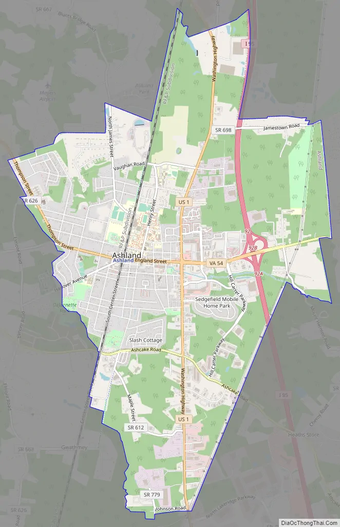
Ashland Road Map
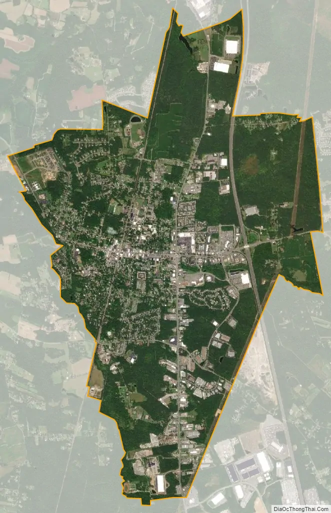
Ashland city Satellite Map
Geography
Ashland is located near the center of Hanover County at 37°45′34″N 77°28′38″W / 37.75944°N 77.47722°W / 37.75944; -77.47722 (37.759361, −77.477226). U.S. Route 1 passes through the east side of the center of town, leading north 8 miles (13 km) to Doswell and south 16 miles (26 km) to Richmond. Interstate 95 passes through the town limits further to the east, with access from Exit 92. I-95 leads north 38 miles (61 km) to Fredericksburg and 90 miles (140 km) to Washington, D.C., while to the south it leads 16 miles to Richmond and 40 miles (64 km) to Petersburg. Virginia State Route 54 goes through the center of Ashland as England Street and Thompson Street, leading east 6 miles (10 km) to U.S. Route 301 at Hanover, the county seat, and northwest 13 miles (21 km) to Montpelier.
According to the United States Census Bureau, Ashland has a total area of 7.2 square miles (18.6 km), of which 0.03 square miles (0.08 km), or 0.43%, are water. Ashland is drained to the north by tributaries of the South Anna River, part of the Pamunkey and York River watershed, and to the south by tributaries of the Chickahominy River, part of the James River watershed.
See also
Map of Virginia State and its subdivision:- Accomack
- Albemarle
- Alexandria
- Alleghany
- Amelia
- Amherst
- Appomattox
- Arlington
- Augusta
- Bath
- Bedford
- Bedford City
- Bland
- Botetourt
- Bristol
- Brunswick
- Buchanan
- Buckingham
- Buena Vista
- Campbell
- Caroline
- Carroll
- Charles City
- Charlotte
- Charlottesville
- Chesapeake
- Chesterfield
- Clarke
- Clifton Forge City
- Colonial Heights
- Covington
- Craig
- Culpeper
- Cumberland
- Danville
- Dickenson
- Dinwiddie
- Emporia
- Essex
- Fairfax
- Fairfax City
- Falls Church
- Fauquier
- Floyd
- Fluvanna
- Franklin
- Frederick
- Fredericksburg
- Galax
- Giles
- Gloucester
- Goochland
- Grayson
- Greene
- Greensville
- Halifax
- Hampton
- Hanover
- Harrisonburg
- Henrico
- Henry
- Highland
- Hopewell
- Isle of Wight
- James City
- King and Queen
- King George
- King William
- Lancaster
- Lee
- Lexington
- Loudoun
- Louisa
- Lunenburg
- Lynchburg
- Madison
- Manassas
- Manassas Park
- Martinsville
- Mathews
- Mecklenburg
- Middlesex
- Montgomery
- Nelson
- New Kent
- Newport News
- Norfolk
- Northampton
- Northumberland
- Norton
- Nottoway
- Orange
- Page
- Patrick
- Petersburg
- Pittsylvania
- Poquoson
- Portsmouth
- Powhatan
- Prince Edward
- Prince George
- Prince William
- Pulaski
- Radford
- Rappahannock
- Richmond
- Roanoke
- Roanoke City
- Rockbridge
- Rockingham
- Russell
- Salem
- Scott
- Shenandoah
- Smyth
- Southampton
- Spotsylvania
- Stafford
- Staunton
- Suffolk
- Surry
- Sussex
- Tazewell
- Virginia Beach
- Warren
- Washington
- Waynesboro
- Westmoreland
- Williamsburg
- Winchester
- Wise
- Wythe
- York
- Alabama
- Alaska
- Arizona
- Arkansas
- California
- Colorado
- Connecticut
- Delaware
- District of Columbia
- Florida
- Georgia
- Hawaii
- Idaho
- Illinois
- Indiana
- Iowa
- Kansas
- Kentucky
- Louisiana
- Maine
- Maryland
- Massachusetts
- Michigan
- Minnesota
- Mississippi
- Missouri
- Montana
- Nebraska
- Nevada
- New Hampshire
- New Jersey
- New Mexico
- New York
- North Carolina
- North Dakota
- Ohio
- Oklahoma
- Oregon
- Pennsylvania
- Rhode Island
- South Carolina
- South Dakota
- Tennessee
- Texas
- Utah
- Vermont
- Virginia
- Washington
- West Virginia
- Wisconsin
- Wyoming