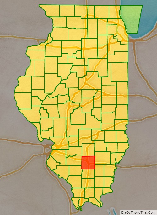
Jefferson County is a county located in the southern part of the U.S. state of Illinois. According to the 2020 census, it has a population of 37,113. The county seat is Mount Vernon.
Jefferson County contains the Mount Vernon, Illinois micropolitan area. It is located in the southern portion known locally as “Little Egypt”.
The western border of the county adjoins the Greater St. Louis consolidated metropolitan statistical area, the Metro-East region, and the St. Louis commuter region and market and viewing area.
| Name: | Jefferson County |
|---|---|
| FIPS code: | 17-081 |
| State: | Illinois |
| Founded: | 1819 |
| Named for: | Thomas Jefferson |
| Seat: | Mount Vernon |
| Largest city: | Mount Vernon |
| Total Area: | 584 sq mi (1,510 km²) |
| Land Area: | 571 sq mi (1,480 km²) |
| Total Population: | 37,113 |
| Population Density: | 64/sq mi (25/km²) |
| Time zone: | UTC−6 (Central) |
| Summer Time Zone (DST): | UTC−5 (CDT) |
| Website: | www.jeffersoncountyillinois.com |
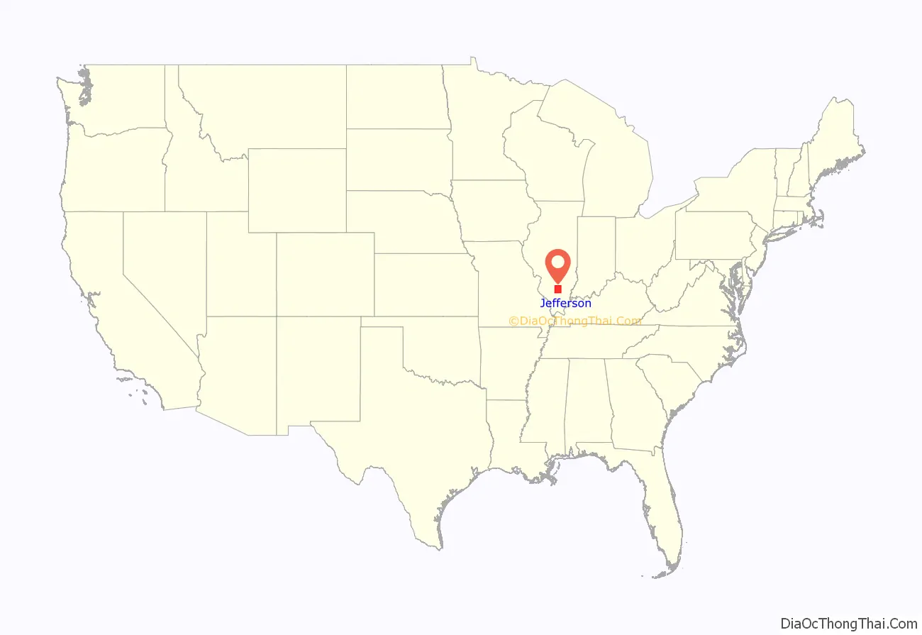
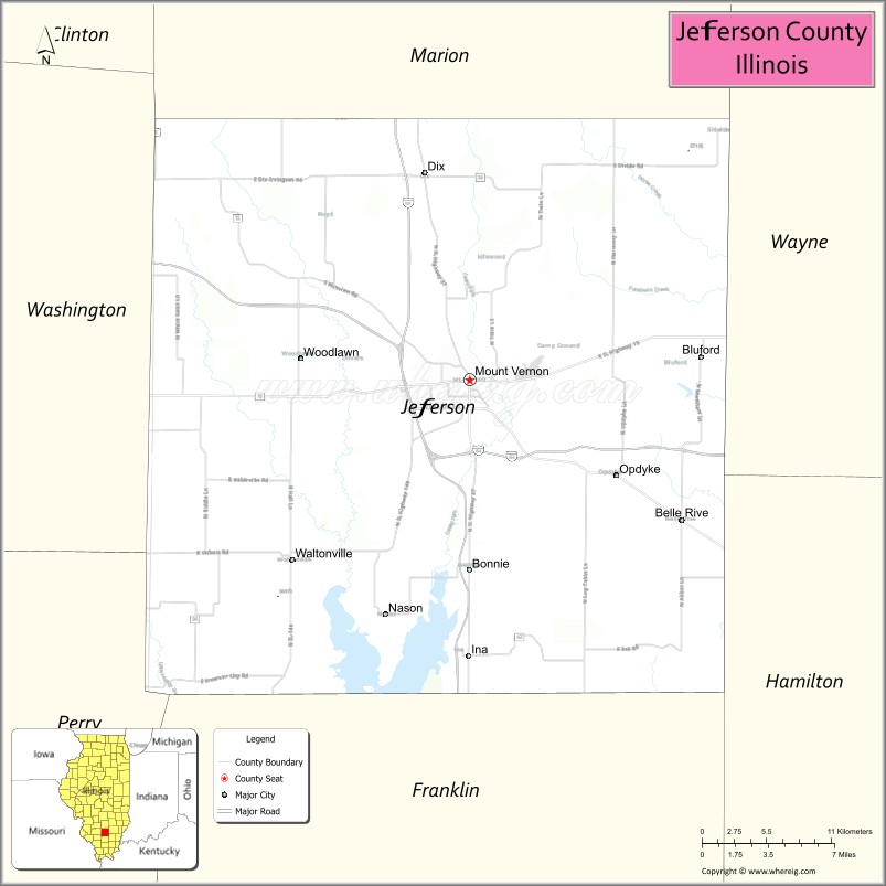
Jefferson County location map. Where is Jefferson County?
History
The first settler in Jefferson County is believed to have been Andrew Moore. In 1810, he settled near the southeast corner of the county, near where the Goshen Road emerges from the forest of Hamilton County into what is now known as Moore’s Prairie. Moore arrived from the Goshen Settlement, near Edwardsville. His migration was therefore retrograde, from the west toward the interior of the State.
In 1814, Andrew Moore departed with his eight-year-old son for Jordan’s settlement, a journey from which he never returned. A skull that was believed to have been Moore’s was found several years later about two miles from his cabin. Jordan’s Settlement, also called Jordan’s Fort, was southeast of modern Thompsonville, Illinois, about twenty miles south of Moore’s cabin. This episode occurred during the War of 1812 when many of the Indian tribes were allied with the British.
In 1816, Carter Wilkey, Daniel Crenshaw and Robert Cook settled in Moore’s Prairie. Daniel Crenshaw moved into Moore’s cabin. This settlement is believed to be the first permanent settlement in the county.
Jefferson County was organized in 1819, out of parts of White, Edwards and Franklin Counties. It was named in honor of Thomas Jefferson, principal draftsman of the Northwest Ordinance, among other things. The baseline along the northern border of the County crosses the Third Principal Meridian at the northwest corner of the county.
Jefferson County between the time of its creation and 1821
Jefferson County between 1821 and 1823
Jefferson County in 1823, reduced to its current size
Jefferson County Road Map
Geography
According to the U.S. Census Bureau, the county has a total area of 584 square miles (1,510 km), of which 571 square miles (1,480 km) is land and 13 square miles (34 km) (2.2%) is water.
Climate and weather
In recent years, average temperatures in the county seat of Mount Vernon have ranged from a low of 19 °F (−7 °C) in January to a high of 88 °F (31 °C) in July, although a record low of −21 °F (−29 °C) was recorded in January 1994 and a record high of 114 °F (46 °C) was recorded in July 1936. Average monthly precipitation ranged from 2.45 inches (62 mm) in January to 4.58 inches (116 mm) in May.
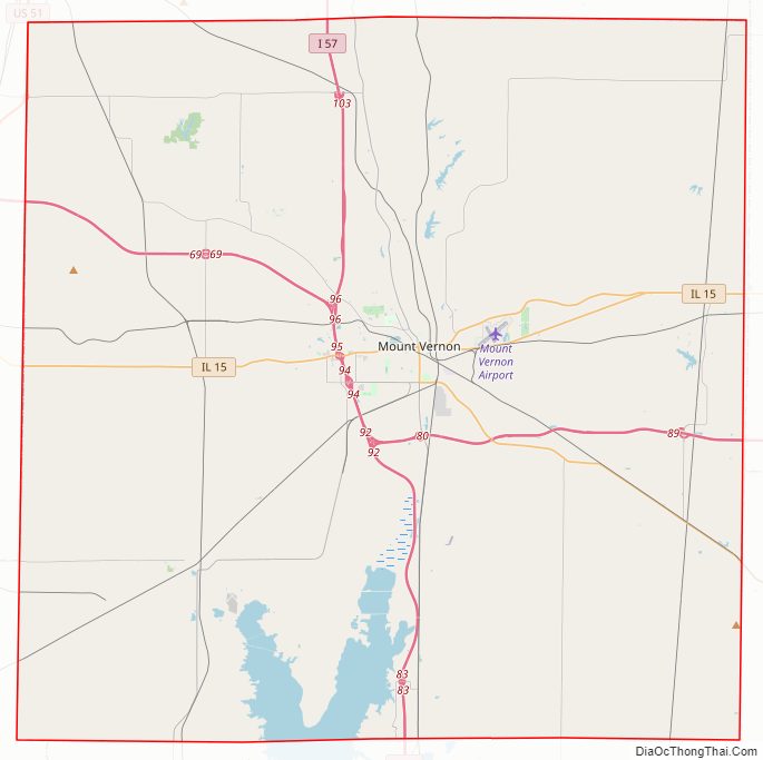
Major highways
- Interstate 57
- Interstate 64
- U.S. Highway 51
- Illinois Route 15
- Illinois Route 37
- Illinois Route 142
- Illinois Route 148
Transit
- List of intercity bus stops in Illinois
Adjacent counties
- Marion County – north
- Wayne County – northeast
- Hamilton County – southeast
- Franklin County – south
- Perry County – southwest
- Washington County – west
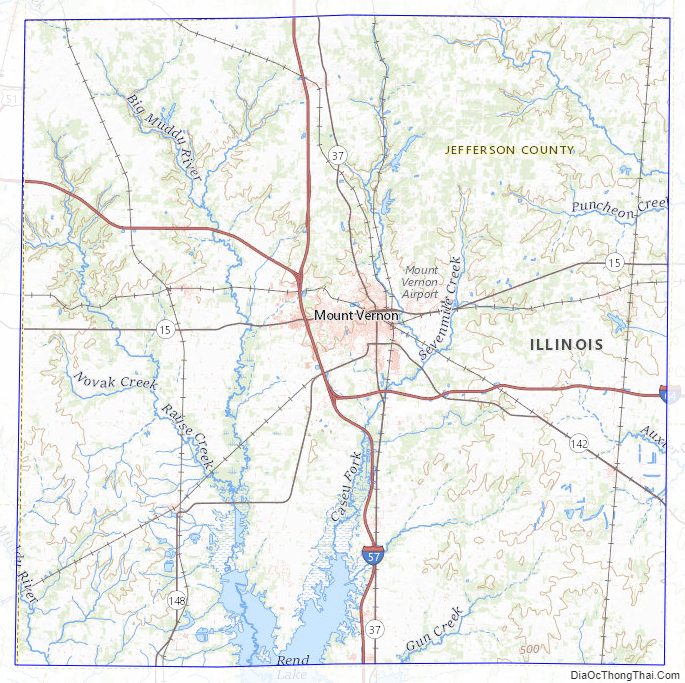
Jefferson County Topographic Map
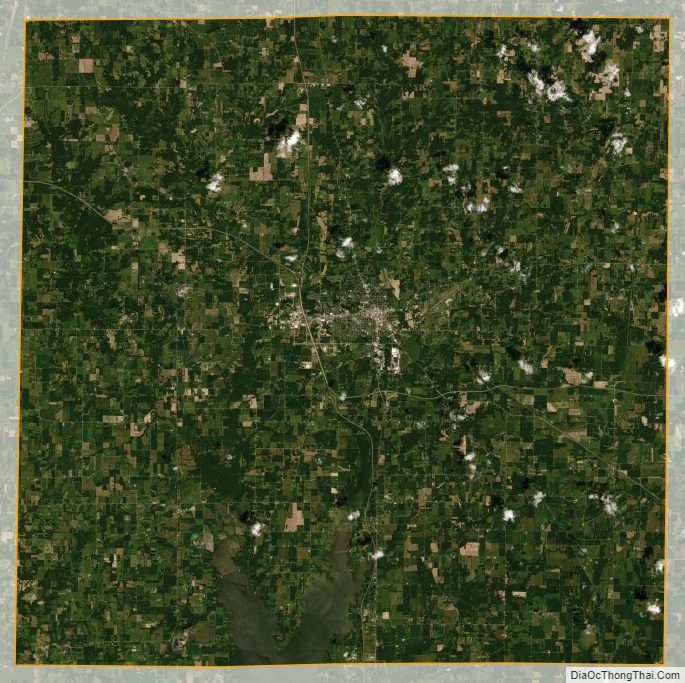
Jefferson County Satellite Map
Jefferson County Outline Map