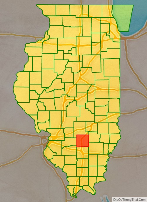
Marion County is a county located in the U.S. state of Illinois. According to the 2010 census, it had a population of 39,437. Its county seat is Salem.
Marion County comprises the Centralia, IL Micropolitan Statistical Area, which is included in the St. Louis–St. Charles–Farmington, MO-IL Combined Statistical Area.
| Name: | Marion County |
|---|---|
| FIPS code: | 17-121 |
| State: | Illinois |
| Founded: | 1823 |
| Named for: | Francis Marion |
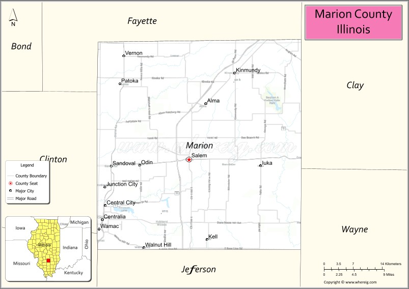
| Seat: | Salem |
| Largest city: | Centralia |
| Total Area: | 576 sq mi (1,490 km²) |
| Land Area: | 572 sq mi (1,480 km²) |
| Total Population: | 39,437 |
| Population Density: | 68/sq mi (26/km²) |
| Time zone: | UTC−6 (Central) |
| Summer Time Zone (DST): | UTC−5 (CDT) |
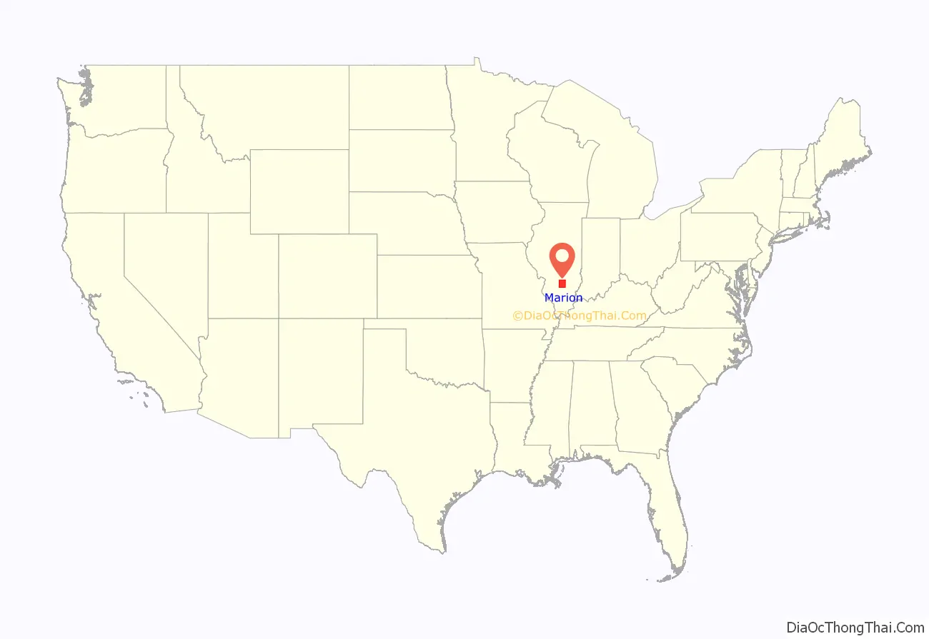
Marion County location map. Where is Marion County?
History
Marion County was organized on 24 January 1823 from portions of Jefferson and Fayette counties. It was named in honor of Revolutionary War Gen. Francis Marion, the “Swamp Fox”.
Marion County at the time of its creation in 1823
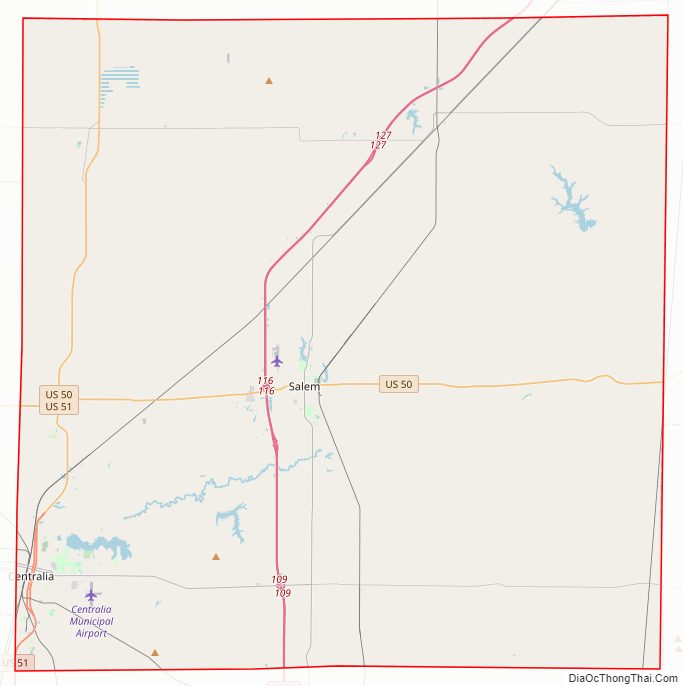
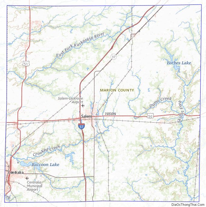
Marion County Road Map
Geography
According to the U.S. Census Bureau, the county has a total area of 576 square miles (1,490 km), of which 572 square miles (1,480 km) is land and 3.7 square miles (9.6 km) (0.6%) is water.
The southwest corner of Marion County is the intersection of the Baseline with the Third Principal Meridian, the point of origin for the third survey of the Northwest Territory under the Land Ordinance of 1785. The origin is marked with a boulder south of Centralia just off U.S. 51.
Climate and weather
In recent years, average temperatures in the county seat of Salem have ranged from a low of 18 °F (−8 °C) in January to a high of 88 °F (31 °C) in July, although a record low of −23 °F (−31 °C) was recorded in January 1994 and a record high of 105 °F (41 °C) was recorded in August 1983. Average monthly precipitation ranged from 2.46 inches (62 mm) in January to 4.37 inches (111 mm) in May.
Major highways
- Interstate 57
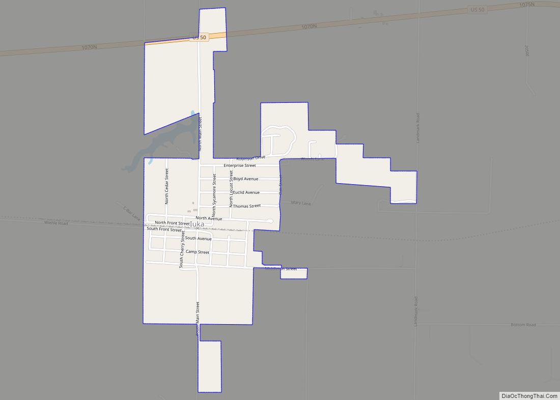
- U.S. Route 50
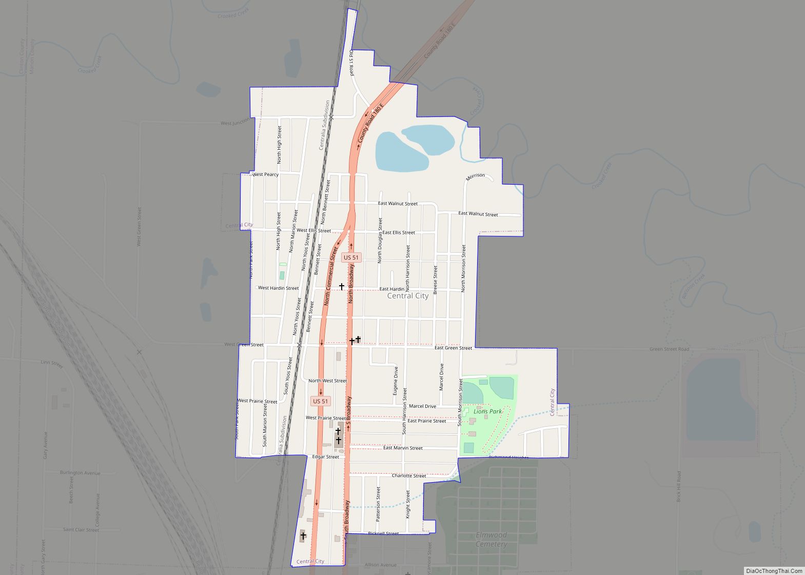
- U.S. Route 51
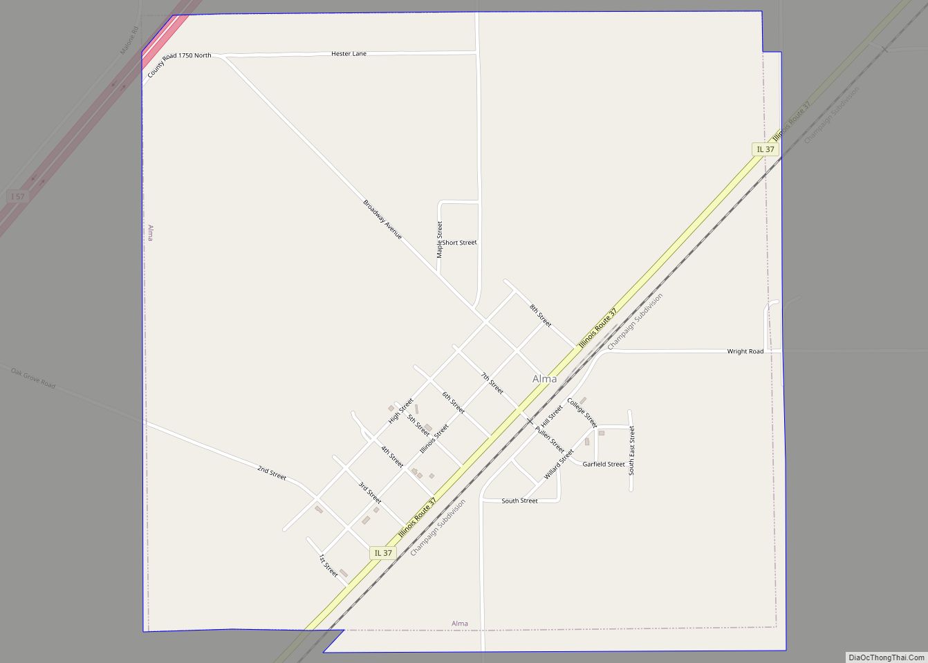
- Illinois Route 37
- Illinois Route 161
Adjacent counties
- Fayette County – north
- Clay County – east
- Wayne County – southeast
- Jefferson County – south
- Washington County – southwest
- Clinton County – west
Marion County Topographic Map
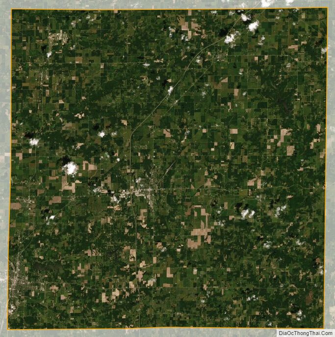
Marion County Satellite Map
Marion County Outline Map