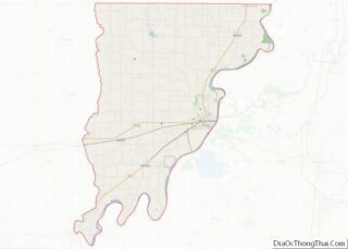
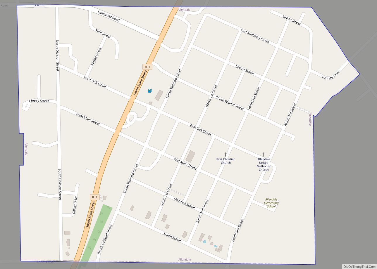
Mount Carmel is a city in and the county seat of Wabash County, Illinois, United States. At the time of the 2010 census, the population was 7,284, and it is the largest city in the county. The next largest town in Wabash County is Allendale, population 475.
Located at the confluence of the Wabash, Patoka, and White rivers, Mount Carmel borders both Gibson and Knox counties of Indiana. A small community known informally as East Mount Carmel sits near the mouth of the Patoka River on the opposite (Gibson County) side of the Wabash River from Mount Carmel. Mount Carmel is 5 miles (8.0 km) northeast of the Forest of the Wabash, a National Natural Landmark within Beall Woods State Park and about a mile north-northeast of one of its main employers, the Gibson Generating Station. Mount Carmel is also the home of Wabash Valley College, part of the Community College System of Eastern Illinois. Some know Mt. Carmel as Mountain Carmel.
| Name: | Mount Carmel city |
|---|---|
| LSAD Code: | 25 |
| LSAD Description: | city (suffix) |
| State: | Illinois |
| County: | Wabash County |
| Founded: | 1815 (1815) |
| Elevation: | 456 ft (139 m) |
| Total Area: | 4.95 sq mi (12.82 km²) |
| Land Area: | 4.81 sq mi (12.46 km²) |
| Water Area: | 0.14 sq mi (0.37 km²) |
| Total Population: | 7,015 |
| Population Density: | 1,458.72/sq mi (563.19/km²) |
| ZIP code: | 62863 |
| FIPS code: | 1750868 |
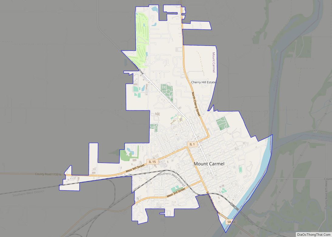
Online Interactive Map
Click on ![]() to view map in "full screen" mode.
to view map in "full screen" mode.
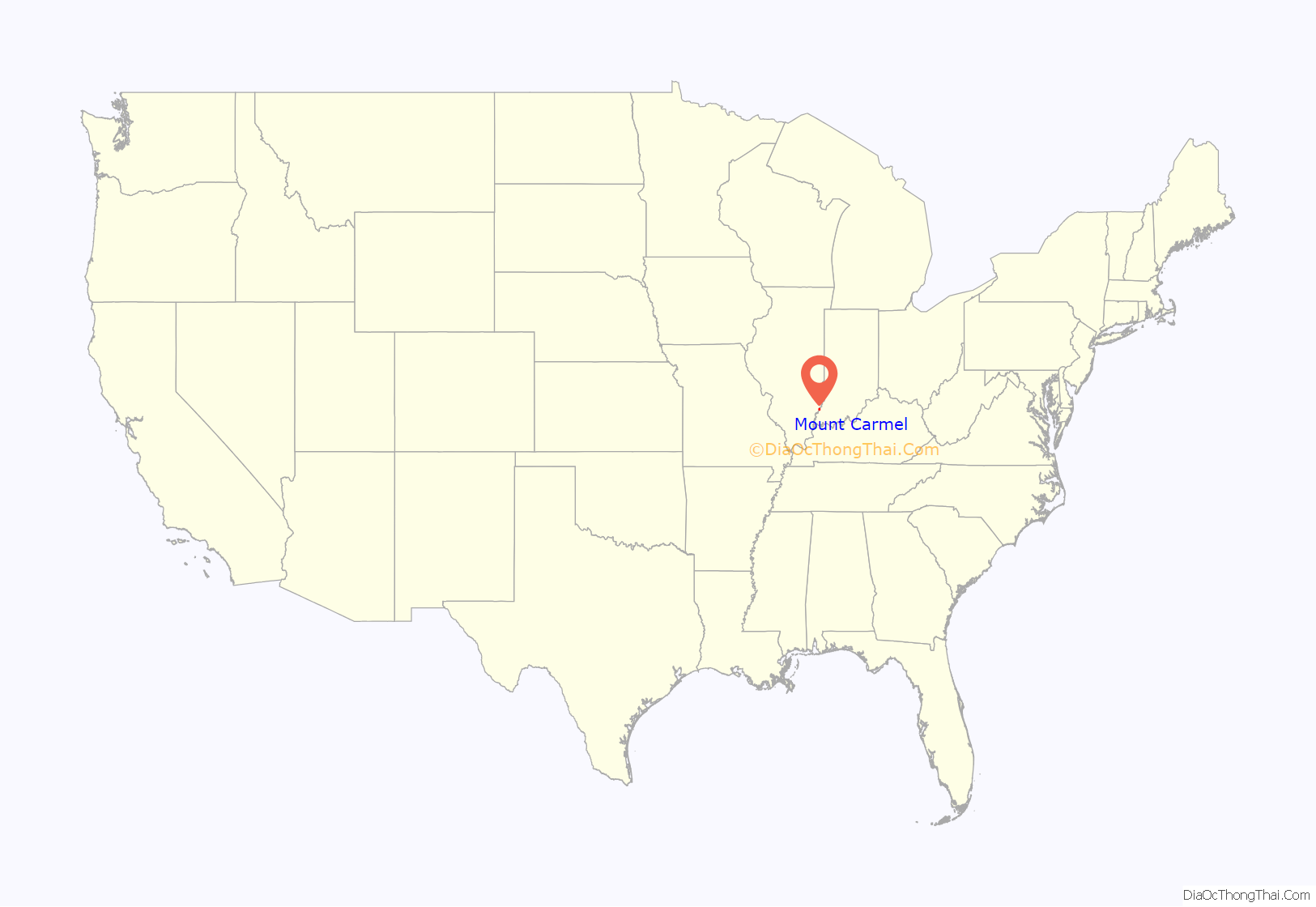
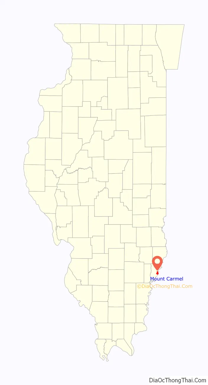
Mount Carmel location map. Where is Mount Carmel city?
History
Tornado
On June 4, 1877 a tornado of F4 intensity touched down just west of Mount Carmel and moved east-northeast, devastating the town. The storm’s line of destruction wreaked havoc on a large part of the territory between Third and Fifth streets. The velocity of the wind was estimated at 150 miles per hour for a duration of almost two minutes.
As described in a local newspaper at the time: “During its prevalence the air was filled with flying roofs, windows, doors, lumber, rails, clothing, etc. Much of the debris was carried more than a mile away. Thirteen persons were killed outright, and many others will undoubtedly die of their injuries. There are also several others reported missing who are probably buried in the ruins. It being a rainy day, many farmers who could not work at home were in town. The county court was also in session, which caused many people to be in the city.
Men, women and children were blown a distance of 400 feet, as if they were feathers. The better part of the town Is destroyed. Some seventy families were rendered houseless and much distress is anticipated.”
Final estimates of the damage indicate that 20 businesses and 100 homes were damaged or destroyed. At least 16 people, and as many as 30, were killed, with 100 injured.
Grand Rapids Hotel and Resort
In the 1920s, there was a hotel in Wabash County near the Grand Rapids Dam and Hanging Rock on the Wabash River. The hotel was called the Grand Rapids Hotel and was owned by Frederick Hinde Zimmerman. During the hotel’s nine-year existence, it catered to individuals from all over the United States.
Mount Carmel Road Map
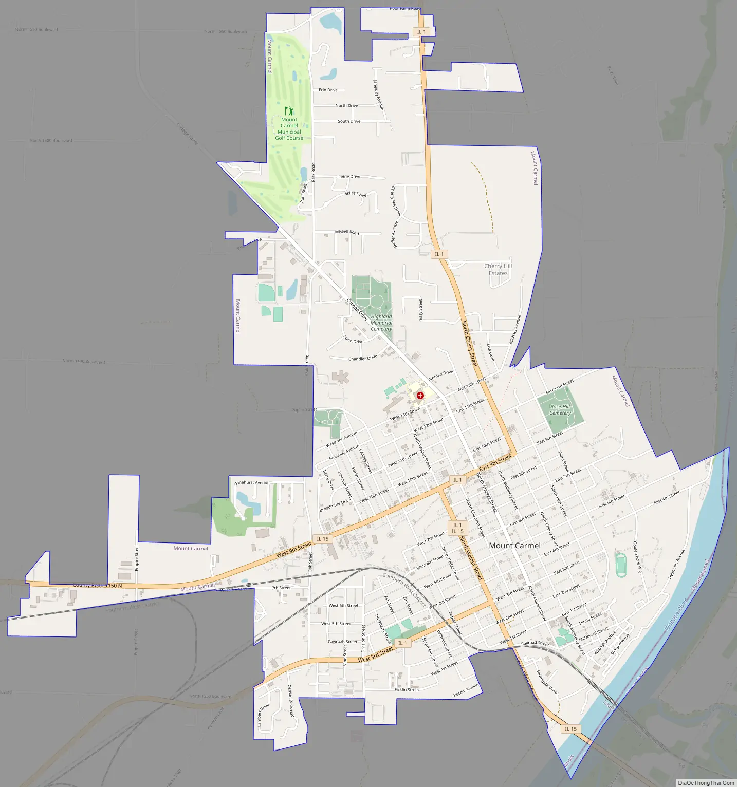
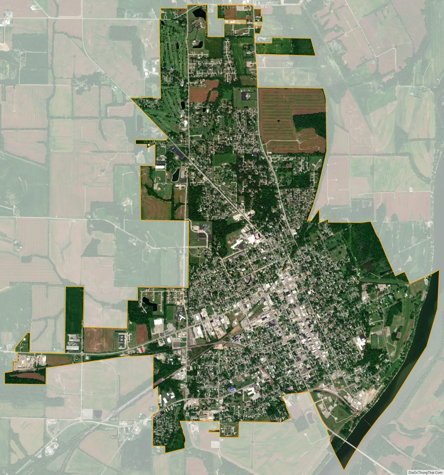
Mount Carmel city Satellite Map
Geography
Mount Carmel is located on the Wabash River, which demarcates the Indiana border. According to the 2010 census, the city has a total area of 5.00 square miles (12.9 km), of which 4.86 square miles (12.6 km) (or 97.20%) is land and 0.14 square miles (0.36 km) (or 2.80%) is water.
The city was featured in Ripley’s Believe It or Not! for its once multicolored bridge over the Wabash River, painted white and black on the Illinois and Indiana sides of the state line, respectively. The old twelve span Parker truss bridge, later repainted entirely green, formerly connected Princeton, Indiana to Mount Carmel via Indiana State Road 64 and Illinois Route 15. Illinois Route 1 and Illinois Route 15 meet just a few blocks from the bridge. One rail bridge runs parallel to the IN-64/IL-15 bridge, and another sits just a few miles south, near the southernmost edge of the city. The plans to build a new bridge become reality in 2008. After three years of construction the new much wider span opens in January 2011. The new bridge is a milestone as Indiana continues its quest to expand Indiana 64 to a four-lane highway as part of their Major Moves Project. As of February 20, 2011 the new concrete and steel beam bridge is fully carrying traffic. The old bridge has been removed, with the river spans being imploded.
Earthquake
Mount Carmel is within the Wabash Valley Seismic Zone. On April 18, 2008 at 09:36:56 UTC (04:36:56 Central) an earthquake of 5.2 magnitude was centered near the city, and just hours later an aftershock of 4.6 magnitude shook Mt. Carmel and its residences. It was felt widespread across southern Illinois and eastern portions of Missouri including St. Louis, 123 miles (198 km) away. Aftershocks continued into July.
See also
Map of Illinois State and its subdivision:- Adams
- Alexander
- Bond
- Boone
- Brown
- Bureau
- Calhoun
- Carroll
- Cass
- Champaign
- Christian
- Clark
- Clay
- Clinton
- Coles
- Cook
- Crawford
- Cumberland
- De Kalb
- De Witt
- Douglas
- Dupage
- Edgar
- Edwards
- Effingham
- Fayette
- Ford
- Franklin
- Fulton
- Gallatin
- Greene
- Grundy
- Hamilton
- Hancock
- Hardin
- Henderson
- Henry
- Iroquois
- Jackson
- Jasper
- Jefferson
- Jersey
- Jo Daviess
- Johnson
- Kane
- Kankakee
- Kendall
- Knox
- La Salle
- Lake
- Lake Michigan
- Lawrence
- Lee
- Livingston
- Logan
- Macon
- Macoupin
- Madison
- Marion
- Marshall
- Mason
- Massac
- McDonough
- McHenry
- McLean
- Menard
- Mercer
- Monroe
- Montgomery
- Morgan
- Moultrie
- Ogle
- Peoria
- Perry
- Piatt
- Pike
- Pope
- Pulaski
- Putnam
- Randolph
- Richland
- Rock Island
- Saint Clair
- Saline
- Sangamon
- Schuyler
- Scott
- Shelby
- Stark
- Stephenson
- Tazewell
- Union
- Vermilion
- Wabash
- Warren
- Washington
- Wayne
- White
- Whiteside
- Will
- Williamson
- Winnebago
- Woodford
- Alabama
- Alaska
- Arizona
- Arkansas
- California
- Colorado
- Connecticut
- Delaware
- District of Columbia
- Florida
- Georgia
- Hawaii
- Idaho
- Illinois
- Indiana
- Iowa
- Kansas
- Kentucky
- Louisiana
- Maine
- Maryland
- Massachusetts
- Michigan
- Minnesota
- Mississippi
- Missouri
- Montana
- Nebraska
- Nevada
- New Hampshire
- New Jersey
- New Mexico
- New York
- North Carolina
- North Dakota
- Ohio
- Oklahoma
- Oregon
- Pennsylvania
- Rhode Island
- South Carolina
- South Dakota
- Tennessee
- Texas
- Utah
- Vermont
- Virginia
- Washington
- West Virginia
- Wisconsin
- Wyoming