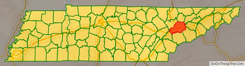
Knox County is located in the U.S. state of Tennessee. As of the 2020 census, the population was 478,971, making it the third-most populous county in Tennessee. Its county seat is Knoxville, which is the third-most populous city in Tennessee. Knox County is included in the Knoxville metropolitan area. The county is located at the geographical center of the Great Valley of East Tennessee. Near the heart of the county is the origin of the Tennessee River, at the confluence of the Holston and French Broad rivers.
| Name: | Knox County |
|---|---|
| FIPS code: | 47-093 |
| State: | Tennessee |
| Founded: | June 11, 1792 |
| Named for: | Henry Knox |
| Seat: | Knoxville |
| Largest city: | Knoxville |
| Total Area: | 526 sq mi (1,360 km²) |
| Land Area: | 508 sq mi (1,320 km²) |
| Total Population: | 478,971 |
| Population Density: | 910.6/sq mi (351.6/km²) |
| Website: | knoxcounty.org |
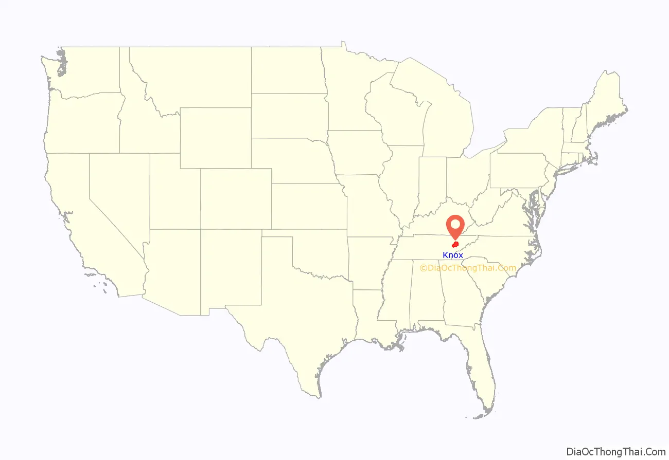
Knox County location map. Where is Knox County?
History
Knox County was created after the American Revolutionary War on June 11, 1792, by Governor William Blount from parts of Greene and Hawkins counties. It was one of the few counties created when this area was still known as the Southwest Territory. It is one of nine United States counties named for American Revolutionary War general Henry Knox, who was appointed as the first United States Secretary of War. As population increased, parts of Knox County were taken out to form Blount (1795), Anderson (1801), Roane (1801), and Union (1850) counties.
In 1783, James White and Francis Alexander Ramsey led an expedition to explore the Upper Tennessee Valley, now within the boundaries of Knox County. White moved to what is now the Riverdale community in the eastern part of the county in 1785, and the following year constructed a fort a few miles to the west. A community developed around the fortified trading post, ultimately becoming the city of Knoxville. Governor Blount designated the fort as the capital of the Southwest Territory in 1790, and gave the new town the name “Knoxville” after his superior, Henry Knox.
Blount began construction of his house, Blount Mansion, in the early 1790s. This is one of a number of late eighteenth-century structures that have been preserved in the county. The house still stands in downtown Knoxville. The Alexander McMillan House, built in the mid-1780s by Alexander McMillan (1749–1837), still stands in eastern Knox County. The Alexander Bishop House, built by Stockley Donelson in 1793, and a log house built in the same year by Nicholas Gibbs both still stand in the northern part of the county. Campbell’s Station, a fort and stagecoach stop located in what is now Farragut, was built by Captain David Campbell (1753–1832) in 1787. John Sevier established a plantation, known as Marble Springs, in the southern part of the county in the 1790s. He was active in leading raids against the Cherokee people, who for years resisted with force American settlement in their territory.
Civil War
Important railroad lines passed through Knox County, making it a strategic area both for Union and for Confederate forces throughout the Civil War. Since the mountainous terrain of East Tennessee was mostly unsuitable for plantation crops such as cotton, slavery was not as prevalent as it was in Middle and West Tennessee. The US 1860 census of Knox County showed a population of 20,020 white citizens and 2,370 enslaved African Americans. The lack of slavery combined with the vestiges of a once-strong abolitionist movement were two reasons most residents of Knox County, along with much of East Tennessee, were pro-Union. In February 1861, 89% of Knox Countians voted for the pro-Union ballot in a statewide referendum on secession. On June 8, 1861, the county voted against Tennessee’s Ordinance of Secession by a margin of 3,108 to 1,226.
Prior to secession, Unionists from Knox County collaborated with other East Tennessee Unionists in an attempt to secede from Tennessee itself and remain part of the Union. Oliver Perry Temple, a Knoxville lawyer, was named to a three-man commission to appear before the General Assembly in Nashville and request East Tennessee and pro-Union Middle Tennessee counties be allowed to secede from the state. The attempt failed. After the second state referendum for secession passed in 1861, Knox County and the rest of Tennessee joined the Confederacy.
Knox County remained under Confederate control until September 3, 1863, when General Ambrose Burnside and the Union army marched into Knoxville unopposed. Parts of Middle Tennessee had been occupied by Union troops since 1862.
Union Colonel William Harris, son of New York Senator Ira Harris, wrote his father:
With the success of Burnside’s troops in the Knoxville Campaign, and especially during the decisive Battle of Fort Sanders, Knox County remained under Union control for the duration of the Civil War.
Tennessee marble
In the late 19th and early 20th centuries, Knox County was an important venue for the quarrying and finishing of Tennessee marble, a type of limestone used in monument construction across the United States and Canada. Eleven quarries were operating in Knox County in 1882, and within ten years that number had doubled. Notable quarries in Knox included the Bond Quarry in Concord, an Evans Company quarry near Forks-of-the-River, and the Ross-Republic quarries near Island Home Park in South Knoxville. Finishing centers were located in Lonsdale and at the Candoro Marble Works in South Knoxville.
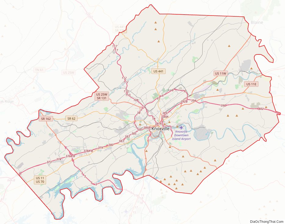
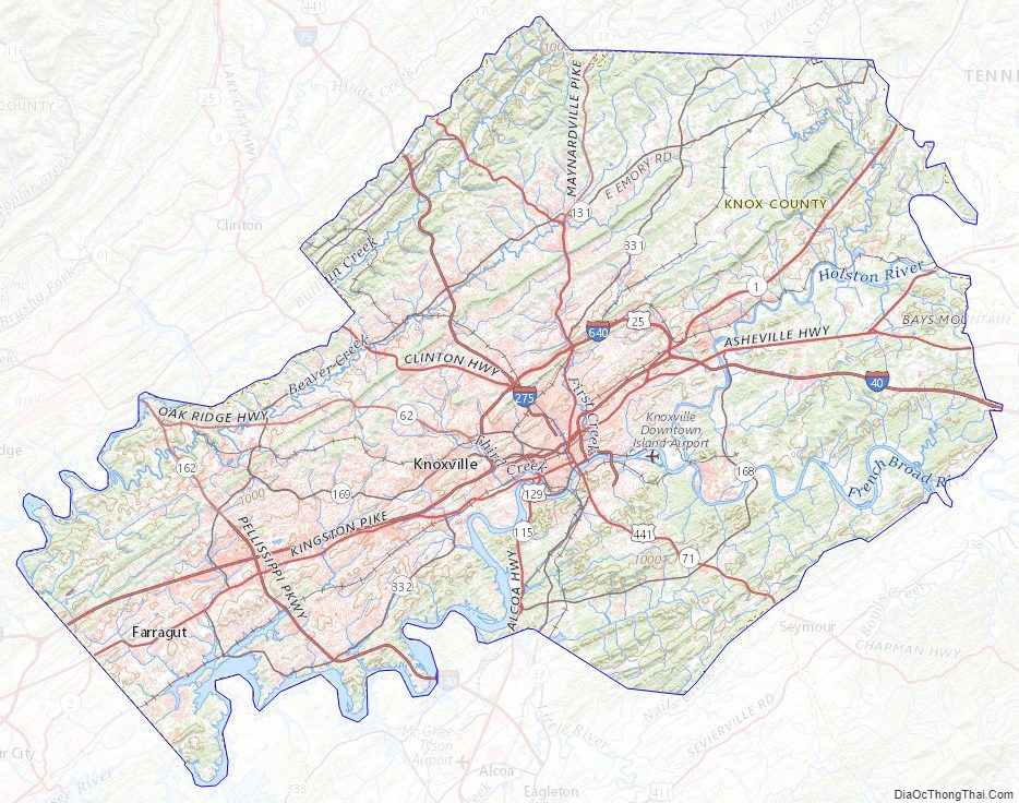
Knox County Road Map
Geography
According to the U.S. Census Bureau, the county has a total area of 526 square miles (1,360 km), of which 508 square miles (1,320 km) is land and 18 square miles (47 km) (3.4%) is water. The county lies amidst the Ridge-and-Valley Appalachians, which are characterized by long, narrow ridges, oriented northeast-to-southwest, alternating with similarly shaped valleys. Notable ridges in the county include Bays Mountain, McAnnally Ridge, Beaver Ridge, Sharp’s Ridge and Copper Ridge. House Mountain, at 2,064 feet (629 m), is the county’s highest point, and is the focus of a state natural area.
The Holston and French Broad rivers join to form the Tennessee River in the eastern part of the county, an area known as “Forks-of-the-River.” This section of the river is part of Fort Loudoun Lake, which is created by Fort Loudoun Dam on the river several miles downstream in Lenoir City.
Cherokee Caverns
Cherokee Caverns is 14 miles west of Knoxville and can be accessed by Highway 62. It was discovered in 1854 by Robert Crudgington, who noticed fog emerging between rocks on his farm. He dug the entrance open and explored the cave. His daughter Margaret Crudgington opened the cave to the public in 1929 under the name Gentrys Cave; the next year she changed the name to Grand Caverns.
The cave has been open to the public, sporadically, ever since, under a variety of names. It is currently called Cherokee Caverns, referring to the historic tribe who occupied this area at the time of European encounter.
Indian artifacts located in the cave indicate that another entrance to the cave existed at some time in the past.
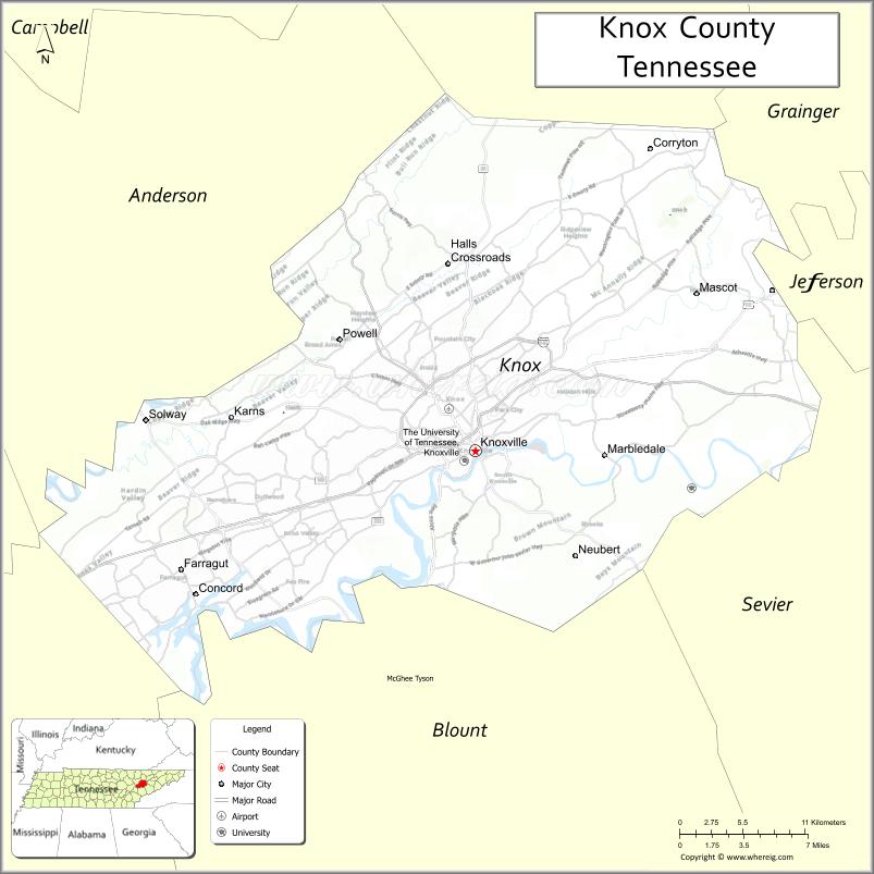
Adjacent counties
- Union County (north)
- Grainger County (northeast)
- Jefferson County (east)
- Sevier County (southeast)
- Blount County (south)
- Loudon County (southwest)
- Roane County (west)
- Anderson County (northwest)
State protected areas
- Forks of the River Wildlife Management Area
- Fort Loudoun Wildlife Management Area
- House Mountain State Natural Area
- Marble Springs (state historic site)
- Seven Islands State Birding Park
Knox County Topographic Map
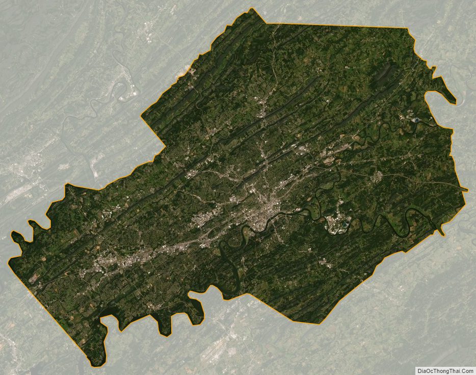
Knox County Satellite Map
Knox County Outline Map