Farragut is a suburban town located in Knox and Loudon counties in the State of Tennessee, United States. The town’s population was 23,506 at the 2020 census. It is included in the Knoxville Metropolitan Area. The town is named in honor of Hispanic American and Union Admiral David Farragut, who was born just east of Farragut at Campbell’s Station in 1801, and fought in the American Civil War.
| Name: | Farragut town |
|---|---|
| LSAD Code: | 43 |
| LSAD Description: | town (suffix) |
| State: | Tennessee |
| County: | Knox County, Loudon County |
| Incorporated: | 1980 |
| Elevation: | 873 ft (266 m) |
| Total Area: | 16.14 sq mi (41.80 km²) |
| Land Area: | 15.98 sq mi (41.38 km²) |
| Water Area: | 0.16 sq mi (0.42 km²) |
| Total Population: | 23,506 |
| Population Density: | 1,471.15/sq mi (568.01/km²) |
| ZIP code: | 37922 and 37934 |
| Area code: | 865 |
| FIPS code: | 4725760 |
| GNISfeature ID: | 1284150 |
| Website: | www.townoffarragut.org |
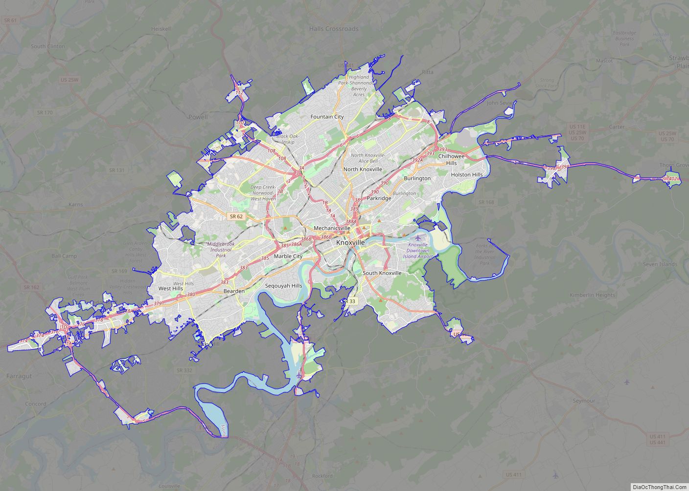
Online Interactive Map
Click on ![]() to view map in "full screen" mode.
to view map in "full screen" mode.
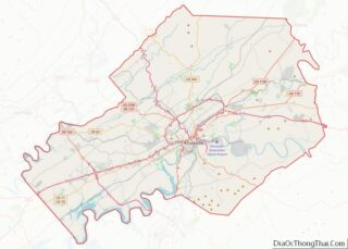
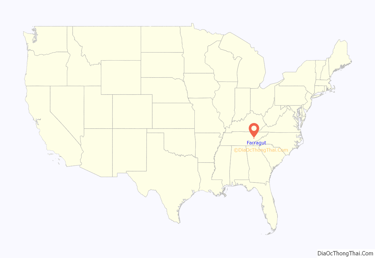
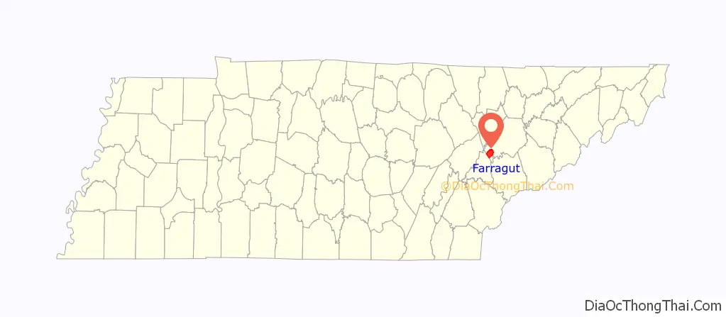
Farragut location map. Where is Farragut town?
History
The area was originally known as Campbell’s Station after a fort and stage coach station erected by Captain David Campbell (1753–1832) in 1787. The brick Campbell’s Station Inn was built in 1810 and still stands on Kingston Pike within sight of the Farragut Town Hall. The Civil War Battle of Campbell’s Station was fought there on November 16, 1863.
The historic unincorporated village of Concord (listed on the National Register of Historic Places) was founded in 1854 just east of what would become the eastern boundary of Farragut. Concord is located on the main rail line to Atlanta and main channel of the Tennessee River, and was an important transloading center for the Tennessee marble industry in the late 19th century. Picturesque buildings and antebellum homes sit along the river, as well as several very old churches.
The original Farragut High School was built by the community in 1904, and moved to its current location in 1976. Some parts of Farragut are zoned for Hardin Valley Academy in the neighboring suburb of Hardin Valley, built in 2008.
In early December 1979, the Knoxville City Council would vote to annex right-of-way acreage of I-40 in the Farragut area, prompting community residents to petition an incorporation election. On January 16, 1980, Farragut would vote to incorporate as a town preventing further annexation by Knoxville, which was trying to shore up its tax base by annexing affluent communities along Kingston Pike. The effort was led by a group of citizens who called themselves the Farragut Community Group. The first mayor, Bob Leonard, was elected April 1, 1980, along with four aldermen. Alderman Eddy Ford became mayor in 1993 and served in that position until April 2009, when he failed to win re-election, losing to Dr. Ralph McGill, another of the original founders of the town government.
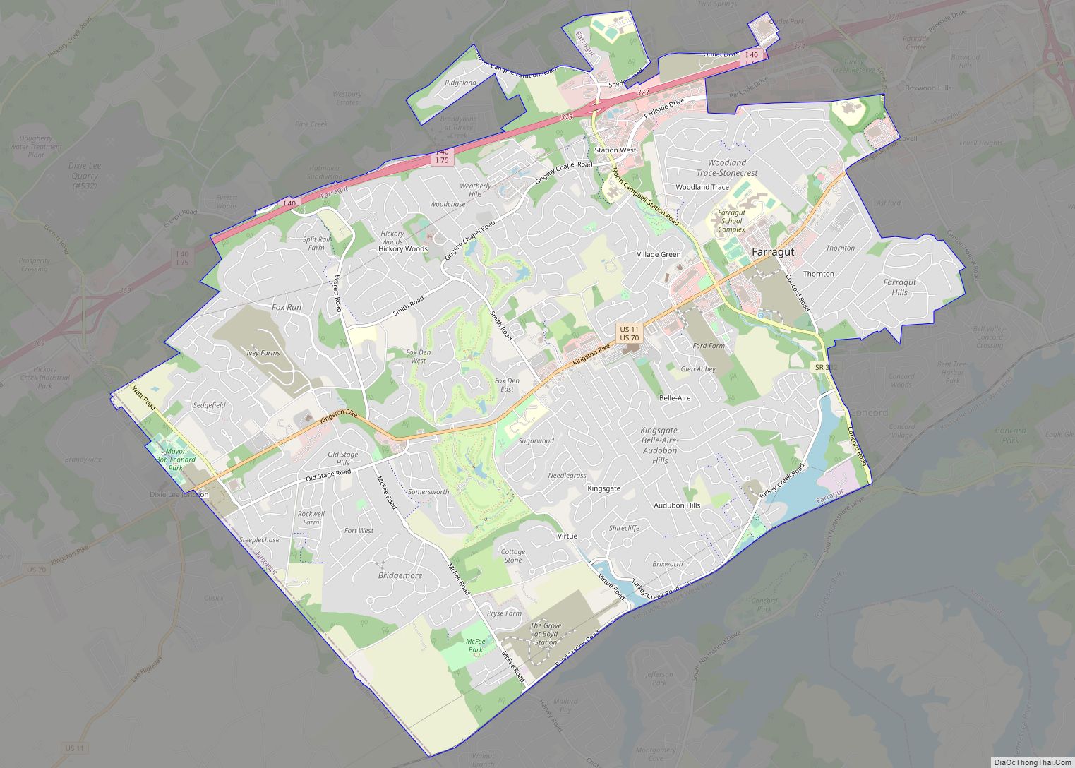
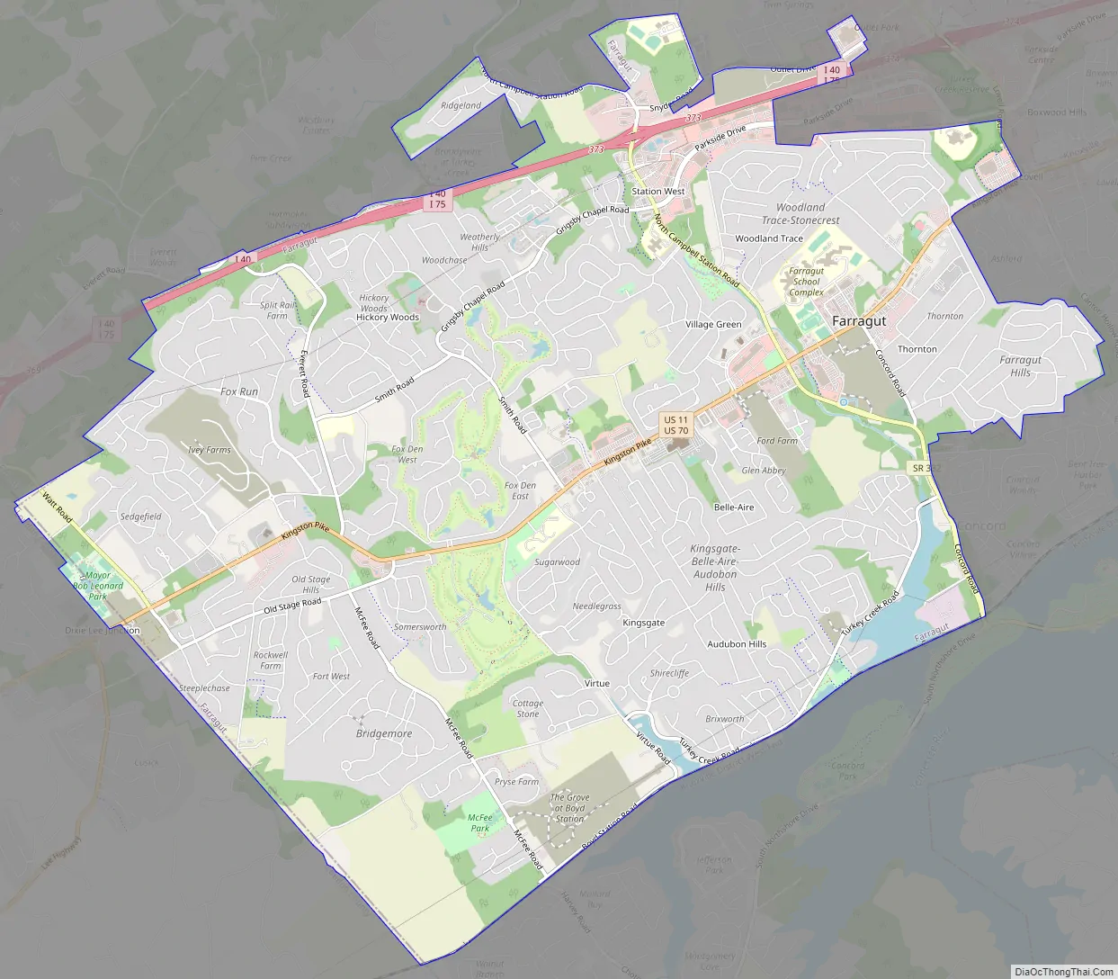
Farragut Road Map
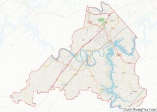
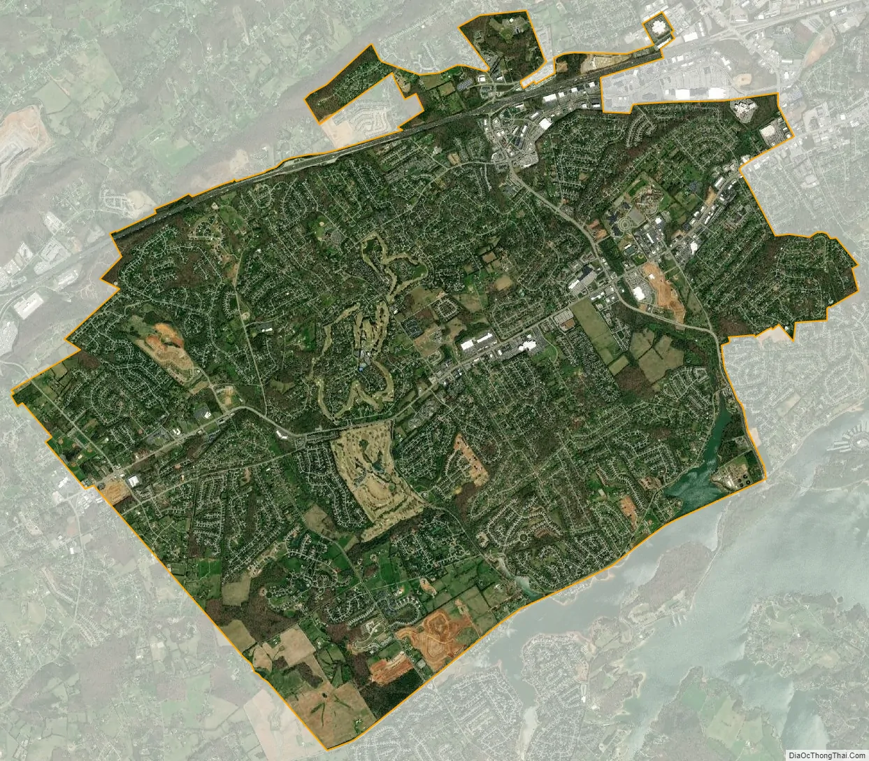
Farragut city Satellite Map
Geography
Farragut is located at 35°52′39″N 84°10′25″W / 35.87750°N 84.17361°W / 35.87750; -84.17361 (35.877511, -84.173548). According to the United States Census Bureau, the town has a total area of 16.2 square miles (42.1 km), of which 16.1 square miles (41.7 km) is land and 0.2 square mile (0.4 km) (1.05%) is water.
The town of Farragut is bound to the north by I-40/75, except at Campbell Station Road, Snyder Road, and the Outlets Drive area; to the south by Turkey Creek Road and the Norfolk Southern Railroad line; to the west at the Loudon County line; and to the east by Lovell Road (on the north side of Kingston Pike and Thornton Heights) and Concord Hills subdivisions (on the south side of Kingston Pike).
Farragut is situated in a hilly area between Blackoak Ridge to the north and the Tennessee River (Fort Loudoun Lake) to the south. Its municipal area is mostly located south of the merged Interstate 40 (I-40)/I-75, with the exception of a few neighborhoods. Kingston Pike, a merged stretch of U.S. Route 70 (US 70) and US 11, traverses the town. Concord lies immediately southeast of Farragut, and Hardin Valley lies opposite Blackoak Ridge to the north. The unincorporated community of Dixie Lee Junction lies along Kingston Pike, just across the Loudon County line.
See also
Map of Tennessee State and its subdivision:- Anderson
- Bedford
- Benton
- Bledsoe
- Blount
- Bradley
- Campbell
- Cannon
- Carroll
- Carter
- Cheatham
- Chester
- Claiborne
- Clay
- Cocke
- Coffee
- Crockett
- Cumberland
- Davidson
- Decatur
- DeKalb
- Dickson
- Dyer
- Fayette
- Fentress
- Franklin
- Gibson
- Giles
- Grainger
- Greene
- Grundy
- Hamblen
- Hamilton
- Hancock
- Hardeman
- Hardin
- Hawkins
- Haywood
- Henderson
- Henry
- Hickman
- Houston
- Humphreys
- Jackson
- Jefferson
- Johnson
- Knox
- Lake
- Lauderdale
- Lawrence
- Lewis
- Lincoln
- Loudon
- Macon
- Madison
- Marion
- Marshall
- Maury
- McMinn
- McNairy
- Meigs
- Monroe
- Montgomery
- Moore
- Morgan
- Obion
- Overton
- Perry
- Pickett
- Polk
- Putnam
- Rhea
- Roane
- Robertson
- Rutherford
- Scott
- Sequatchie
- Sevier
- Shelby
- Smith
- Stewart
- Sullivan
- Sumner
- Tipton
- Trousdale
- Unicoi
- Union
- Van Buren
- Warren
- Washington
- Wayne
- Weakley
- White
- Williamson
- Wilson
- Alabama
- Alaska
- Arizona
- Arkansas
- California
- Colorado
- Connecticut
- Delaware
- District of Columbia
- Florida
- Georgia
- Hawaii
- Idaho
- Illinois
- Indiana
- Iowa
- Kansas
- Kentucky
- Louisiana
- Maine
- Maryland
- Massachusetts
- Michigan
- Minnesota
- Mississippi
- Missouri
- Montana
- Nebraska
- Nevada
- New Hampshire
- New Jersey
- New Mexico
- New York
- North Carolina
- North Dakota
- Ohio
- Oklahoma
- Oregon
- Pennsylvania
- Rhode Island
- South Carolina
- South Dakota
- Tennessee
- Texas
- Utah
- Vermont
- Virginia
- Washington
- West Virginia
- Wisconsin
- Wyoming