Logan County is a county in the U.S. state of West Virginia. As of the 2020 census, the population was 32,567. Its county seat is Logan. Logan County comprises the Logan, WV Micropolitan Statistical Area, which is also included in the Charleston–Huntington–Ashland, WV–OH–KY Combined Statistical Area.
| Name: | Logan County |
|---|---|
| FIPS code: | 54-045 |
| State: | West Virginia |
| Founded: | January 12, 1824 |
| Named for: | Chief Logan |
| Seat: | Logan |
| Largest city: | Logan |
| Total Area: | 456 sq mi (1,180 km²) |
| Land Area: | 454 sq mi (1,180 km²) |
| Total Population: | 32,567 |
| Population Density: | 71/sq mi (28/km²) |
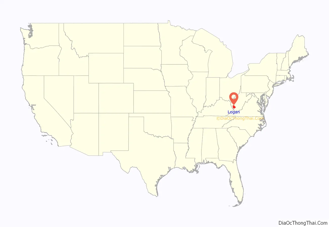
Logan County location map. Where is Logan County?
History
Logan County was formed in 1824 from parts of Giles, Tazewell, Cabell, and Kanawha counties, then part of the state of Virginia. It is named for Chief Logan, famous Native American chief of the Mingo tribe. Logan was one of fifty Virginia counties that became part of the new state of West Virginia in 1863, by an executive order of Abraham Lincoln during the Civil War, even though Logan Country had voted for secession in the April 4, 1861 convention.
Within months of its admission to the Union, West Virginia’s counties were divided into civil townships, with the intention of encouraging local government. This proved impractical in the heavily rural state, and in 1872 the townships were converted into magisterial districts. Logan County was divided into five districts: Chapmanville, Hardee, Logan, Magnolia, and Triadelphia. A sixth district, Lee, was formed in 1878 from portions of Hardy and Magnolia Districts. In 1895, Mingo County was formed from Hardee, Lee, and Magnolia Districts, along with portions of Chapmanville and Triadelphia Districts.
In the 1960s, Chapmanville District was discontinued, and two new districts, Guyan and Island Creek, formed from its territory, along with portions of Logan and Triadelphia Districts. The county was redistricted again in the 1980s, resulting in nine magisterial districts: Buffalo, Chapmanville, East, Guyan, Island Creek, Logan, Northwest, Triadelphia, and West. However, in the following decade these were consolidated into three districts: Central, Eastern, and Western.
In 1921 it was the location of the Battle of Blair Mountain, one of the largest armed uprisings in U.S. history. More recently, the Buffalo Creek Flood of February 26, 1972, killed 125 people when a coal slurry dam burst under the pressure of heavy rains, releasing over 100,000,000 US gallons (380,000,000 L) of waste and water in a 30-foot (9.1 m) wave onto the valley below. The communities of Lorado and Lundale were destroyed and 14 other communities heavily damaged, including Saunders, Amherstdale, Crites, and Latrobe.
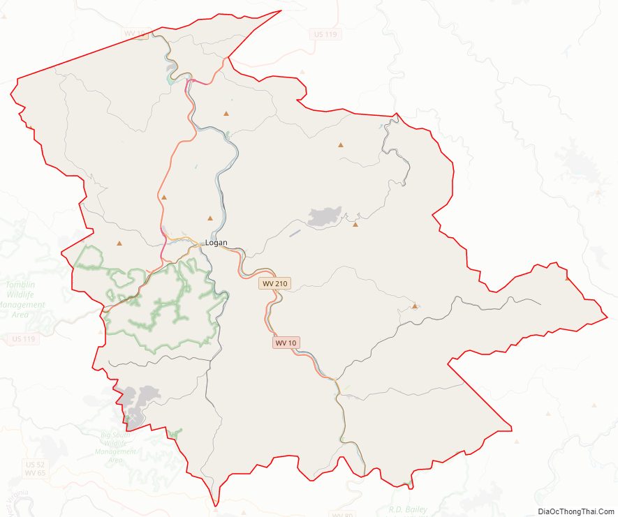
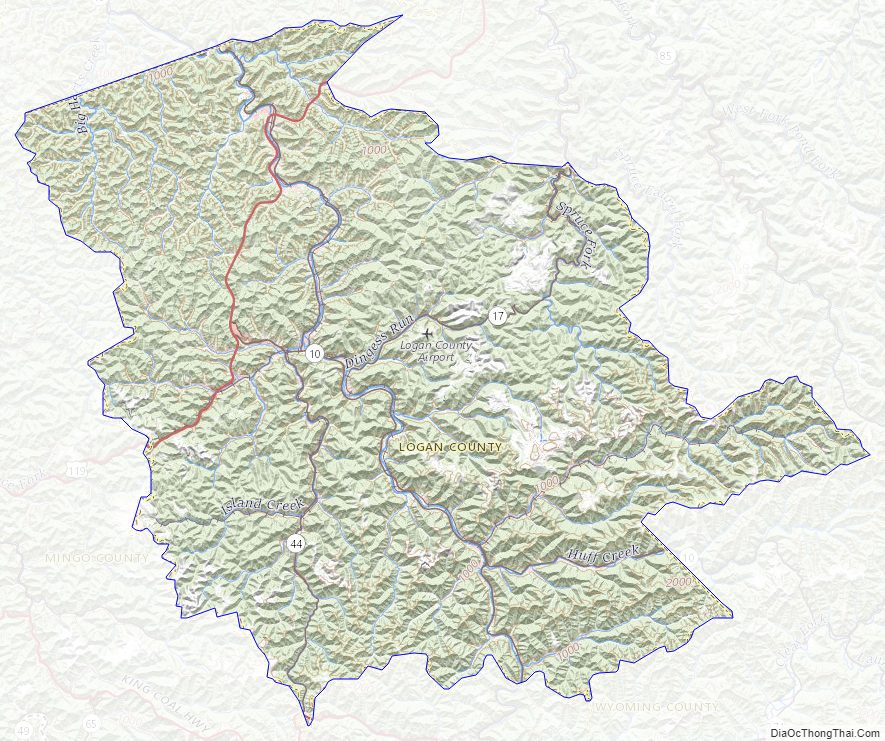
Logan County Road Map
Geography
According to the United States Census Bureau, the county has a total area of 456 square miles (1,180 km), of which 454 square miles (1,180 km) is land and 1.9 square miles (4.9 km) (0.4%) is water.
Major highways
- I-73 (future)
- I-74 (future)
- U.S. Highway 52
- U.S. Highway 119
- West Virginia Route 10
- West Virginia Route 17
- West Virginia Route 44
- West Virginia Route 73
- West Virginia Route 80
Adjacent counties
- Lincoln County (north)
- Boone County (northeast)
- Wyoming County (southeast)
- Mingo County (southwest)
Logan County Topographic Map
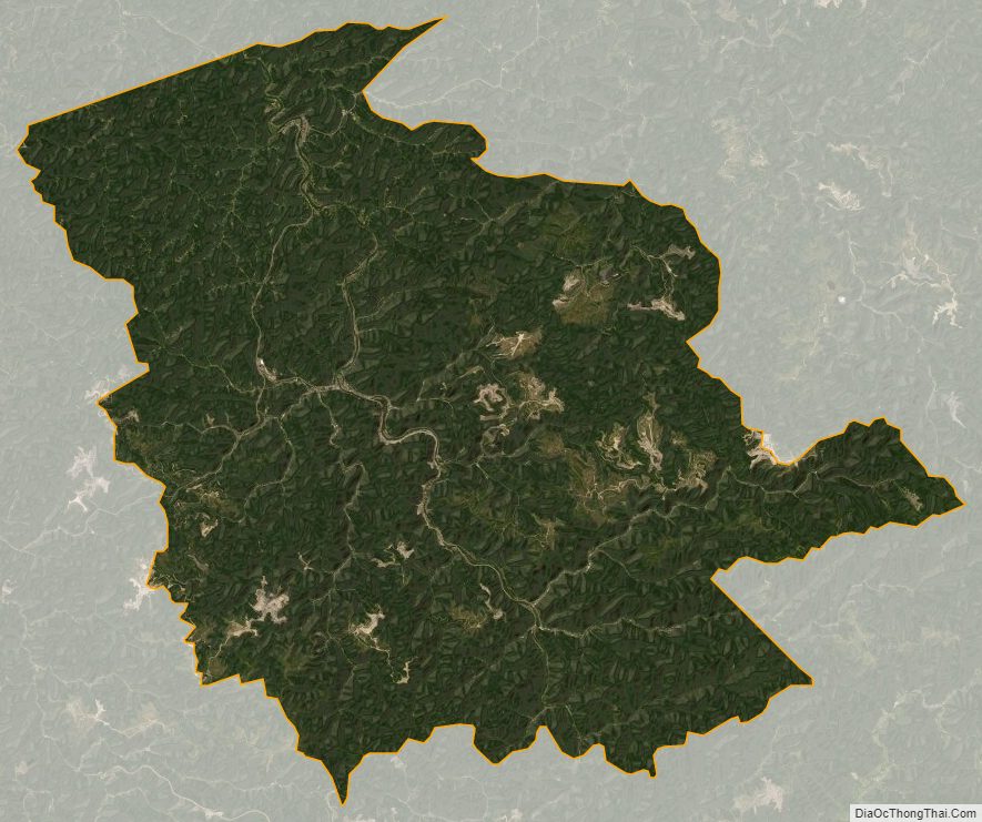
Logan County Satellite Map
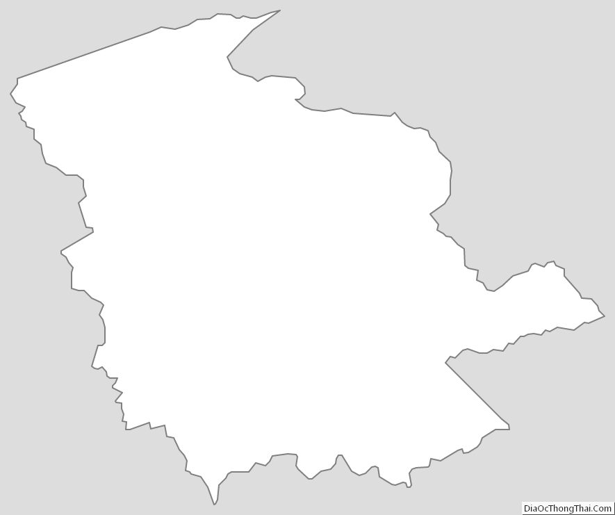
Logan County Outline Map