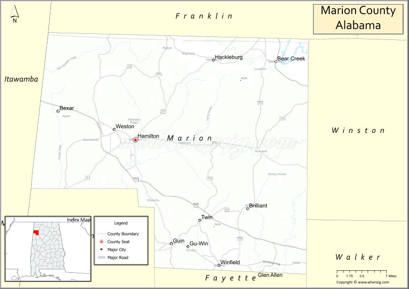
Marion County is a county of the U.S. state of Alabama. As of the 2020 census the population was 29,341. The county seat is Hamilton. The county was created by an act of the Alabama Territorial General Assembly on February 13, 1818. The county seat was originally established in Pikeville in 1820, and moved to Hamilton in 1881. The county was named by planter and US Indian agent John Dabney Terrell, Sr., in recognition of General Francis Marion of South Carolina.
Marion County is located in the northwestern part of the state, bounded on the west by the state of Mississippi. It encompasses 743 square miles (1,920 km). The county is a prohibition or dry county, however, the sale of alcohol is permitted within the cities of Guin, Hamilton, and Winfield.
| Name: | Marion County |
|---|---|
| FIPS code: | 01-093 |
| State: | Alabama |
| Founded: | February 13, 1818 |
| Named for: | Francis Marion |
| Seat: | Hamilton |
| Largest city: | Hamilton |
| Total Area: | 744 sq mi (1,930 km²) |
| Land Area: | 742 sq mi (1,920 km²) |
| Total Population: | 29,341 |
| Population Density: | 39/sq mi (15/km²) |
| Time zone: | UTC−6 (Central) |
| Summer Time Zone (DST): | UTC−5 (CDT) |
| Website: | marioncountyalabama.org |
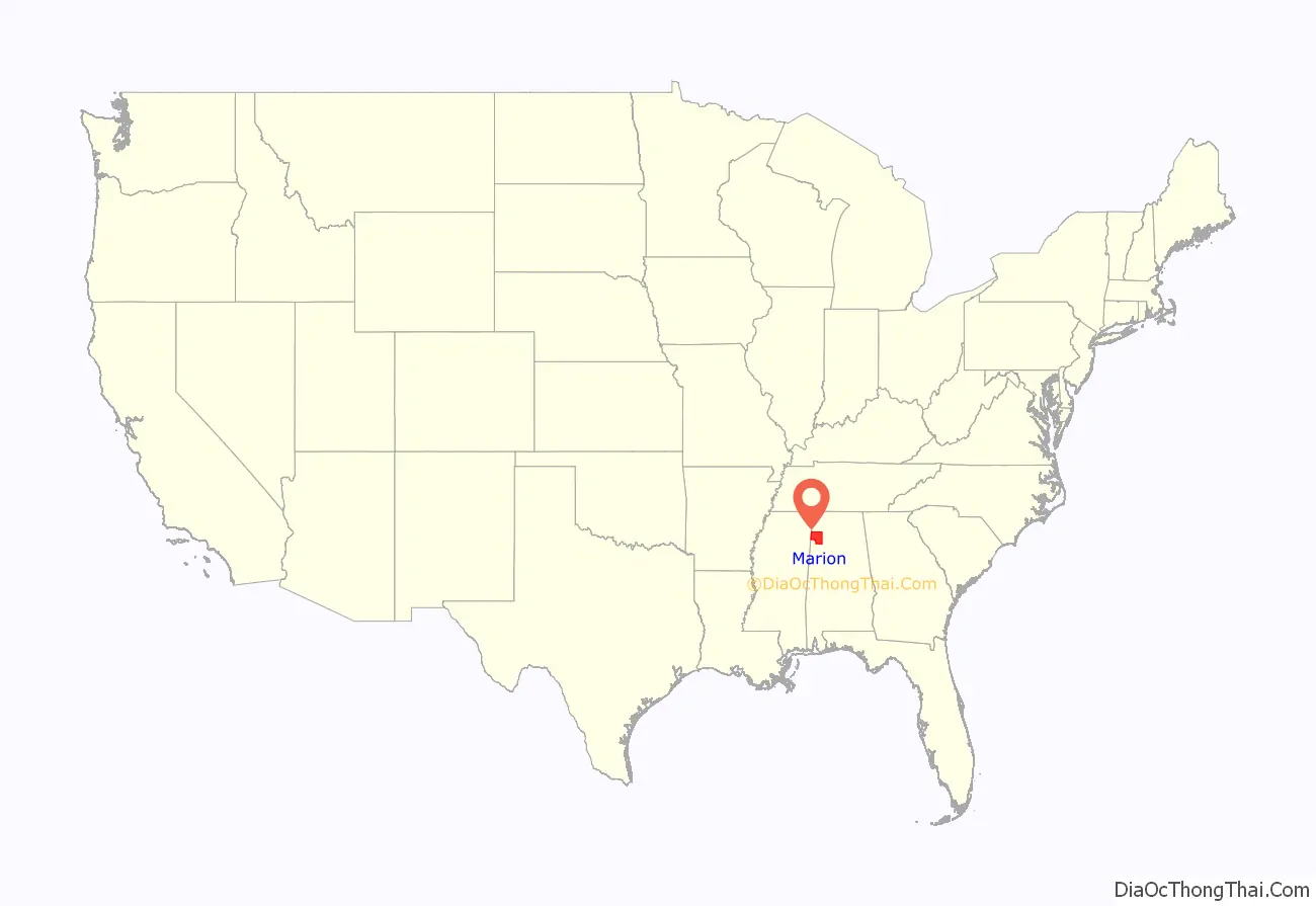
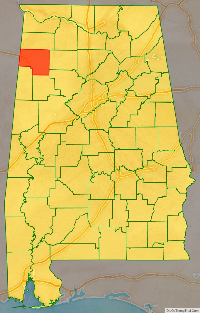
Marion County location map. Where is Marion County?
History
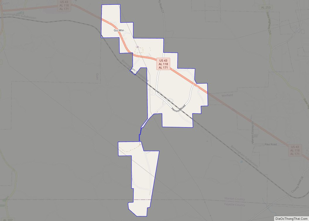
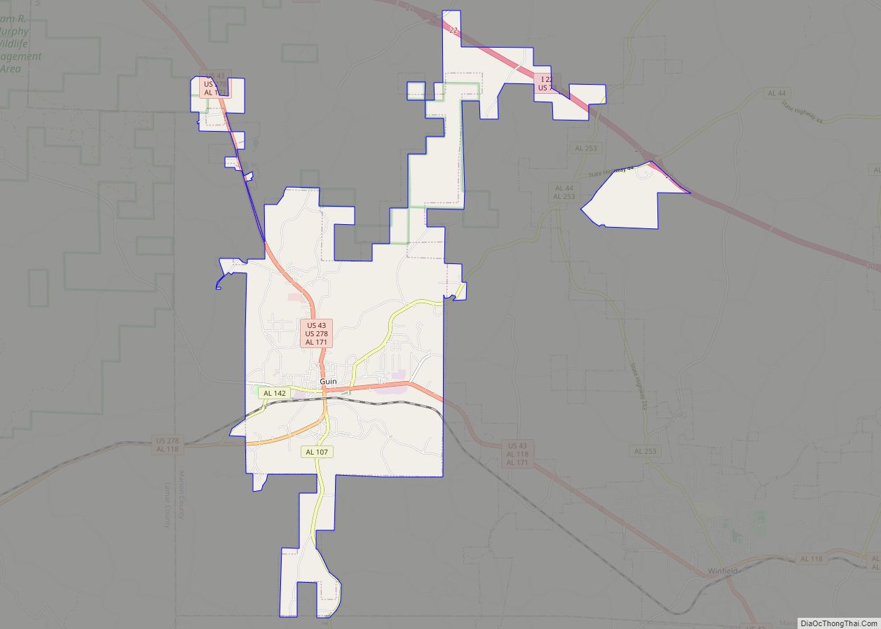
The county was created by the Alabama Territorial General Assembly on February 13, 1818, preceding Alabama’s statehood by almost two years. It was created from land acquired from the Chickasaw Indians by the Treaty of 1816. Marion County included all of its current territory and parts of what are now Winston, Walker, Fayette, and Lamar counties in Alabama as well as portions of present-day Lowndes, Monroe, and Itawamba counties in Mississippi. The county was named in honor of General Francis Marion (1732–1795), an American Revolutionary War hero from South Carolina who was known as “The Swamp Fox.” Many early settlers of Marion County came from Kentucky and Tennessee after General Andrew Jackson established the Military Road. The first towns in the area were Pikeville, Hamilton (formerly named Toll Gate), Winfield, and Guin.
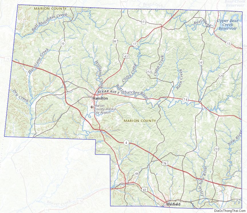
The county’s first seat was settled in 1818 at Cotton Gin Port, near present-day Amory, Mississippi. It was moved in 1819 to the home of Henry Greer along the Buttahatchee River, in 1820, the first permanent county seat was established at Pikeville, now a ghost town, located between present day Hamilton and Guin, along U.S. Highway 43. Pikeville served as the county seat of Marion County until 1882. Although the town is now abandoned, the home of Judge John Dabney Terrell Sr., which served as the third county courthouse, still stands. In 1882, Hamilton became the county seat. The first courthouse in Hamilton was destroyed by fire on March 30, 1887, and the second courthouse, constructed in the same place, also burned. A new courthouse, constructed of local sandstone opened in 1901. In 1959, the building was significantly remodeled to give the structure its current 1950’s “international style” design theme.
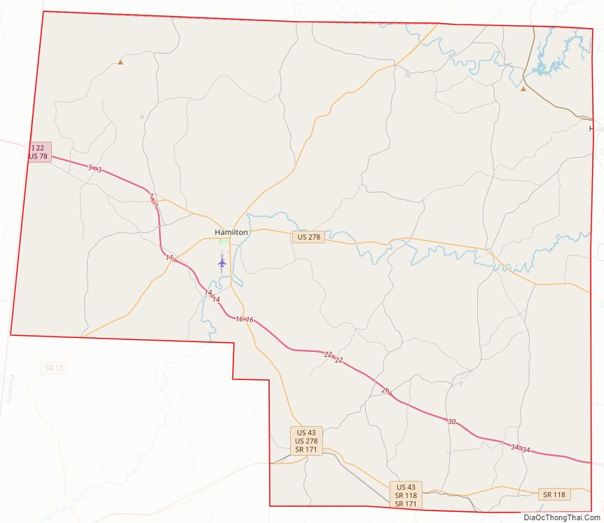
Marion County Road Map
Geography
According to the United States Census Bureau, the county has a total area of 744 square miles (1,930 km), of which 742 square miles (1,920 km) is land and 1.3 square miles (3.4 km) (0.2%) is water.
Adjacent counties
- Franklin County (north)
- Winston County (east)
- Walker County (southeast)
- Fayette County (south)
- Lamar County (southwest)
- Monroe County, Mississippi (southwest)
- Itawamba County, Mississippi (west)
Marion County Topographic Map
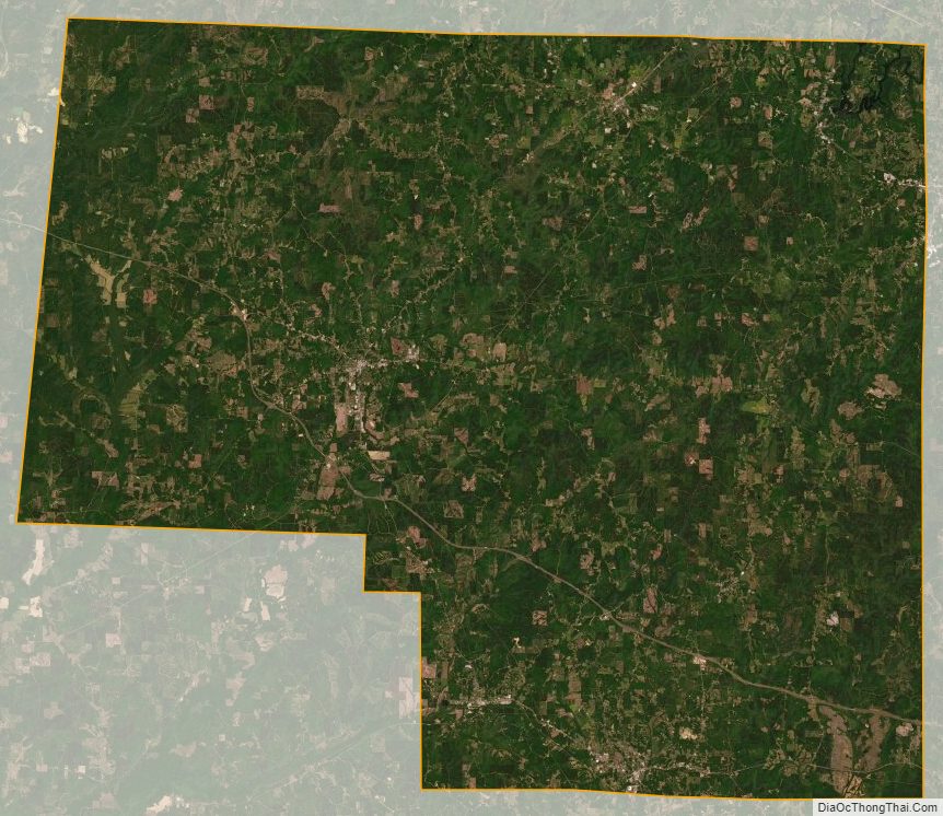
Marion County Satellite Map
Marion County Outline Map