Glen Allen is a town located in Fayette and Marion counties in the U.S. state of Alabama. The town incorporated in May 1959. At the 2020 census, the population was 433, down from 510 at the 2010 census. Glen Allen is positioned along the BNSF railway and is near Interstate 22, providing access to multiple expanding industries.
| Name: | Glen Allen town |
|---|---|
| LSAD Code: | 43 |
| LSAD Description: | town (suffix) |
| State: | Alabama |
| County: | Fayette County, Marion County |
| Elevation: | 600 ft (200 m) |
| Total Area: | 6.54 sq mi (16.9 km²) |
| Land Area: | 6.53 sq mi (16.9 km²) |
| Water Area: | 0.01 sq mi (0.03 km²) |
| Total Population: | 433 |
| Population Density: | 66.34/sq mi (25.61/km²) |
| ZIP code: | 35559 |
| Area code: | 205, 659 |
| FIPS code: | 0129944 |
| GNISfeature ID: | 0155077 |
| Website: | townofglenallen.org |
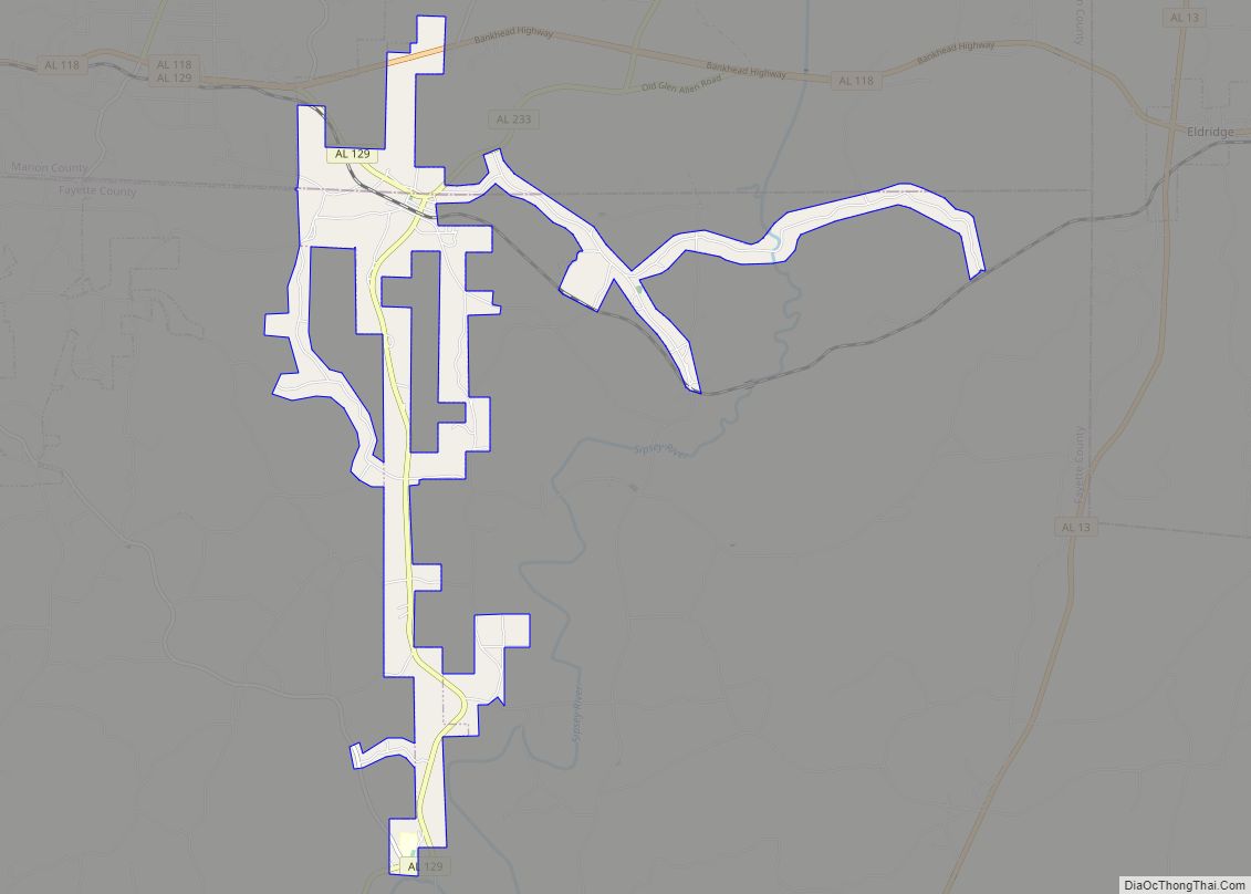
Online Interactive Map
Click on ![]() to view map in "full screen" mode.
to view map in "full screen" mode.
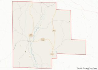
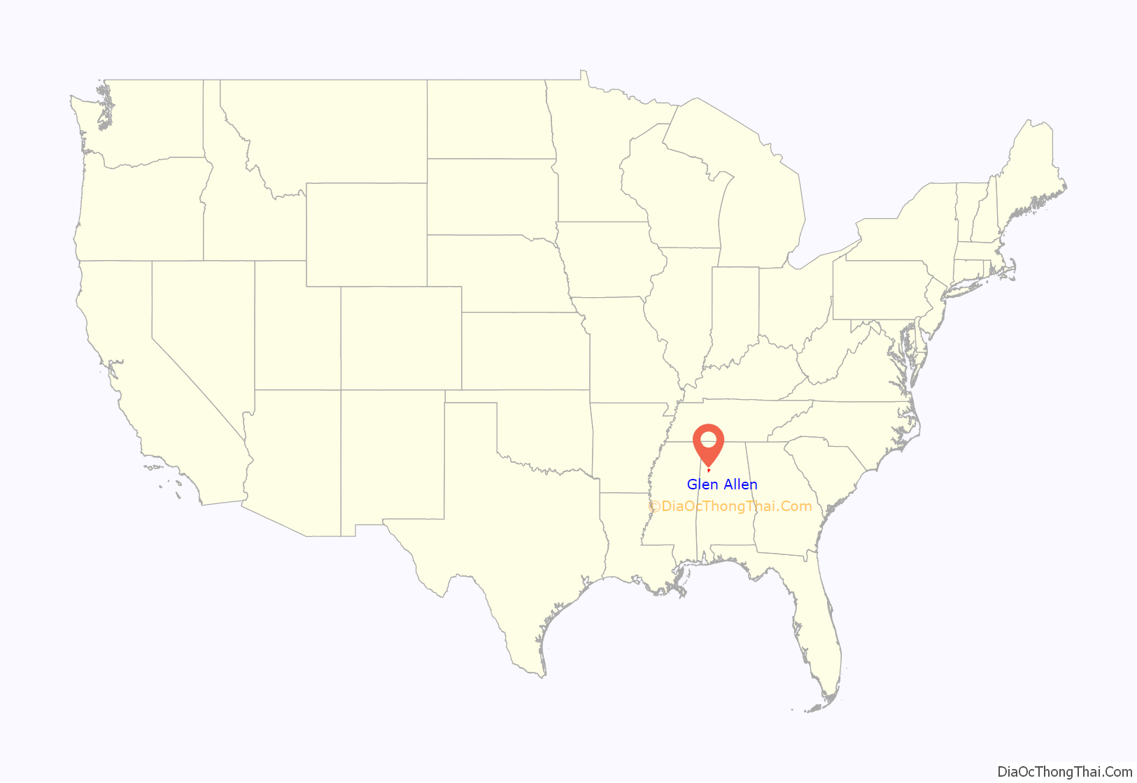
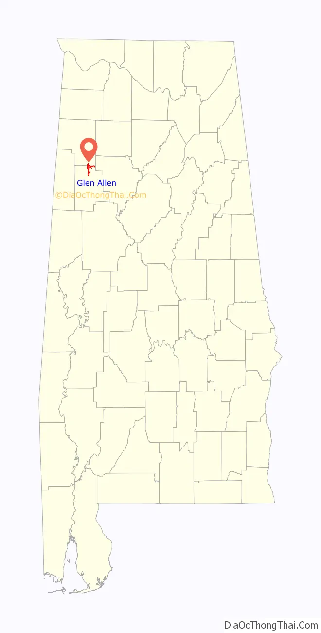
Glen Allen location map. Where is Glen Allen town?
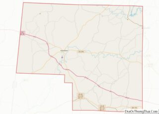
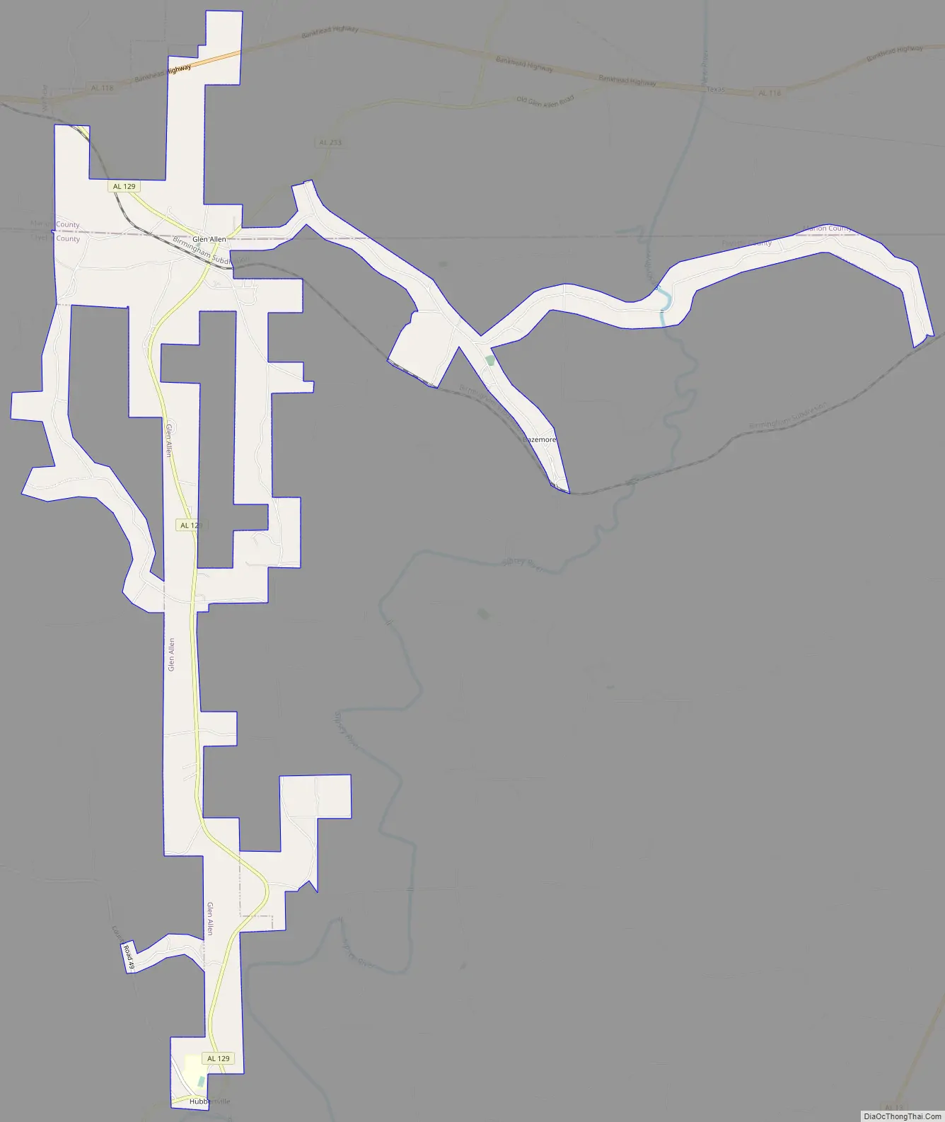
Glen Allen Road Map
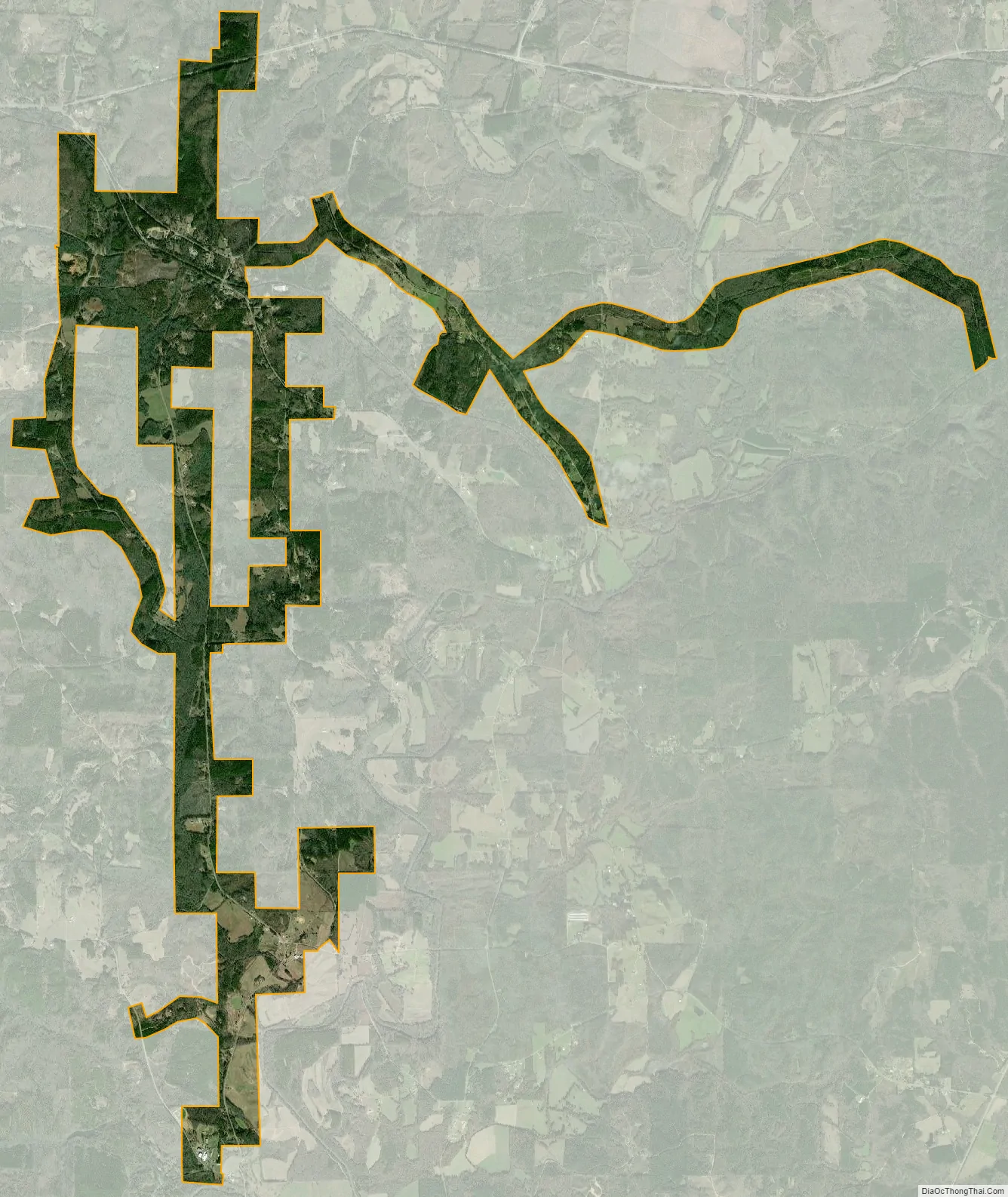
Glen Allen city Satellite Map
Geography
Glen Allen is located on the border of Fayette and Marion counties at 33°53′58″N 87°43′49″W / 33.89944°N 87.73028°W / 33.89944; -87.73028 (33.899470, -87.730388). It is bordered to the west by the city of Winfield. Interstate 22 passes 5 miles (8 km) north of the town, with access from Exit 34.
According to the U.S. Census Bureau, the town has a total area of 6.5 square kilometres (2.5 sq mi), of which 0.01 square miles (0.03 km), or 0.21%, are water.
See also
Map of Alabama State and its subdivision:- Autauga
- Baldwin
- Barbour
- Bibb
- Blount
- Bullock
- Butler
- Calhoun
- Chambers
- Cherokee
- Chilton
- Choctaw
- Clarke
- Clay
- Cleburne
- Coffee
- Colbert
- Conecuh
- Coosa
- Covington
- Crenshaw
- Cullman
- Dale
- Dallas
- De Kalb
- Elmore
- Escambia
- Etowah
- Fayette
- Franklin
- Geneva
- Greene
- Hale
- Henry
- Houston
- Jackson
- Jefferson
- Lamar
- Lauderdale
- Lawrence
- Lee
- Limestone
- Lowndes
- Macon
- Madison
- Marengo
- Marion
- Marshall
- Mobile
- Monroe
- Montgomery
- Morgan
- Perry
- Pickens
- Pike
- Randolph
- Russell
- Saint Clair
- Shelby
- Sumter
- Talladega
- Tallapoosa
- Tuscaloosa
- Walker
- Washington
- Wilcox
- Winston
- Alabama
- Alaska
- Arizona
- Arkansas
- California
- Colorado
- Connecticut
- Delaware
- District of Columbia
- Florida
- Georgia
- Hawaii
- Idaho
- Illinois
- Indiana
- Iowa
- Kansas
- Kentucky
- Louisiana
- Maine
- Maryland
- Massachusetts
- Michigan
- Minnesota
- Mississippi
- Missouri
- Montana
- Nebraska
- Nevada
- New Hampshire
- New Jersey
- New Mexico
- New York
- North Carolina
- North Dakota
- Ohio
- Oklahoma
- Oregon
- Pennsylvania
- Rhode Island
- South Carolina
- South Dakota
- Tennessee
- Texas
- Utah
- Vermont
- Virginia
- Washington
- West Virginia
- Wisconsin
- Wyoming