Montcalm County (/ˌmɒntkɔːlm/ MAHNT-calm) is a county in the U.S. state of Michigan. As of the 2020 Census, the population was 66,614. The county is geographically located in the West Michigan region of the Lower Peninsula. The county seat is Stanton, and the largest city is Greenville. The county is named for General Marquis Louis-Joseph de Montcalm, military commander of French troops during the French and Indian War. The county was set off in 1831 and organized in 1850.
Montcalm County is part of the Grand Rapids–Kentwood, MI Metropolitan Statistical Area.
| Name: | Montcalm County |
|---|---|
| FIPS code: | 26-117 |
| State: | Michigan |
| Founded: | 1831 |
| Named for: | Louis-Joseph de Montcalm |
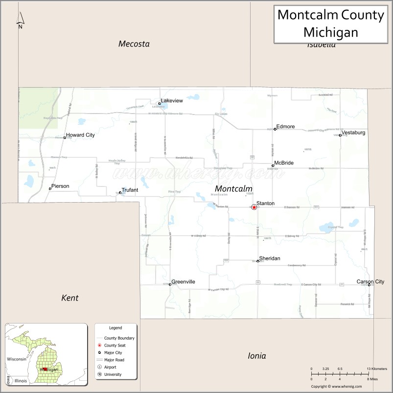
| Seat: | Stanton |
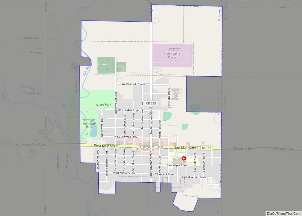
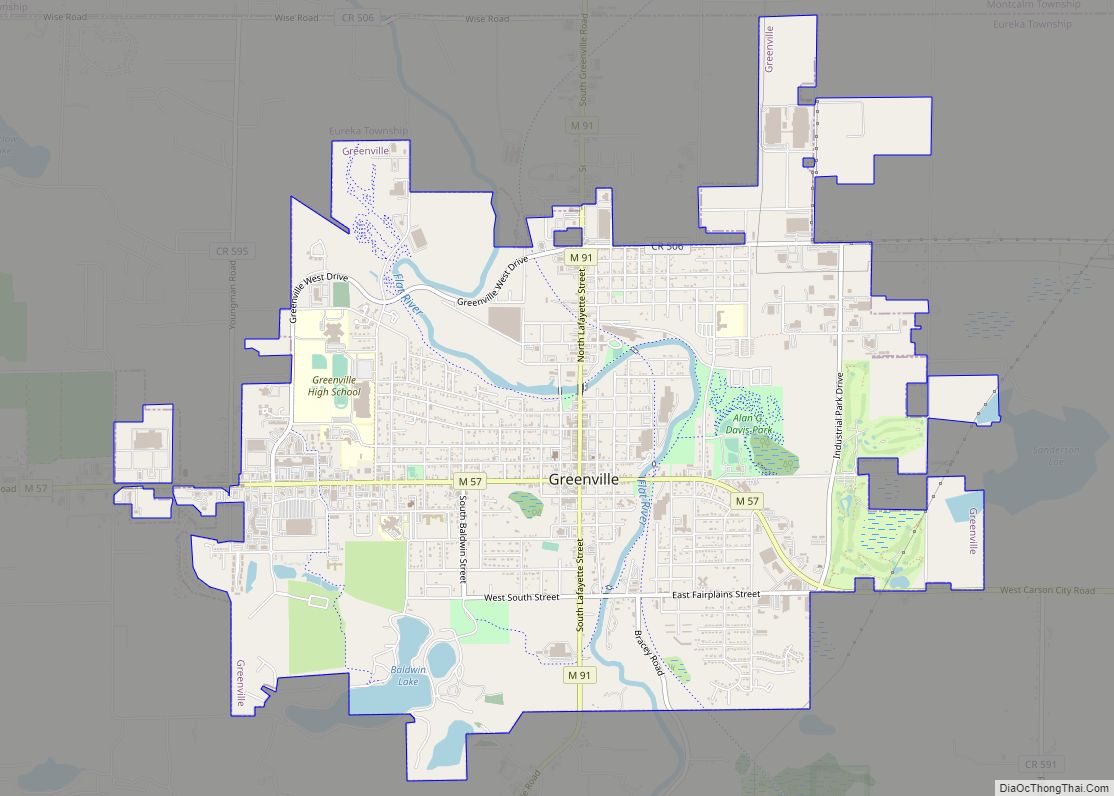
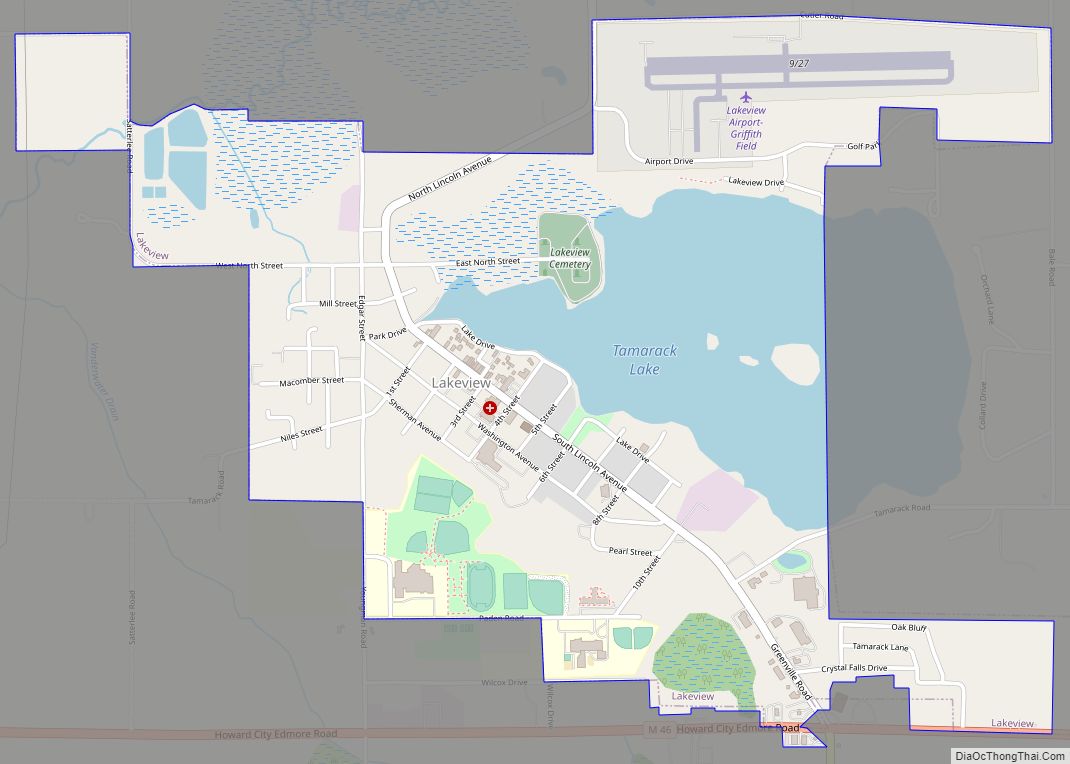
| Largest city: | Greenville |
| Total Area: | 721 sq mi (1,870 km²) |
| Land Area: | 705 sq mi (1,830 km²) |
| Total Population: | 66,614 |
| Population Density: | 90/sq mi (30/km²) |
| Time zone: | UTC−5 (Eastern) |
| Summer Time Zone (DST): | UTC−4 (EDT) |
| Website: | www.montcalm.org |
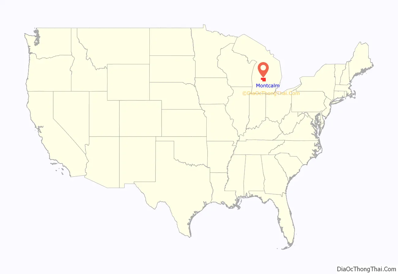
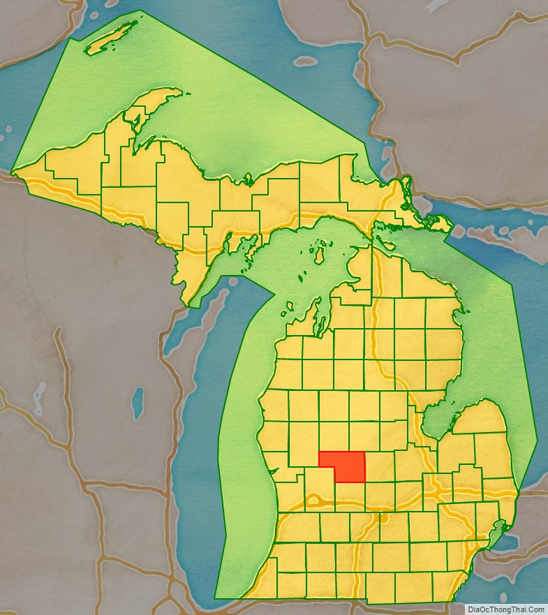
Montcalm County location map. Where is Montcalm County?
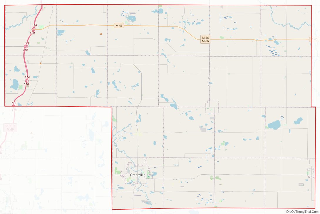
Montcalm County Road Map
Geography
According to the U.S. Census Bureau, the county has a total area of 721 square miles (1,870 km), of which 705 square miles (1,830 km) is land and 15 square miles (39 km) (2.1%) is water.
Adjacent counties
- Isabella County (northeast)
- Mecosta County (north)
- Gratiot County (east)
- Newaygo County (west)
- Ionia County (south)
- Kent County (southwest)
- Clinton County (southeast)
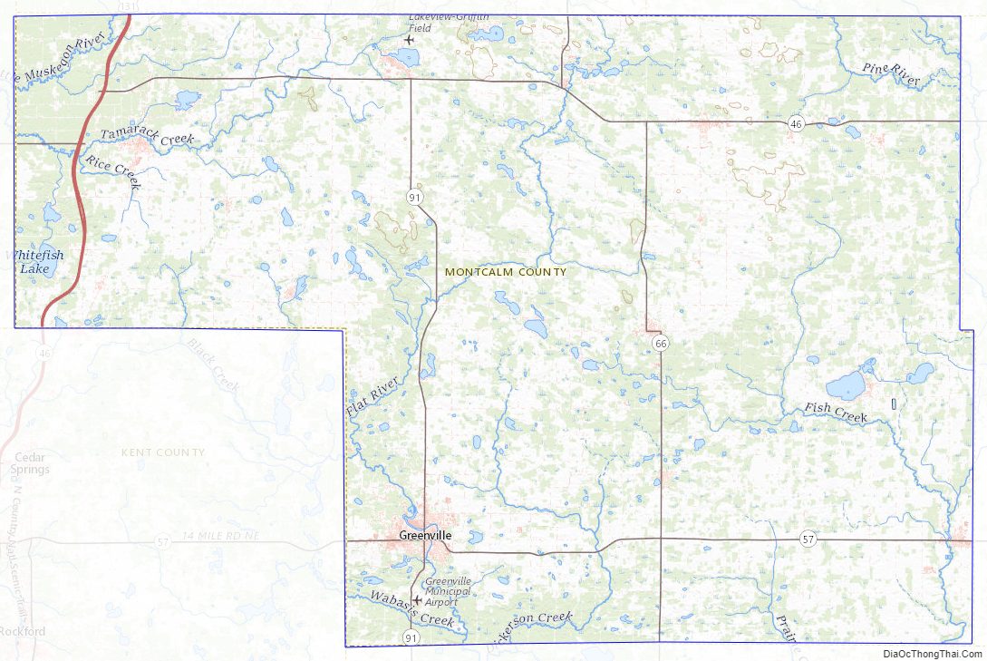
National protected area
- Manistee National Forest (part)
Major highways
- US 131
- M-46
- M-57
- M-66
- M-82
- M-91
Montcalm County Topographic Map
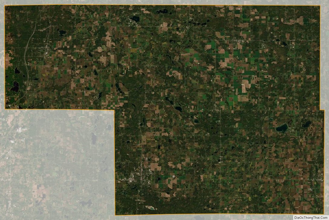
Montcalm County Satellite Map
Montcalm County Outline Map