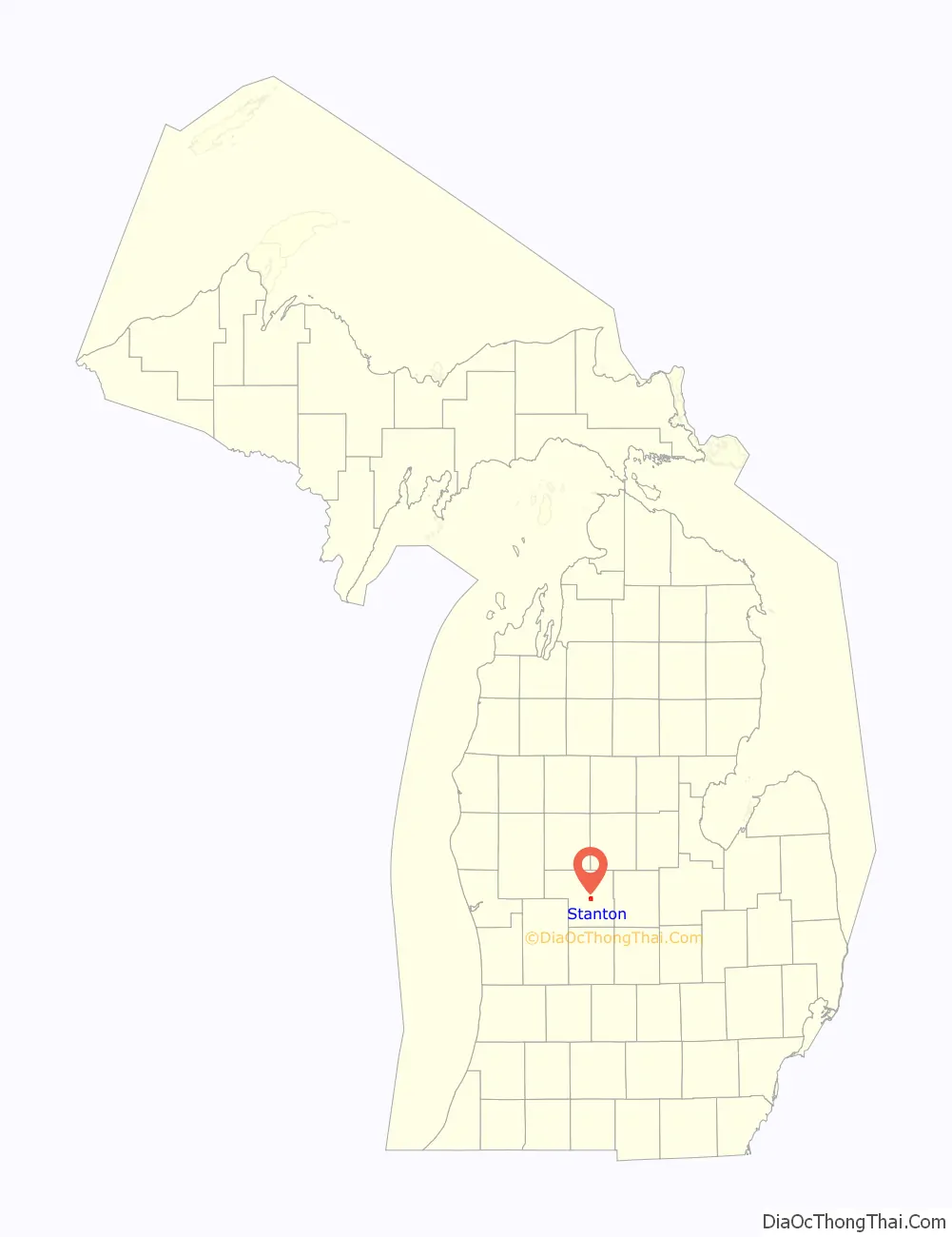
Stanton is a city in the U.S. state of Michigan. The population was 1,417 at the 2010 census. It is the county seat of Montcalm County. It is located at the corners of four townships and incorporates land from each: Day Township to the northeast, Evergreen Township to the southeast, Sidney Township to the southwest, and Douglass Township to the northwest.
| Name: | Stanton city |
|---|---|
| LSAD Code: | 25 |
| LSAD Description: | city (suffix) |
| State: | Michigan |
| County: | Montcalm County |
| Founded: | 1860 |
| Incorporated: | 1869 (village) 1881 (city) |
| Elevation: | 902 ft (275 m) |
| Total Area: | 2.15 sq mi (5.57 km²) |
| Land Area: | 2.15 sq mi (5.56 km²) |
| Water Area: | 0.00 sq mi (0.01 km²) |
| Total Population: | 1,348 |
| Population Density: | 628.15/sq mi (242.51/km²) |
| ZIP code: | 48888 |
| Area code: | 989 |
| FIPS code: | 2676220 |
| GNISfeature ID: | 1627122 |
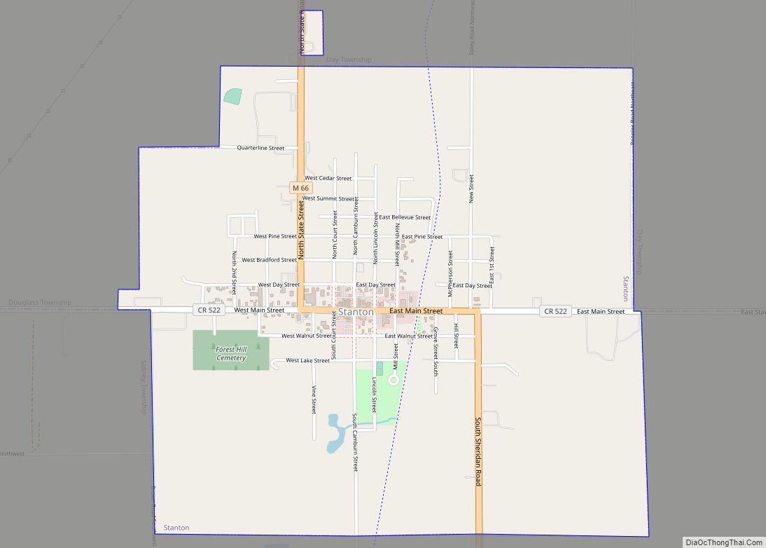
Online Interactive Map
Click on ![]() to view map in "full screen" mode.
to view map in "full screen" mode.
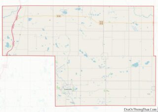
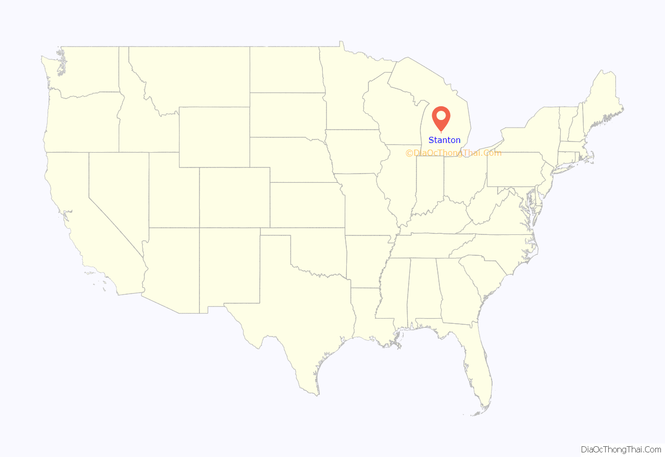
Stanton location map. Where is Stanton city?
History
Stanton was organized in 1860 when the people of Montcalm County voted to move the county seat here from Greenville, which was the original county seat from 1840. At that time, the County Board purchased 40 acres (160,000 m) from Fred Hall of Ionia and named the city “Fred” in his honor. The family of Levi Camburn was the first to settle here and he became its first postmaster on March 10, 1862. The city was renamed for Secretary of War, Edwin M. Stanton in 1863. Stanton was platted in 1865, incorporated as a village in 1869, and as a city in 1881. The Hotel Montcalm was established in 1863.
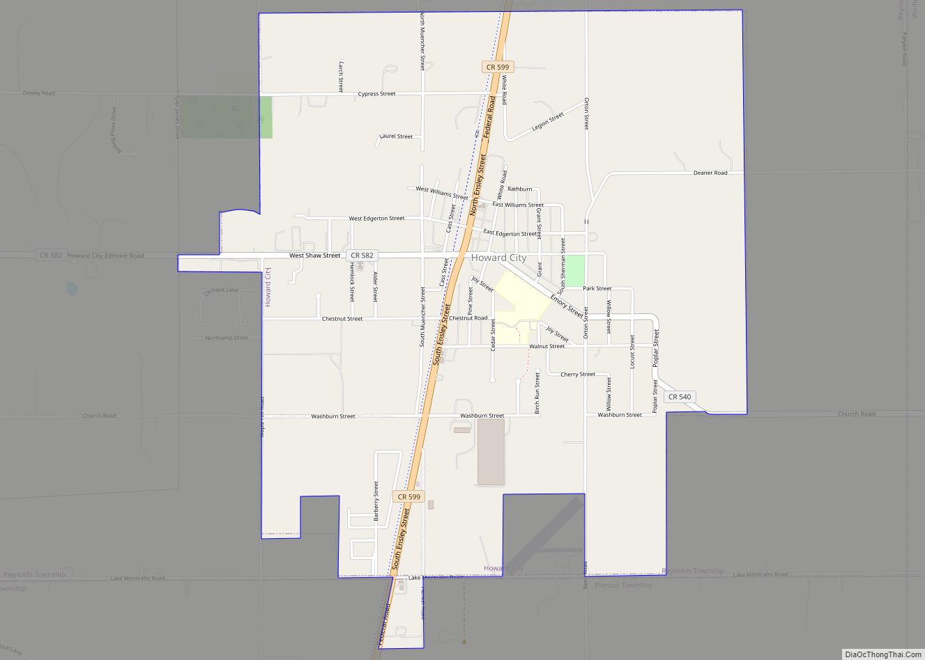
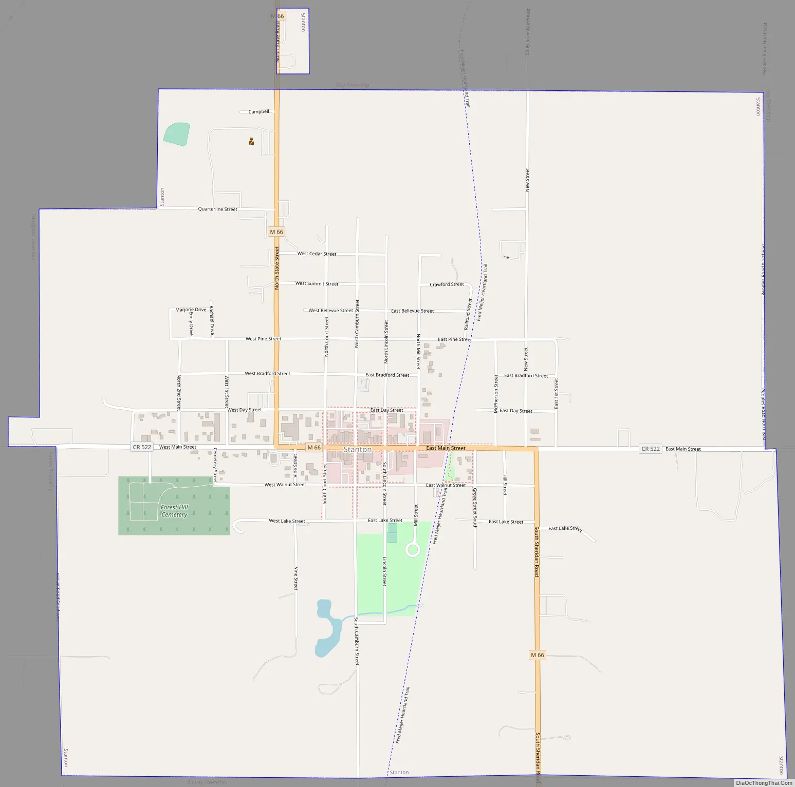
Stanton Road Map
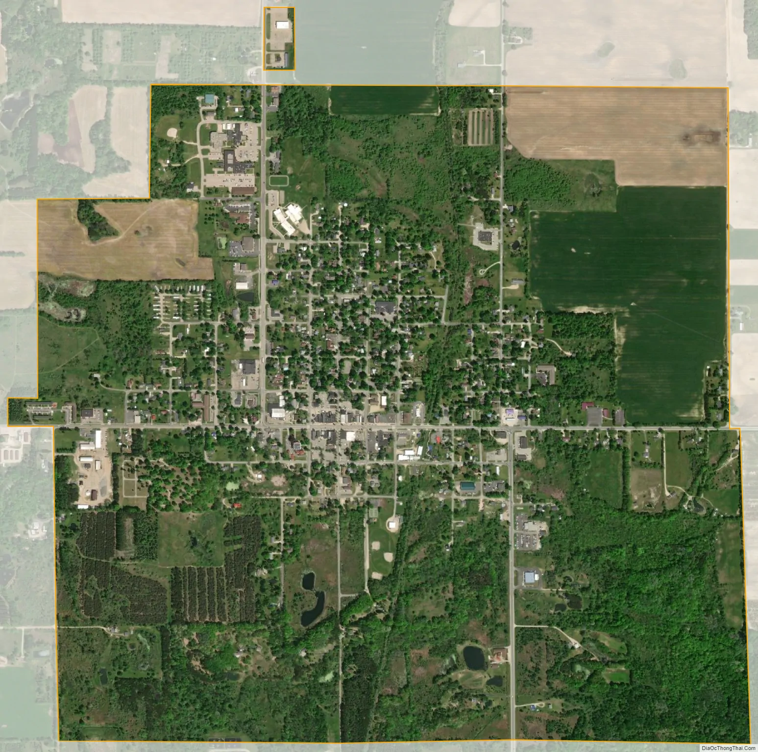
Stanton city Satellite Map
Geography
According to the United States Census Bureau, the city has a total area of 2.15 square miles (5.57 km), all land.
The Stanton post office, with ZIP code 48888, also serves portions of the four surrounding townships: Day Township to the northeast, Evergreen Township to the southeast, Sidney Township to the southwest, and Douglass Township to the northwest, as well as areas of Ferris Township to the east of Day, Belvidere Township to the north of Douglass, and Pine Township to the west of Douglass.
See also
Map of Michigan State and its subdivision:- Alcona
- Alger
- Allegan
- Alpena
- Antrim
- Arenac
- Baraga
- Barry
- Bay
- Benzie
- Berrien
- Branch
- Calhoun
- Cass
- Charlevoix
- Cheboygan
- Chippewa
- Clare
- Clinton
- Crawford
- Delta
- Dickinson
- Eaton
- Emmet
- Genesee
- Gladwin
- Gogebic
- Grand Traverse
- Gratiot
- Hillsdale
- Houghton
- Huron
- Ingham
- Ionia
- Iosco
- Iron
- Isabella
- Jackson
- Kalamazoo
- Kalkaska
- Kent
- Keweenaw
- Lake
- Lake Hurron
- Lake Michigan
- Lake St. Clair
- Lake Superior
- Lapeer
- Leelanau
- Lenawee
- Livingston
- Luce
- Mackinac
- Macomb
- Manistee
- Marquette
- Mason
- Mecosta
- Menominee
- Midland
- Missaukee
- Monroe
- Montcalm
- Montmorency
- Muskegon
- Newaygo
- Oakland
- Oceana
- Ogemaw
- Ontonagon
- Osceola
- Oscoda
- Otsego
- Ottawa
- Presque Isle
- Roscommon
- Saginaw
- Saint Clair
- Saint Joseph
- Sanilac
- Schoolcraft
- Shiawassee
- Tuscola
- Van Buren
- Washtenaw
- Wayne
- Wexford
- Alabama
- Alaska
- Arizona
- Arkansas
- California
- Colorado
- Connecticut
- Delaware
- District of Columbia
- Florida
- Georgia
- Hawaii
- Idaho
- Illinois
- Indiana
- Iowa
- Kansas
- Kentucky
- Louisiana
- Maine
- Maryland
- Massachusetts
- Michigan
- Minnesota
- Mississippi
- Missouri
- Montana
- Nebraska
- Nevada
- New Hampshire
- New Jersey
- New Mexico
- New York
- North Carolina
- North Dakota
- Ohio
- Oklahoma
- Oregon
- Pennsylvania
- Rhode Island
- South Carolina
- South Dakota
- Tennessee
- Texas
- Utah
- Vermont
- Virginia
- Washington
- West Virginia
- Wisconsin
- Wyoming