Picuris Pueblo (/pɪkəˈriːs/; Tiwa: P’įwweltha [p’ī̃wːēltʰà]) is a historic pueblo in Taos County, New Mexico, United States. It is also a census-designated place (CDP) and a federally recognized tribe of Native American Pueblo people. The 2010 census estimated that 68 people lived in the CDP, while 267 people in the U.S. reported being of the tribal group Picuris alone and 439 reported being of the tribal group Picuris alone or in combination with other groups. Picurís Pueblo is a member of the Eight Northern Pueblos. Their own name for their pueblo is P’įwweltha, meaning “mountain warrior place” or “mountain pass place.” They speak the Picuris dialect of the Northern Tiwa language, part of the Kiowa-Tanoan language family.
| Name: | Picuris Pueblo CDP |
|---|---|
| LSAD Code: | 57 |
| LSAD Description: | CDP (suffix) |
| State: | New Mexico |
| County: | Taos County |
| Elevation: | 7,323 ft (2,232 m) |
| Total Area: | 0.46 sq mi (1.19 km²) |
| Land Area: | 0.46 sq mi (1.18 km²) |
| Water Area: | 0.00 sq mi (0.01 km²) |
| Total Population: | 83 |
| Population Density: | 181.62/sq mi (70.17/km²) |
| Area code: | 505 |
| FIPS code: | 3556810 |
| GNISfeature ID: | 0928771 |
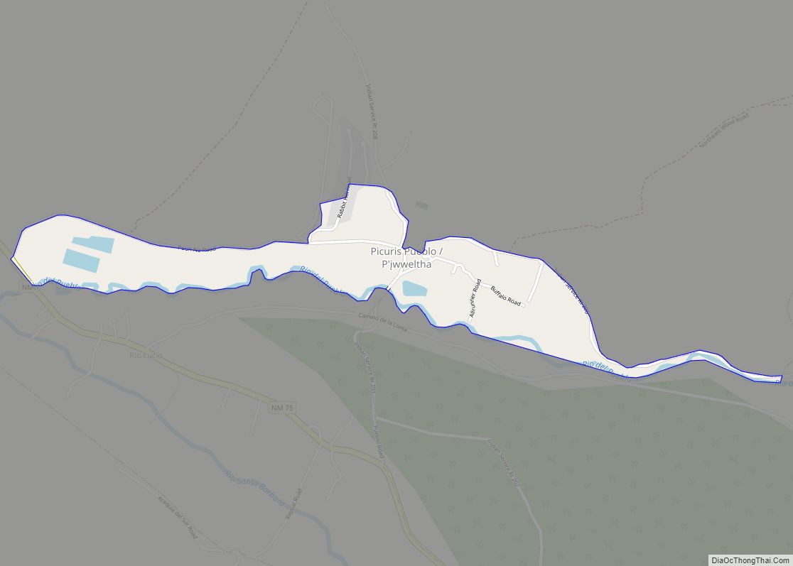
Online Interactive Map
Click on ![]() to view map in "full screen" mode.
to view map in "full screen" mode.
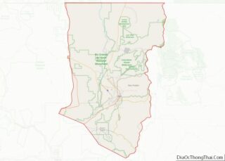
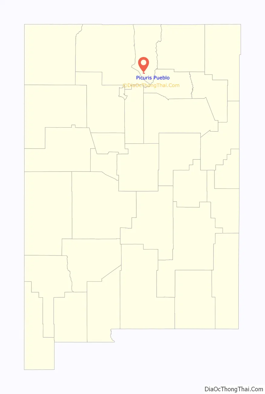
Picuris Pueblo location map. Where is Picuris Pueblo CDP?

History
The Picuris people previously lived in an earlier, larger village of about 3,000 people now known as Pot Creek, near Taos. They migrated to the present location along the Rio Pueblo de Taos about 1250 CE. In the 15th century it was one of the largest Tiwa pueblos, influenced by Apache and other Plains Indian cultures, as was the Taos Pueblo.
In the late 17th century people from the pueblos of New Mexico revolted against the Spanish colonialists, particularly during a revolt between 1680 and 1696 when they fought for autonomy and their land. Following this period the people of the pueblo were dispersed and had abandoned their pueblo until 1706. At that time they joined with the Spanish to fight against attacks by Comanche and Apache tribes. Then, the Picuris pueblo people settled into a peaceful period.
Spanish explorer Don Juan de Oñate named the pueblo “Pikuria” – which means “those who paint.” The pueblo was influenced by the Spanish, particularly adoption of Christian religious practices and letting go of traditional rituals and ceremonies. The San Lorenzo de Picurís church was built of adobe by 1776 and was restored in the 21st century. Having been influenced by the Spanish and then the Americans for centuries, the Picuris adopted telephone and electrical services, paved roads and television. They resumed their traditional customs, which are performed throughout the year, and became self-governing again in the mid 1920s. As of 2014, the pueblo maintained a growing herd of buffalo.
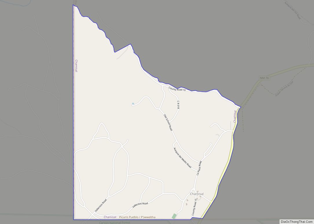
Picuris Pueblo Road Map
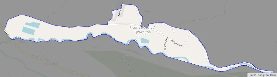
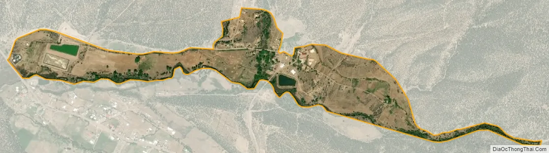
Picuris Pueblo city Satellite Map
Geography
Picuris Pueblo is located in northern New Mexico, on the western slopes of the Sangre de Cristo Mountains and 18 miles south of Taos Pueblo. Average elevation in the pueblo is over 7,000 feet.
According to the United States Census Bureau, the CDP has a total area of 0.4 square miles (1.0 km), all land.
See also
Map of New Mexico State and its subdivision: Map of other states:- Alabama
- Alaska
- Arizona
- Arkansas
- California
- Colorado
- Connecticut
- Delaware
- District of Columbia
- Florida
- Georgia
- Hawaii
- Idaho
- Illinois
- Indiana
- Iowa
- Kansas
- Kentucky
- Louisiana
- Maine
- Maryland
- Massachusetts
- Michigan
- Minnesota
- Mississippi
- Missouri
- Montana
- Nebraska
- Nevada
- New Hampshire
- New Jersey
- New Mexico
- New York
- North Carolina
- North Dakota
- Ohio
- Oklahoma
- Oregon
- Pennsylvania
- Rhode Island
- South Carolina
- South Dakota
- Tennessee
- Texas
- Utah
- Vermont
- Virginia
- Washington
- West Virginia
- Wisconsin
- Wyoming