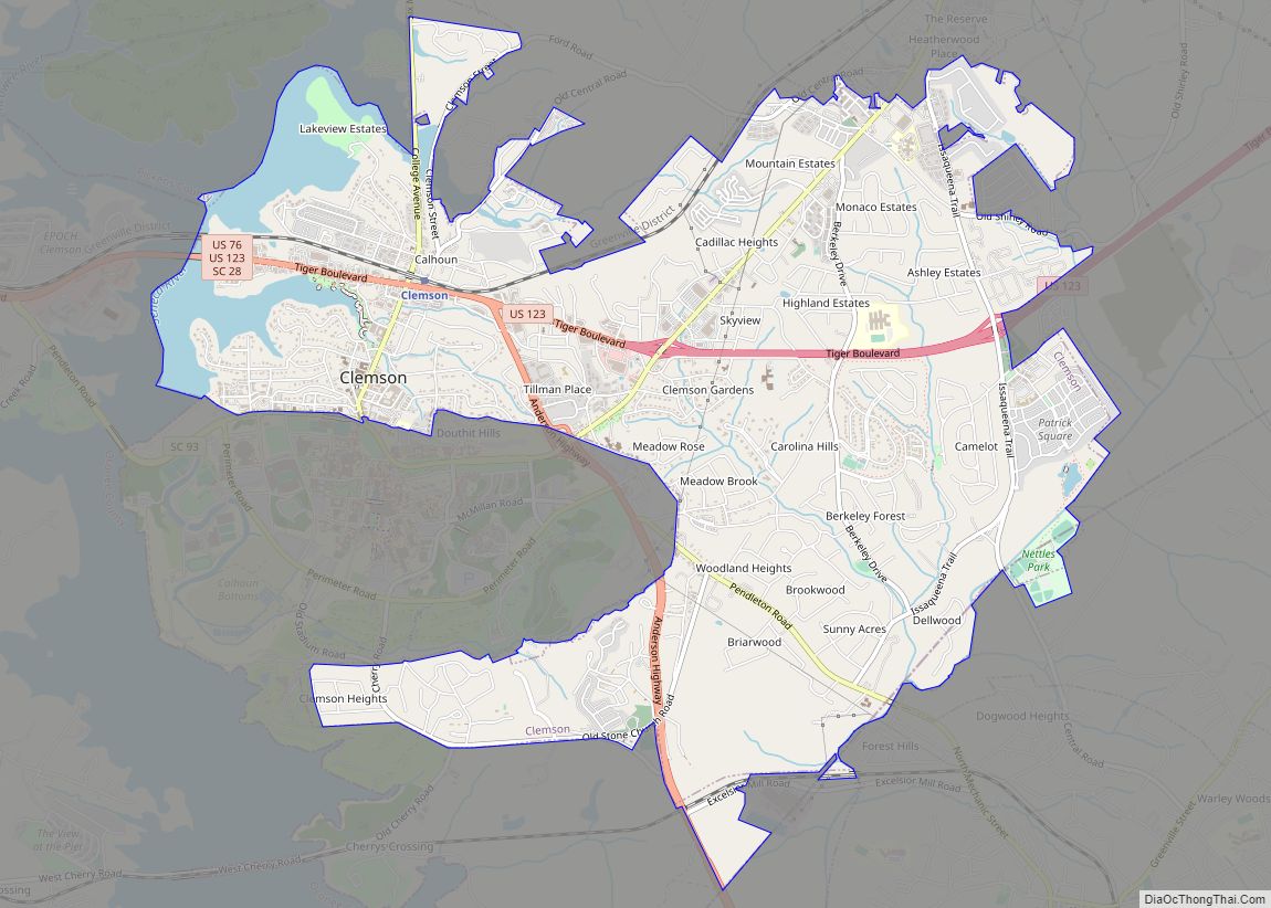
Clemson (/ˈklɛmpsən, ˈklɛmzən/) is a city in Pickens and Anderson counties in the U.S. state of South Carolina. Clemson is home to Clemson University; in 2015, the Princeton Review cited the town of Clemson as ranking #1 in the United States for “town-and-gown” relations with its resident university. The population of the city was 17,681 at the 2020 census.
Clemson is part of the Greenville–Spartanburg–Anderson, South Carolina Combined Statistical Area. Most of the city is in Pickens County, which is part of the Greenville-Mauldin–Anderson Metropolitan Statistical Area. A small portion is in Anderson County.
| Name: | Clemson city |
|---|---|
| LSAD Code: | 25 |
| LSAD Description: | city (suffix) |
| State: | South Carolina |
| County: | Anderson County, Pickens County |
| Elevation: | 725 ft (221 m) |
| Land Area: | 7.69 sq mi (19.92 km²) |
| Water Area: | 0.46 sq mi (1.19 km²) |
| Population Density: | 2,298.62/sq mi (887.54/km²) |
| ZIP code: | 29631-29634 |
| Area code: | 864 |
| FIPS code: | 4514950 |
| GNISfeature ID: | 1247312 |
| Website: | www.clemsoncity.org |
Online Interactive Map
Click on ![]() to view map in "full screen" mode.
to view map in "full screen" mode.
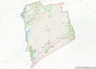
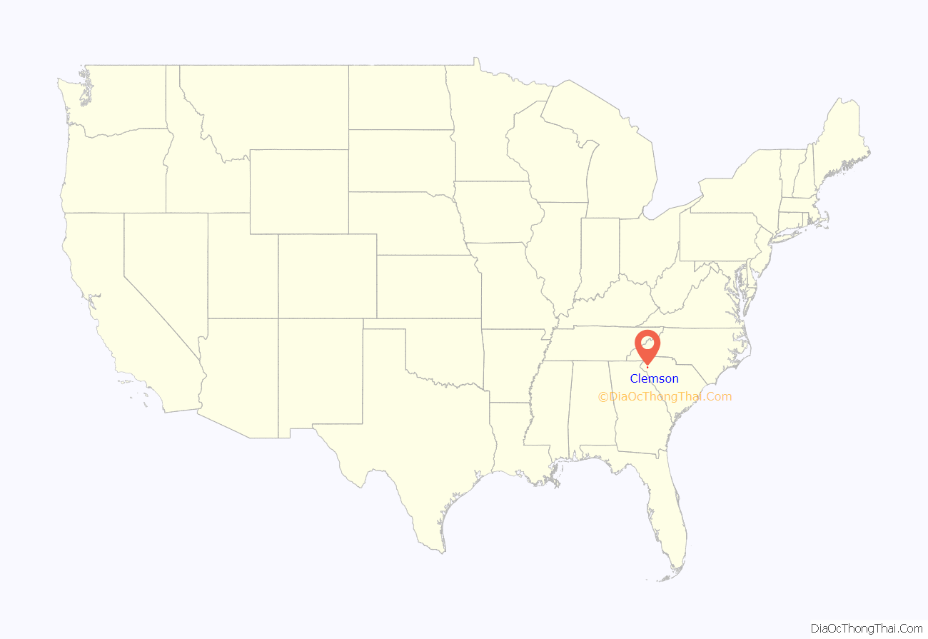
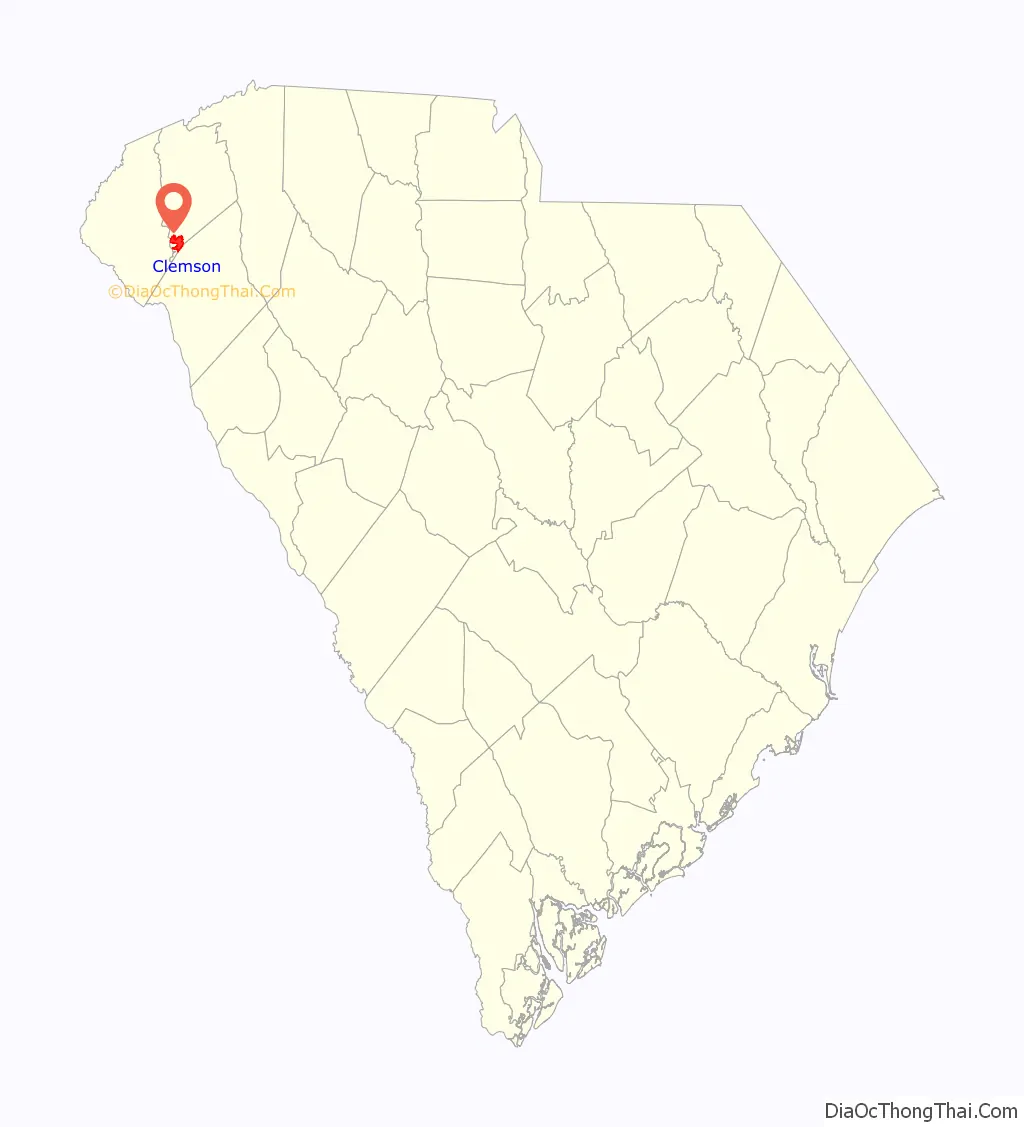
Clemson location map. Where is Clemson city?
History
European Americans settled here after the Cherokee were forced to cede their land in 1819. They had lived at Keowee, and six other towns along the Keowee River as part of their traditional homelands in the Southeast. They migrated and settled in Tennessee and deeper into Georgia and Alabama, before most were subjected to forced Indian Removal in 1839 to Indian Territory (now Oklahoma).
The community was originally named Calhoun. Clemson University, founded in 1889, has developed as a large public university that dominates the town and serves as a cultural center. Its campus developed south of the original town. This was renamed as Clemson in 1943, reflecting its identification with the university. A small, multi-block downtown has some housing, retail and restaurants.
The university provides housing for students, but many students live off campus in a wide variety of apartment complexes. Outside the downtown, there are few paved sidewalks, but some streets have bike paths. The city’s comprehensive plan has a historic preservation component to apply to keep a range of structures in the area.
The Clemson (train) Depot, built in 1893, was renovated in 2001; it now houses the local chamber of commerce and visitor center. The station was temporarily closed in 2016 for a road project, but was reopened in 2019. U.S. Route 123 runs along the northern end of the city and its edges have been developed with typical suburban-style shopping centers.
Development of Clemson College/University
Clemson University was founded as an agricultural college starting in 1889, on the former Fort Hill Plantation of statesman John C. Calhoun, which he had acquired by marriage. The plantation was originally owned by his mother-in-law, mother of his wife Floride. Floride Calhoun inherited the property after her mother’s death in 1836 but, under South Carolina law, she likely lost any individual rights to it because of her marriage.
In the meantime, Floride and John C. Calhoun had a daughter named Anna Maria. At age 21, she married Thomas Green Clemson. After her father John C. Calhoun died in 1850; his widow Floride Calhoun gained total ownership of Fort Hill Plantation.
Because Anna Maria was the only living child, she inherited a part of Fort Hill when Floride died in 1866. Anna Maria bequeathed Thomas G. Clemson a portion of the property in her will. When Anna Maria died in 1875, he inherited the plantation. He knew that Anna Maria had wanted the land to be used as the site of an agricultural college, so Thomas Green Clemson bequeathed land for such a college in his will. After his death in 1888, what developed as Clemson University was founded on that land.
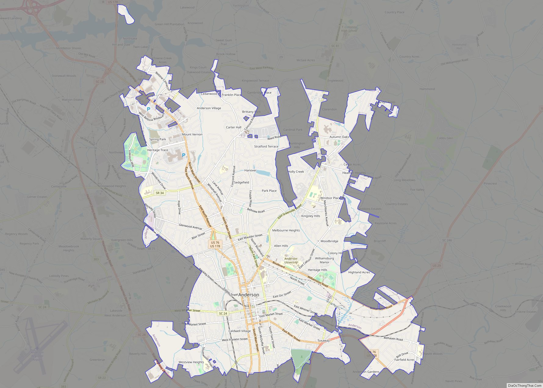
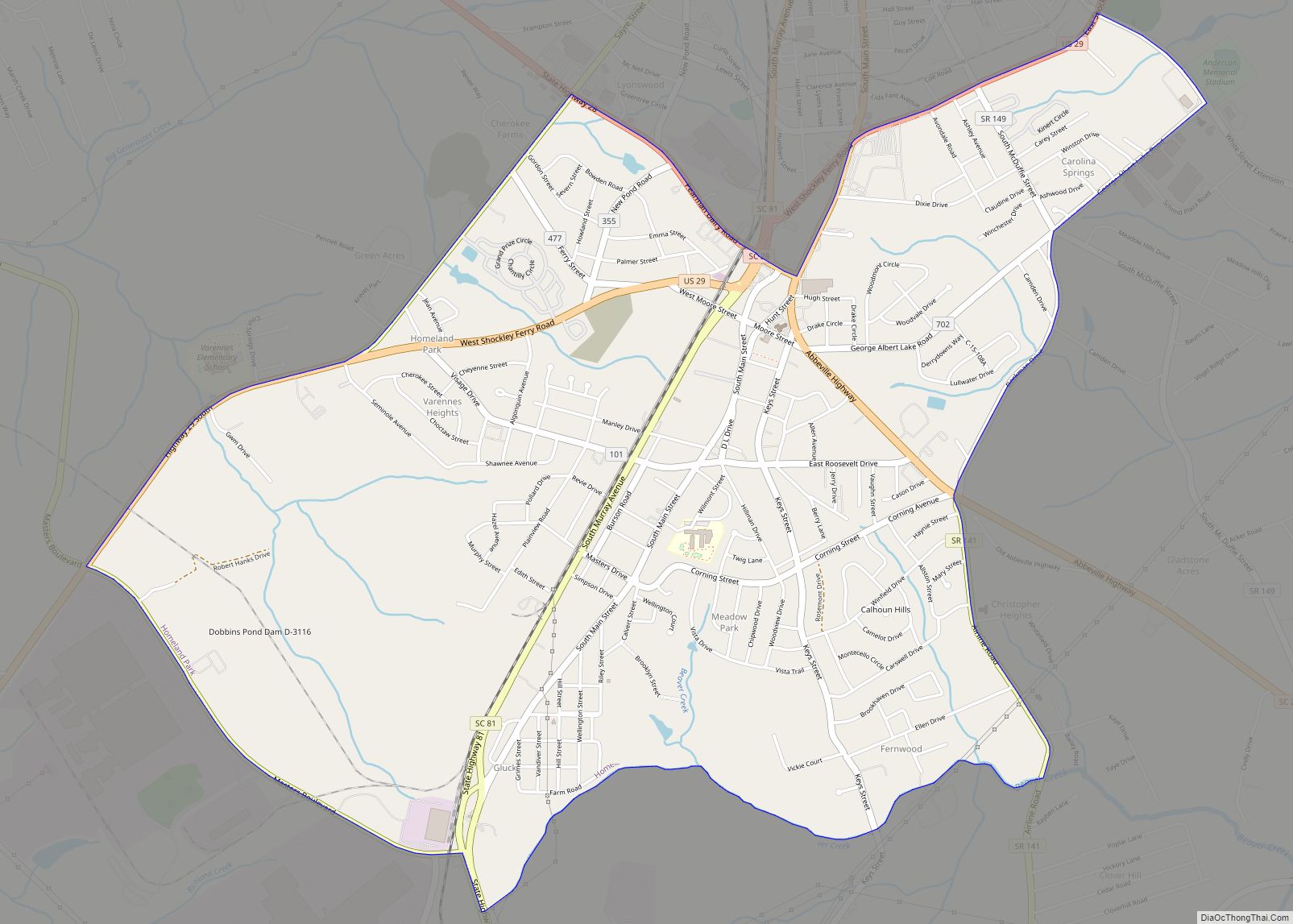
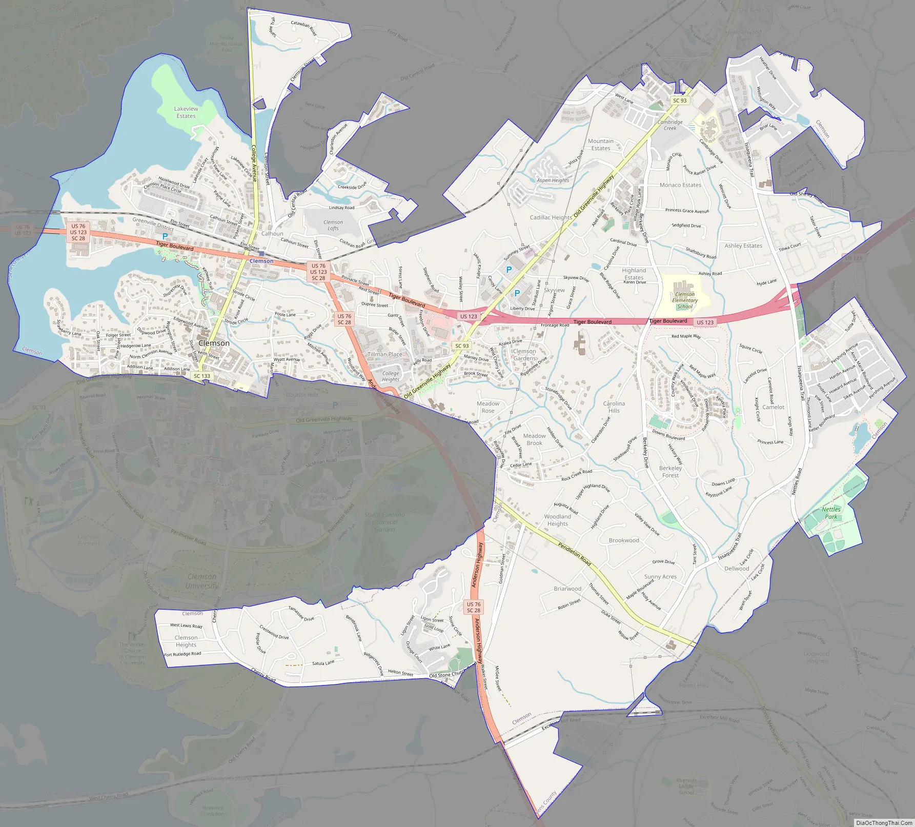
Clemson Road Map
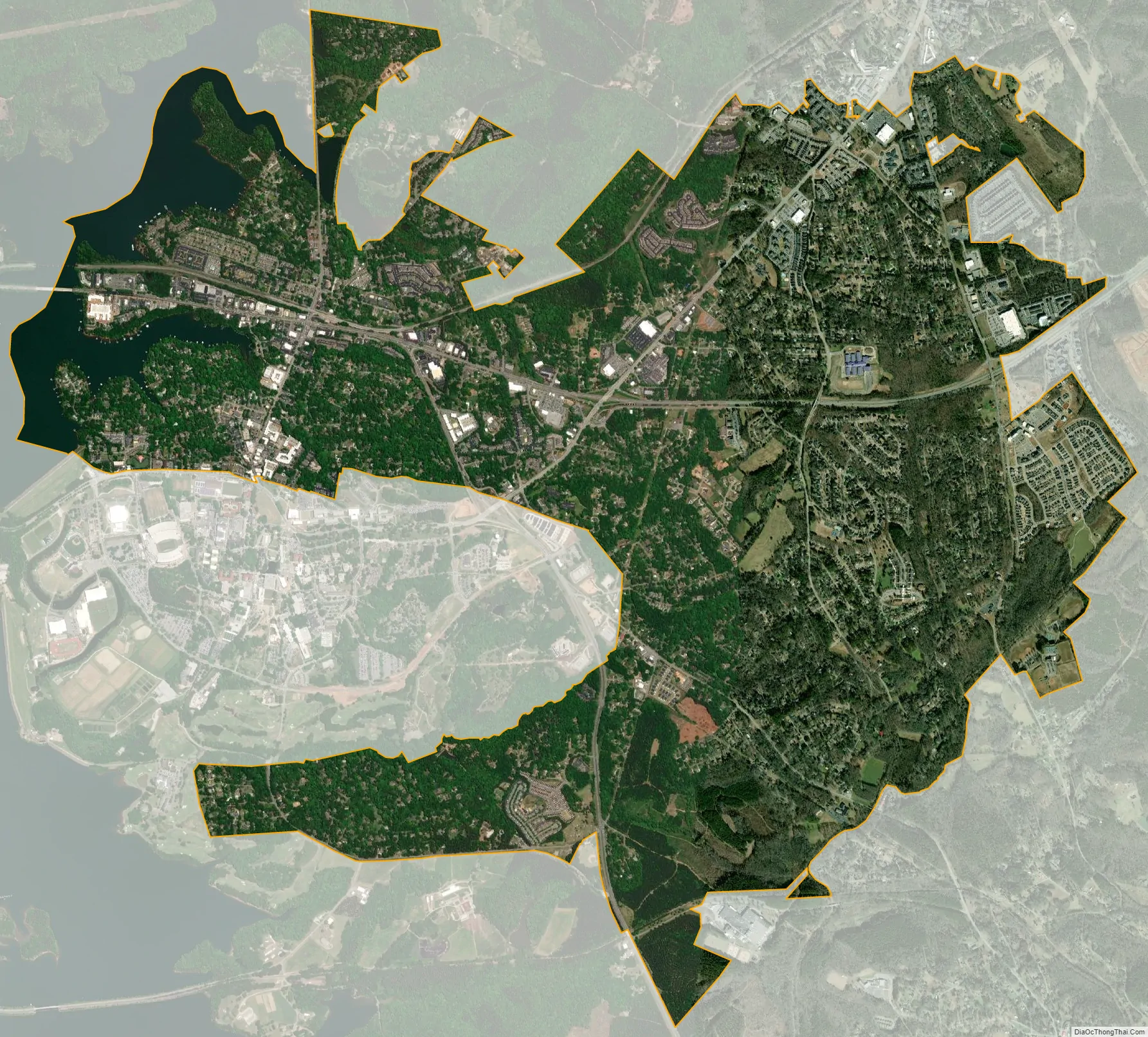
Clemson city Satellite Map
Geography
Clemson is located at 34°41′6″N 82°48′53″W / 34.68500°N 82.81472°W / 34.68500; -82.81472 (34.684930, −82.814777) approximately 27 miles (43 km) west of downtown Greenville and 15 miles (24 km) north of Anderson. The city is situated near the northwestern corner of South Carolina in the foothills of the Blue Ridge Mountains while also on the shores of Lake Hartwell.
According to the United States Census Bureau, the city has an area of 7.9 square miles (20.5 km), of which 7.5 square miles (19.3 km) is land and 0.46 square miles (1.2 km), or 5.85%, is water.
Climate
Typical of the Upstate, Clemson has a humid subtropical climate (Köppen) characterized by hot, humid summers and cool winters. Precipitation is ample through the year, although it reaches a maximum in August and February; snowfall is typically sporadic with a normal seasonal (December through March) total accumulation of 2.2 in (5.6 cm).
National Register of Historical Places
The following places and buildings in Clemson are listed on the National Register of Historic Places:
- Clemson University Historic District I and II
- Clemson College Sheep Barn
- Fort Hill (John C. Calhoun Mansion and Library)
- Hanover House
- Hopewell Plantation – Gen. Andrew Pickens’ Home
- J. C. Stribling Barn
- Old Stone Church and Cemetery
Clemson College Sheep Barn
J. C. Stribling Barn
Old Stone Church and Cemetery
Bowman Field and Sikes Hall of the Clemson University Historic District I
Hanover House
Amphitheater of the Clemson University Historic District II
Attractions
In addition to Clemson University, the city is home to the South Carolina Botanical Garden, Fort Hill Plantation and Bob Campbell Geology Museum. Lake Hartwell, a reservoir, is a popular recreation area that borders the city on the west. The Blue Ridge Mountains are just 30 miles (48 km) from the city center. VISITCLEMSON, the city’s tourism office, offers more information on things to do in the area.
South Carolina Botanical Garden
Fort Hill
Lake Hartwell
See also
Map of South Carolina State and its subdivision:- Abbeville
- Aiken
- Allendale
- Anderson
- Bamberg
- Barnwell
- Beaufort
- Berkeley
- Calhoun
- Charleston
- Cherokee
- Chester
- Chesterfield
- Clarendon
- Colleton
- Darlington
- Dillon
- Dorchester
- Edgefield
- Fairfield
- Florence
- Georgetown
- Greenville
- Greenwood
- Hampton
- Horry
- Jasper
- Kershaw
- Lancaster
- Laurens
- Lee
- Lexington
- Marion
- Marlboro
- McCormick
- Newberry
- Oconee
- Orangeburg
- Pickens
- Richland
- Saluda
- Spartanburg
- Sumter
- Union
- Williamsburg
- York
- Alabama
- Alaska
- Arizona
- Arkansas
- California
- Colorado
- Connecticut
- Delaware
- District of Columbia
- Florida
- Georgia
- Hawaii
- Idaho
- Illinois
- Indiana
- Iowa
- Kansas
- Kentucky
- Louisiana
- Maine
- Maryland
- Massachusetts
- Michigan
- Minnesota
- Mississippi
- Missouri
- Montana
- Nebraska
- Nevada
- New Hampshire
- New Jersey
- New Mexico
- New York
- North Carolina
- North Dakota
- Ohio
- Oklahoma
- Oregon
- Pennsylvania
- Rhode Island
- South Carolina
- South Dakota
- Tennessee
- Texas
- Utah
- Vermont
- Virginia
- Washington
- West Virginia
- Wisconsin
- Wyoming