Central is a town in Pickens County, South Carolina, United States. As of the 2010 census, the population was 5,159, roughly 3,000 of whom were considered permanent residents. Contrary to its name, it is not near South Carolina’s center. It received its name from being halfway or the central point between Atlanta and Charlotte along the former Atlanta and Richmond Air-Line Railway line. Southern Wesleyan University’s main campus is east of downtown Central.
| Name: | Central town |
|---|---|
| LSAD Code: | 43 |
| LSAD Description: | town (suffix) |
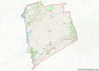
| State: | South Carolina |
| County: | Pickens County |
| Incorporated: | 1875 |
| Elevation: | 906 ft (276 m) |
| Total Area: | 3.07 sq mi (7.94 km²) |
| Land Area: | 3.06 sq mi (7.93 km²) |
| Water Area: | 0.00 sq mi (0.01 km²) |
| Total Population: | 5,296 |
| Population Density: | 1,713.59/sq mi (661.56/km²) |
| ZIP code: | 29630 |
| Area code: | 864 |
| FIPS code: | 4513015 |
| GNISfeature ID: | 1247236 |
| Website: | cityofcentral.org |
Online Interactive Map
Click on ![]() to view map in "full screen" mode.
to view map in "full screen" mode.
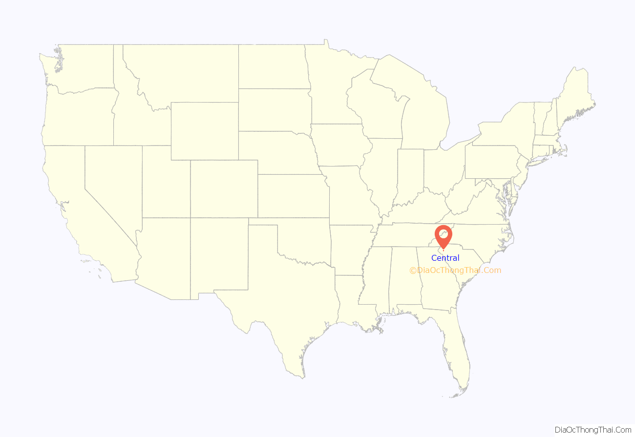
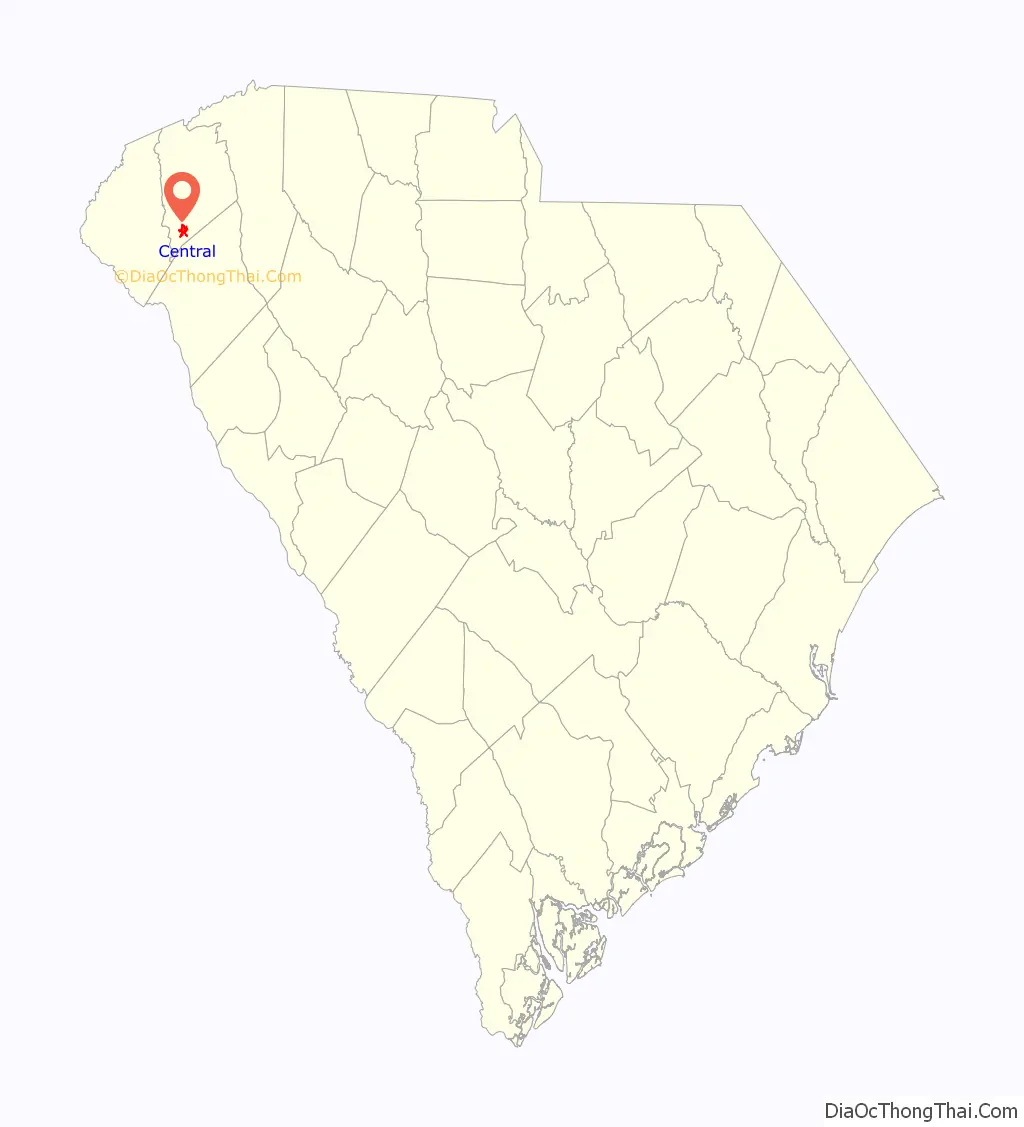
Central location map. Where is Central town?
History
Central was founded by the Atlanta and Richmond Air Line Railway in a railroad boom that began in 1873. The town’s name represents the fact that it is midway between Atlanta and Charlotte. Central was incorporated as a town on March 17, 1875.
In 1897, Southern Railway moved its headquarters from Central to Greenville; trains no longer stopped to change engines, and soon all shops and offices were closed. The establishment of Issaqueena Mill and, in 1906, Wesleyan Methodist Bible Institute (now Southern Wesleyan University) brought people back to the town.
Two buildings on Church Street in Central are listed on the National Register of Historic Places: Central High School and Morgan House. The Central Roller Mills on Madden Bridge Road was listed in 2013.
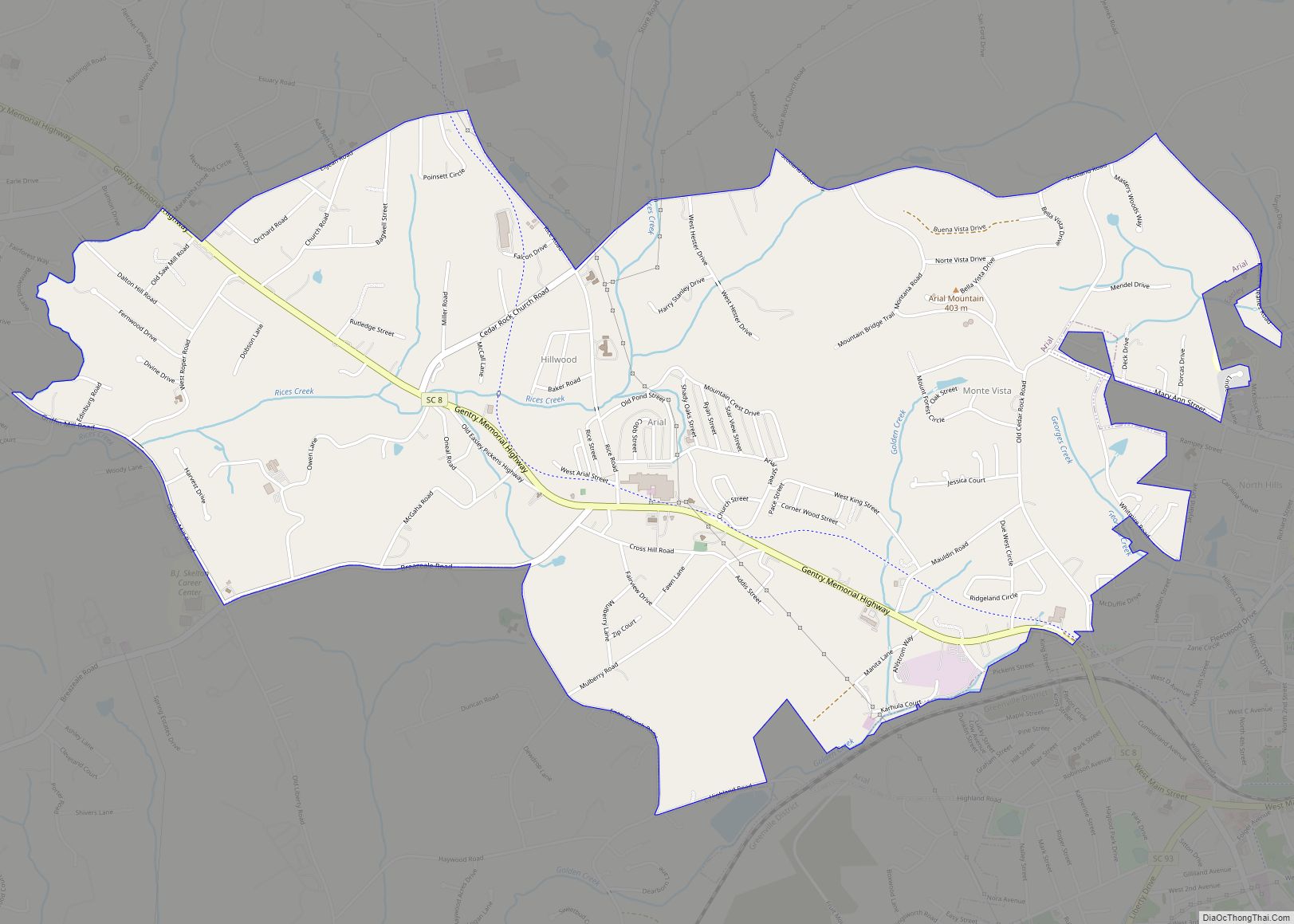
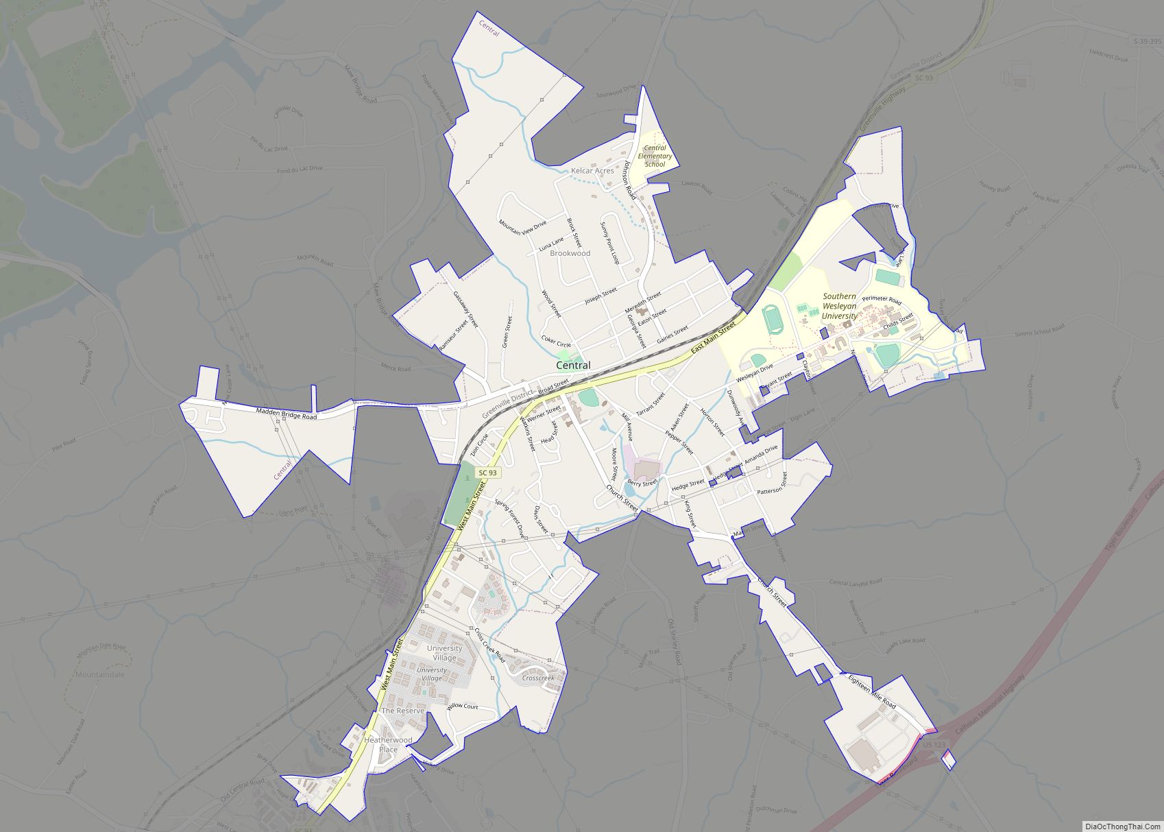
Central Road Map
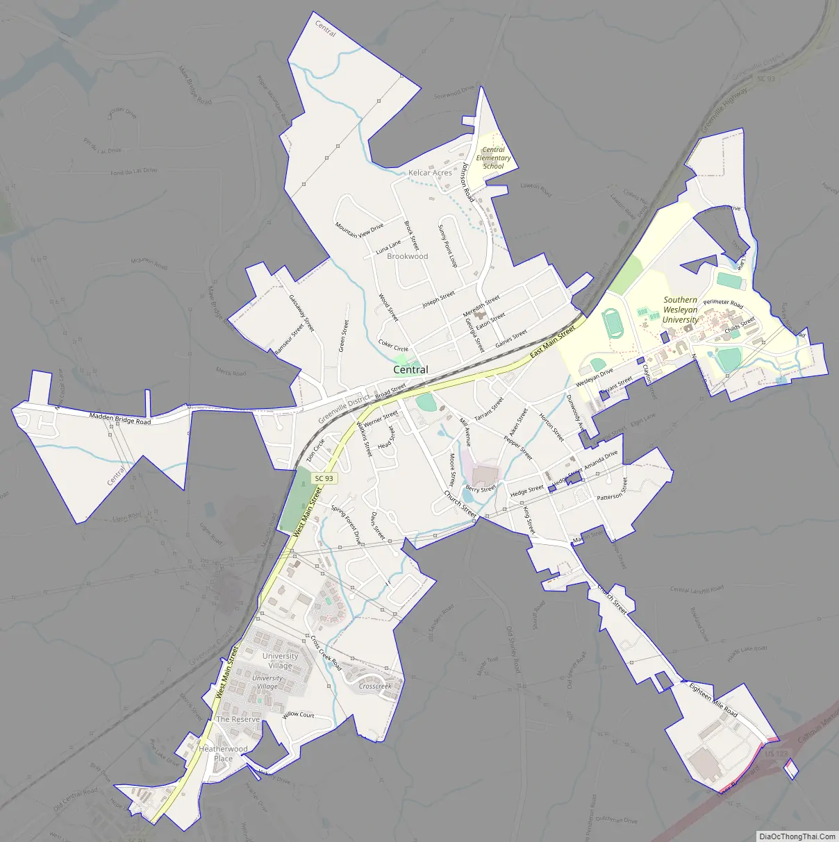
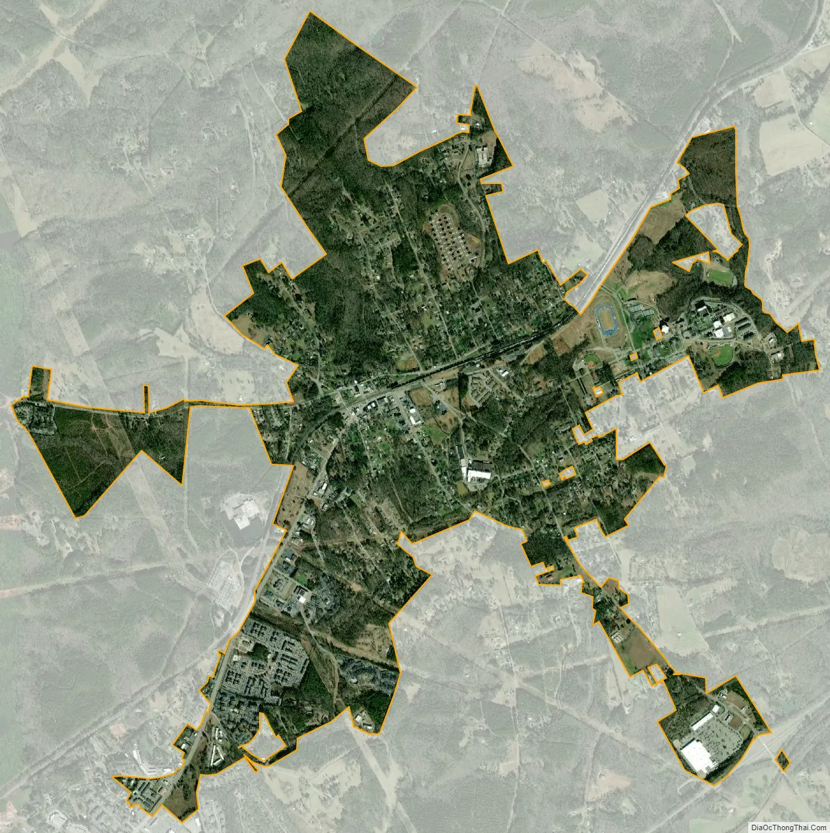
Central city Satellite Map
Geography
Central is located at 34°43′26″N 82°46′47″W / 34.723781°N 82.779754°W / 34.723781; -82.779754. According to the United States Census Bureau, the town has an area of 2.4 square miles (6.2 km), all of it land.
Downtown Central is bisected by a rail line. A significant number of late 19th- to early 20th-century commercial buildings remain, most of which are single-story and retain a good amount of historical integrity. As of 2006, a downtown streetscape project is underway that is designed to improve the area’s aesthetics. There are also many modest pre-World War II homes near the downtown. Central has several large apartment complexes, including The Reserve, which primarily house students from nearby Clemson University (who can use Clemson Area Transit to get there), as well as from Southern Wesleyan University.
The Central Heritage Society has a museum and information on many historic buildings and homes in the area.
Attractions
In addition to Southern Wesleyan University, the town is home to Grand Central Station, a disc golf course that hosts Professional Disc Golf Association (PDGA) tournaments.
See also
Map of South Carolina State and its subdivision:- Abbeville
- Aiken
- Allendale
- Anderson
- Bamberg
- Barnwell
- Beaufort
- Berkeley
- Calhoun
- Charleston
- Cherokee
- Chester
- Chesterfield
- Clarendon
- Colleton
- Darlington
- Dillon
- Dorchester
- Edgefield
- Fairfield
- Florence
- Georgetown
- Greenville
- Greenwood
- Hampton
- Horry
- Jasper
- Kershaw
- Lancaster
- Laurens
- Lee
- Lexington
- Marion
- Marlboro
- McCormick
- Newberry
- Oconee
- Orangeburg
- Pickens
- Richland
- Saluda
- Spartanburg
- Sumter
- Union
- Williamsburg
- York
- Alabama
- Alaska
- Arizona
- Arkansas
- California
- Colorado
- Connecticut
- Delaware
- District of Columbia
- Florida
- Georgia
- Hawaii
- Idaho
- Illinois
- Indiana
- Iowa
- Kansas
- Kentucky
- Louisiana
- Maine
- Maryland
- Massachusetts
- Michigan
- Minnesota
- Mississippi
- Missouri
- Montana
- Nebraska
- Nevada
- New Hampshire
- New Jersey
- New Mexico
- New York
- North Carolina
- North Dakota
- Ohio
- Oklahoma
- Oregon
- Pennsylvania
- Rhode Island
- South Carolina
- South Dakota
- Tennessee
- Texas
- Utah
- Vermont
- Virginia
- Washington
- West Virginia
- Wisconsin
- Wyoming