Haines City is a city in Polk County, Florida, United States. Its population was 13,174 at the 2000 census and 20,535 at the 2010 census. It is the third most populous city in Polk County. It is part of the Lakeland–Winter Haven Metropolitan Statistical Area, which, in turn, is considered part of the Tampa Bay Area.
| Name: | Haines City city |
|---|---|
| LSAD Code: | 25 |
| LSAD Description: | city (suffix) |
| State: | Florida |
| County: | Polk County |
| Incorporated: | February 23, 1914 |
| Elevation: | 164 ft (50 m) |
| Total Area: | 20.10 sq mi (52.06 km²) |
| Land Area: | 18.75 sq mi (48.57 km²) |
| Water Area: | 1.35 sq mi (3.49 km²) 7.27% |
| Total Population: | 26,669 |
| Population Density: | 1,422.04/sq mi (549.05/km²) |
| ZIP code: | 33844-33845 |
| Area code: | 863 |
| FIPS code: | 1228400 |
| GNISfeature ID: | 2403781 |
| Website: | hainescity.com |
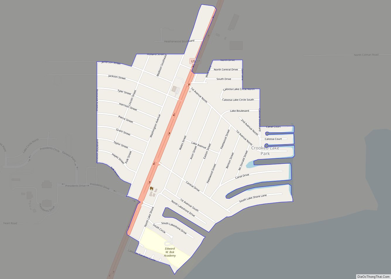
Online Interactive Map
Click on ![]() to view map in "full screen" mode.
to view map in "full screen" mode.
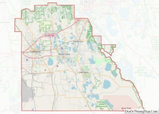
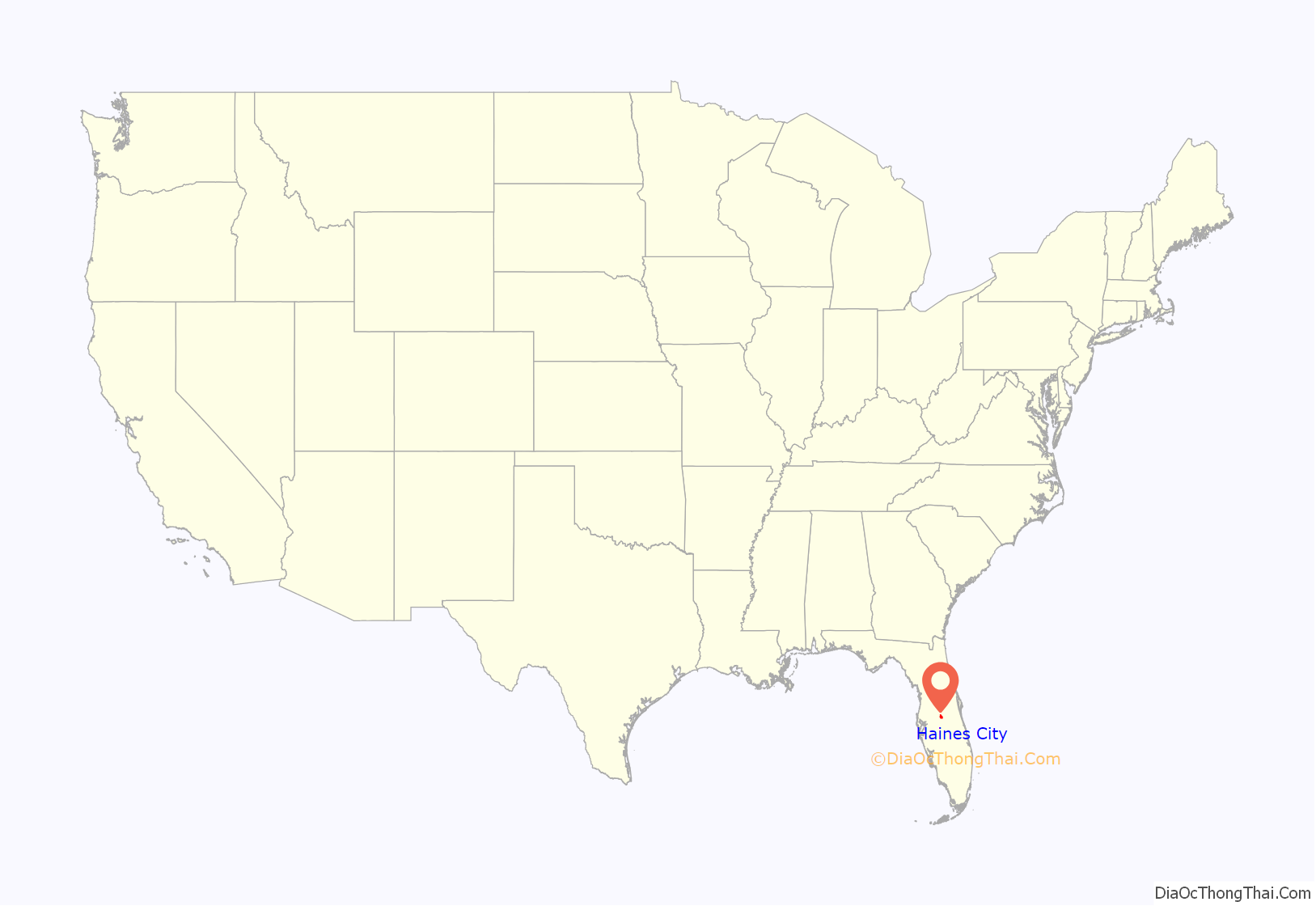
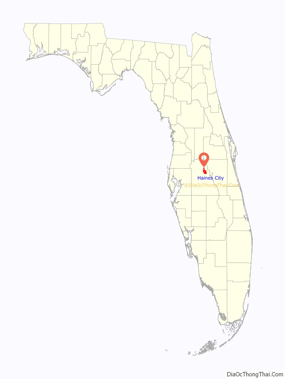
Haines City location map. Where is Haines City city?
History
Haines City was platted in 1885, shortly after the South Florida Railroad reached the area. The city was first known as Clay Cut, but there was no railroad station. It is said that the inhabitants persuaded the railroad company to build a station by agreeing to rename their city Haines City, to honor a senior railroad official, former Confederate States Army Colonel Henry Haines.
The City of Haines City was originally incorporated under the General Statutes of Florida as the Town of Haines City on February 23, 1914. The first state legislative act affecting the City was enacted on May 20, 1919, and, by Chapter 8272, it was reincorporated under a Mayor-Council form of government. The present charter was adopted as Chapter 12790 on July 1, 1927, changing the form of government to “Commission-Manager Plan,” as amended. The City operates under a commission-manager form of government and provides the following services as authorized by its charter: Public safety (Police and Fire), Streets and Highways, Culture-Recreation, Public Improvements, Sanitation, Planning and Zoning and General and Administrative Services.
The early settlers planted citrus groves, and citrus growing and processing became the main industry of the city.
From 1974 to 1986, Circus World, a theme park created by the Ringling Brothers and Barnum & Bailey Circus, was open just north of Haines City. After Circus World shut down, Boardwalk and Baseball opened on the same site. It featured carnival games and theme park styled rides like the Grand Rapids Flume. It closed in 1990, and the site has been redeveloped as a residential and shopping complex named Posner Park.
In recent years Haines City has seen explosive growth, largely because of its easy access to Orlando and Walt Disney World Resort. New residential areas have been developed on the edges of the city. On high ground in the north of the city, Southern Dunes, a golf and country club with both vacation homes and residential homes, was developed between 1995 and 2005.
In 2004, Haines City experienced three hurricanes. Hurricane Charley passed through the city in August. Hurricane Frances came right on the heels of Charley but mostly just dumped a lot of rain. Hurricane Jeanne soon followed packing a punch not quite as strong as Charley but longer lasting. The city has since recovered.
Four years after Charley, Haines City got struck again this time by a weaker storm named Tropical Storm Fay. This storm caused little damage, but schools closed on the second day of the school year (Tuesday, August 19) due to it; the original plan had been to close schools Tuesday and Wednesday, but the lack of danger it showed on Tuesday caused the change in agenda.
Park renovations
A new park on Lake Eva, replacing a previous park on the site, was completed in 2009. The city has also built a new park, called “8-Acre Park”, and auditorium in the Oakland area, on the northern side of the city.
Brush fire
Haines City was the site of a 350-acre (1.4 km) brush fire on March 25, 2009. It was a scare to the residents of dozens of houses in a housing complex named Randa Ridge.
Legoland
Haines City is responding to the arrival of Legoland Florida in Winter Haven. Legoland’s expected tourist influx is leading Haines City to search for ways to advertise and bring more people to the historic downtown area, specifically, motorists coming down U.S. 27 from Interstate 4.
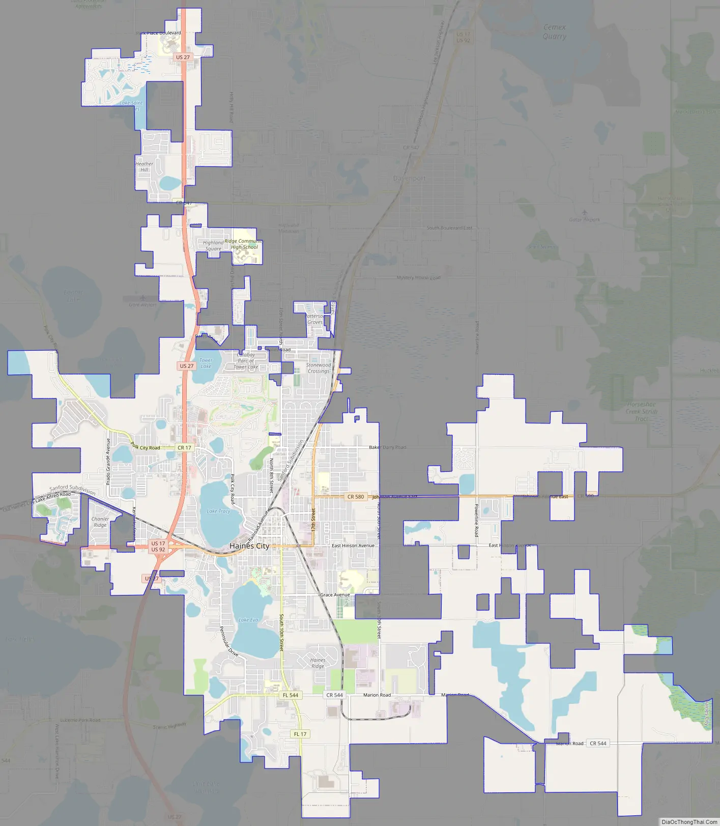
Haines City Road Map
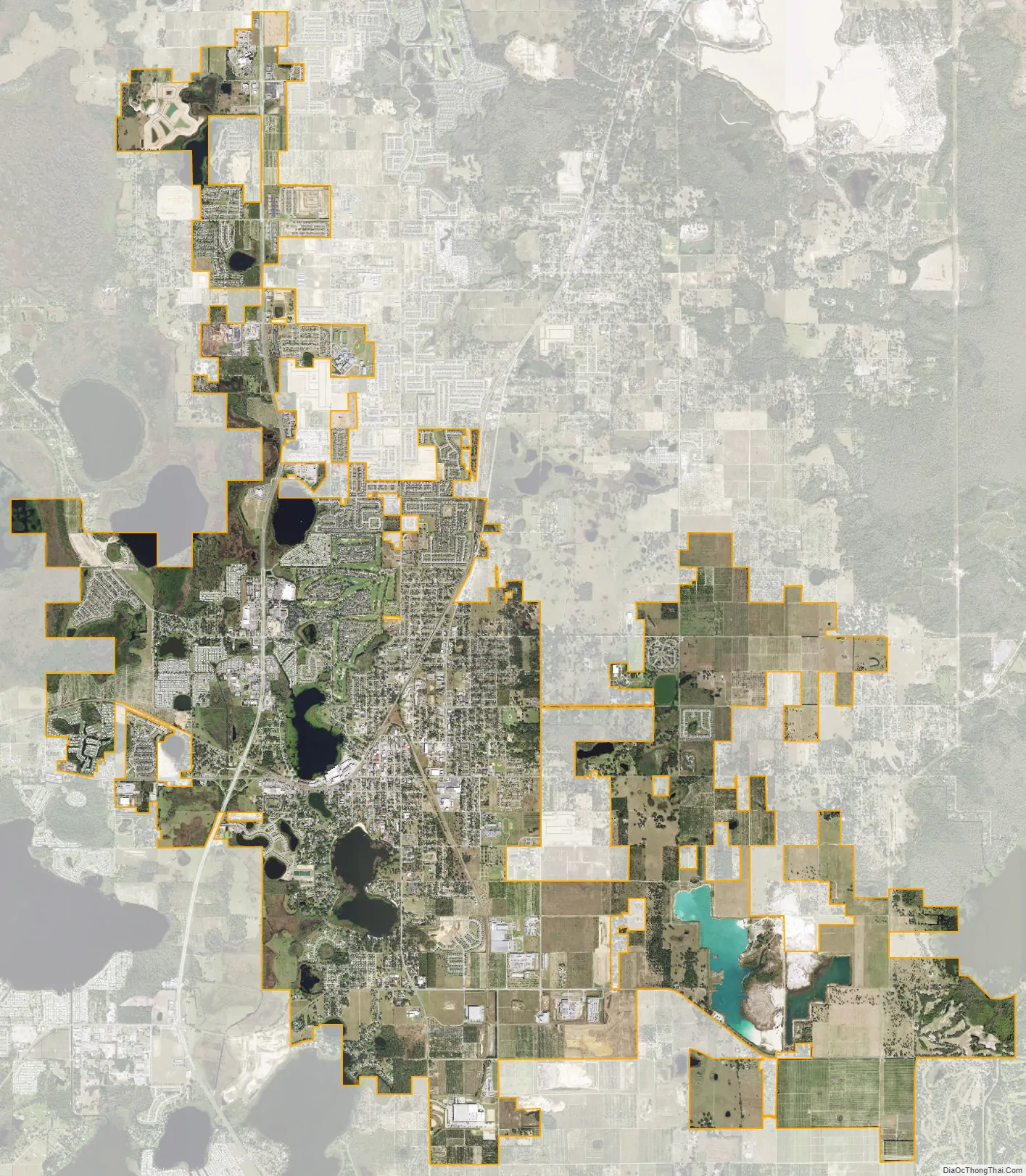
Haines City city Satellite Map
Geography
Haines City is located within the Central Florida Highlands area of the Atlantic coastal plain, part of the Lake Wales Ridge, a sandy terrain consisting of a low ridge of gently rolling hills rising from the coastal flatlands.
According to the United States Census Bureau, the city has a total area of 19.8 square miles (51 km), of which 8.3 square miles (21 km) is land and 0.6 square miles (1.6 km), 7.27% of the total, is water.
Haines City is located in the humid subtropical zone as designated by (Köppen climate classification: Cfa). The porous white sands and open terrain create the often hot and dry climate that parts of interior Florida near the Lakes Wales sand ridge is known for.
See also
Map of Florida State and its subdivision:- Alachua
- Baker
- Bay
- Bradford
- Brevard
- Broward
- Calhoun
- Charlotte
- Citrus
- Clay
- Collier
- Columbia
- Desoto
- Dixie
- Duval
- Escambia
- Flagler
- Franklin
- Gadsden
- Gilchrist
- Glades
- Gulf
- Hamilton
- Hardee
- Hendry
- Hernando
- Highlands
- Hillsborough
- Holmes
- Indian River
- Jackson
- Jefferson
- Lafayette
- Lake
- Lee
- Leon
- Levy
- Liberty
- Madison
- Manatee
- Marion
- Martin
- Miami-Dade
- Monroe
- Nassau
- Okaloosa
- Okeechobee
- Orange
- Osceola
- Palm Beach
- Pasco
- Pinellas
- Polk
- Putnam
- Saint Johns
- Saint Lucie
- Santa Rosa
- Sarasota
- Seminole
- Sumter
- Suwannee
- Taylor
- Union
- Volusia
- Wakulla
- Walton
- Washington
- Alabama
- Alaska
- Arizona
- Arkansas
- California
- Colorado
- Connecticut
- Delaware
- District of Columbia
- Florida
- Georgia
- Hawaii
- Idaho
- Illinois
- Indiana
- Iowa
- Kansas
- Kentucky
- Louisiana
- Maine
- Maryland
- Massachusetts
- Michigan
- Minnesota
- Mississippi
- Missouri
- Montana
- Nebraska
- Nevada
- New Hampshire
- New Jersey
- New Mexico
- New York
- North Carolina
- North Dakota
- Ohio
- Oklahoma
- Oregon
- Pennsylvania
- Rhode Island
- South Carolina
- South Dakota
- Tennessee
- Texas
- Utah
- Vermont
- Virginia
- Washington
- West Virginia
- Wisconsin
- Wyoming