Rolette County is a county in the U.S. state of North Dakota. As of the 2020 census, the population was 12,187. Its county seat is Rolla.
| Name: | Rolette County |
|---|---|
| FIPS code: | 38-079 |
| State: | North Dakota |
| Founded: | 1873 |
| Named for: | Joseph Rolette |
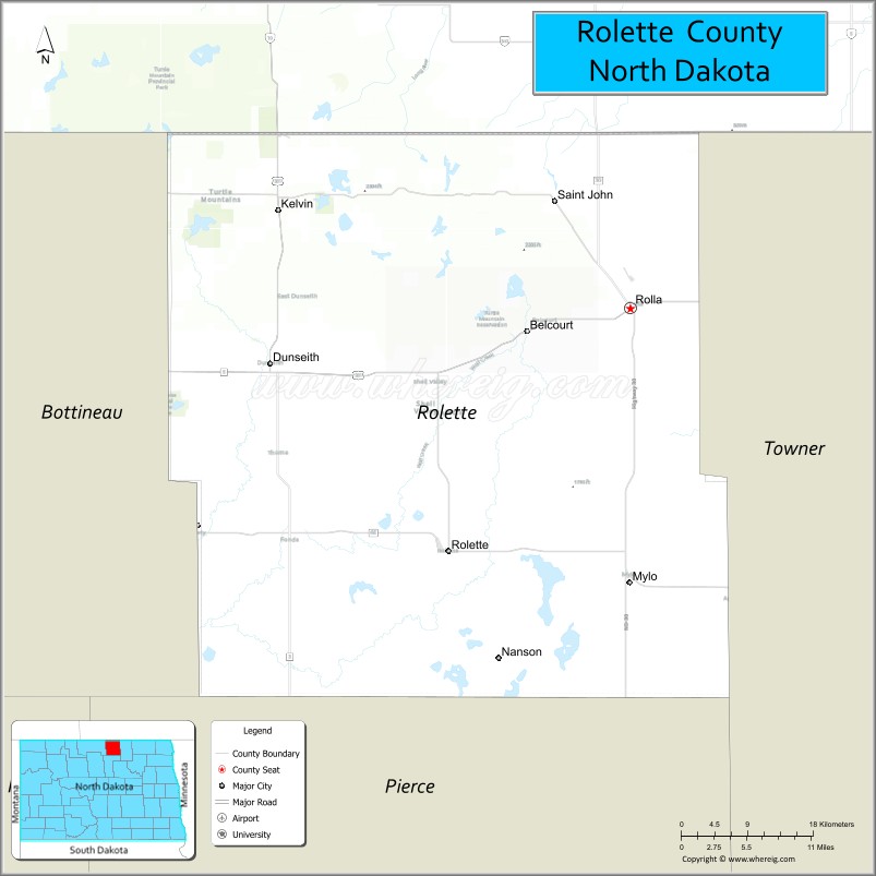
| Seat: | Rolla |
| Total Area: | 939 sq mi (2,430 km²) |
| Land Area: | 903 sq mi (2,340 km²) |
| Total Population: | 12,187 |
| Population Density: | 13/sq mi (5.0/km²) |
| Time zone: | UTC−6 (Central) |
| Summer Time Zone (DST): | UTC−5 (CDT) |
| Website: | www.rolettecounty.com |
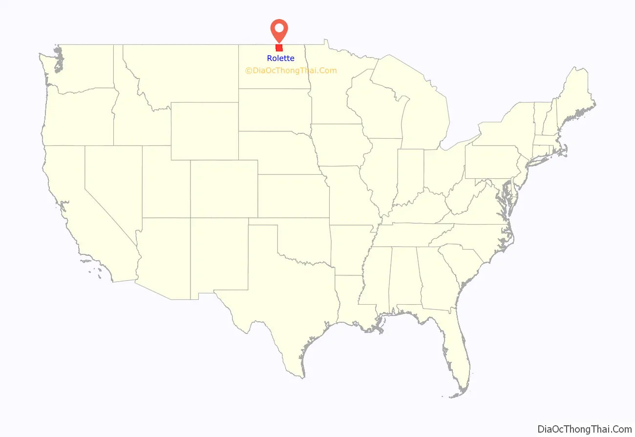
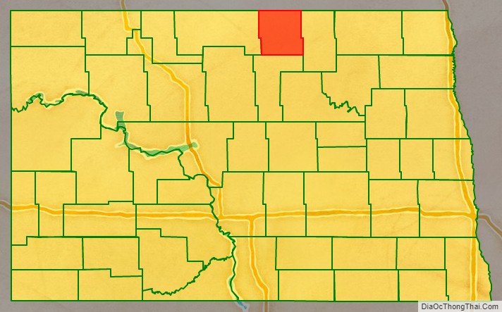
Rolette County location map. Where is Rolette County?
History
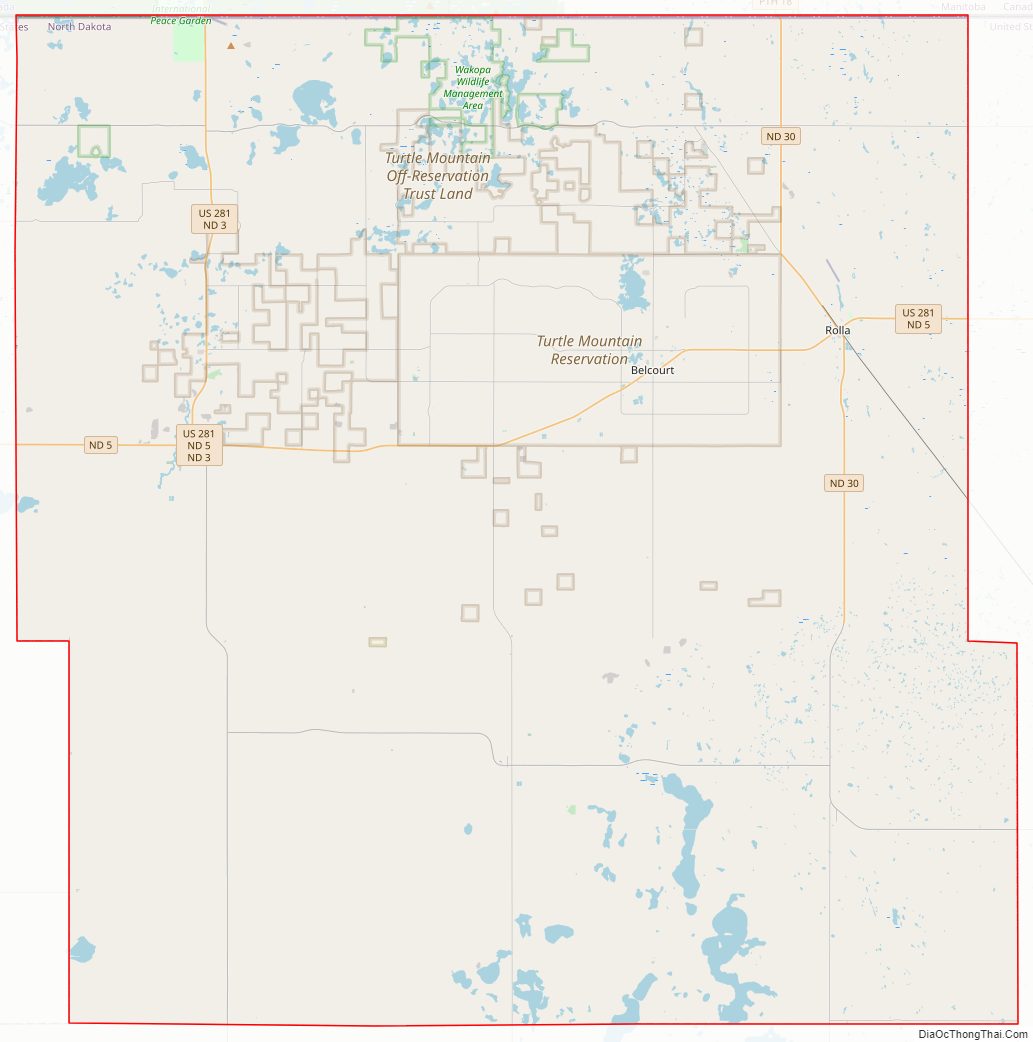
The Dakota Territory legislature created the county on January 4, 1873, with territory partitioned from Buffalo County. It was not organized at that date, and was not attached to another county for judicial or administrative purposes. It was named for Joseph Rolette Jr., a fur trader and political figure from Pembina. The county government was effected on October 14, 1884, with Dunseith as the county seat. In 1885 the county seat was assigned to Saint John, and in 1889 it was assigned to Rolla.
The county boundaries were adjusted in 1883 and in 1887. It has retained its present boundary configuration since 1887.
The International Peace Garden is located in the northwest corner of the county along the Canada–United States border with Manitoba.
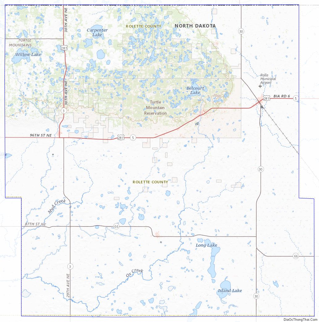
Rolette County Road Map
Geography
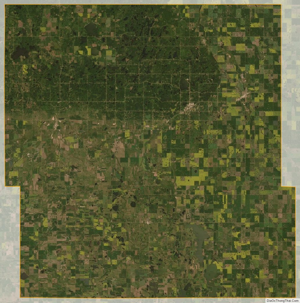
Rolette County lies on the northern border of North Dakota with Canada. Gimby Creek and Wakopa Creek flow into the county from Canada. The terrain consists of dry rolling hills in the south, and more verdant low hills in the north and northwest, dotted with lakes and ponds.
Part of the Turtle Mountain plateau lies in the northwestern part of the county. The terrain slopes to the south and east; its highest point is its northwest corner, at 2,195′ (669m) ASL.
The Turtle Mountain Indian Reservation is in the northeast section of Rolette County.
Rolette County has an area of 939 square miles (2,430 km), of which 903 square miles (2,340 km) is land and 36 square miles (93 km) (3.9%) is water.
Major highways
- U.S. Highway 281
- North Dakota Highway 3
- North Dakota Highway 5
- North Dakota Highway 30
- North Dakota Highway 43
- North Dakota Highway 66
Adjacent counties and rural municipalities
- Municipality of Boissevain-Morton, Manitoba – northwest
- Municipality of Killarney-Turtle Mountain, Manitoba – northeast
- Towner County – east
- Pierce County – south
- Bottineau County – west
Protected areas
- Lords Lake National Wildlife Refuge (part)
- Rabb Lake National Wildlife Refuge
- School Section Lake National Wildlife Refuge
- Willow Lake National Wildlife Refuge
Lakes
- Belcourt Lake
- Bigham Lake
- Bymes Lake
- Carpenters Lake
- Coon Lake
- Gatten Lake
- Girl Lake
- Gordon Lake
- Hartley Lake (part)
- Horseshoe Lake
- Island Lake
- Lagerquist Lake
- Lake Upsilon
- Little Gurr Lake
- Long Lake
- Lords Lake (part)
- Mill Lake
- Mill Lake
- Rabb Lake
- School Section Lake
- Schutte Lake
- South Messier Lake (part)
- Ducker Lake
- Twin Lake
- Twin Lakes (part)
- Willow Lake
Rolette County Topographic Map
Rolette County Satellite Map
Rolette County Outline Map