| Name: | Russell County |
|---|---|
| FIPS code: | 20-167 |
| State: | Kansas |
| Founded: | February 26, 1867 |
| Named for: | Avra P. Russell |
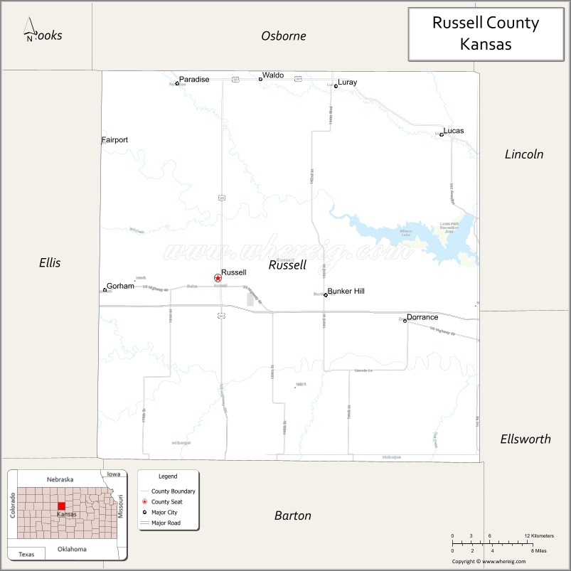
| Seat: | Russell |
| Largest city: | Russell |
| Total Area: | 899 sq mi (2,330 km²) |
| Land Area: | 886 sq mi (2,290 km²) |
| Total Population: | 6,691 |
| Population Density: | 7.4/sq mi (2.9/km²) |
| Time zone: | UTC−6 (Central) |
| Summer Time Zone (DST): | UTC−5 (CDT) |
| Website: | County Website |
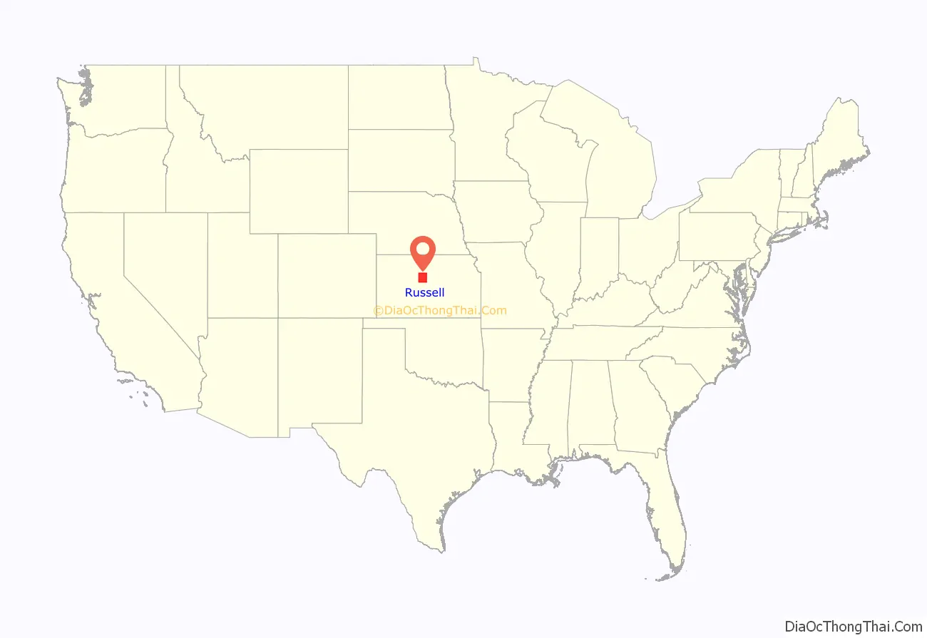
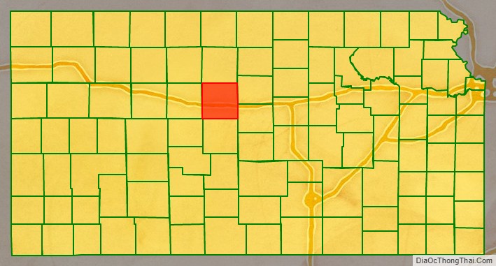
Russell County location map. Where is Russell County?
History
Early history
For many millennia, the Great Plains of North America was inhabited by nomadic Native Americans. From the 16th century to 18th century, the Kingdom of France claimed ownership of large parts of North America. In 1762, after the French and Indian War, France secretly ceded New France to Spain, per the Treaty of Fontainebleau.
19th century
In 1802, Spain returned most of the land to France, but keeping title to about 7,500 square miles. In 1803, most of the land for modern day Kansas was acquired by the United States from France as part of the Louisiana Purchase.
In 1854, the Kansas Territory was organized, then in 1861 Kansas became the 34th U.S. state. In 1867, Russell County was established.
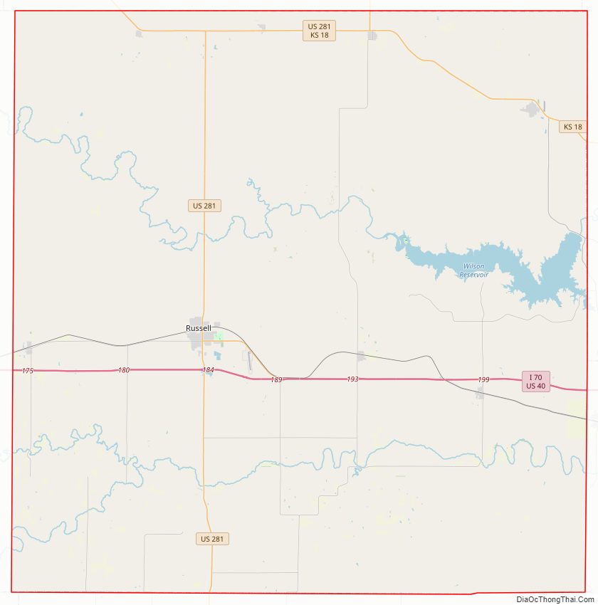
Russell County Road Map
Geography
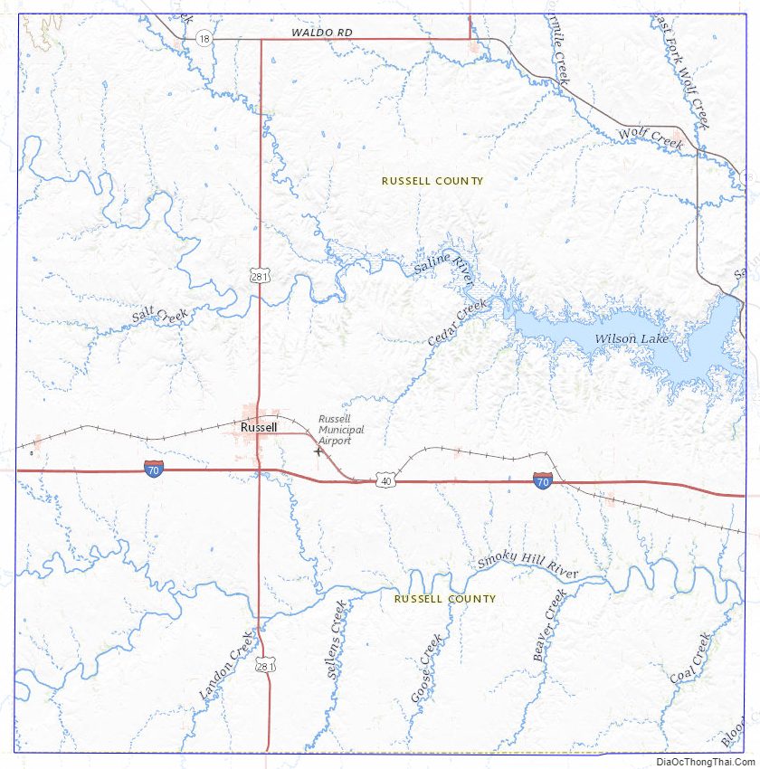
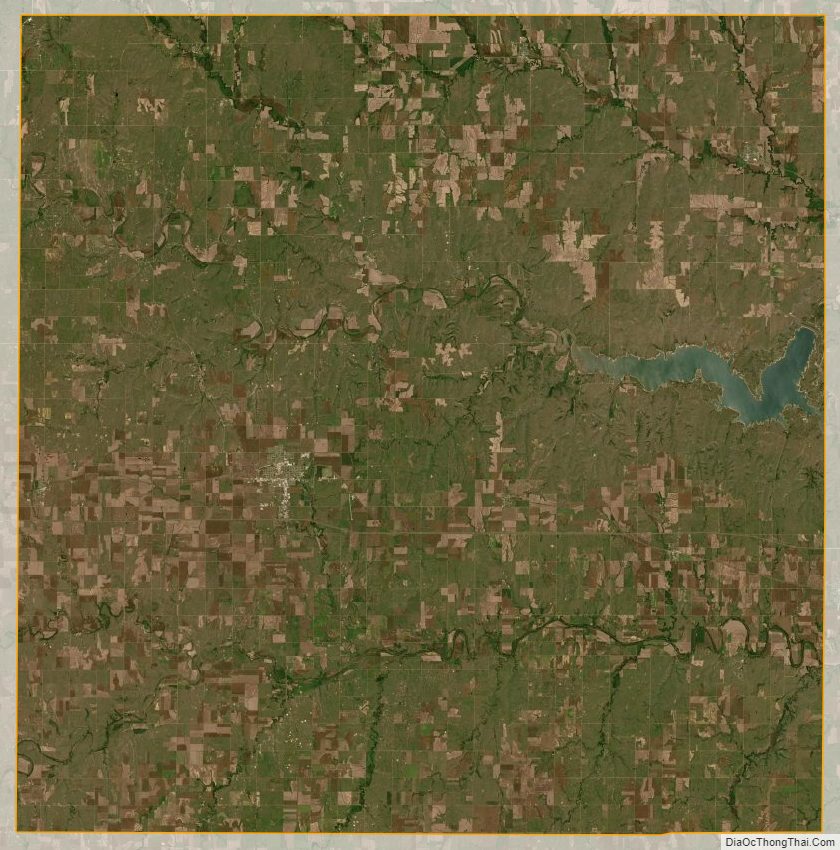
According to the U.S. Census Bureau, the county has a total area of 899 square miles (2,330 km), of which 886 square miles (2,290 km) is land and 13 square miles (34 km) (1.5%) is water.
Adjacent counties
- Osborne County (north)
- Lincoln County (east)
- Ellsworth County (southeast)
- Barton County (south)
- Rush County (southwest)
- Ellis County (west)
Major highways
The city of Russell is the junction of Interstate 70, a major east-west highway through the Midwestern United States, and U.S. Route 281, which begins at the Canada–US border in North Dakota and ends at the Mexico–US border in Texas. I-70 also runs through Gorham on the western end of the county and Dorrance on the eastern end. Hays is 27 miles (43 km) west of Russell and Salina is 67 miles (108 km) east of Russell.
Further along I-70, Russell is approximately 250 miles (400 km) west of Kansas City, Missouri and 360 miles (580 km) east of Denver, Colorado.
K-18, a major east-west state highway in northern Kansas, enters from Osborne County to the west and runs through Paradise before joining up with US 281 through Waldo. US 281 and K-18 split again at the city limits of Luray, and K-18 continues east through Lucas and into Lincoln County. US 281 heads north into Osborne County.
South of I-70, US 281 heads into Barton County and towards the city of Great Bend.
Russell County Topographic Map
Russell County Satellite Map
Russell County Outline Map