Russell is the most populous city in and the county seat of Russell County, Kansas, United States. As of the 2020 census, the population of the city was 4,401.
| Name: | Russell city |
|---|---|
| LSAD Code: | 25 |
| LSAD Description: | city (suffix) |
| State: | Kansas |
| County: | Russell County |
| Founded: | 1871 |
| Incorporated: | 1872 |
| Elevation: | 1,828 ft (557 m) |
| Total Area: | 4.82 sq mi (12.47 km²) |
| Land Area: | 4.82 sq mi (12.47 km²) |
| Water Area: | 0.00 sq mi (0.00 km²) |
| Total Population: | 4,401 |
| Population Density: | 910/sq mi (350/km²) |
| ZIP code: | 67665 |
| Area code: | 785 |
| FIPS code: | 2061825 |
| Website: | russellcity.org |
Online Interactive Map
Click on ![]() to view map in "full screen" mode.
to view map in "full screen" mode.
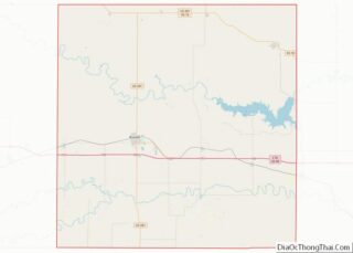
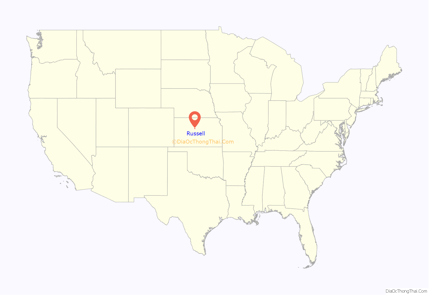
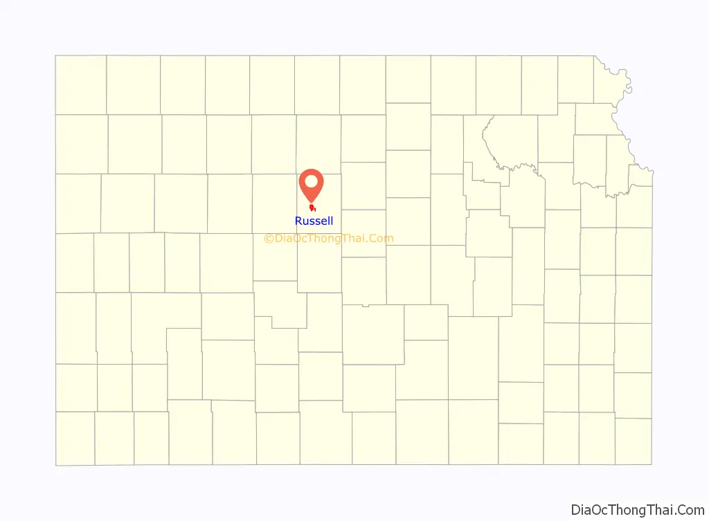
Russell location map. Where is Russell city?
History
In 1865, the Butterfield Overland Despatch established a short-lived station named Fossil Creek Station along its route from Atchison, Kansas to Denver near the site of modern Russell. In 1867, the Kansas Pacific Railway reached the area and built its own station, also named Fossil Creek, later just Fossil, north of the Butterfield station. That same year, the Kansas Legislature established the surrounding area as Russell County. In 1871, colonists from Ripon, Wisconsin established a permanent settlement at Fossil Station, renaming it Russell after the county. Russell was incorporated and named the provisional county seat in 1872, and, after a two-year dispute with neighboring Bunker Hill, it became the permanent county seat in 1874. In 1876, Volga Germans, mostly from the area around Saratov and Samara in Russia, began settling in and around Russell.
The first discovery oil well in Russell County was drilled west of Russell in 1923. An oil boom ensued and lasted through the 1930s, attracting settlers from Oklahoma and Texas. Petroleum production became a staple of the local economy.
Russell came to national attention in the mid-1990s as the hometown of U.S. Senators Bob Dole and Arlen Specter when both men campaigned for the U.S. presidency. Dole was born and raised in Russell, and it remained his official place of residence throughout his political career.
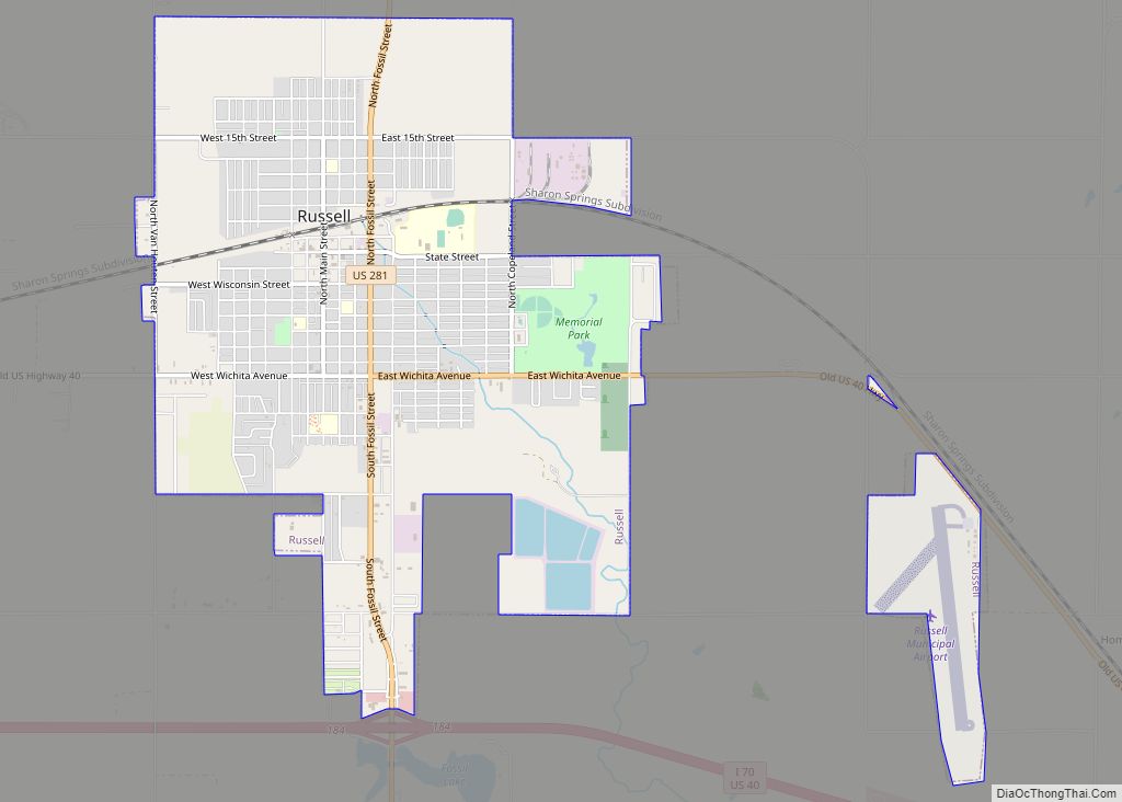
Russell Road Map
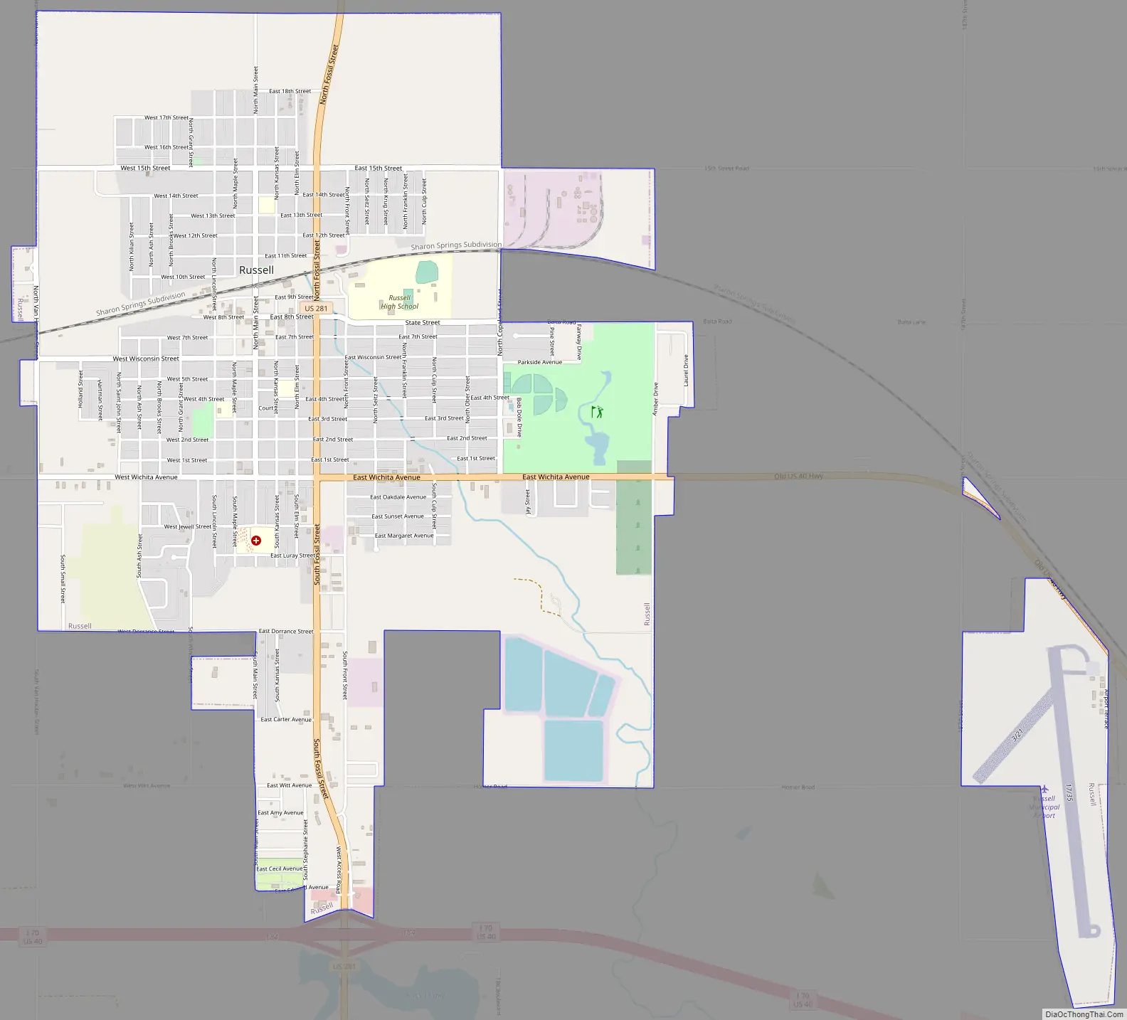
Russell city Satellite Map
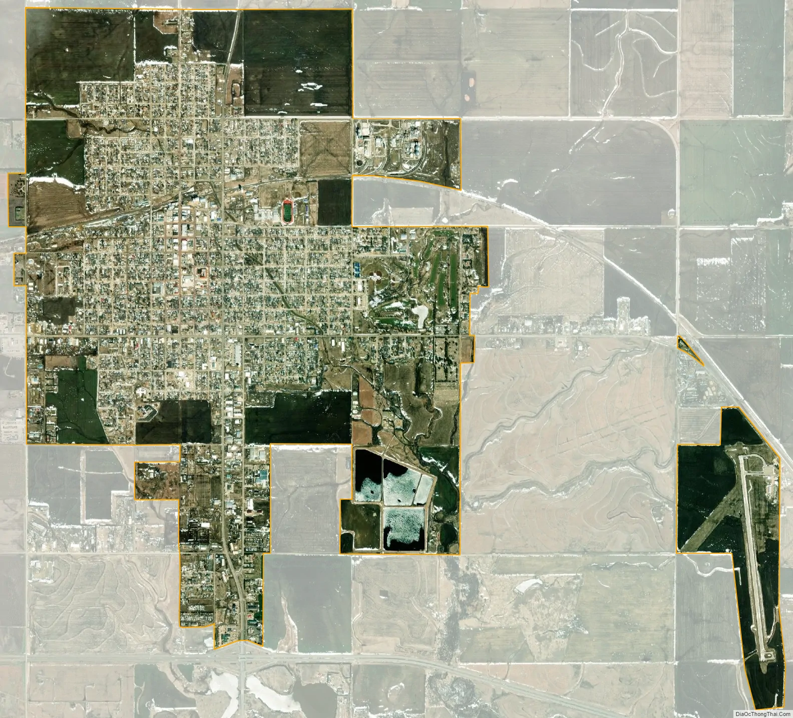
Geography
Russell is located at 38°53′23″N 98°51′26″W / 38.88972°N 98.85722°W / 38.88972; -98.85722 (38.889807, -98.857113) at an elevation of 1,828 feet (557 m). Located in north-central Kansas at the intersection of Interstate 70 and U.S. Route 281, Russell is approximately 113 miles (182 km) northwest of Wichita, 231 miles (372 km) west of Kansas City, and 336 miles (541 km) east-southeast of Denver.
The city lies in the Smoky Hills region of the Great Plains approximately 5 miles (8.0 km) south of the Saline River and 8 miles (13 km) north of the Smoky Hill River. Fossil Creek, a tributary of the Smoky Hill River, passes immediately south of the city where it has been dammed to form a small reservoir, Fossil Lake.
According to the United States Census Bureau, the city has a total area of 4.87 square miles (12.61 km), all of it land.
Climate
Russell has a humid continental climate (Köppen Dfa), with hot, humid summers and cold, dry winters. On average, January is the coldest month, and July is both the hottest month and the wettest month.
The average temperature in Russell is 55 °F (12.5 °C). Over the course of a year, temperatures range from an average low of 18 °F (−8 °C) in January to an average high of 92 °F (33 °C) in July. The high temperature reaches or exceeds 90 °F (32 °C) an average of 59 days a year and reaches or exceeds 100 °F (38 °C) an average of 11 days a year. The minimum temperature falls below the freezing point 32 °F (0 °C) an average of 126 days a year. The hottest temperature recorded in Russell was 114 °F (46 °C) in 1980; the coldest temperature recorded was -24 °F (-31 °C) in 1989.
The city is located near the eastern edge of western Kansas’s semi-arid steppe climate (Köppen BSk), and precipitation is sometimes scarce. The city receives 26 inches (660 mm) of precipitation during an average year with the largest share being received from May through August. The average relative humidity is 64%. There are, on average, 86 days of measurable precipitation each year. Annual snowfall averages 20 inches (51 cm). Measurable snowfall occurs an average of 12 days a year with at least an inch of snow being received on seven of those days. Snow depth of at least an inch occurs an average of 26 days a year. Typically, the first fall freeze occurs by the second week of October, and the last spring freeze occurs by the last week of April.
See also
Map of Kansas State and its subdivision:- Allen
- Anderson
- Atchison
- Barber
- Barton
- Bourbon
- Brown
- Butler
- Chase
- Chautauqua
- Cherokee
- Cheyenne
- Clark
- Clay
- Cloud
- Coffey
- Comanche
- Cowley
- Crawford
- Decatur
- Dickinson
- Doniphan
- Douglas
- Edwards
- Elk
- Ellis
- Ellsworth
- Finney
- Ford
- Franklin
- Geary
- Gove
- Graham
- Grant
- Gray
- Greeley
- Greenwood
- Hamilton
- Harper
- Harvey
- Haskell
- Hodgeman
- Jackson
- Jefferson
- Jewell
- Johnson
- Kearny
- Kingman
- Kiowa
- Labette
- Lane
- Leavenworth
- Lincoln
- Linn
- Logan
- Lyon
- Marion
- Marshall
- McPherson
- Meade
- Miami
- Mitchell
- Montgomery
- Morris
- Morton
- Nemaha
- Neosho
- Ness
- Norton
- Osage
- Osborne
- Ottawa
- Pawnee
- Phillips
- Pottawatomie
- Pratt
- Rawlins
- Reno
- Republic
- Rice
- Riley
- Rooks
- Rush
- Russell
- Saline
- Scott
- Sedgwick
- Seward
- Shawnee
- Sheridan
- Sherman
- Smith
- Stafford
- Stanton
- Stevens
- Sumner
- Thomas
- Trego
- Wabaunsee
- Wallace
- Washington
- Wichita
- Wilson
- Woodson
- Wyandotte
- Alabama
- Alaska
- Arizona
- Arkansas
- California
- Colorado
- Connecticut
- Delaware
- District of Columbia
- Florida
- Georgia
- Hawaii
- Idaho
- Illinois
- Indiana
- Iowa
- Kansas
- Kentucky
- Louisiana
- Maine
- Maryland
- Massachusetts
- Michigan
- Minnesota
- Mississippi
- Missouri
- Montana
- Nebraska
- Nevada
- New Hampshire
- New Jersey
- New Mexico
- New York
- North Carolina
- North Dakota
- Ohio
- Oklahoma
- Oregon
- Pennsylvania
- Rhode Island
- South Carolina
- South Dakota
- Tennessee
- Texas
- Utah
- Vermont
- Virginia
- Washington
- West Virginia
- Wisconsin
- Wyoming