Union County is the southernmost county in the U.S. state of South Dakota. As of the 2020 United States Census, the population was 16,811, making it the 13th most populous county in South Dakota. Its county seat has been Elk Point since April 30, 1865. Originally named Cole County, its name was changed to Union on January 7, 1864, because of Civil War sentiment.
Union County is part of the Sioux City, IA–NE–SD Metropolitan Statistical Area. The Progressive Farmer rated Union County second in the “2006 Best Place to Live Survey” in the U.S., because “its schools are good, its towns neat and its people friendly”.
| Name: | Union County |
|---|---|
| FIPS code: | 46-127 |
| State: | South Dakota |
| Founded: | April 10, 1862 |
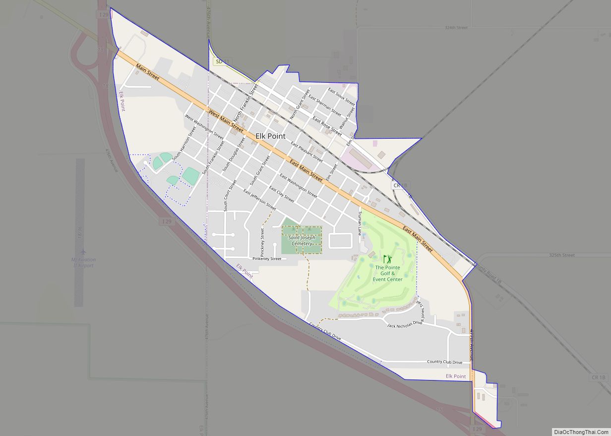
| Seat: | Elk Point |
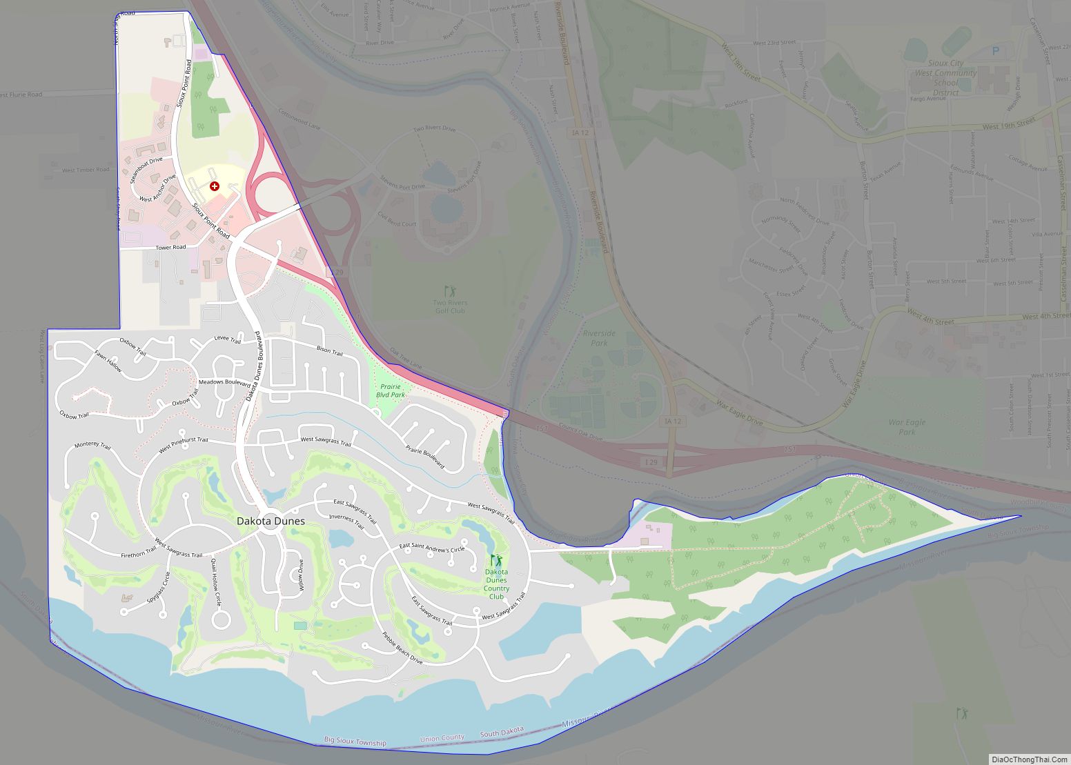
| Largest city: | Dakota Dunes |
| Total Area: | 467 sq mi (1,210 km²) |
| Land Area: | 461 sq mi (1,190 km²) |
| Total Population: | 16,811 |
| Population Density: | 36/sq mi (14/km²) |
| Time zone: | UTC−6 (Central) |
| Summer Time Zone (DST): | UTC−5 (CDT) |
| Website: | unioncountysd.org |
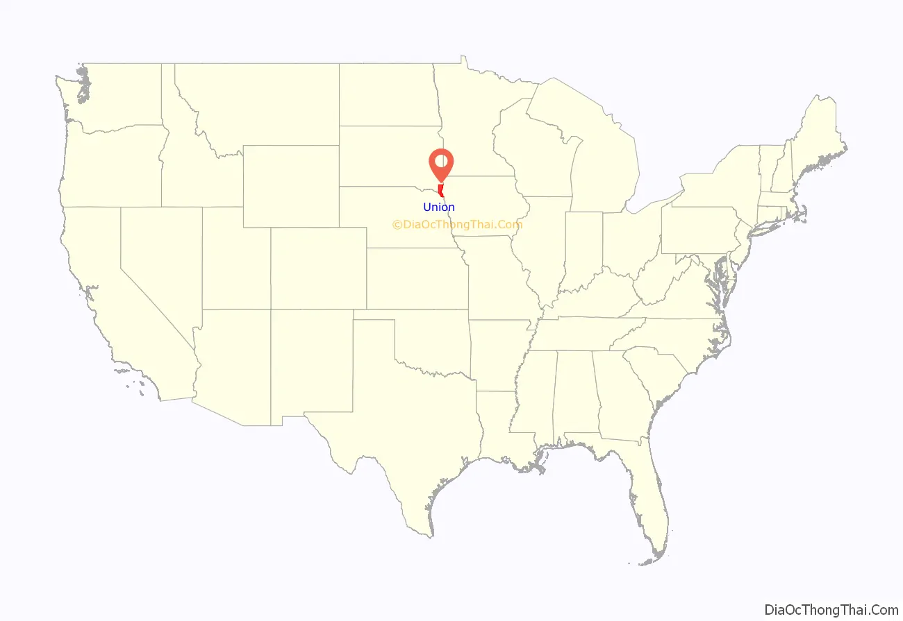
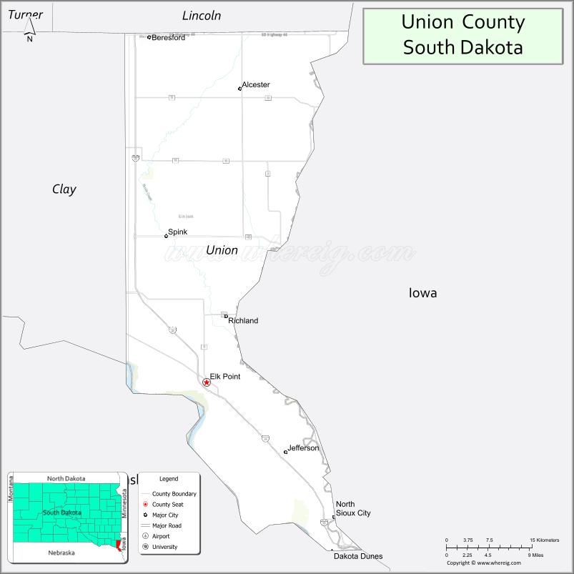
Union County location map. Where is Union County?
History
Founded on April 10, 1862, as Cole County, it was renamed Union County on January 7, 1864, when its boundaries were changed to encompass land previously part of neighboring Lincoln County. The county seat was moved from Richland to Elk Point on April 30, 1865.
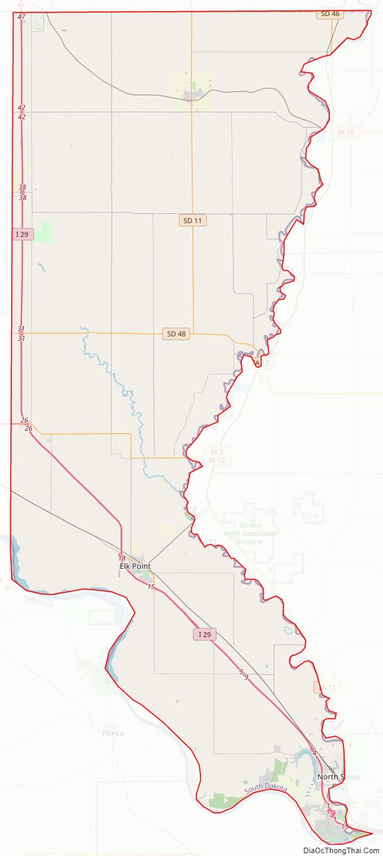
Union County Road Map
Geography
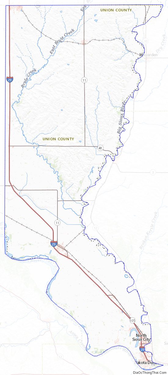
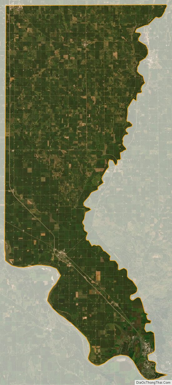
Union County lies on the southeast corner of South Dakota. Its east boundary line abuts the west boundary line of the State of Iowa (across the Big Sioux River), and its south/southwest boundary line abuts the north boundary line of the State of Nebraska (across the Missouri River). The Brule Creek flows southeasterly across the central part of the county, emptying into the Big Sioux. The county terrain consists of rolling hills, devoted to agriculture except around built-up areas. The terrain slopes to the south and east; its highest point is near its northwest corner, at 1,509′ (460m) ASL. The county has a total area of 467 square miles (1,210 km), of which 461 square miles (1,190 km) is land and 6.6 square miles (17 km) (1.4%) is water. It is the fifth-smallest county in South Dakota by area.
Major highways
- Interstate 29
- South Dakota Highway 11
- South Dakota Highway 19
- South Dakota Highway 46
- South Dakota Highway 48
- South Dakota Highway 50
- South Dakota Highway 105
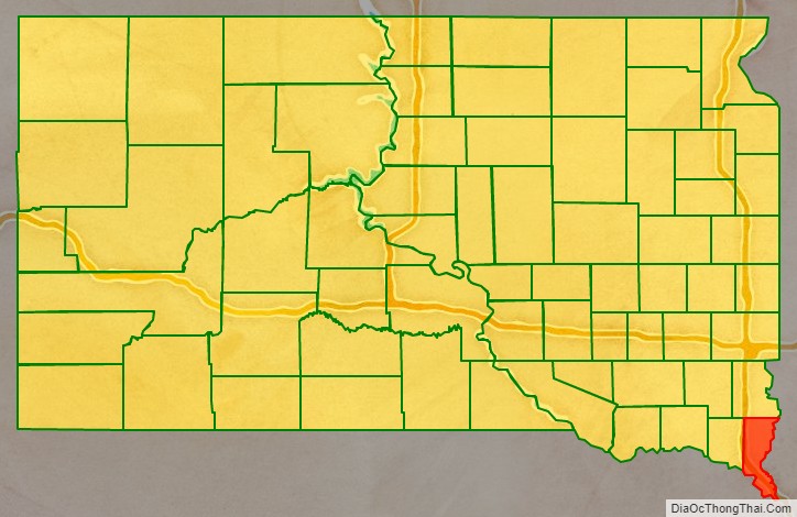
Adjacent counties
- Lincoln County to the north
- Sioux County, Iowa to the northeast
- Plymouth County, Iowa to the east
- Woodbury County, Iowa to the southeast
- Dakota County, Nebraska to the south
- Dixon County, Nebraska to the southwest
- Clay County to the west
Protected areas
- Adams Homestead and State Nature Preserve
- Bent River State Game Production Area
- Bolton State Game Production Area
- Cusick State game Production Area
- Cut Off Bend State Game Production Area
- Missouri National Recreational River (partial)
- Petry-Conway State Game Production Area
- Petry/Harmelink State Game Production Area
- Ryan State Game Production Area
- Union Grove State Park
- Warren Wilderness State Game Production Area
Lakes
- Burbank Lake (partial)
- McCook Lake
- Mud Lake
Union County Topographic Map
Union County Satellite Map
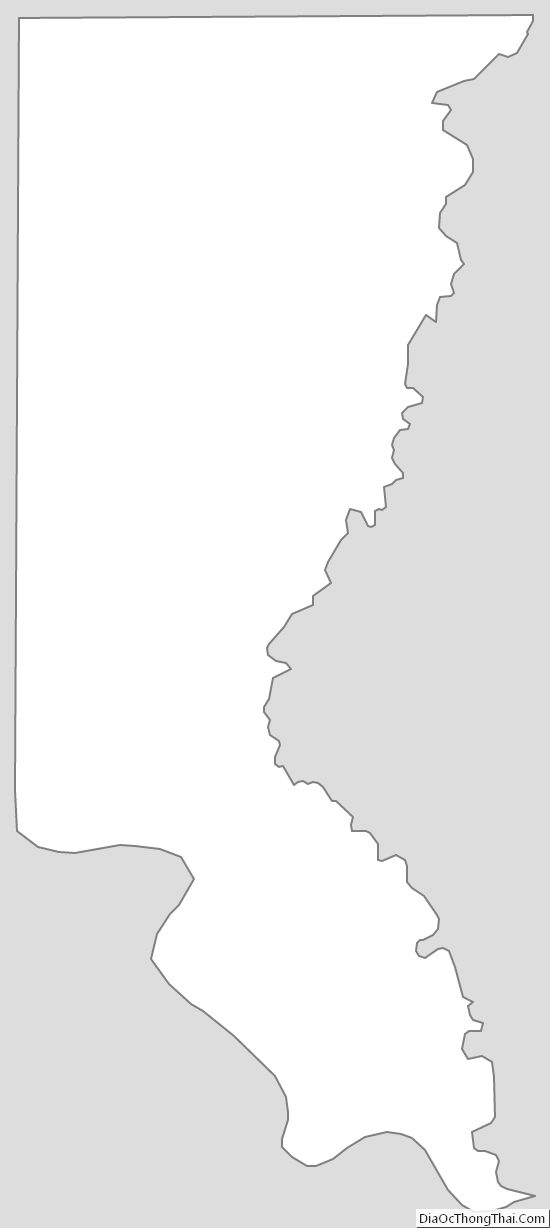
Union County Outline Map