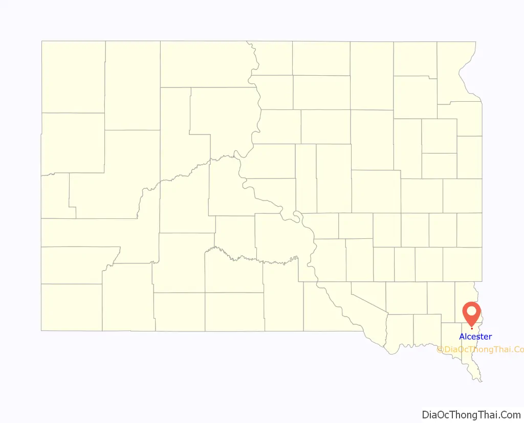
Alcester is a city in northern Union County, South Dakota, United States. It is part of the Sioux City, IA–NE–SD Metropolitan Statistical Area. The population was 820 at the 2020 census.
| Name: | Alcester city |
|---|---|
| LSAD Code: | 25 |
| LSAD Description: | city (suffix) |
| State: | South Dakota |
| County: | Union County |
| Incorporated: | 1893 |
| Elevation: | 1,375 ft (419 m) |
| Total Area: | 0.73 sq mi (1.90 km²) |
| Land Area: | 0.73 sq mi (1.90 km²) |
| Water Area: | 0.00 sq mi (0.00 km²) |
| Total Population: | 820 |
| Population Density: | 1,117.17/sq mi (431.39/km²) |
| ZIP code: | 57001 |
| Area code: | 605 |
| FIPS code: | 4600700 |
| GNISfeature ID: | 1253607 |
| Website: | www.alcestersd.org |
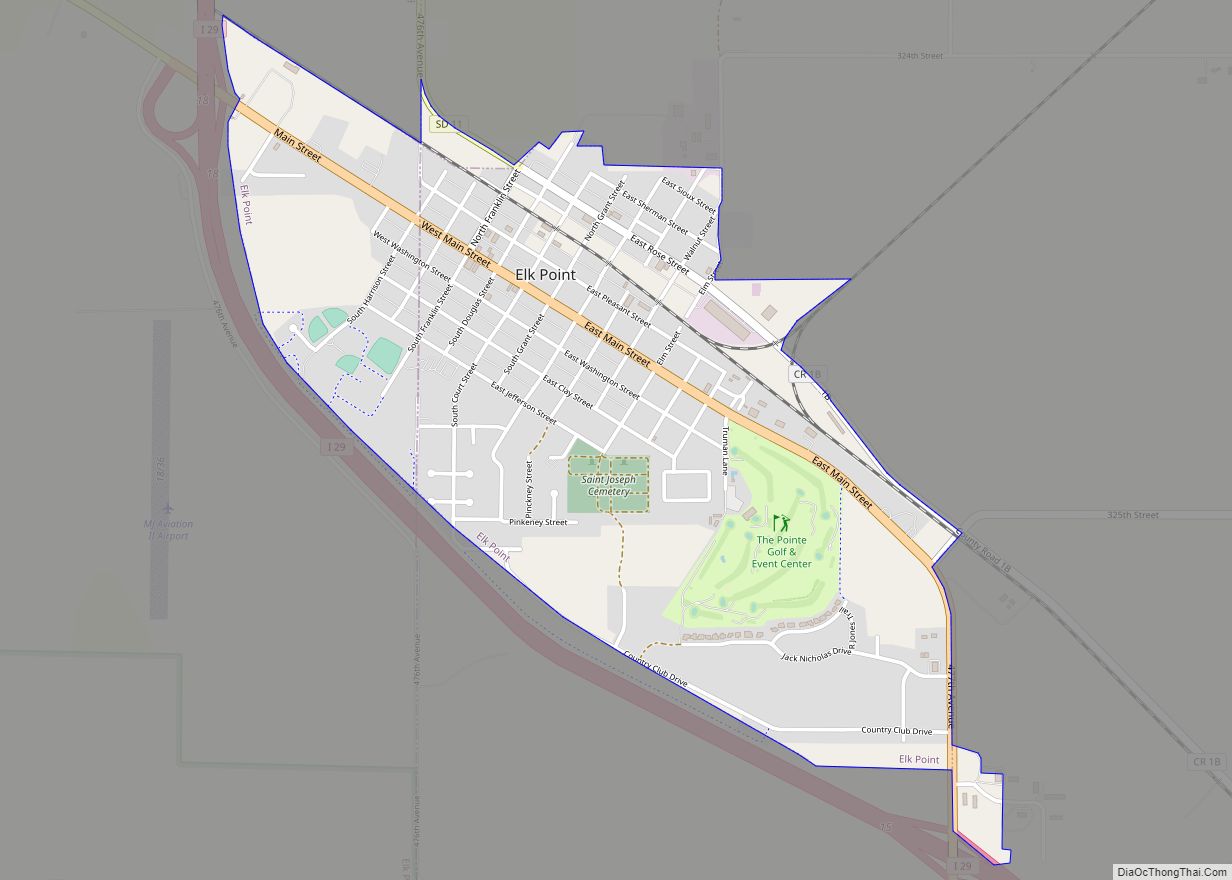
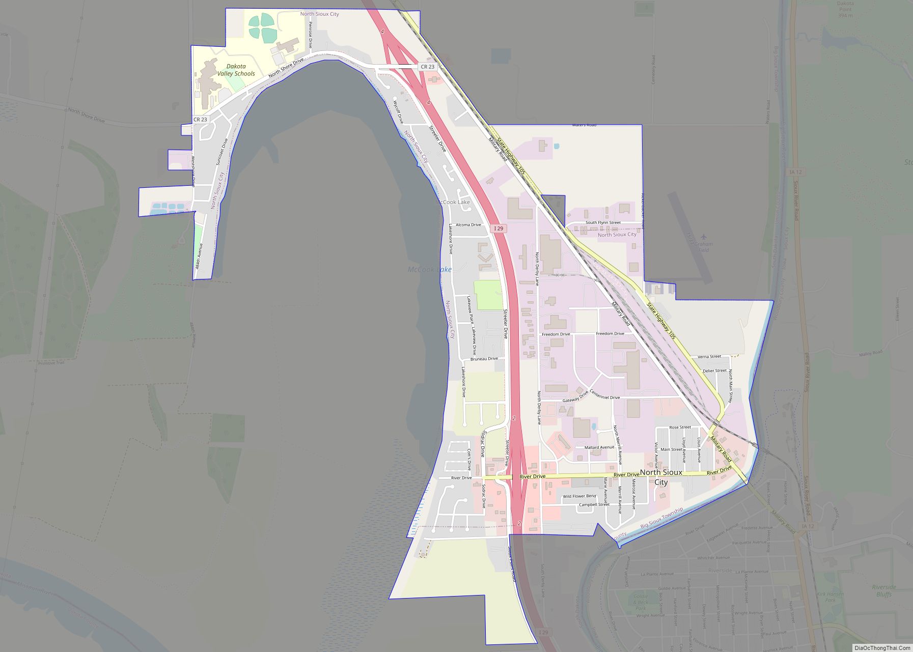
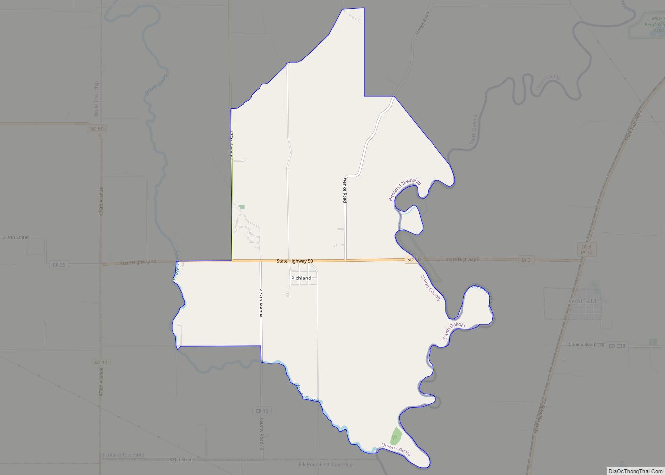
Online Interactive Map
Click on ![]() to view map in "full screen" mode.
to view map in "full screen" mode.
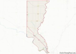
Alcester location map. Where is Alcester city?

History
Alcester was platted in 1879; early variant names were Linia and Irene. The present name honors Colonel Alcester of the British army. The weekly Alcester Union newspaper began publishing in 1888.
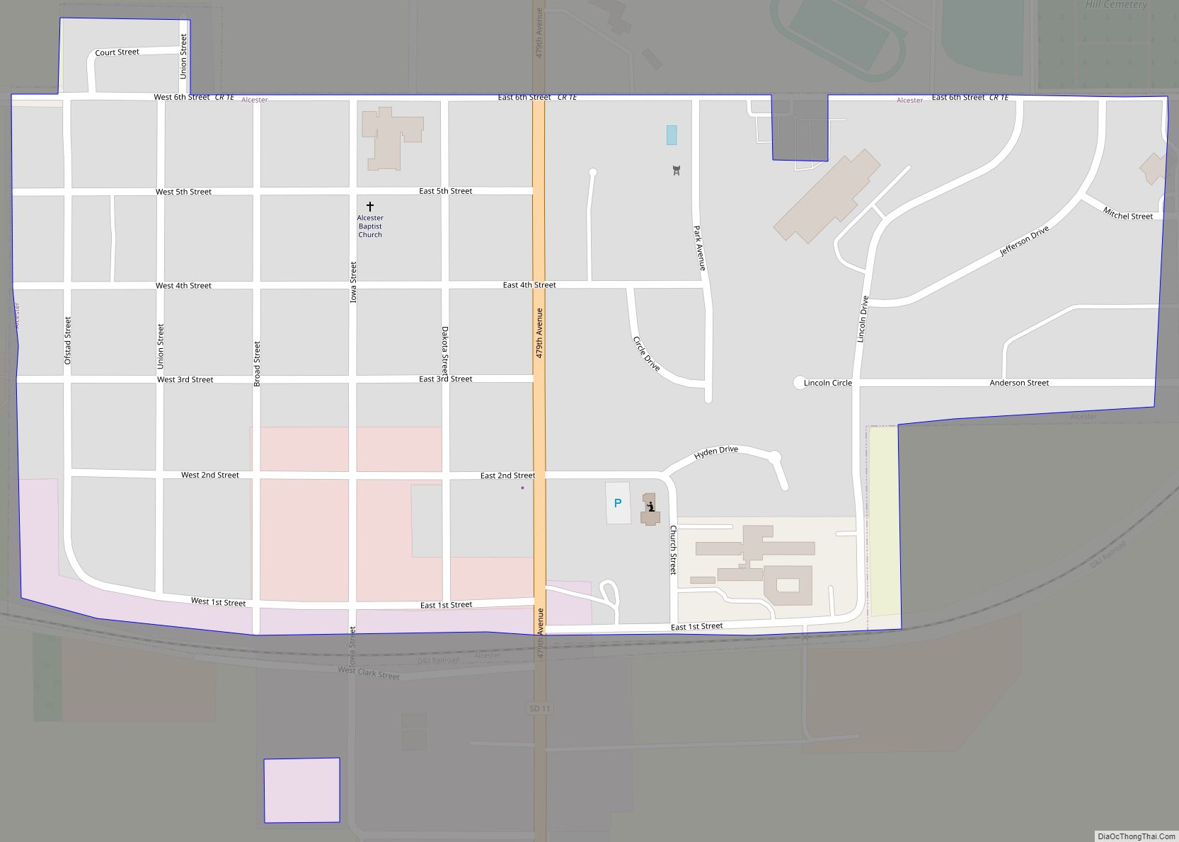
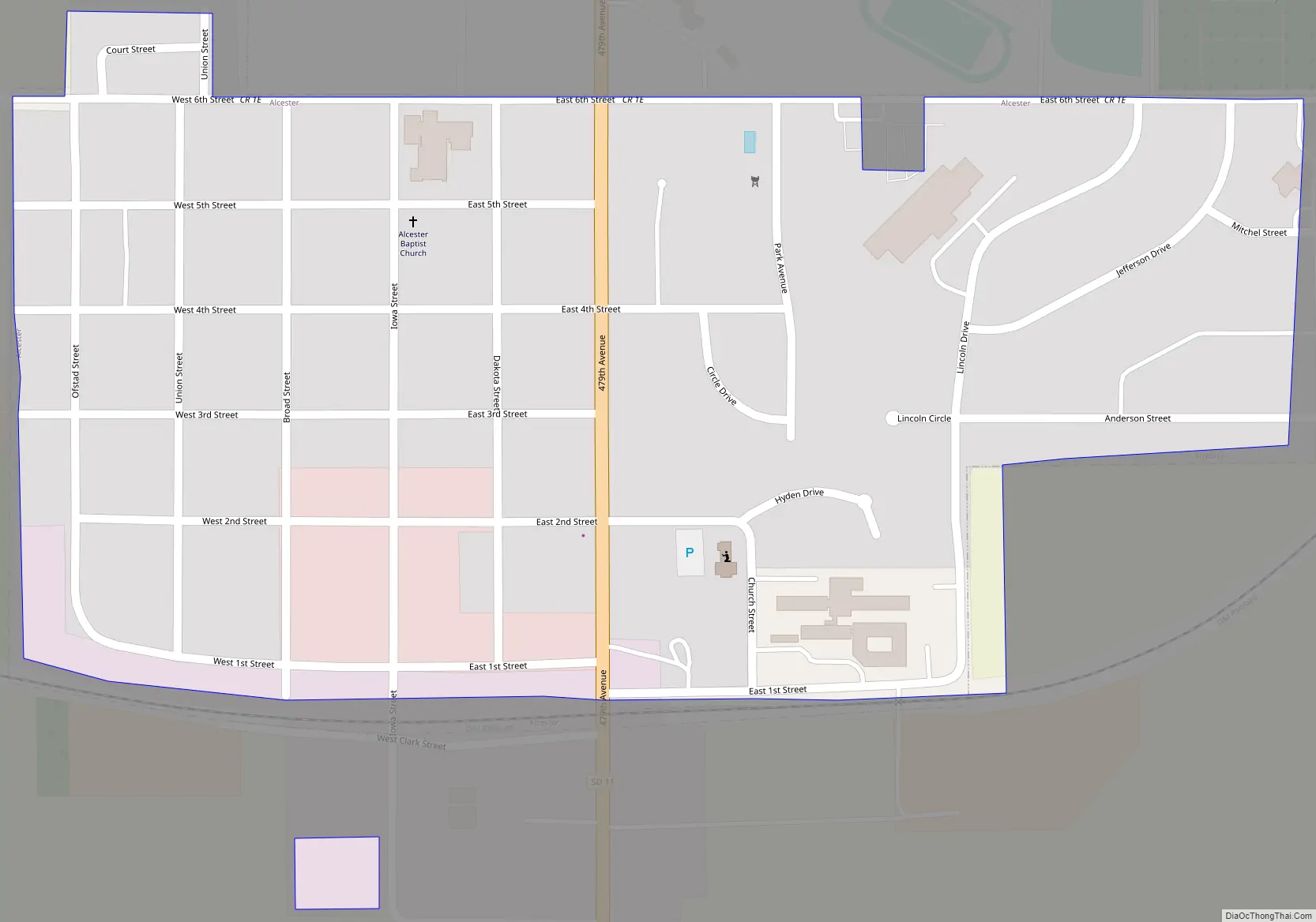
Alcester Road Map
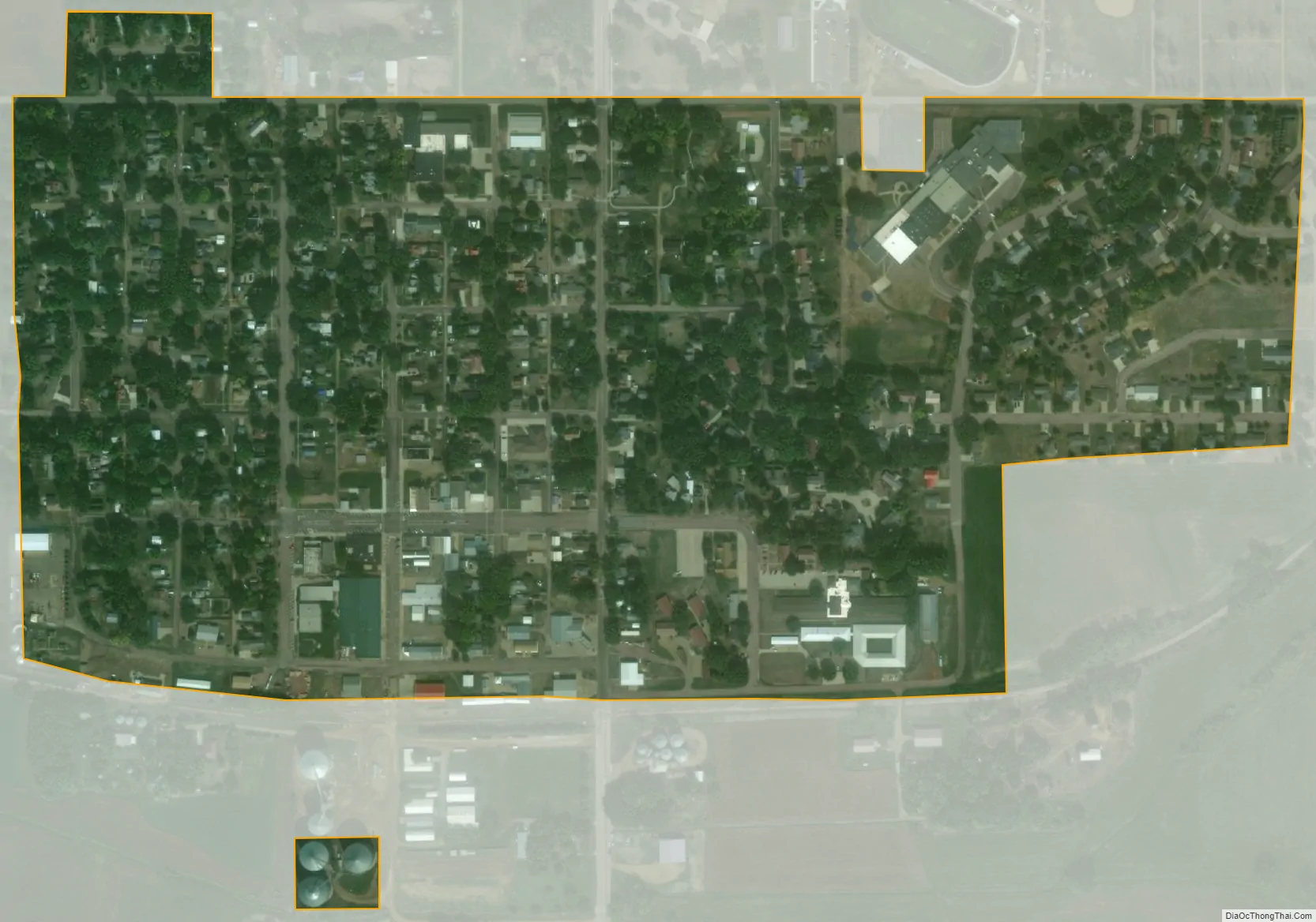
Alcester city Satellite Map
Geography
According to the United States Census Bureau, the city has a total area of 0.33 square miles (0.85 km), all land.
See also
Map of South Dakota State and its subdivision:- Aurora
- Beadle
- Bennett
- Bon Homme
- Brookings
- Brown
- Brule
- Buffalo
- Butte
- Campbell
- Charles Mix
- Clark
- Clay
- Codington
- Corson
- Custer
- Davison
- Day
- Deuel
- Dewey
- Douglas
- Edmunds
- Fall River
- Faulk
- Grant
- Gregory
- Haakon
- Hamlin
- Hand
- Hanson
- Harding
- Hughes
- Hutchinson
- Hyde
- Jackson
- Jerauld
- Jones
- Kingsbury
- Lake
- Lawrence
- Lincoln
- Lyman
- Marshall
- McCook
- McPherson
- Meade
- Mellette
- Miner
- Minnehaha
- Moody
- Pennington
- Perkins
- Potter
- Roberts
- Sanborn
- Shannon
- Spink
- Stanley
- Sully
- Todd
- Tripp
- Turner
- Union
- Walworth
- Yankton
- Ziebach
- Alabama
- Alaska
- Arizona
- Arkansas
- California
- Colorado
- Connecticut
- Delaware
- District of Columbia
- Florida
- Georgia
- Hawaii
- Idaho
- Illinois
- Indiana
- Iowa
- Kansas
- Kentucky
- Louisiana
- Maine
- Maryland
- Massachusetts
- Michigan
- Minnesota
- Mississippi
- Missouri
- Montana
- Nebraska
- Nevada
- New Hampshire
- New Jersey
- New Mexico
- New York
- North Carolina
- North Dakota
- Ohio
- Oklahoma
- Oregon
- Pennsylvania
- Rhode Island
- South Carolina
- South Dakota
- Tennessee
- Texas
- Utah
- Vermont
- Virginia
- Washington
- West Virginia
- Wisconsin
- Wyoming