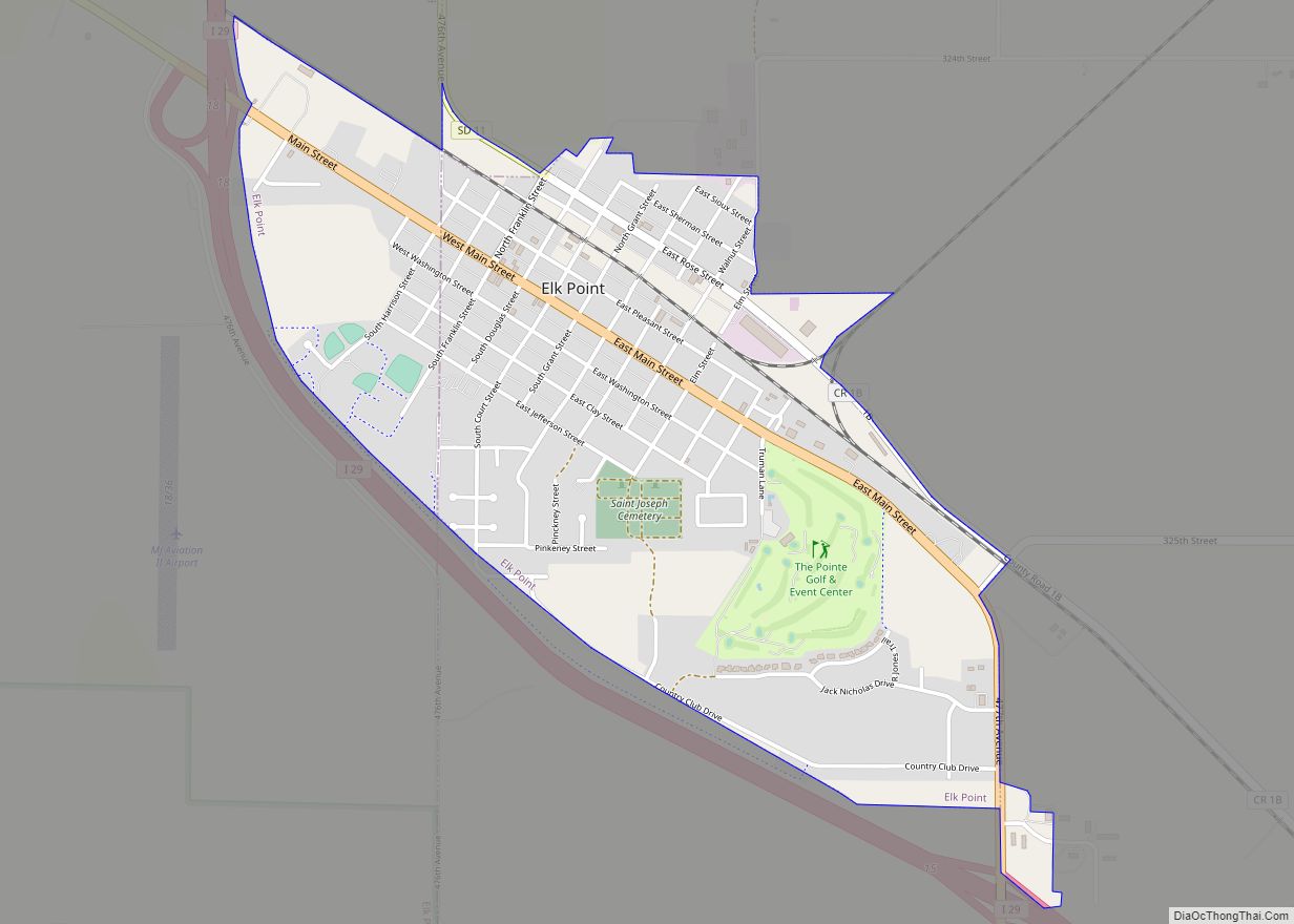
Elk Point is a city in and county seat of Union County, South Dakota, United States. The population was 2,149 as of the 2020 census.
| Name: | Elk Point city |
|---|---|
| LSAD Code: | 25 |
| LSAD Description: | city (suffix) |
| State: | South Dakota |
| County: | Union County |
| Incorporated: | 1873 |
| Elevation: | 1,125 ft (343 m) |
| Total Area: | 1.55 sq mi (4.01 km²) |
| Land Area: | 1.55 sq mi (4.01 km²) |
| Water Area: | 0.00 sq mi (0.00 km²) |
| Total Population: | 2,149 |
| Population Density: | 1,387.35/sq mi (535.79/km²) |
| ZIP code: | 57025 |
| Area code: | 605 |
| FIPS code: | 4618620 |
| GNISfeature ID: | 1254905 |
| Website: | www.elkpoint.org |
Online Interactive Map
Click on ![]() to view map in "full screen" mode.
to view map in "full screen" mode.
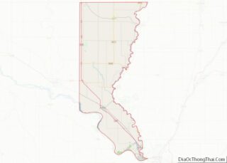
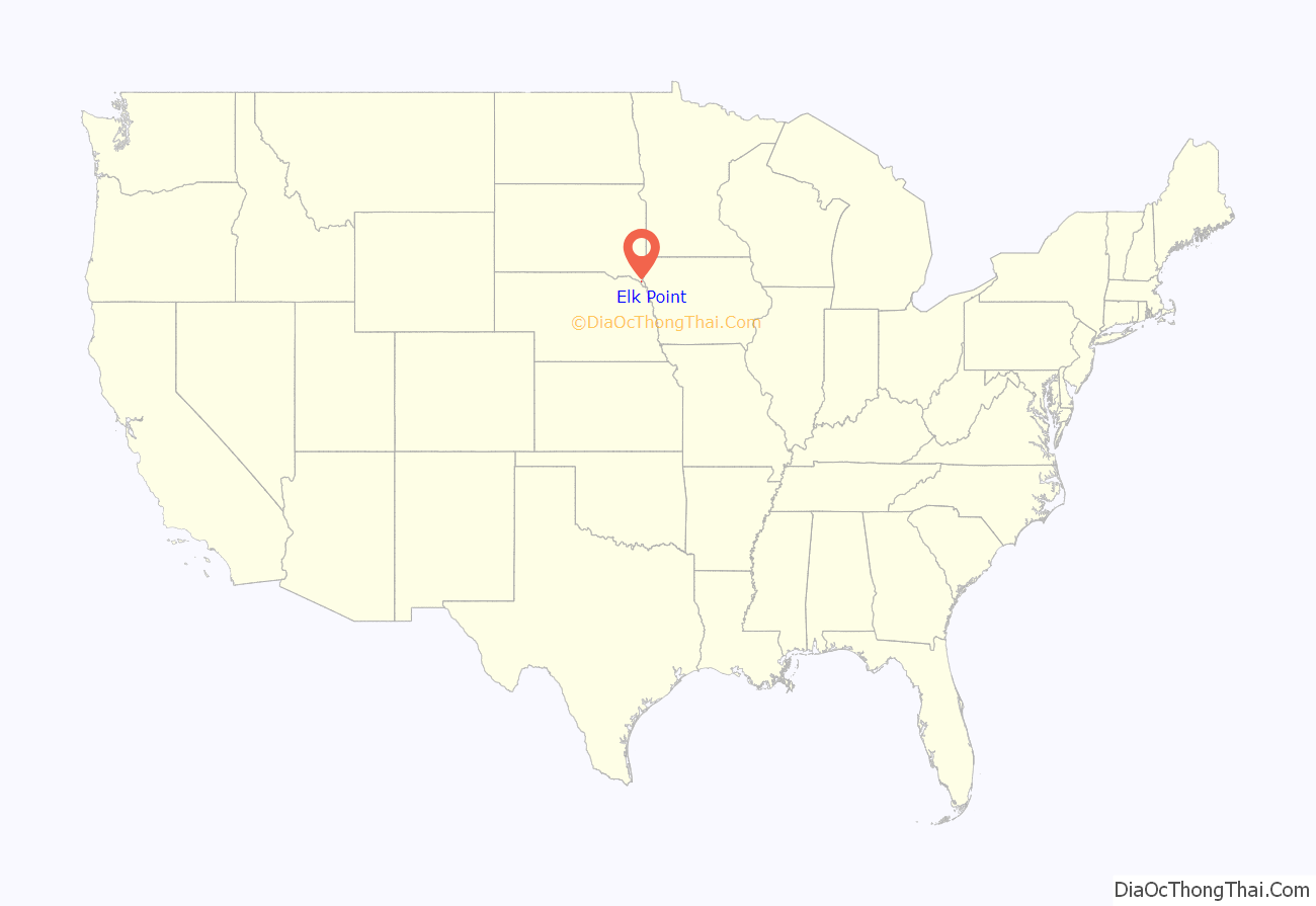
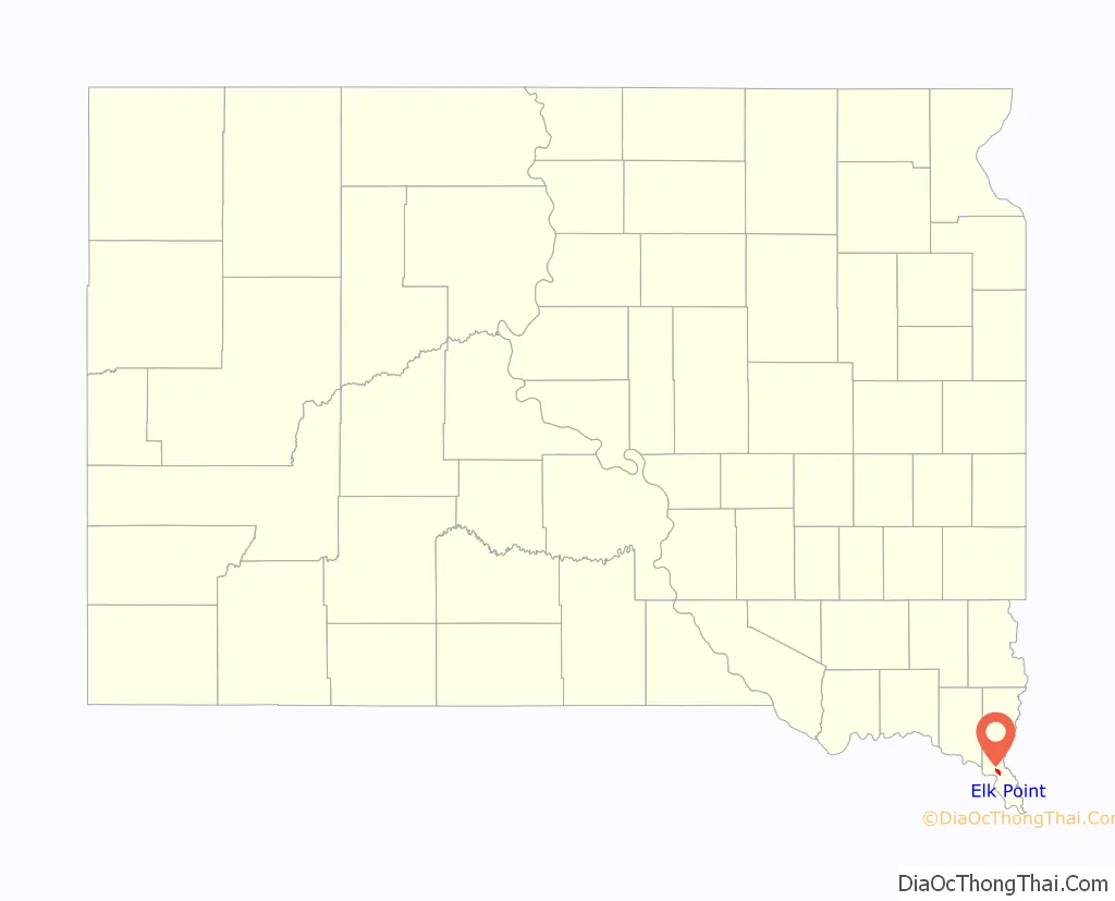
Elk Point location map. Where is Elk Point city?
History
The British established a Hudson’s Bay Company trading post in 1755 near present-day Elk Point. Elk Point was so named on account of the abundant elk in the area. The town was incorporated in 1873.
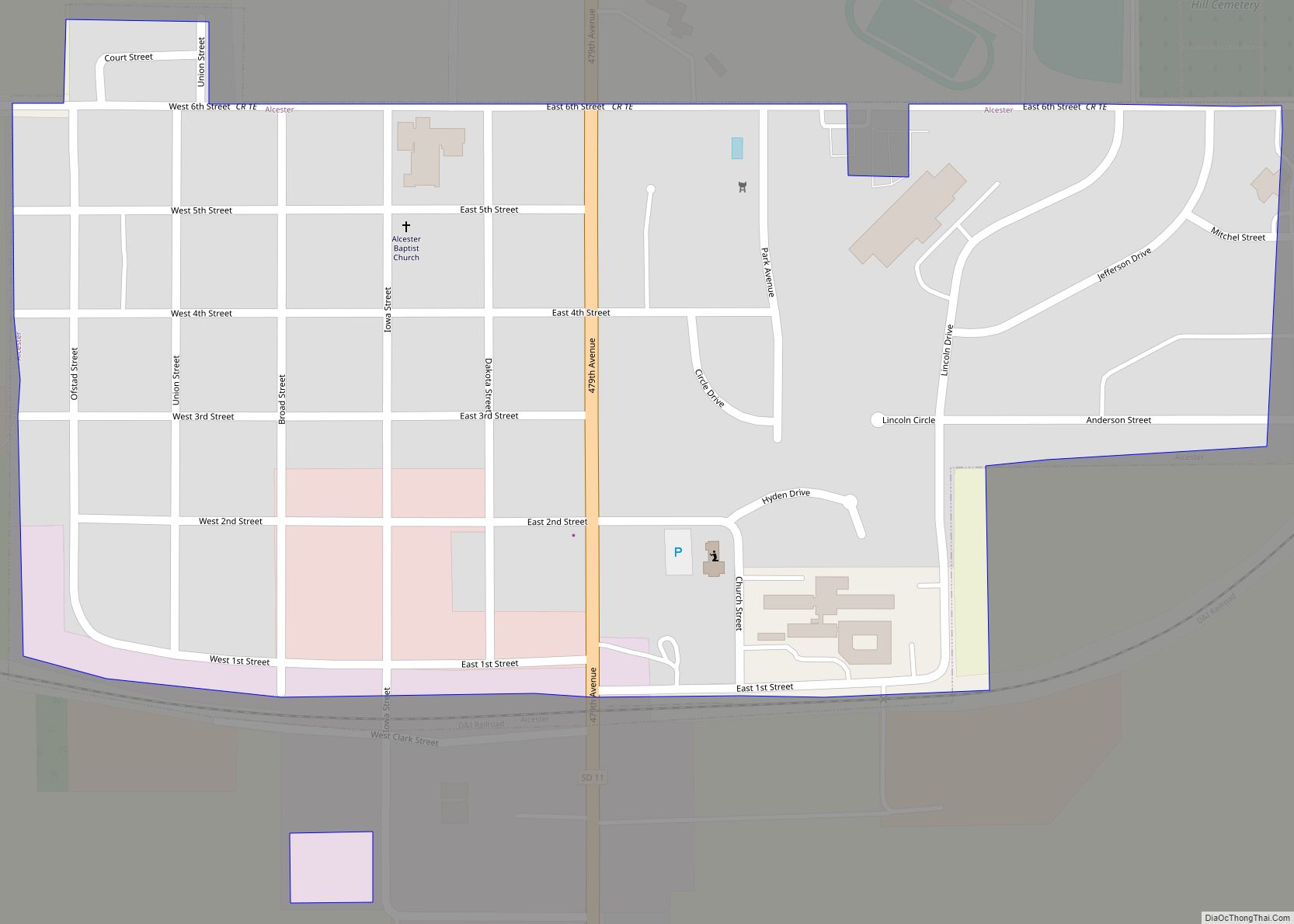
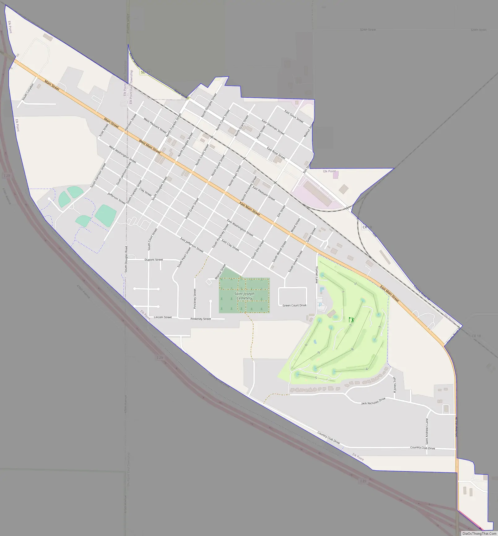
Elk Point Road Map
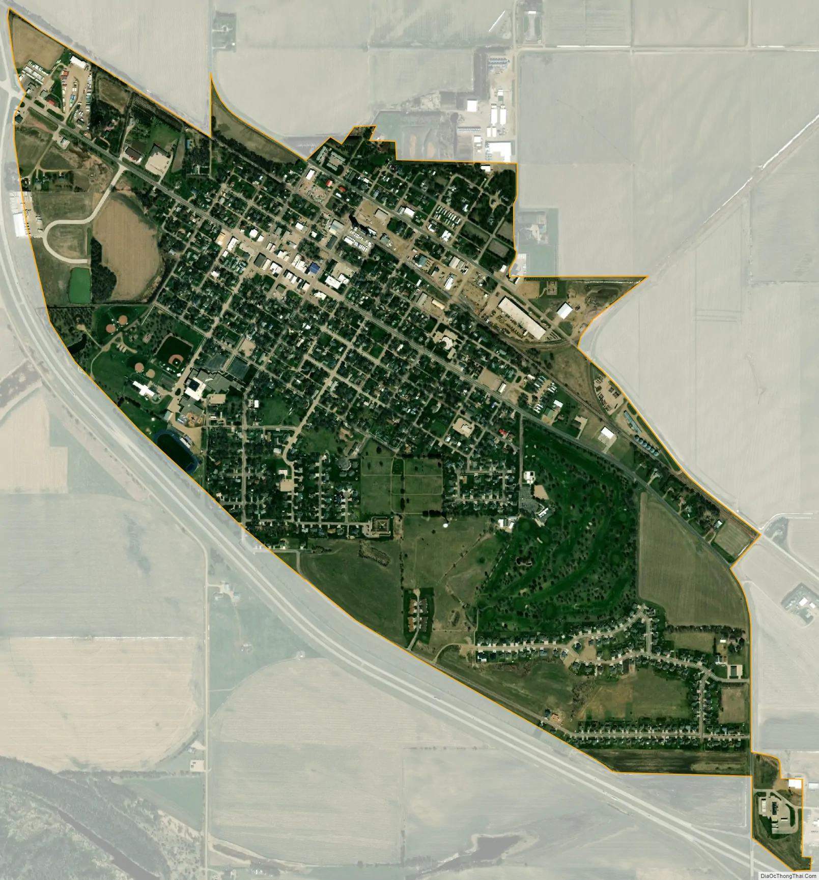
Elk Point city Satellite Map
Geography
Elk Point is located at 42°41′8″N 96°40′54″W / 42.68556°N 96.68167°W / 42.68556; -96.68167 (42.685512, −96.681789). According to the United States Census Bureau, the city has a total area of 1.36 square miles (3.52 km), all land.
Elk Point has been assigned the ZIP code 57025 and the FIPS place code 18620.
See also
Map of South Dakota State and its subdivision:- Aurora
- Beadle
- Bennett
- Bon Homme
- Brookings
- Brown
- Brule
- Buffalo
- Butte
- Campbell
- Charles Mix
- Clark
- Clay
- Codington
- Corson
- Custer
- Davison
- Day
- Deuel
- Dewey
- Douglas
- Edmunds
- Fall River
- Faulk
- Grant
- Gregory
- Haakon
- Hamlin
- Hand
- Hanson
- Harding
- Hughes
- Hutchinson
- Hyde
- Jackson
- Jerauld
- Jones
- Kingsbury
- Lake
- Lawrence
- Lincoln
- Lyman
- Marshall
- McCook
- McPherson
- Meade
- Mellette
- Miner
- Minnehaha
- Moody
- Pennington
- Perkins
- Potter
- Roberts
- Sanborn
- Shannon
- Spink
- Stanley
- Sully
- Todd
- Tripp
- Turner
- Union
- Walworth
- Yankton
- Ziebach
- Alabama
- Alaska
- Arizona
- Arkansas
- California
- Colorado
- Connecticut
- Delaware
- District of Columbia
- Florida
- Georgia
- Hawaii
- Idaho
- Illinois
- Indiana
- Iowa
- Kansas
- Kentucky
- Louisiana
- Maine
- Maryland
- Massachusetts
- Michigan
- Minnesota
- Mississippi
- Missouri
- Montana
- Nebraska
- Nevada
- New Hampshire
- New Jersey
- New Mexico
- New York
- North Carolina
- North Dakota
- Ohio
- Oklahoma
- Oregon
- Pennsylvania
- Rhode Island
- South Carolina
- South Dakota
- Tennessee
- Texas
- Utah
- Vermont
- Virginia
- Washington
- West Virginia
- Wisconsin
- Wyoming