Saratoga Springs is a city in Utah County, Utah, United States. The elevation is 4,505 feet. It is part of the Provo–Orem, Utah Metropolitan Statistical Area. The city is a relatively new development along the northwestern shores of Utah Lake. It was incorporated on December 31, 1997 and has been growing rapidly since then. The population was 37,696 at the 2020 Census. Saratoga Springs became a city in 2001.
| Name: | Saratoga Springs city |
|---|---|
| LSAD Code: | 25 |
| LSAD Description: | city (suffix) |
| State: | Utah |
| County: | Utah County |
| Incorporated: | December 31, 1997 |
| Elevation: | 4,505 ft (1,373 m) |
| Total Area: | 23.36 sq mi (60.49 km²) |
| Land Area: | 23.22 sq mi (60.15 km²) |
| Water Area: | 0.13 sq mi (0.34 km²) |
| Total Population: | 37,696 |
| Population Density: | 1,623.43/sq mi (626.7/km²) |
| ZIP code: | 84045 |
| Area code: | 385, 801 |
| FIPS code: | 4967825 |
| GNISfeature ID: | 1437677 |
| Website: | www.saratogaspringscity.com |
Online Interactive Map
Click on ![]() to view map in "full screen" mode.
to view map in "full screen" mode.
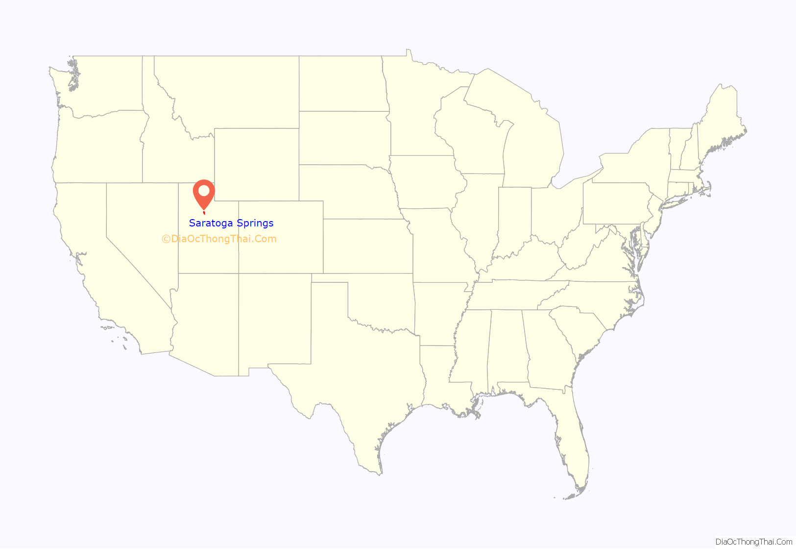
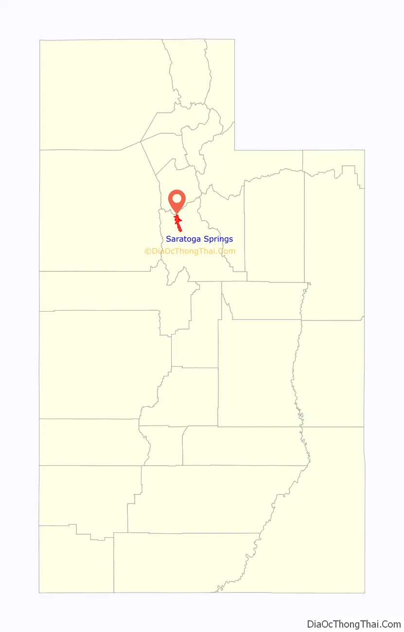
Saratoga Springs location map. Where is Saratoga Springs city?
History
The natural hot springs near the source of the Jordan River inspired early European-American settlers to create a resort known as Beck’s Saratoga Springs, named after the original New York resort and owner John Beck. The Beck family opened their resort in 1884 and used it as their residence. With several lodge buildings and amusement park facilities, the resort became a popular location for tourists and visitors. The original buildings were taken down. The resort area has now been redeveloped privately, containing an outdoor pool, clubhouse, bowery, and kitchen facility for groups and parties.
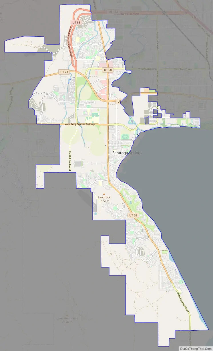
In the early 1990s, landowners began to investigate the possibilities of developing the land around the hot springs and in the foothill locations of the nearby Lake Mountains range. The Utah County land development ordinances were not sufficiently urban in nature, so several landowners sought incorporation as a town. Subsequently, Saratoga Springs incorporated in December 1997. Several hundred acres have since been annexed into the City limits and the City now occupies a somewhat narrow strip running north and south between Utah Lake and the Jordan River on the East and the foothills to the west. The City contains over twenty-one square miles and runs from Pelican Point on the west side of Utah Lake over eleven miles north to the Camp Williams US Army facility in the foothills between Utah and Salt Lake Counties.
On April 2, 2017, Thomas S. Monson, then president of the Church of Jesus Christ of Latter-day Saints, announced that an LDS temple would be built somewhere in Saratoga Springs.
On June 28, 2020, a wildfire known as the Knolls Fire forced the evacuation of around 13,000 people in 3,100 homes in Saratoga Springs.
Saratoga Springs Road Map
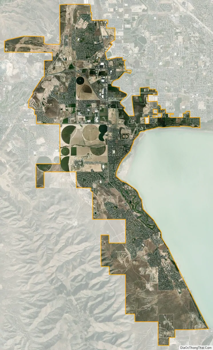
Saratoga Springs city Satellite Map
Geography
According to the United States Census Bureau, the city has a total area of 16.61 square miles (26.8 km), of which 16.51 square miles (26.4 km) is land and 0.1 square mile (0.3 km) (1.26%) is water. (This water is mostly Utah lake.)
See also
Map of Utah State and its subdivision: Map of other states:- Alabama
- Alaska
- Arizona
- Arkansas
- California
- Colorado
- Connecticut
- Delaware
- District of Columbia
- Florida
- Georgia
- Hawaii
- Idaho
- Illinois
- Indiana
- Iowa
- Kansas
- Kentucky
- Louisiana
- Maine
- Maryland
- Massachusetts
- Michigan
- Minnesota
- Mississippi
- Missouri
- Montana
- Nebraska
- Nevada
- New Hampshire
- New Jersey
- New Mexico
- New York
- North Carolina
- North Dakota
- Ohio
- Oklahoma
- Oregon
- Pennsylvania
- Rhode Island
- South Carolina
- South Dakota
- Tennessee
- Texas
- Utah
- Vermont
- Virginia
- Washington
- West Virginia
- Wisconsin
- Wyoming


