Draper is a city in Salt Lake and Utah counties in the U.S. state of Utah, about 20 miles (32 km) south of Salt Lake City along the Wasatch Front. As of the 2020 census, the population is 51,017, up from 7,143 in 1990.
Draper is part of two metropolitan areas; the Salt Lake County portion is in the Salt Lake City metropolitan area, while the Utah County portion is in the Provo-Orem metropolitan area.
The Utah State Prison is in Draper, near Point of the Mountain, alongside Interstate 15. Gary Gilmore’s execution occurred on 17 January 1977. The Utah Legislature voted to relocate the state prison to Draper in 2014 and in 2015 approved the Salt Lake City location the prison relocation commission recommended. The Draper Prison will close in 2022. Inmates will be moved to a new prison facility in Salt Lake City; the new prison is slated for completion in mid-2022.
Draper has two UTA TRAX stations (Draper Town Center, 12300/12400 South and Kimball’s Lane 11800 South) as well as one on the border with Sandy (Crescent View 11400 South). A FrontRunner commuter rail station serves the city’s west side. The city has around 5 FLEX bus routes connecting neighboring communities and two bus routes to Lehi Frontrunner Station and River/Herriman, connecting at Draper Town Center and the Draper Frontrunner Stations.
The city is home of 1-800 Contacts and a large eBay campus.
| Name: | Draper city |
|---|---|
| LSAD Code: | 25 |
| LSAD Description: | city (suffix) |
| State: | Utah |
| County: | Salt Lake County, Utah County |
| Incorporated: | 1978 |
| Elevation: | 4,505 ft (1,373 m) |
| Total Area: | 29.96 sq mi (77.61 km²) |
| Land Area: | 29.95 sq mi (77.57 km²) |
| Water Area: | 0.01 sq mi (0.04 km²) |
| Total Population: | 51,017 |
| Population Density: | 1,700/sq mi (660/km²) |
| ZIP code: | 84020 |
| Area code: | 385, 801 |
| FIPS code: | 4920120 |
| GNISfeature ID: | 1427473 |
| Website: | www.draperutah.gov |
Online Interactive Map
Click on ![]() to view map in "full screen" mode.
to view map in "full screen" mode.
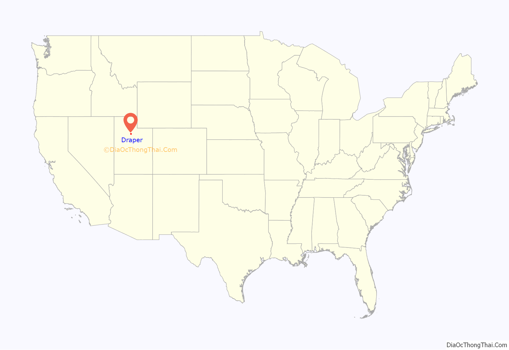
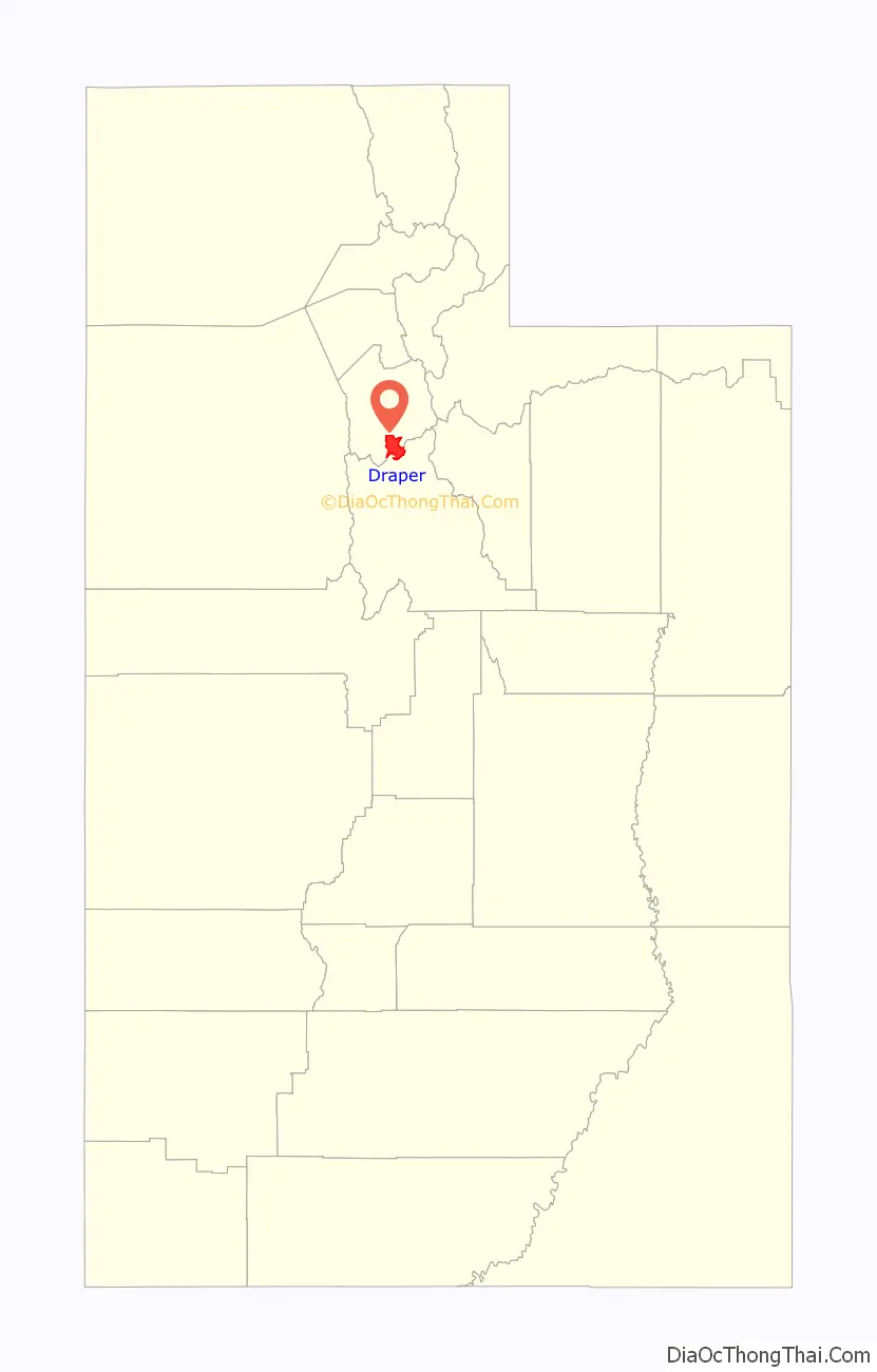
Draper location map. Where is Draper city?
History
In the fall of 1849, Ebenezer Brown brought cattle to graze along the mountain stream of South Willow Creek. The next spring, Ebenezer moved with his wife Phebe (“Phebe Draper Palmer Brown”) and their family to settle in Sivogah, the Native American name for the area, which means “Willows.” By the end of 1850, residents of the small settlement consisted of Ebenezer Brown and his three children (by a prior marriage), Phebe Draper Palmer Brown and her two children (by a prior marriage), and Phebe’s brother, William Draper Jr. and his large family numbering about fifteen. Consequently, by the end of the settlement’s first year, most residents were members of the Draper Family, and William Draper Jr. was soon called to be the presiding elder for the Church of Jesus Christ of Latter-day Saints in the area. During this time, the Drapers mainly farmed, and Ebenezer Brown ranched and sold cattle to immigrants heading to the gold fields of California along what became the Mormon Road. More settlers moved to Draper in the next few years. Later the area was called South Willow Creek. By 1852, 20 families lived along the creek. In 1854, the first post office was established with the name Draperville in recognition of William Draper Jr. and its other Draper residents. The town’s name in later years was shortened to Draper. (William Draper Sr., father of both William and Phebe Draper, who was older at the time of his family’s settlement of Draper is buried in the town cemetery.)
Hostilities with the Native Americans began in 1854, and a fort was established where the local settlers lived during the winters of 1855 and 1856. The fort was never completed, as the feared hostilities did not materialize, and its former location is now the site of the Draper Historical Park and the aptly-named Fort Street.
In the 1940s, Draper was known as the “Egg Basket of Utah.” Eggs produced in Draper were marketed from coast to coast, and the co-op furnished eggs for the military troops in the South Pacific during WWII. The poultry business was the single most important economic industry in Draper during this time. One large poultry farm was the Washburn Poultry Farm, run by Bruce D. Washburn, with over 10,000 chickens during the 1950s.
Draper remained a small farming community until the late 1990s when its population began growing exponentially from 7,257 in 1990 to an estimated 47,710 in 2018.
Draper was incorporated as a city in 1978.
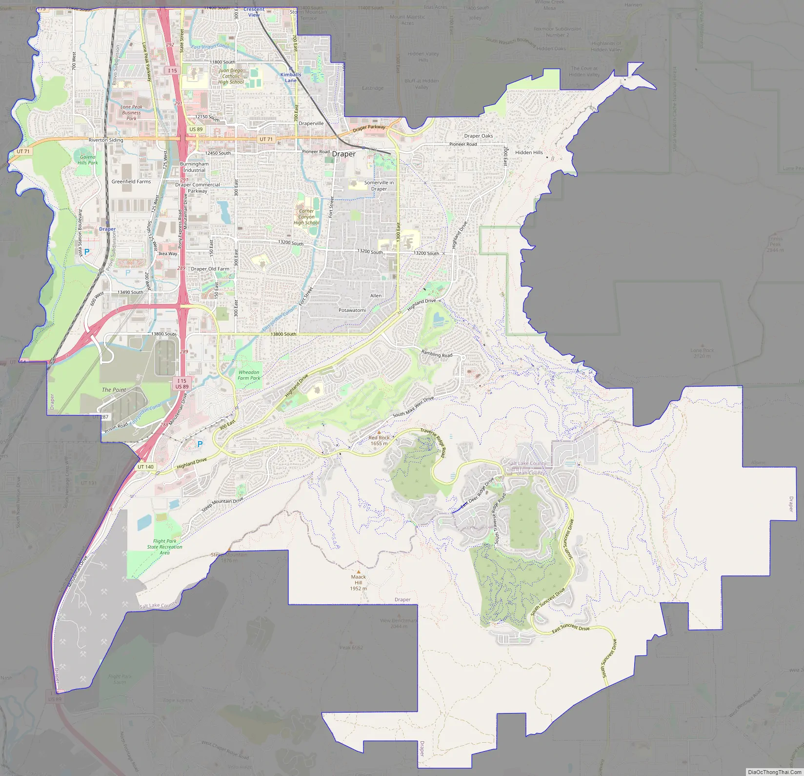
Draper Road Map
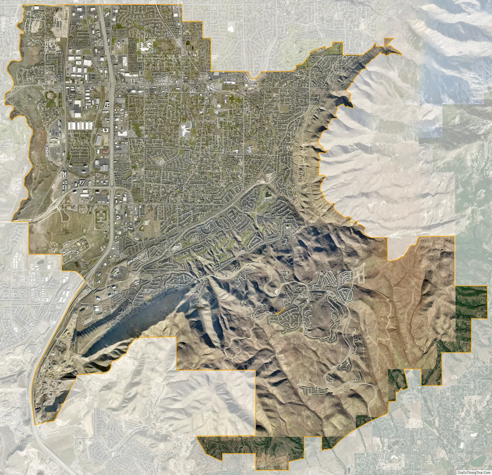
Draper city Satellite Map
Geography
Draper City is nestled in the far southeast corner of the Salt Lake Valley, with the Wasatch Mountain Range on the east and the Traverse Ridge Mountain on the south. At the Point of the Mountain, Draper is known for being one of the most popular and best wind areas in the country for hang gliding and paragliding.
Draper lies roughly midway between Salt Lake City and Provo. Draper is bordered by Riverton and Bluffdale to the west, South Jordan to the northwest, Sandy to the north, Alpine to the southeast, Highland to the south, and Lehi to the southwest.
According to the United States Census Bureau, the city has a total area of 30.1 square miles (78.0 km), of which 30.1 square miles (77.9 km) is land and 0.015 square miles (0.04 km), or 0.05%, is water.
See also
Map of Utah State and its subdivision: Map of other states:- Alabama
- Alaska
- Arizona
- Arkansas
- California
- Colorado
- Connecticut
- Delaware
- District of Columbia
- Florida
- Georgia
- Hawaii
- Idaho
- Illinois
- Indiana
- Iowa
- Kansas
- Kentucky
- Louisiana
- Maine
- Maryland
- Massachusetts
- Michigan
- Minnesota
- Mississippi
- Missouri
- Montana
- Nebraska
- Nevada
- New Hampshire
- New Jersey
- New Mexico
- New York
- North Carolina
- North Dakota
- Ohio
- Oklahoma
- Oregon
- Pennsylvania
- Rhode Island
- South Carolina
- South Dakota
- Tennessee
- Texas
- Utah
- Vermont
- Virginia
- Washington
- West Virginia
- Wisconsin
- Wyoming


