Salt Lake City, often shortened to Salt Lake, and colloquially called SLC, is the capital and most populous city of Utah, United States. It is the seat of Salt Lake County, the most populous county in Utah. With a population of 200,133 in 2020, the city is the core of the Salt Lake City metropolitan area, which had a population of 1,257,936 at the 2020 census. Salt Lake City is further situated within a larger metropolis known as the Salt Lake City–Ogden–Provo Combined Statistical Area, a corridor of contiguous urban and suburban development stretched along a 120-mile (190 km) segment of the Wasatch Front, comprising a population of 2,746,164 (as of 2021 estimates), making it the 22nd largest in the nation. It is also the central core of the larger of only two major urban areas located within the Great Basin (the other being Reno, Nevada).
Salt Lake City was founded on July 24, 1847 by early pioneer settlers led by Brigham Young who were seeking to escape persecution they had experienced while living farther east. The Mormon pioneers, as they would come to be known, entered a semi-arid valley and immediately began planning and building an extensive irrigation network which could feed the population and foster future growth. Salt Lake City’s street grid system is based on a standard compass grid plan, with the southeast corner of Temple Square (the area containing the Salt Lake Temple in downtown Salt Lake City) serving as the origin of the Salt Lake meridian. Owing to its proximity to the Great Salt Lake, the city was originally named Great Salt Lake City. In 1868, the word “Great” was dropped from the city’s name.
Immigration of international members of the Church of Jesus Christ of Latter-day Saints (LDS Church), mining booms, and the construction of the first transcontinental railroad initially brought economic growth, and the city was nicknamed “The Crossroads of the West”. It was traversed by the Lincoln Highway, the first transcontinental highway, in 1913. Two major cross-country freeways, I-15 and I-80, now intersect in the city. The city also has a belt route, I-215.
Salt Lake City has developed a strong tourist industry based primarily on skiing, outdoor recreation, and religious tourism. It hosted the 2002 Winter Olympics and is a candidate city for the 2030 Winter Olympics. It is known for its politically liberal culture, which stands in contrast with the rest of the state’s highly conservative leanings. It is home to a significant LGBT community and hosts the annual Utah Pride Festival. It is the industrial banking center of the United States. Salt Lake City and the surrounding area are also the location of several institutions of higher education including the state’s flagship research school, the University of Utah. Sustained drought in Utah has more recently strained Salt Lake City’s water security and caused the Great Salt Lake level drop to record low levels, and has impacted the local and state economy.
| Name: | Salt Lake City city |
|---|---|
| LSAD Code: | 25 |
| LSAD Description: | city (suffix) |
| State: | Utah |
| County: | Salt Lake County |
| Elevation: | 4,265 ft (1,300 m) |
| Land Area: | 110.34 sq mi (285.77 km²) |
| Water Area: | 0.47 sq mi (1.22 km²) |
| Population Density: | 1,797.52/sq mi (701.84/km²) |
| FIPS code: | 4967000 |
| GNISfeature ID: | 1454997 |
Discover Salt Lake City in more detail with this map collection. The maps show highways, roads, things to do, and reference information. Explore the city nicknamed “The Crossroads of the West” in more detail with an interactive map of Salt Lake City.
Salt Lake City is located in northern Utah between the Wasatch Mountains to the east and the Oquirrh Mountains to the west. The city is just a short distance away from the largest saltwater lake in the Western Hemisphere, the Great Salt Lake. It is also home to one of the largest per capita Mormon populations in the United States and is known for hosting the 2002 Winter Olympics. Today, it remains a popular tourist destination, thanks to its natural attractions and its diverse cultural experiences.
Discover the city of Salt Lake City in more detail with this map collection. The maps display highways, roads, attractions, and reference information. Explore the city nicknamed “The Crossroads of the West” with an interactive map of Salt Lake City and learn more about the city’s culture, attractions, and more.
Online Interactive Map
Click on ![]() to view map in "full screen" mode.
to view map in "full screen" mode.
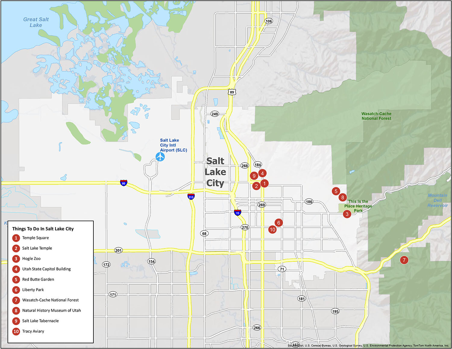
From its iconic Temple Square to its beautiful lakes and mountains, Salt Lake City is a must-see destination in your travels. There is so much to do in Salt Lake City. Take advantage of this interactive map to find walking and biking trails, restaurants, hotels, shopping, and attractions. Whether you’re visiting or just want to find out what Salt Lake City has to offer, this map is the one you need.
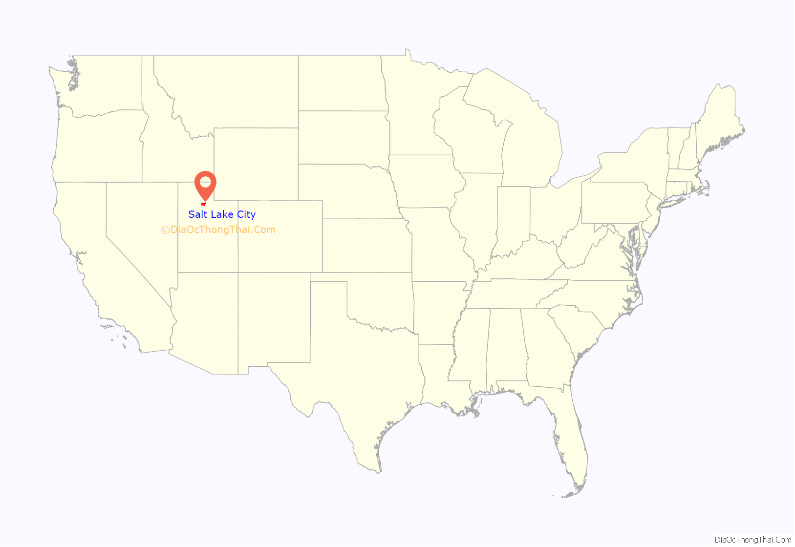
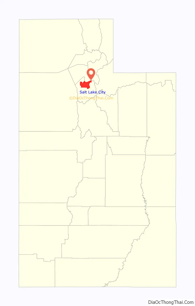
Salt Lake City location map. Where is Salt Lake City city?
History
Before settlement by members of the LDS Church, the Shoshone, Weber Ute, and Paiute had dwelt in the Salt Lake Valley for thousands of years. At the time of Salt Lake City’s founding, the valley was within the territory of the Northwestern Shoshone. One local Shoshone tribe, the Western Goshute tribe, had names for the Jordan River, City Creek, and Red Butte Canyon (Pi’o-gwût, So’ho-gwût, and Mo’ni-wai-ni). The Goshutes (or, Gosiutes) also lived in the vicinity of Salt Lake and the valleys to the west. The land was treated by the United States as public domain; no aboriginal title by the Northwestern Shoshone was ever ceded or relinquished by treaty with the United States. The first explorer of European descent in the Salt Lake area was likely Jim Bridger in 1825, although others had been in Utah earlier, including some who traveled as far north as the nearby Utah Valley (the 1776 Dominguez-Escalante expedition were undoubtedly aware of Salt Lake Valley’s existence). U.S. Army officer John C. Frémont surveyed the Great Salt Lake and the Salt Lake Valley in 1843 and 1845. The Donner Party, a group of ill-fated pioneers, had traveled through the Great Salt Lake Valley in August 1846.
The settling of Salt Lake City dates to the arrival of the Latter-day Saints in July 1847. They had traveled beyond the boundaries of the United States into Mexican Territory seeking a secluded area to safely practice their religion away from the violence and the persecution they experienced in the United States. Upon arrival at the Salt Lake Valley, president of the church Brigham Young is recorded as stating, “This is the right place, drive on.” Brigham Young is said to have seen the area in a vision before the wagon train’s arrival. They found the broad valley empty of any human settlement.
The city was not platted until after the federal surveyor abandoned his post in 1857. In 1855 Congress directed the President of the United States to appoint a surveyor general for Utah Territory, and to cause that the lands of that territory should be surveyed preparatory to bringing them on the market. Because of numerous conflicts between the surveyor and the territorial government the first surveyor general abandoned his post in 1857, not to return till 1869.
There was a Native American population in the valley, but an outbreak of measles during the winter of 1847 killed many. The Shoshone saved the pioneers when they taught them to eat the bulb of the native sego lily, which has long been part of the ordinary diet of the Shoshone, sego being derived from the Shoshone word seego. The sego lily was commemorated by the Sego Lily Dam, a flood-prevention infrastructure project in the shape of a giant sego lily, built in Sugar House Park in 2017.
Four days after arriving in the Salt Lake Valley, Brigham Young designated the building site for the Salt Lake Temple. The Salt Lake Temple, constructed on the block later called Temple Square, took 40 years to complete. Construction started in 1853, and the temple was dedicated on April 6, 1893. The temple has become an icon for the city and serves as its centerpiece. The southeast corner of Temple Square is the point of reference for the Salt Lake meridian, and for all addresses in the Salt Lake Valley.
The pioneers organized a state called State of Deseret, and petitioned for its recognition in 1849. The United States Congress rebuffed the settlers in 1850 and established the Utah Territory, vastly reducing its size, and designated Fillmore as its capital city. Great Salt Lake City replaced Fillmore as the territorial capital in 1856, and the name later was shortened to Salt Lake City. The city’s population continued to swell with an influx of converts to the LDS Church and Gold Rush gold seekers, making it one of the most populous cities in the American Old West.
The first group of settlers brought African slaves with them, making Utah the only place in the western United States to have African slavery. Three slaves, Green Flake, Hark Lay, and Oscar Crosby, came west with the first group of settlers in 1847. The settlers also began to purchase Indian slaves in the well-established Indian slave trade, as well as enslaving Indian prisoners of war. In 1850, 26 slaves were counted in Salt Lake County. In 1852, the territorial legislature passed the Act in Relation to Service and the Act for the relief of Indian Slaves and Prisoners formally legalizing slavery in the territory. Slavery was abolished in the territory during the Civil War.
Explorer, ethnologist, and author Richard Francis Burton traveled by coach in the summer of 1860 to document life in Great Salt Lake City. He was granted unprecedented access during his three-week visit, including audiences with Brigham Young and other contemporaries of Joseph Smith. The records of his visit include sketches of early city buildings, a description of local geography and agriculture, commentary on its politics and social order, essays, speeches, and sermons from Young, Isaac Morley, George Washington Bradley and other leaders, and snippets of everyday life such as newspaper clippings and the menu from a high-society ball.
Disputes with the federal government ensued over the church’s practice of polygamy. A climax occurred in 1857 when President James Buchanan declared the area in rebellion after Brigham Young refused to step down as governor, beginning the Utah War. A division of the United States Army, commanded by Albert Sidney Johnston, later a general in the army of the Confederate States of America, marched through the city and found it had been evacuated. They continued their march through the deserted city to vacant land at the southwest corner of the valley. There they set up Camp Floyd (40 miles (64 km) south of the city). Another military installation, Fort Douglas, was established in 1862 to maintain Union allegiance during the American Civil War. Many area leaders were incarcerated at the territorial prison in Sugar House in the 1880s for violation of anti-polygamy laws. The church began its eventual abandonment of polygamy in 1890, releasing “The Manifesto”, which officially suggested members obey the law of the land (which was equivalent to forbidding new polygamous marriages inside the US and its territories, but not in church member settlements in Canada and Mexico). This paved the way for statehood in 1896, when Salt Lake City became the state capital.
The First Transcontinental Railroad was completed in 1869 at Promontory Summit on the north side of the Great Salt Lake. A railroad was connected to the city from the Transcontinental Railroad in 1870, making travel less burdensome. Mass migration of different groups followed. Ethnic Chinese (who had laid most of the Central Pacific railway) established a flourishing Chinatown in Salt Lake City nicknamed “Plum Alley”, which housed around 1,800 Chinese during the early 20th century. The Chinese businesses and residences were demolished in 1952 although a historical marker has been erected near the parking ramp which has replaced Plum Alley. Immigrants also found economic opportunities in the booming mining industries. Remnants of a once-thriving Japantown – namely a Buddhist temple and Japanese Christian chapel – remain in downtown Salt Lake City. European ethnic groups and East Coast missionary groups constructed St. Mark’s Episcopal Cathedral in 1874, B’nai Israel Temple in 1890, the Roman Catholic Cathedral of the Madeleine in 1909 and the Greek Orthodox Holy Trinity Cathedral in 1923. This time period also saw the creation of Salt Lake City’s now defunct red-light district that employed 300 courtesans at its height before being closed in 1911.
During the late 19th and early 20th centuries, an extensive streetcar system was constructed throughout the city, with the first streetcar running in 1872 and electrification of the system in 1889. As in the rest of the country, the automobile usurped the streetcar, and the last trolley was approved for conversion in 1941, yet ran until 1945, due to World War II. Trolley buses ran until 1946. Light rail transit returned to the city when UTA’s TRAX opened in 1999. The S Line (formerly known as Sugar House Streetcar) opened for service in December 2013 on an old D&RGW right-of-way.
The city’s population began to stagnate during the 20th century as population growth shifted to suburban areas north and south of the city. Few of these areas were annexed to the city, while nearby towns incorporated and expanded. As a result, the population of the surrounding metropolitan area greatly outnumbers Salt Lake City. A major concern of recent government officials has been combating inner-city commercial decay. The city lost population from the 1960s through the 1980s, but experienced some recovery in the 1990s. Presently, the city has gained an estimated 5 percent of its population since the year 2000.
The city has experienced significant demographic shifts in recent years. Hispanics now account for approximately 22% of residents and the city has a significant LGBT community. There is also a large Pacific Islander population (mainly Samoans and Tongans; they compose roughly 2% of the population of the Salt Lake Valley area.
Salt Lake City was selected in 1995 to host the 2002 Winter Olympics. The games were plagued with controversy. A bid scandal surfaced in 1998 alleging bribes had been offered to secure the bid. During the games, other scandals erupted over contested judging scores and illegal drug use. Despite the controversies, the games were heralded as a financial success, being one of the few in recent history to turn a profit. In preparation major construction projects were initiated. Local freeways were expanded and repaired, and a light rail system was constructed. Olympic venues are now used for local, national, and international sporting events and Olympic athlete training. Tourism has increased since the Olympic games, but business did not pick up immediately following. Salt Lake City is currently bidding to host the 2030 or 2034 Winter Olympics. Salt Lake City hosted the 16th Winter Deaflympic games in 2007, taking place in the venues in Salt Lake City and Park City, and Rotary International chose the city as the host site of their 2007 convention, which was the single largest gathering in Salt Lake City since the 2002 Winter Olympics. The U.S. Volleyball Association convention in 2005 drew 39,500 attendees.
In 2020, the city experienced a 5.7 magnitude earthquake, protests against the killing of Bernardo Palacios-Carbajal, and a damaging windstorm with hurricane-force winds, amidst the wider national George Floyd protests, the global COVID-19 pandemic, and protests against pandemic measures.
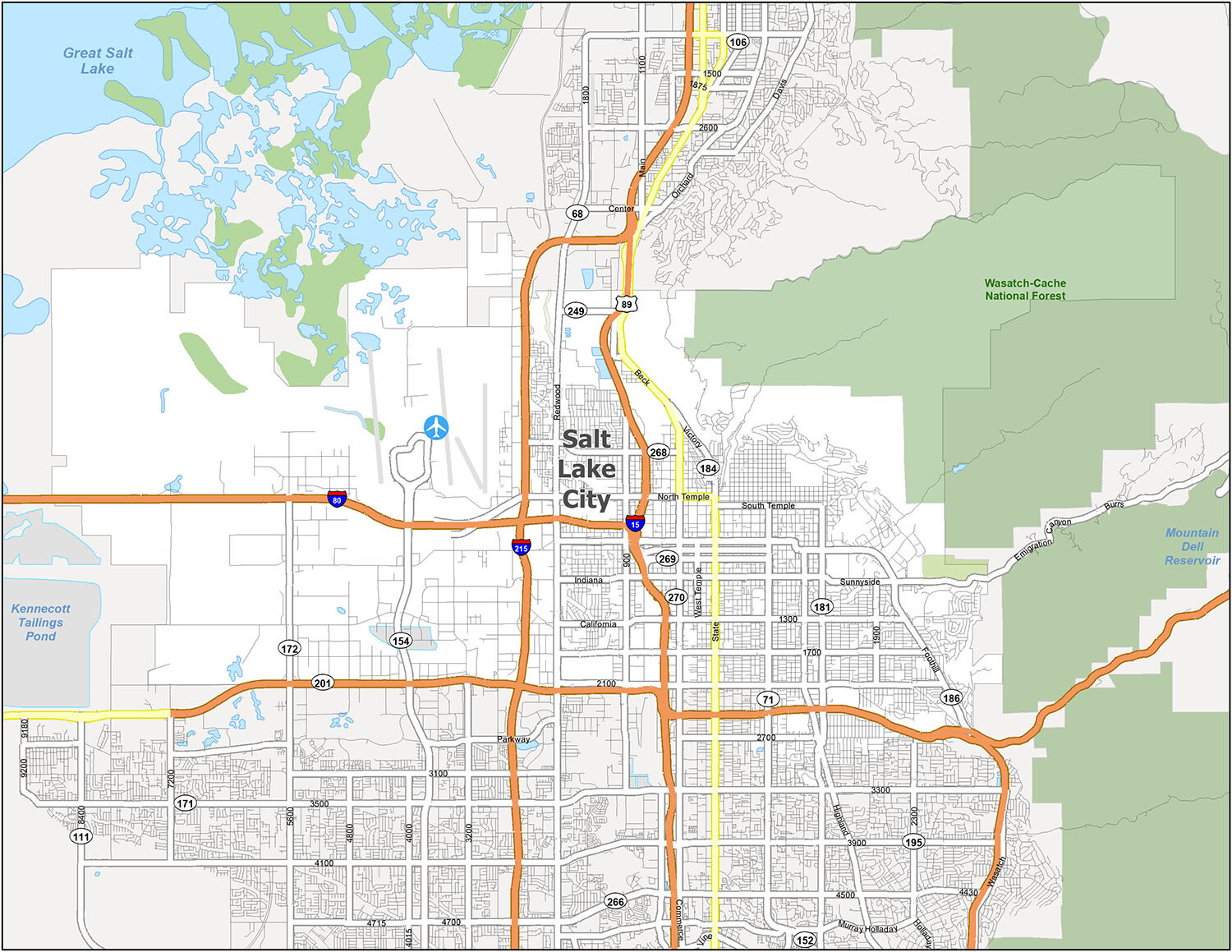
Salt Lake City Road Map
This Salt Lake City road map is the perfect way to navigate your way around the city. It includes all the major interstates, highways, and roads. With this printable road map, you’ll be able to find your way to all the best attractions in the city. The highways included are I-15, I-80, and I-215. As well as US Highways 68, 71, 89, 171, 186, 201, and 266. And some of the major roads are Beck St, California Ave, Chicago St, Columbus St, Emigration Canyon, Foothill Dr, Frontage Rd, Highland Dr, Indiana Ave, North Temple, Poplar Grove Blvd, Redwood Rd, Richmond St, South Temple St, State St, Sunnyside Ave, Victory Rd, Warm Springs Rd, and West Temple.
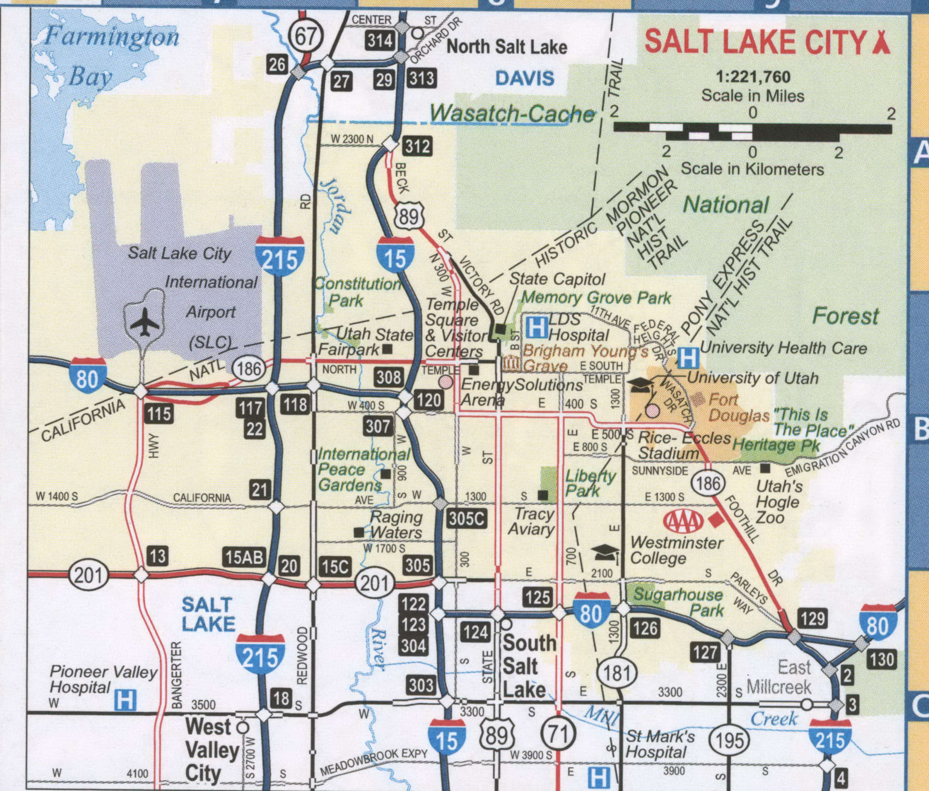
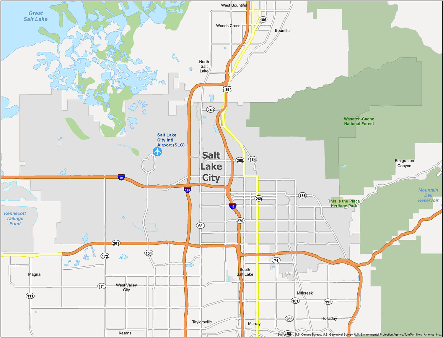
Looking to plan your perfect vacation to Salt Lake City? Look no further than our reference map, which includes all the information you need to experience the best of this beautiful city and its surrounding areas. From parks and forests to populated areas, our map has everything you need to make the most of your trip. And with our handy guide, you won’t have to worry about getting lost or missing out on any of the must-see sights in Salt Lake City.
Airports: Salt Lake City International Airport (SLC)
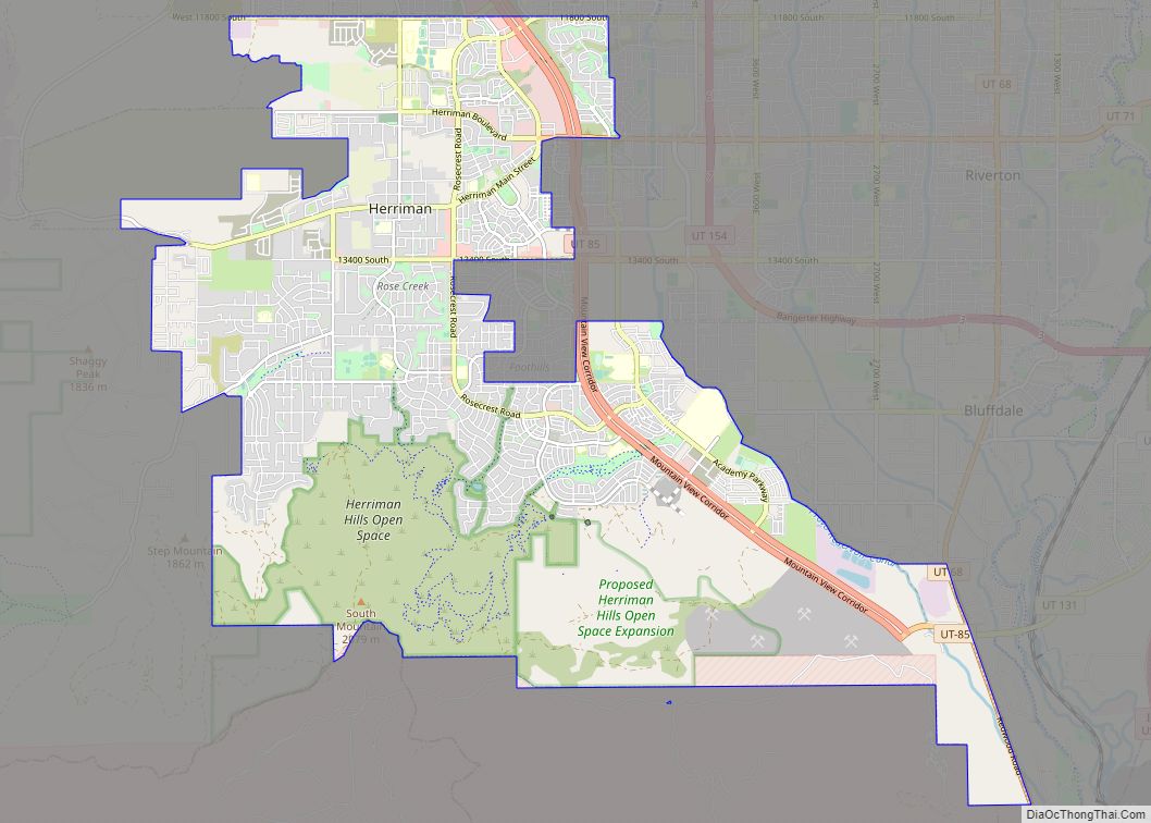
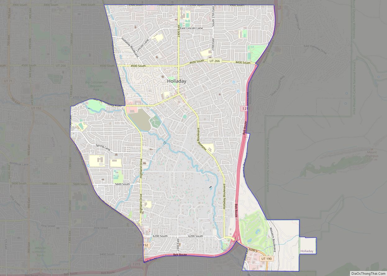
Cities: Bountiful, Holladay, Millcreek, Murray, North Salt Lake, Salt Lake City, South Salt Lake, Taylorsville, West Bountiful, West Valley City, Woods Cross
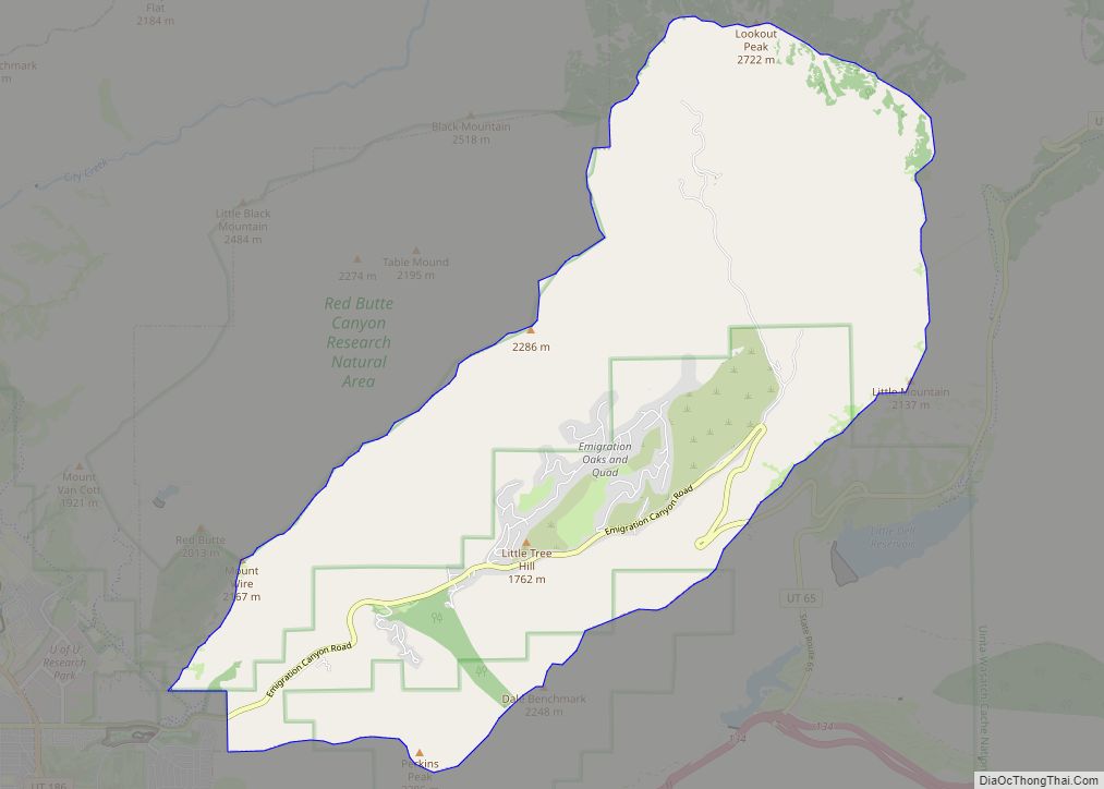
Townships: Emigration Canyon, Kearns, Magna
Forests/Parks: This Is the Place Heritage Park, Wasatch-Cache National Forest
10 things to do in Salt Lake City city
From its iconic Temple Square to its beautiful lakes and mountains, Salt Lake City is a must-see destination in your travels. There is so much to do in Salt Lake City. Take advantage of this interactive map to find walking and biking trails, restaurants, hotels, shopping, and attractions. Whether you’re visiting or just want to find out what Salt Lake City has to offer, this map is the one you need.
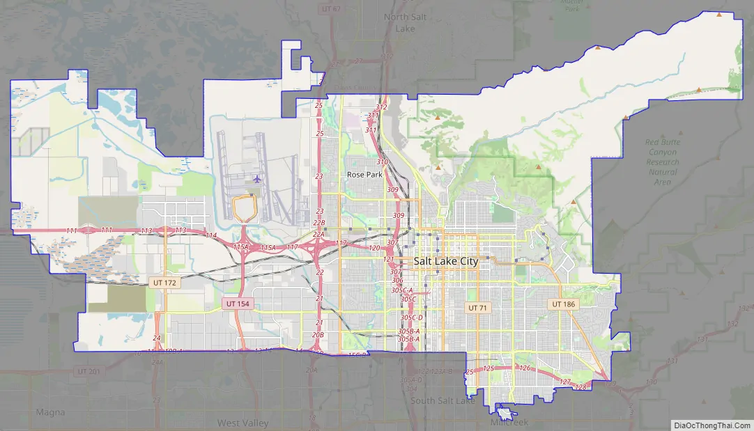
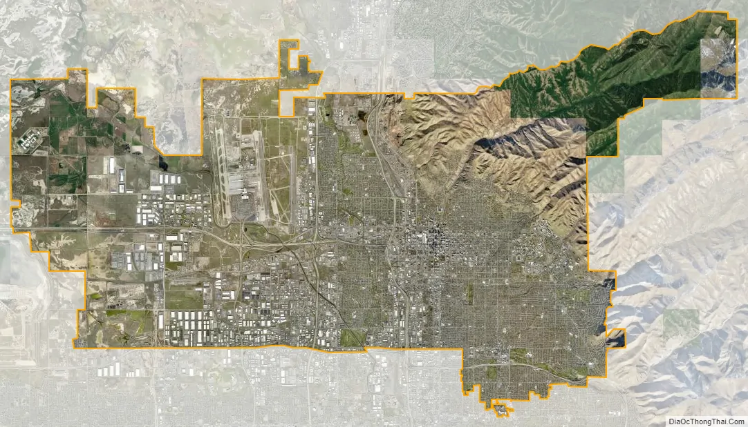
Salt Lake City city Satellite Map
See also
Map of Utah State and its subdivision: Map of other states:- Alabama
- Alaska
- Arizona
- Arkansas
- California
- Colorado
- Connecticut
- Delaware
- District of Columbia
- Florida
- Georgia
- Hawaii
- Idaho
- Illinois
- Indiana
- Iowa
- Kansas
- Kentucky
- Louisiana
- Maine
- Maryland
- Massachusetts
- Michigan
- Minnesota
- Mississippi
- Missouri
- Montana
- Nebraska
- Nevada
- New Hampshire
- New Jersey
- New Mexico
- New York
- North Carolina
- North Dakota
- Ohio
- Oklahoma
- Oregon
- Pennsylvania
- Rhode Island
- South Carolina
- South Dakota
- Tennessee
- Texas
- Utah
- Vermont
- Virginia
- Washington
- West Virginia
- Wisconsin
- Wyoming