Cleveland (/ˈkliːvlənd/ KLEEV-lənd), officially the City of Cleveland, is a city in the U.S. state of Ohio and the county seat of Cuyahoga County. Located in Northeast Ohio along the southern shore of Lake Erie, it is situated across the U.S. maritime border with Canada and lies approximately 60 miles (97 km) west of Pennsylvania.
The largest city on Lake Erie and one of the major cities of the Great Lakes region, Cleveland ranks as the second-largest city in Ohio and 54th-largest city in the U.S. with a 2020 population of 372,624. The city anchors both the Greater Cleveland metropolitan statistical area (MSA) and the larger Cleveland–Akron–Canton combined statistical area (CSA). The CSA is the most populous in Ohio and the 17th-largest in the country, with a population of 3.63 million in 2020, while the MSA ranks as 34th-largest at 2.09 million.
Cleveland was founded in 1796 near the mouth of the Cuyahoga River by General Moses Cleaveland, after whom the city was named. Its location on both the river and the lake shore allowed it to grow into a major commercial and industrial center, attracting large numbers of immigrants and migrants. Cleveland is a port city, connected to the Atlantic Ocean via the Saint Lawrence Seaway. Its economy relies on diverse sectors that include higher education, manufacturing, financial services, healthcare, and biomedicals. The GDP for the Greater Cleveland MSA was $135 billion in 2019. Combined with the Akron MSA, the seven-county Cleveland–Akron metropolitan economy was $175 billion in 2019, the largest in Ohio, accounting for 25% of the state’s GDP.
Designated as a global city by the Globalization and World Cities Research Network, Cleveland is home to several major cultural institutions, including the Cleveland Museum of Art, the Cleveland Museum of Natural History, the Cleveland Orchestra, Playhouse Square, and the Rock and Roll Hall of Fame. Known as “The Forest City” among many other nicknames, Cleveland serves as the center of the Cleveland Metroparks nature reserve system. The city’s major league professional sports teams include the Cleveland Browns, the Cleveland Cavaliers, and the Cleveland Guardians.
| Name: | Cleveland city |
|---|---|
| LSAD Code: | 25 |
| LSAD Description: | city (suffix) |
| State: | Ohio |
| County: | Cuyahoga County |
| Founded: | July 22, 1796; 226 years ago (1796-07-22) |
| Elevation: | 653 ft (199 m) |
| Land Area: | 77.73 sq mi (201.33 km²) |
| Water Area: | 4.75 sq mi (12.29 km²) |
| Population Density: | 4,793.52/sq mi (1,850.78/km²) |
| Area code: | 216 |
| FIPS code: | 3916000 |
| Website: | clevelandohio.gov |
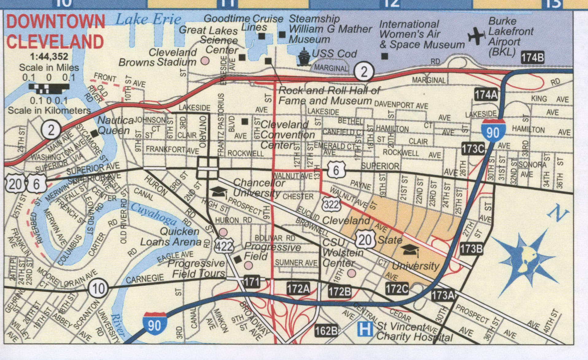
Discover Cleveland and all its hidden gems with this Cleveland map collection. From a road map to a reference map, and all the things to do, this collection will help you explore and get familiarized with the Cleveland area.
Explore the iconic landmarks the city has to offer, such as the Rock and Roll Hall of Fame, a Christmas Story’s House, and many other hidden gems. With this map collection, you’ll get a sense of what you’ll experience during your stay in Cleveland.
Online Interactive Map
Click on ![]() to view map in "full screen" mode.
to view map in "full screen" mode.
With this map, you can locate everything that you need in the Cleveland area. Whether you are a tourist, a resident, or just want to enjoy Cleveland’s cultural and historical sites, this map has you covered. This interactive map includes the best attractions, restaurants, and other important points of interest in Cleveland. Get the inside scoop on the best things to do, where to stay, and where to eat with the map below.
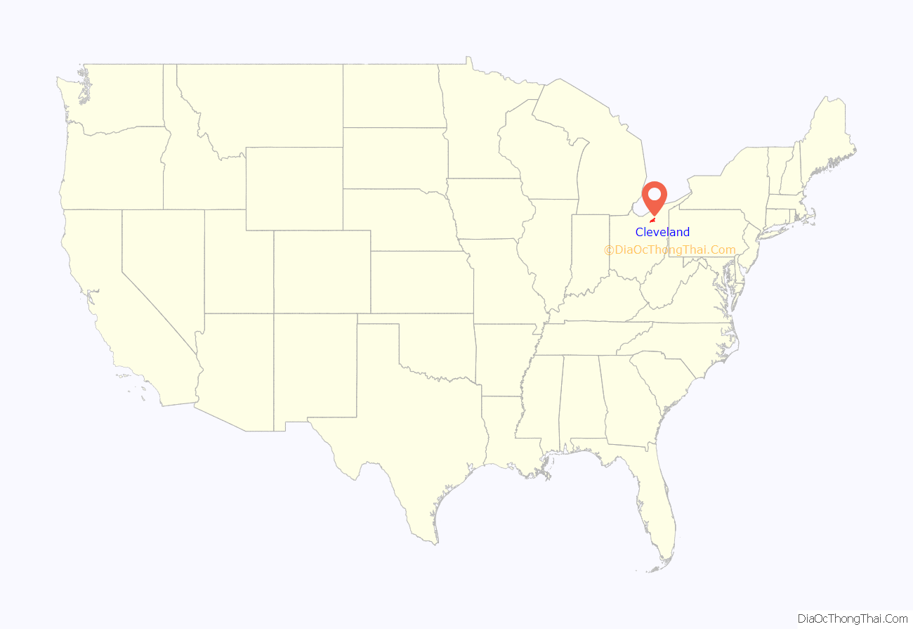
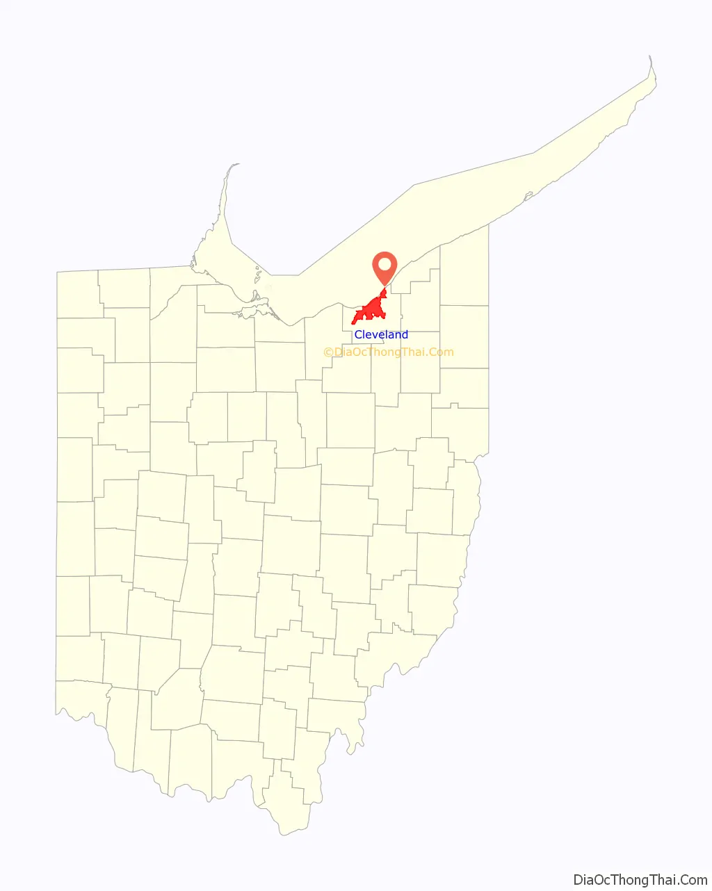
Cleveland location map. Where is Cleveland city?
History
Establishment
Cleveland was established on July 22, 1796, by surveyors of the Connecticut Land Company when they laid out Connecticut‘s Western Reserve into townships and a capital city. They named the new settlement “Cleaveland” after their leader, General Moses Cleaveland, a veteran of the American Revolutionary War. Cleaveland oversaw the New England-style design of the plan for what would become the modern downtown area, centered on Public Square, before returning to Connecticut, never again to visit Ohio. The town’s name was often shortened to “Cleveland,” even by Cleaveland’s original surveyors. A common myth emerged that the spelling was altered by The Cleveland Advertiser in order to fit the name on the newspaper’s masthead.
The first permanent European settler in Cleaveland was Lorenzo Carter, who built a cabin on the banks of the Cuyahoga River. The emerging community served as an important supply post for the U.S. during the Battle of Lake Erie in the War of 1812. Locals adopted Commodore Oliver Hazard Perry as a civic hero and erected a monument in his honor decades later. Largely through the efforts of the settlement’s first lawyer Alfred Kelley, the village of Cleaveland was incorporated on December 23, 1814.
In spite of the nearby swampy lowlands and harsh winters, the town’s waterfront location proved to be an advantage, giving it access to Great Lakes trade. It grew rapidly after the 1832 completion of the Ohio and Erie Canal. This key link between the Ohio River and the Great Lakes connected it to the Atlantic Ocean via the Erie Canal and Hudson River, and later via the Saint Lawrence Seaway. Its products could reach markets on the Gulf of Mexico via the Mississippi River. The town’s growth continued with added railroad links.
In 1836, Cleveland, then only on the eastern banks of the Cuyahoga River, was officially incorporated as a city, and John W. Willey was elected its first mayor. That same year, it nearly erupted into open warfare with neighboring Ohio City over a bridge connecting the two communities. Ohio City remained an independent municipality until its annexation by Cleveland in 1854.
A center of abolitionist activity, Cleveland (code-named “Station Hope”) was a major stop on the Underground Railroad for escaped African American slaves en route to Canada. The city also served as an important center for the Union during the American Civil War. Decades later, in July 1894, the wartime contributions of those serving the Union from Cleveland and Cuyahoga County would be honored with the Soldiers’ and Sailors’ Monument on Public Square.
Growth and expansion
The Civil War vaulted Cleveland into the first rank of American manufacturing cities and fueled unprecedented growth. Its prime geographic location as a transportation hub between the East Coast and the Midwest played an important role in its development as a commercial center. The city served as a destination for iron ore shipped from Minnesota, along with coal transported by rail. In 1870, John D. Rockefeller founded Standard Oil in Cleveland. In 1885, he moved its headquarters to New York City, which had become a center of finance and business.
By the end of the 19th century, Cleveland had emerged as a major American manufacturing center. The city’s economic growth and industrial jobs attracted large waves of immigrants from Southern and Eastern Europe as well as Ireland. Urban growth was accompanied by significant strikes and labor unrest, as workers demanded better working conditions. In 1881–86, 70-80% of strikes were successful in improving labor conditions in Cleveland. The Cleveland Streetcar Strike of 1899 was one of the more violent instances of labor unrest in the city during this period.
By 1910, Cleveland had become known as the “Sixth City” due to its status at the time as the sixth-largest U.S. city. Its businesses included automotive companies such as Peerless, People’s, Jordan, Chandler, and Winton, maker of the first car driven across the U.S. Other manufacturers in Cleveland produced steam-powered cars, which included those by White and Gaeth, and electric cars produced by Baker. The city counted major Progressive Era politicians among its leaders, most prominently the populist Mayor Tom L. Johnson, who was responsible for the development of the Cleveland Mall Plan. The era of the City Beautiful movement in Cleveland architecture, this period also saw wealthy patrons support the establishment of the city’s major cultural institutions. The most prominent among them were the Cleveland Museum of Art, which opened in 1916, and the Cleveland Orchestra, established in 1918.
In addition to the large immigrant population, African American migrants from the rural South arrived in Cleveland (among other Northeastern and Midwestern cities) as part of the Great Migration for jobs, constitutional rights, and relief from racial discrimination. Between 1910 and 1930, the African American population of Cleveland grew by more than 400%. By 1920, the year in which the Cleveland Indians won their first World Series championship, Cleveland had grown into a densely-populated metropolis of 796,841, making it the fifth-largest city in the nation, with a foreign-born population of 30%. At this time, Cleveland saw the rise of radical labor movements, most prominently the Industrial Workers of the World (IWW), in response to the conditions of the largely immigrant and migrant workers. In 1919, the city attracted national attention amid the First Red Scare for the Cleveland May Day Riots, in which local socialist and IWW demonstrators clashed with anti-socialists.
Despite the immigration restrictions of 1921 and 1924, the city’s population continued to grow throughout the 1920s. Prohibition first took effect in Ohio in May 1919 (although it was not well-enforced in Cleveland), became law with the Volstead Act in 1920, and was eventually repealed nationally by Congress in 1933. The ban on alcohol led to the rise of speakeasies throughout the city and organized crime gangs, such as the Mayfield Road Mob, who smuggled bootleg liquor across Lake Erie from Canada into Cleveland. The Roaring Twenties also saw the establishment of Cleveland’s Playhouse Square and the rise of the risqué Short Vincent entertainment district. The Bal-Masque balls of the avant-garde Kokoon Arts Club scandalized the city. Jazz came to prominence in Cleveland during this period.
In 1929, the city hosted the first of many National Air Races, and Amelia Earhart flew to the city from Santa Monica, California in the Women’s Air Derby (nicknamed the “Powder Puff Derby” by Will Rogers). The Van Sweringen brothers commenced construction of the Terminal Tower skyscraper in 1926 and, by the time it was dedicated in 1930, Cleveland had a population of over 900,000. The era of the flapper also marked the beginning of the golden age in Downtown Cleveland retail, centered on major department stores Higbee’s, Bailey’s, the May Company, Taylor’s, Halle’s, and Sterling Lindner Davis, which collectively represented one of the largest and most fashionable shopping districts in the country, often compared to New York’s Fifth Avenue.
Cleveland was hit hard by the Wall Street Crash of 1929 and the subsequent Great Depression. A center of union activity, the city saw significant labor struggles in this period, including strikes by workers against Fisher Body in 1936 and against Republic Steel in 1937. The city was also aided by major federal works projects sponsored by President Franklin D. Roosevelt’s New Deal. In commemoration of the centennial of Cleveland’s incorporation as a city, the Great Lakes Exposition debuted in June 1936 at the city’s North Coast Harbor, along the Lake Erie shore north of downtown. Conceived by Cleveland’s business leaders as a way to revitalize the city during the Depression, it drew four million visitors in its first season, and seven million by the end of its second and final season in September 1937.
On December 7, 1941, Imperial Japan attacked Pearl Harbor and declared war on the United States. One of the victims of the attack was a Cleveland native, Rear Admiral Isaac C. Kidd. The attack signaled America’s entry into World War II. A major hub of the “Arsenal of Democracy”, Cleveland under Mayor Frank Lausche contributed massively to the U.S. war effort as the fifth largest manufacturing center in the nation. During his tenure, Lausche also oversaw the establishment of the Cleveland Transit System, the predecessor to the Greater Cleveland Regional Transit Authority.
Late 20th and early 21st centuries
After the war, Cleveland initially experienced an economic boom, and businesses declared the city to be the “best location in the nation”. In 1949, the city was named an All-America City for the first time and, in 1950, its population reached 914,808. In sports, the Indians won the 1948 World Series, the hockey team, the Barons, became champions of the American Hockey League, and the Browns dominated professional football in the 1950s. As a result, along with track and boxing champions produced, Cleveland was declared the “City of Champions” in sports at this time. The 1950s also saw the rising popularity of a new music genre that local WJW (AM) disc jockey Alan Freed dubbed “rock and roll”.
However, by the 1960s, Cleveland’s economy began to slow down, and residents increasingly sought new housing in the suburbs, reflecting the national trends of suburban growth following federally subsidized highways. Industrial restructuring, particularly in the railroad and steel industries, resulted in the loss of numerous jobs in Cleveland and the region, and the city suffered economically. The burning of the Cuyahoga River in June 1969 brought national attention to the issue of industrial pollution in Cleveland and served as a catalyst for the American environmental movement.
Housing discrimination and redlining against African Americans led to racial unrest in Cleveland and numerous other Northern U.S. cities. In Cleveland, the Hough riots erupted from July 18 to 23, 1966, and the Glenville Shootout took place from July 23 to 25, 1968. In November 1967, Cleveland became the first major American city to elect an African American mayor, Carl B. Stokes, who served from 1968 to 1971 and played an instrumental role in restoring the Cuyahoga River.
In December 1978, during the turbulent tenure of Dennis Kucinich as mayor, Cleveland became the first major American city since the Great Depression to enter into a financial default on federal loans. By the beginning of the 1980s, several factors, including changes in international free trade policies, inflation, and the savings and loan crisis, contributed to the recession that severely affected cities like Cleveland. While unemployment during the period peaked in 1983, Cleveland’s rate of 13.8% was higher than the national average due to the closure of several steel production centers.
The city began a gradual economic recovery under Mayor George V. Voinovich in the 1980s. The downtown area saw the construction of the Key Tower and 200 Public Square skyscrapers, as well as the development of the Gateway Sports and Entertainment Complex—consisting of Progressive Field and Rocket Mortgage FieldHouse—and the North Coast Harbor, including the Rock and Roll Hall of Fame, Cleveland Browns Stadium, and the Great Lakes Science Center. The city emerged from default in 1987.
By the turn of the 21st century, Cleveland succeeded in developing a more diversified economy and gained a national reputation as a center for healthcare and the arts. Additionally, it has become a national leader in environmental protection, with its successful cleanup of the Cuyahoga River. The city’s downtown and several neighborhoods have experienced significant population growth since 2010, despite the fact that the overall population has continued to decline. Challenges remain for the city, with economic development of neighborhoods, improvement of city schools, and continued efforts to tackle poverty and urban blight being top municipal priorities.
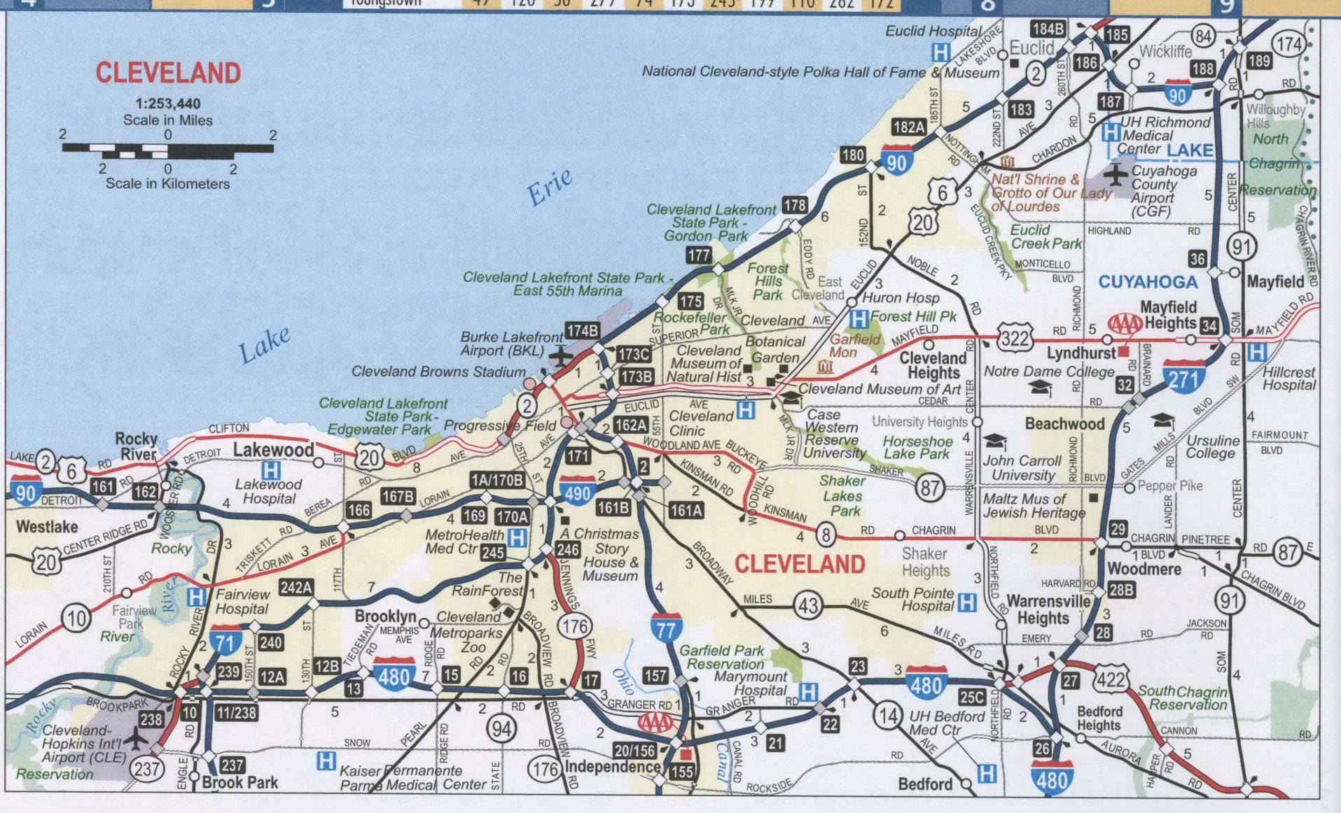
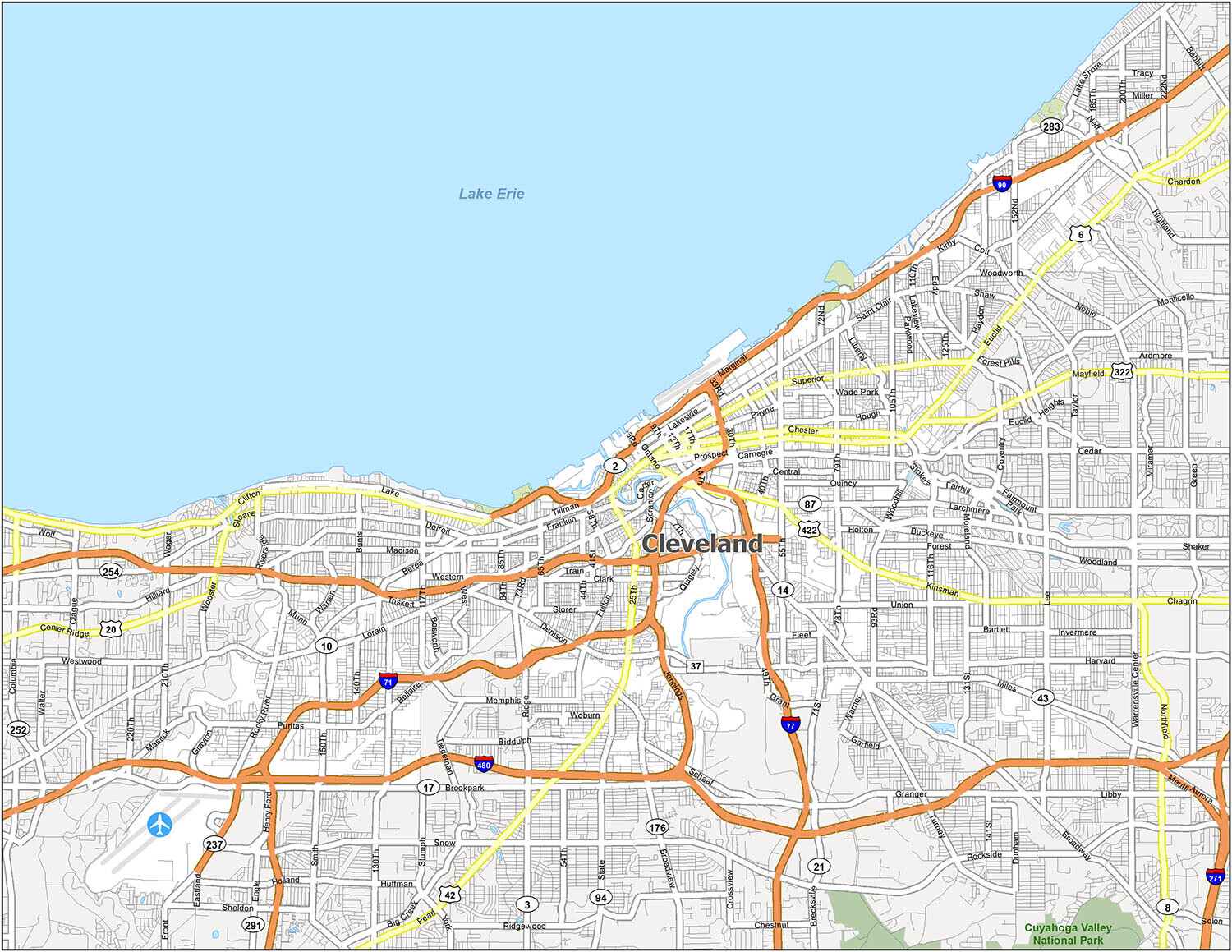
Cleveland Road Map
Whether you’re visiting the city for the first time or you’re an avid traveler, this map is perfect for you. It displays everything from interstates (like I-71, I-77, and I-90), highways, and major roads. It’s all conveniently available in one printable road map of the city. So when you navigate your way around the streets, this road map helps you find your way around and never get lost. Or if you want to explore outside the city, use our Ohio road map.
The following is a list of Interstate highways, US highways and major roads in the city:
- Interstate Highways: I-71, I-77, I-90, I-480, I-490
- US Highways: 2, 6, 10, 14, 17, 20, 37, 42, 87, 94, 176, 237, 322, 422, Jennings Fwy
- Major Roads: 100th St, 13th St, 18th St, 25th St, 26th St, 30th St, 55th St, Access Rd, Broadview Rd, Broadway Ave, Brookpark Rd, Buckeye Rd, Carnegie Ave, Chester Ave, Clark Ave, Clifton Blvd, Detroit Ave, Euclid Ave, Grayton Rd, Henritze Ave, Kinsman Rd, Lake Shore Blvd, Liberty Blvd, Lorain Ave, Marginal Dr, Mayfield Rd, Miles Ave, Ontario St, Pearl Rd, Public Sq, Riverside Dr, Rockefeller Ave, Rocky River Dr, Saint Clair Ave, Shaker Blvd, State Rd, Superior Ave, West Blvd, Western Ave, Woodhill Rd, Woodland Rd
This comprehensive printable road map of the city will help you navigate your way around the streets and never get lost. If you want to explore outside the city, you can use our Ohio road map.
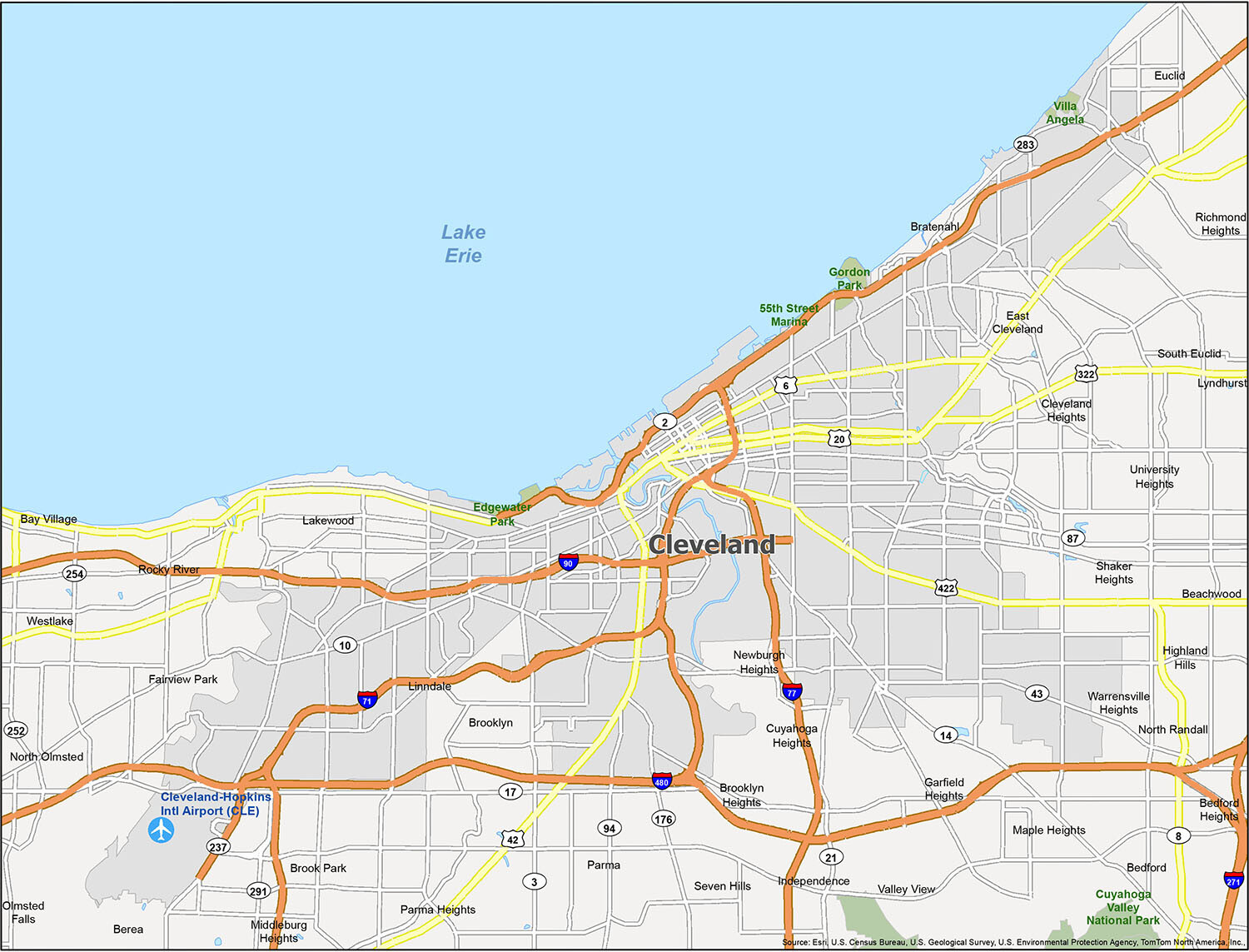
Get the most out of your trip to Cleveland with this comprehensive map. The city’s metro area has 375,000 people, making it the 2nd most populous in Ohio. This makes it smaller than Columbus, but larger than Cincinnati. Our map provides a bird’s eye view of the city, so you can see everything from its parks, surrounding places, and neighborhoods.
Airport: Cleveland-Hopkins International Airport (CLE)
Cities: Bay Village, Beachwood, Bedford, Bedford Heights, Berea, Brook Park, Brooklyn, Cleveland, Cleveland Heights, East Cleveland, Euclid, Fairview Park, Garfield Heights, Independence, Lakewood, Lyndhurst, Maple Heights, Middleburg Heights, North Olmsted, Olmsted Falls, Parma, Parma Heights, Richmond Heights, Rocky River, Seven Hills, Shaker Heights, South Euclid, University Heights, Warrensville Heights, Westlake
Villages: Bratenahl, Brooklyn Heights, Cuyahoga Heights, Highland Hills, Linndale, Newburgh Heights, North Randall, Valley View, Walton Hills
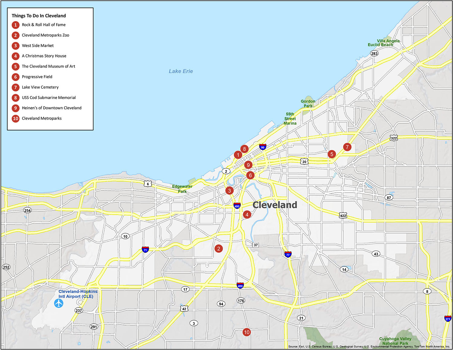
10 things to do in Cleveland city
Cleveland, Ohio, is a city with a lot to offer. From its rich cultural heritage to its world-class sporting venues, there’s something for everyone to explore and enjoy. Check out this map for a list of the best attractions and activities in Cleveland, from the Rock & Roll Hall of Fame to the Cleveland Metroparks Zoo, West Side Market, A Christmas Story House, The Cleveland Museum of Art, Progressive Field, Lake View Cemetery, USS Cod Submarine Memorial, and Heinen’s of Downtown Cleveland.
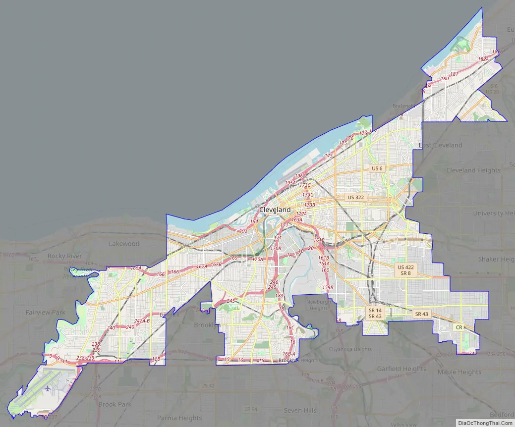
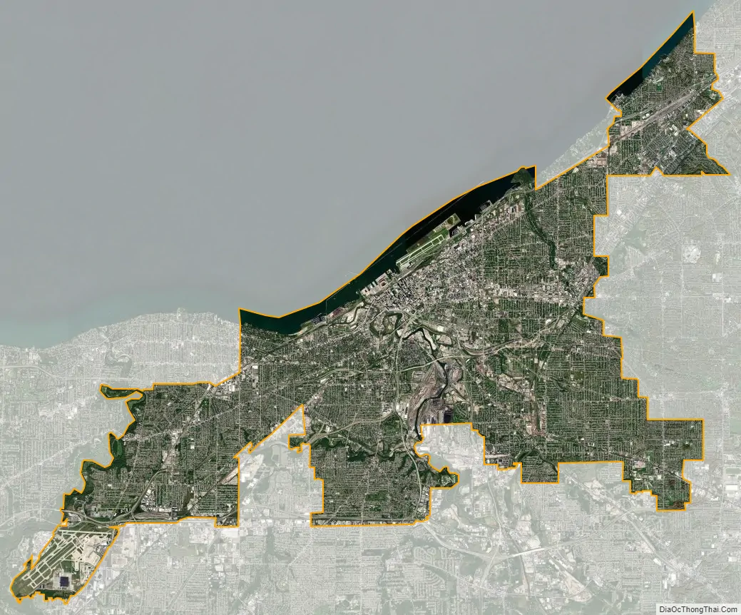
Cleveland city Satellite Map
See also
Map of Ohio State and its subdivision:- Adams
- Allen
- Ashland
- Ashtabula
- Athens
- Auglaize
- Belmont
- Brown
- Butler
- Carroll
- Champaign
- Clark
- Clermont
- Clinton
- Columbiana
- Coshocton
- Crawford
- Cuyahoga
- Darke
- Defiance
- Delaware
- Erie
- Fairfield
- Fayette
- Franklin
- Fulton
- Gallia
- Geauga
- Greene
- Guernsey
- Hamilton
- Hancock
- Hardin
- Harrison
- Henry
- Highland
- Hocking
- Holmes
- Huron
- Jackson
- Jefferson
- Knox
- Lake
- Lake Erie
- Lawrence
- Licking
- Logan
- Lorain
- Lucas
- Madison
- Mahoning
- Marion
- Medina
- Meigs
- Mercer
- Miami
- Monroe
- Montgomery
- Morgan
- Morrow
- Muskingum
- Noble
- Ottawa
- Paulding
- Perry
- Pickaway
- Pike
- Portage
- Preble
- Putnam
- Richland
- Ross
- Sandusky
- Scioto
- Seneca
- Shelby
- Stark
- Summit
- Trumbull
- Tuscarawas
- Union
- Van Wert
- Vinton
- Warren
- Washington
- Wayne
- Williams
- Wood
- Wyandot
- Alabama
- Alaska
- Arizona
- Arkansas
- California
- Colorado
- Connecticut
- Delaware
- District of Columbia
- Florida
- Georgia
- Hawaii
- Idaho
- Illinois
- Indiana
- Iowa
- Kansas
- Kentucky
- Louisiana
- Maine
- Maryland
- Massachusetts
- Michigan
- Minnesota
- Mississippi
- Missouri
- Montana
- Nebraska
- Nevada
- New Hampshire
- New Jersey
- New Mexico
- New York
- North Carolina
- North Dakota
- Ohio
- Oklahoma
- Oregon
- Pennsylvania
- Rhode Island
- South Carolina
- South Dakota
- Tennessee
- Texas
- Utah
- Vermont
- Virginia
- Washington
- West Virginia
- Wisconsin
- Wyoming


