Vatican City is the world’s smallest country. It covers an area of only 0.19 sq mi or 0.49 sq. km. It sits on a low hill known as the Vatican Hill. The highest point here is at 250 ft (76 m) and the lowest point is at 63 ft (19 m). The country lacks any rivers of lakes.
Location Maps
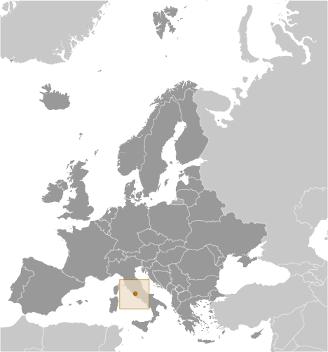
Where is Vatican?
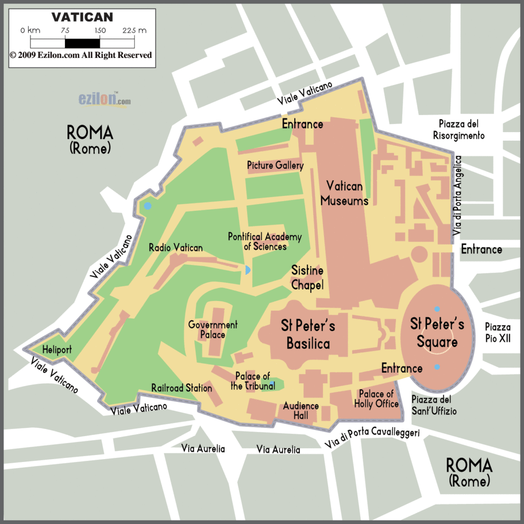
High Definition Political Map of Vatican
History
Early history
The name “Vatican” was already in use in the time of the Roman Republic for the Ager Vaticanus, a marshy area on the west bank of the Tiber across from the city of Rome, located between the Janiculum, the Vatican Hill and Monte Mario, down to the Aventine Hill and up to the confluence of the Cremera creek. The toponym Ager Vaticanus is attested until the 1st century AD: afterwards, another toponym appeared, Vaticanus, denoting an area much more restricted: the Vatican Hill, today’s St. Peter’s Square, and possibly today’s Via della Conciliazione. Because of its vicinity to Rome’s archenemy, the Etruscan city of Veii (another naming for the Ager Vaticanus was Ripa Veientana or Ripa Etrusca), and for being subjected to the floods of the Tiber, the Romans considered this originally uninhabited part of Rome dismal and ominous.
The particularly low quality of Vatican wine, even after the reclamation of the area, was commented on by the poet Martial (40 – between AD 102 and 104). Tacitus wrote that in AD 69, the Year of the Four Emperors, when the northern army that brought Vitellius to power arrived in Rome, “a large proportion camped in the unhealthy districts of the Vatican, which resulted in many deaths among the common soldiery; and the Tiber being close by, the inability of the Gauls and Germans to bear the heat and the consequent greed with which they drank from the stream weakened their bodies, which were already an easy prey to disease”.
During the Roman Empire, many villas were constructed there, after Agrippina the Elder (14 BC–18 October AD 33) drained the area and laid out her gardens in the early 1st century AD. In AD 40, her son, Emperor Caligula (31 August AD 12–24 January AD 41; r. 37–41) built in her gardens a circus for charioteers (AD 40) that was later completed by Nero, the Circus Gaii et Neronis, usually called, simply, the Circus of Nero.
The Vatican Obelisk in St. Peter’s Square is the last visible remnant from the Circus of Nero. It was brought from Heliopolis in Egypt by Emperor Caligula. The obelisk originally stood at the centre of the spina (median) of the Roman circus. The circus became the site of martyrdom for many Christians after the Great Fire of Rome in AD 64. Tradition states that it was in this circus that Saint Peter was crucified upside-down. In 1586, the obelisk was relocated to its current position by Pope Sixtus V using a method devised by Italian architect Domenico Fontana.
Opposite the circus was a cemetery separated by the Via Cornelia. Funeral monuments and mausoleums, and small tombs, as well as altars to pagan gods of all kinds of polytheistic religions, were constructed lasting until before the construction of the Constantinian Basilica of St. Peter in the first half of the 4th century. A shrine dedicated to the Phrygian goddess Cybele and her consort Attis remained active long after the ancient Basilica of St. Peter was built nearby. Remains of this ancient necropolis were brought to light sporadically during renovations by various popes throughout the centuries, increasing in frequency during the Renaissance until it was systematically excavated by orders of Pope Pius XII from 1939 to 1941. The Constantinian basilica was built in 326 over what was believed to be the tomb of Saint Peter, buried in that cemetery.
From then on, the area became more populated in connection with activity at the basilica. A palace was constructed nearby as early as the 5th century during the pontificate of Pope Symmachus (reigned 498–514).
Papal States
Popes gradually came to have a secular role as governors of regions near Rome. They ruled the Papal States, which covered a large portion of the Italian peninsula, for more than a thousand years until the mid-19th century, when all the territory belonging to the papacy was seized by the newly created Kingdom of Italy.
For most of this time, the popes did not live at the Vatican. The Lateran Palace, on the opposite side of Rome, was their habitual residence for about a thousand years. From 1309 to 1377, they lived at Avignon in France. On their return to Rome, they chose to live at the Vatican. They moved to the Quirinal Palace in 1583, after work on it was completed under Pope Paul V (1605–1621), but on the capture of Rome in 1870 retired to the Vatican, and what had been their residence became that of the King of Italy.
Italian unification
In 1870, the Pope’s holdings were left in an uncertain situation when Rome itself was annexed by Italian forces, thus bringing to completion the Italian unification, after a nominal resistance by the papal forces. Between 1861 and 1929 the status of the Pope was referred to as the “Roman Question”.
Italy made no attempt to interfere with the Holy See within the Vatican walls. However, it confiscated church property in many places. In 1871, the Quirinal Palace was confiscated by the King of Italy and became the royal palace. Thereafter, the popes resided undisturbed within the Vatican walls, and certain papal prerogatives were recognised by the Law of Guarantees, including the right to send and receive ambassadors. But the Popes did not recognise the Italian king’s right to rule in Rome, and they refused to leave the Vatican compound until the dispute was resolved in 1929; Pope Pius IX (1846–1878), the last ruler of the Papal States, was referred to as a “prisoner in the Vatican”. Forced to give up secular power, the popes focused on spiritual issues.
Lateran treaties
This situation was resolved on 11 February 1929, when the Lateran Treaty between the Holy See and the Kingdom of Italy was signed by Prime Minister and Head of Government Benito Mussolini on behalf of King Victor Emmanuel III and by Cardinal Secretary of State Pietro Gasparri for Pope Pius XI. The treaty, which became effective on 7 June 1929, established the independent state of Vatican City and reaffirmed the special status of Catholic Christianity in Italy.
World War II
The Holy See, which ruled Vatican City, pursued a policy of neutrality during World War II, under the leadership of Pope Pius XII. Although German troops occupied the city of Rome after the September 1943 Armistice of Cassibile, and the Allies from 1944, they respected Vatican City as neutral territory. One of the main diplomatic priorities of the bishop of Rome was to prevent the bombing of the city; so sensitive was the pontiff that he protested even the British air dropping of pamphlets over Rome, claiming that the few landing within the city-state violated the Vatican’s neutrality. The British policy, as expressed in the minutes of a Cabinet meeting, was: “that we should on no account molest the Vatican City, but that our action as regards the rest of Rome would depend upon how far the Italian government observed the rules of war”.
After the US entered into the war, the US opposed such a bombing, fearful of offending Catholic members of its military forces, but said that “they could not stop the British from bombing Rome if the British so decided”. The US military even exempted Catholic pilots and crew from air raids on Rome and other Church holdings, unless voluntarily agreed upon. Notably, with the exception of Rome, and presumably the possibility of the Vatican, no Catholic US pilot or air crew refused a mission within German-held Italy. The British uncompromisingly said “they would bomb Rome whenever the needs of the war demanded”. In December 1942, the UK’s envoy suggested to the Holy See that Rome be declared an “open city”, a suggestion that the Holy See took more seriously than was probably meant by the UK, who did not want Rome to be an open city, but Mussolini rejected the suggestion when the Holy See put it to him. In connection with the Allied invasion of Sicily, 500 US aircraft bombed Rome on 19 July 1943, aiming particularly at the railway hub. Some 1,500 people were killed. Pius XII, who had been described in the previous month as “worried sick” about the possible bombing, viewed the aftermath. Another raid took place on 13 August 1943, after Mussolini had been ousted from power. On the following day, the new government declared Rome an open city, after consulting the Holy See on the wording of the declaration, but the UK had decided that they would never recognise Rome as an open city.
Post-war history
Pius XII had refrained from creating cardinals during the war. By the end of World War II, there were several prominent vacancies: Cardinal Secretary of State, Camerlengo, Chancellor, and Prefect for the Congregation for the Religious among them. Pius XII created 32 cardinals in early 1946, having announced his intention to do so in his preceding Christmas message.
The Pontifical Military Corps, except for the Swiss Guard, was disbanded by the will of Paul VI, as expressed in a letter of 14 September 1970. The Gendarmerie Corps was transformed into a civilian police and security force.
In 1984, a new concordat between the Holy See and Italy modified certain provisions of the earlier treaty, including the position of Catholic Christianity as the Italian state religion, a position given to it by a statute of the Kingdom of Sardinia of 1848.
Construction in 1995 of a new guest house, Domus Sanctae Marthae, adjacent to St Peter’s Basilica was criticised by Italian environmental groups, backed by Italian politicians. They claimed the new building would block views of the Basilica from nearby Italian apartments. For a short while the plans strained the relations between the Vatican and the Italian government. The head of the Vatican’s Department of Technical Services robustly rejected challenges to the Vatican State’s right to build within its borders.
John R. Morss writes in the European Journal of International Law that due to the terms of the Lateran Treaty, Vatican City’s status as a sovereign state, and the Pope’s status as a head of state, are problematic.
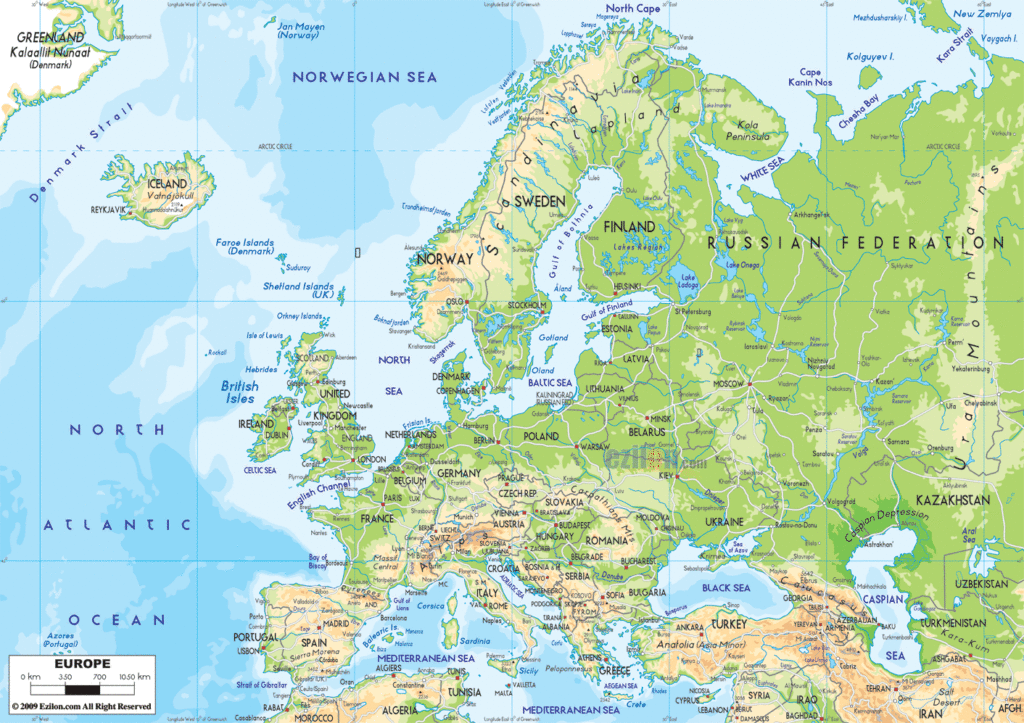
Physical Map of Vatican

Geography
The name “Vatican” was already in use in the time of the Roman Republic for the Ager Vaticanus, a marshy area on the west bank of the Tiber across from the city of Rome, located between the Janiculum, the Vatican Hill and Monte Mario, down to the Aventine Hill and up to the confluence of the Cremera creek. The territory of Vatican City is part of the Vatican Hill, and of the adjacent former Vatican Fields. It is in this territory that St. Peter’s Basilica, the Apostolic Palace, the Sistine Chapel, and museums were built, along with various other buildings. The area was part of the Roman rione of Borgo until 1929. Being separated from the city, on the west bank of the river Tiber, the area was an outcrop of the city that was protected by being included within the walls of Leo IV (847–855), and later expanded by the current fortification walls, built under Paul III (1534–1549), Pius IV (1559–1565), and Urban VIII (1623–1644).
When the Lateran Treaty of 1929 that gave the state its form was being prepared, the boundaries of the proposed territory were influenced by the fact that much of it was all but enclosed by this loop. For some tracts of the frontier, there was no wall, but the line of certain buildings supplied part of the boundary, and for a small part of the frontier a modern wall was constructed.
The territory includes St. Peter’s Square, distinguished from the territory of Italy only by a white line along the limit of the square, where it touches Piazza Pio XII. St. Peter’s Square is reached through the Via della Conciliazione which runs from close to the Tiber to St. Peter’s. This grand approach was constructed by Benito Mussolini after the conclusion of the Lateran Treaty.
According to the Lateran Treaty, certain properties of the Holy See that are located in Italian territory, most notably the Papal Palace of Castel Gandolfo and the major basilicas, enjoy extraterritorial status similar to that of foreign embassies. These properties, scattered all over Rome and Italy, house essential offices and institutions necessary to the character and mission of the Holy See.
Castel Gandolfo and the named basilicas are patrolled internally by police agents of Vatican City State and not by Italian police. According to the Lateran Treaty (Art. 3) St. Peter’s Square, up to but not including the steps leading to the basilica, is normally patrolled by the Italian police.
There are no passport controls for visitors entering Vatican City from the surrounding Italian territory. There is free public access to Saint Peter’s Square and Basilica and, on the occasion of papal general audiences, to the hall in which they are held. For these audiences and for major ceremonies in Saint Peter’s Basilica and Square, tickets free of charge must be obtained beforehand. The Vatican Museums, incorporating the Sistine Chapel, usually charge an entrance fee. There is no general public access to the gardens, but guided tours for small groups can be arranged to the gardens and excavations under the basilica. Other places are open to only those individuals who have business to transact there.
Climate
Vatican City’s climate is the same as Rome’s: a temperate, Mediterranean climate Csa with mild, rainy winters from October to mid-May and hot, dry summers from May to September. Some minor local features, principally mists and dews, are caused by the anomalous bulk of St Peter’s Basilica, the elevation, the fountains, and the size of the large paved square. The highest temperature ever recorded was 40.7 °C (105.3 °F), on both 2 August 2017 and 27 June 2022.
In July 2007, the Vatican accepted a proposal by two firms based respectively in San Francisco and Budapest, whereby it would become the first carbon neutral state by offsetting its carbon dioxide emissions with the creation of a Vatican Climate Forest in Hungary, as a purely symbolic gesture to encourage Catholics to do more to safeguard the planet. Nothing came of the project.
On 26 November 2008, the Vatican itself put into effect a plan announced in May 2007 to cover the roof of the Paul VI Audience Hall with solar panels.
Gardens
Within the territory of Vatican City are the Vatican Gardens (Italian: Giardini Vaticani), which account for about half of this territory. The gardens, established during the Renaissance and Baroque era, are decorated with fountains and sculptures.
The gardens cover approximately 23 hectares (57 acres). The highest point is 60 metres (197 ft) above mean sea level. Stone walls bound the area in the north, south, and west.
The gardens date back to medieval times when orchards and vineyards extended to the north of the Papal Apostolic Palace. In 1279, Pope Nicholas III (Giovanni Gaetano Orsini, 1277–1280) moved his residence back to the Vatican from the Lateran Palace and enclosed this area with walls. He planted an orchard (pomerium), a lawn (pratellum), and a garden (viridarium).


