Berkeley County is a county in the U.S. state of South Carolina. As of the 2020 census, its population was 229,861. Its county seat is Moncks Corner. After two previous incarnations of Berkeley County, the current county was created in 1882. Berkeley County is included in the Charleston–North Charleston, SC Metropolitan Statistical Area.
| Name: | Berkeley County |
|---|---|
| FIPS code: | 45-015 |
| State: | South Carolina |
| Founded: | 1882 |
| Named for: | Sir William Berkeley |
| Seat: | Moncks Corner |
| Largest city: | Goose Creek |
| Total Area: | 1,229 sq mi (3,180 km²) |
| Land Area: | 1,099 sq mi (2,850 km²) |
| Total Population: | 236,701 |
| Population Density: | 215.4/sq mi (83.2/km²) |
| Time zone: | UTC−5 (Eastern) |
| Summer Time Zone (DST): | UTC−4 (EDT) |
| Website: | www.berkeleycountysc.gov |
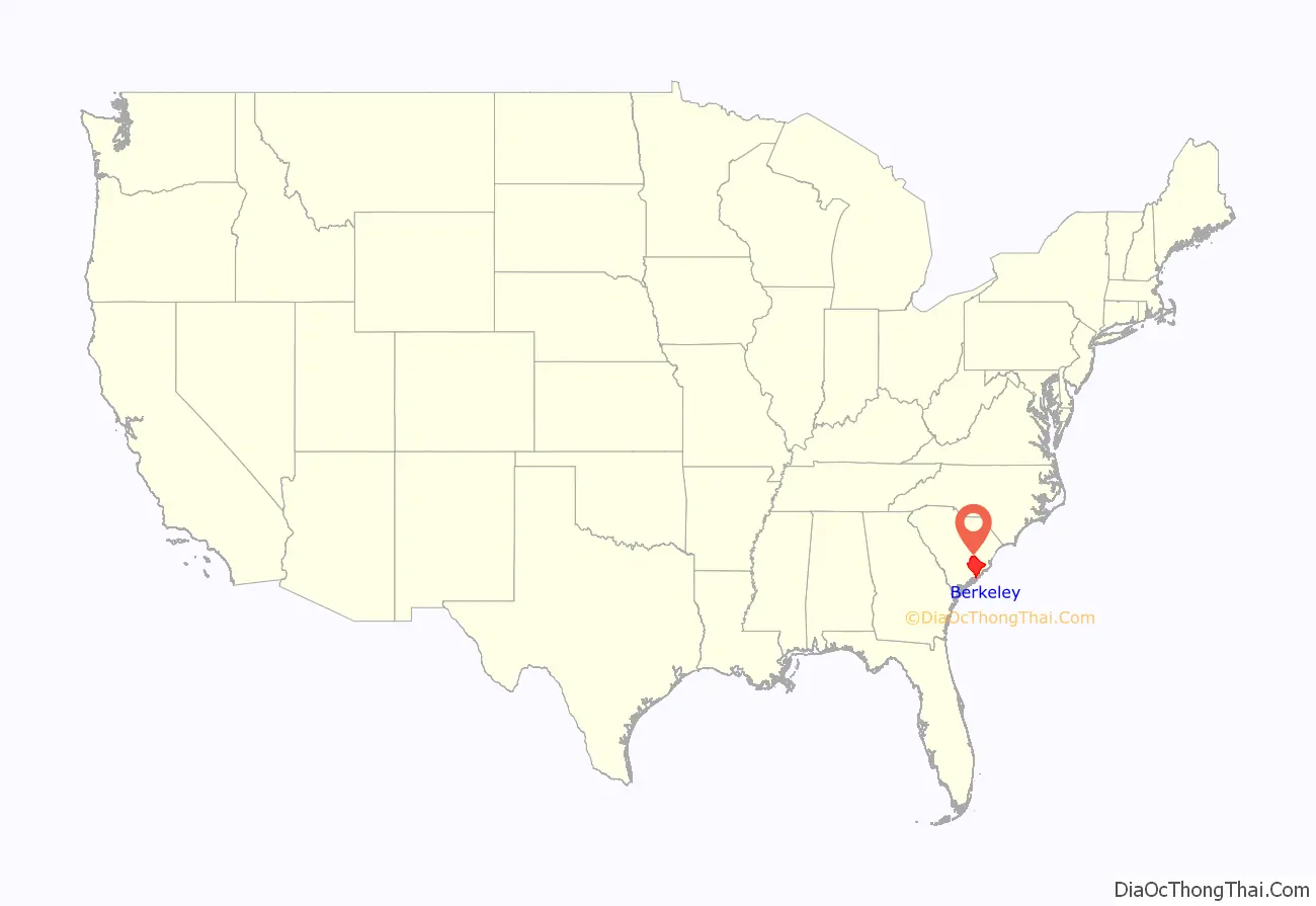
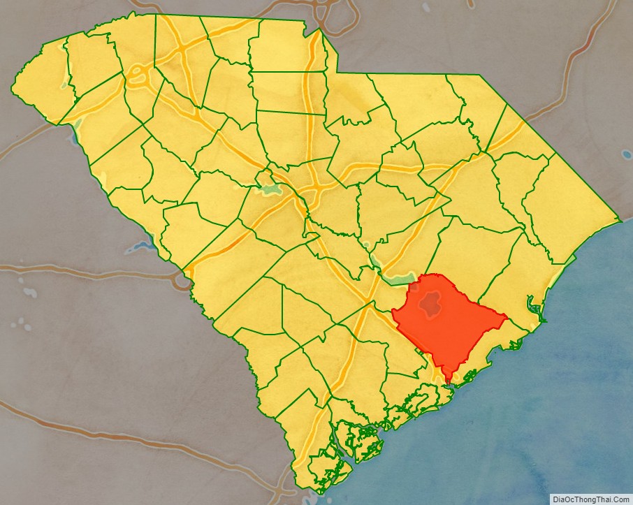
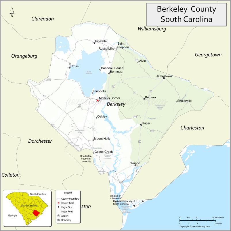
Berkeley County location map. Where is Berkeley County?
History
Berkeley County was established in 1682. It was named after John and William Berkeley, co-owners of the Province of Carolina. It became part of the Charleston District in 1769. It did not exist as a District during most of the 19th century and generally was part of the Low Country culture. In 1882, after Democrats regained control of the state legislature following the Reconstruction era, they established the current incarnation of Berkeley County, with its seat at Mount Pleasant. The county seat was moved in 1895 to Moncks Corner.
The Old Berkeley County Courthouse was listed on the National Register of Historic Places in 1971.
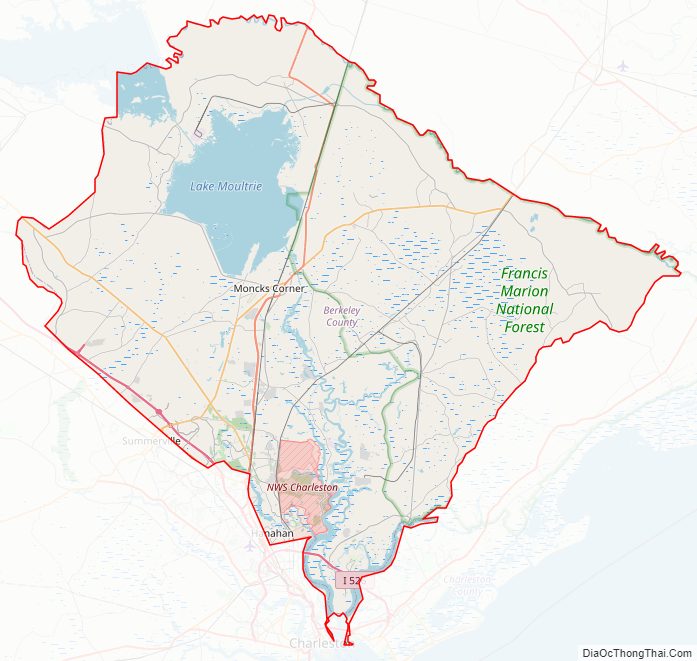
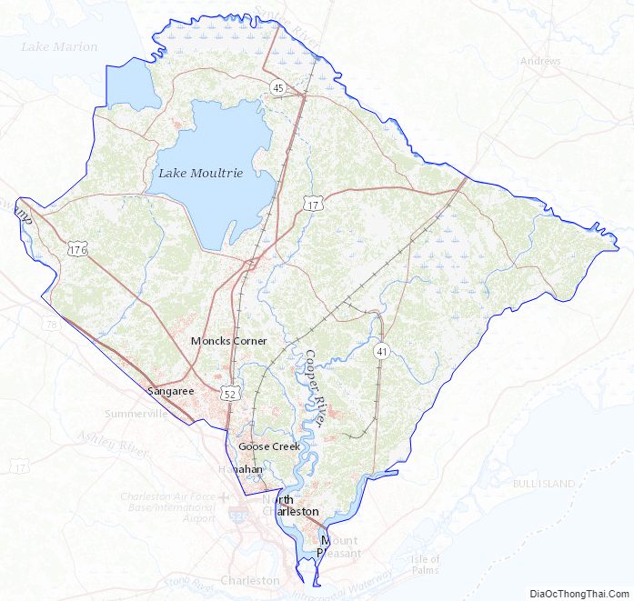
Berkeley County Road Map
Geography
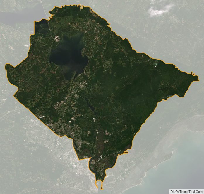
According to the U.S. Census Bureau, the county has a total area of 1,229 square miles (3,180 km), of which 1,099 square miles (2,850 km) is land and 130 square miles (340 km) (11%) is water.
National protected areas
- Francis Marion National Forest (part)
State and local protected areas/sites
- Bonneau Ferry Wildlife Management Area
- Canal Wildlife Management Area
- Cypress Gardens
- Hatchery Wildlife Management Area
- Old Santee Canal Park
- Site of Francis Marion Tomb
- Wee Tee Wildlife Management Area (part)
Major water bodies
- Cooper River
- Goose Creek Reservoir
- Lake Marion
- Lake Moultrie
- Santee River
- Wambaw Creek
- Wando River
Adjacent counties
- Georgetown County – east
- Williamsburg County – northeast
- Clarendon County – north
- Orangeburg County – northwest
- Dorchester County – west
- Charleston County – south
Major highways
- I-26
- I-526
- US 17 Alt.
- US 17 Alt. Truck
- US 52
- US 176
- SC 6
- SC 6 Truck
- SC 16
- SC 27
- SC 41
- SC 45
- SC 165
- SC 311
- SC 402
Major infrastructure
- Seed Orchard Helibase
Berkeley County Topographic Map
Berkeley County Satellite Map
Berkeley County Outline Map