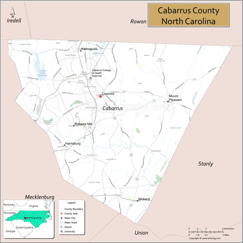
Cabarrus County (/kəˈbærəs/ kə-BARR-əs) is a county located in the south-central part of the U.S. state of North Carolina. As of the 2020 census, the population was 225,804. The county seat is Concord, which was incorporated in 1803. Cabarrus County is included in the Charlotte-Concord-Gastonia, NC-SC Metropolitan Statistical Area.
The first substantiated gold find in America took place in Cabarrus County in 1799, when Conrad Reed discovered gold in Little Meadow Creek. The Reed Gold Mine (now a National Historic Landmark) was founded, and resulted in a gold rush to the area in the early 1800s. While some cotton plantations were established, most of the land was developed for subsistence farming. By 1860 the population consisted of about one-third enslaved African Americans, with few free people of color. Industrialization had started before the war with the introduction of textile mills to process the cotton. More mill development took place, especially after the railroad was constructed to the town. Coleman Manufacturing Company, started in 1897, is believed to be the first cotton mill in the nation to be built, owned and operated by African Americans. It was owned by Warren Clay Coleman from Concord, John C. Dancy (federal collector of customs), and seven partners primarily from Wilmington, North Carolina. Investors included Washington Duke and capitalists in other parts of the state. Textile manufacturing continued to be integral to the regional economy until the late 20th century. In 2015, the Coleman-Franklin-Cannon Mill was listed on the National Register of Historic Places.
| Name: | Cabarrus County |
|---|---|
| FIPS code: | 37-025 |
| State: | North Carolina |
| Founded: | 1792 |
| Named for: | Stephen Cabarrus |
| Seat: | Concord |
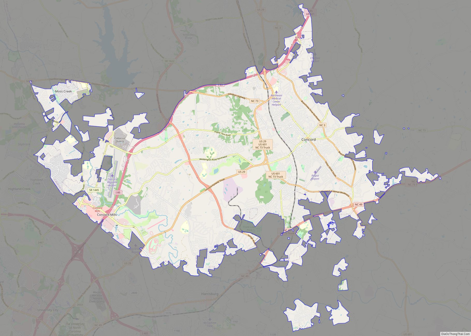
| Largest city: | Concord |
| Total Area: | 364 sq mi (940 km²) |
| Land Area: | 362 sq mi (940 km²) |
| Total Population: | 231,278 |
| Population Density: | 638.9/sq mi (246.7/km²) |
| Time zone: | UTC−5 (Eastern) |
| Summer Time Zone (DST): | UTC−4 (EDT) |
| Website: | www.cabarruscounty.us |
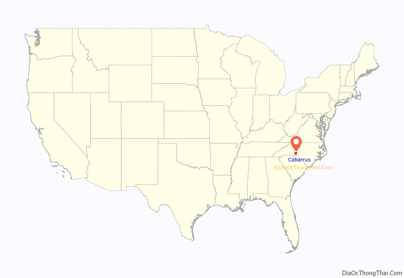
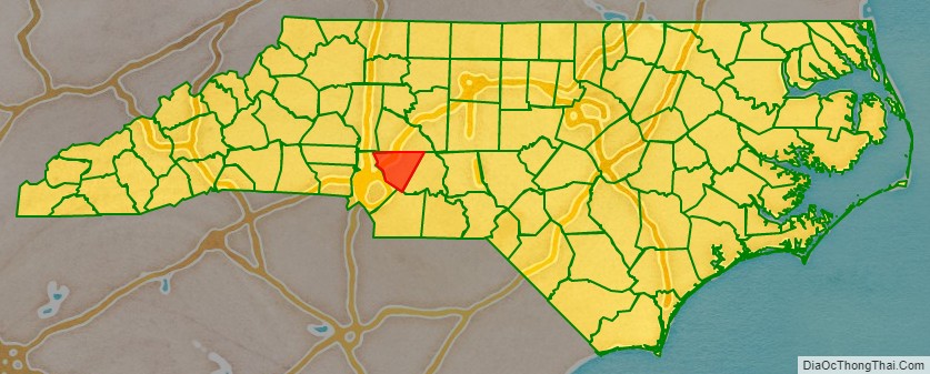
Cabarrus County location map. Where is Cabarrus County?
History
The county was formed on December 29, 1792, from Mecklenburg County. Located in the Piedmont, it was named after Stephen Cabarrus of Chowan County, speaker of the North Carolina House of Commons.
Catawba Indians were the primary inhabitants of the area until beginning about 1750, the county was settled mainly by immigrants: Germans on the eastern side and Scotch-Irish in the western area of the county. When it came time to choose a location for the county seat and county government, each ethnic group wanted the county seat located close to their populations and could not reach agreement on a site. Stephen Cabarrus wrote to the citizens pleading with them to come together in peace to choose a location for their county seat. A central area of the county was chosen in 1796 and aptly named Concord, a derivative of two French words “with” and “peace.” Representative Paul Barringer introduced a bill into the state legislature to incorporate Concord; it passed on December 17, 1806. The town of Concord was begun on land owned by Samuel Huie and wife Jane Morrison Huie.
The first substantiated gold find in America was in 1799 by young Conrad Reed while playing in Little Meadow Creek, located on the Reed farm in southeastern Cabarrus County. According to research, Conrad’s find was a gold chunk approximately the size of a shoe and weighing 17 pounds. His father John Reed took the nugget into Concord to a silversmith, who informed Reed that the rock did not have any value. The elder Reed returned home with it, holding it for three years until a trip in 1802 to Fayetteville, where he sold the “nugget” to a jeweler for $3.50. Over time John Reed learned that the jeweler sold the large nugget for several thousand dollars. Reed returned to Fayetteville insisting on more just compensation. This discovery and news of the sale spurred the beginning of gold mining in the area.
John Reed, or Johannes Rieth as he is known in records of the Staatsarchiv at Marburg, Germany, was one of thousands of Hessian soldiers brought over by British troops to fight against rebellious colonists in the American Revolution. Reed deserted, as did many other Hessians. He traveled from Georgia to North Carolina, where he settled in an ethnic German community sometime around 1787 and began farming.
Reed first developed placer mining on his property, then underground mining, and became wealthy from the gold. His facility became known as Reed’s Gold Mine. Large amounts of gold were being discovered at the Reed Gold Mine and in other mines in the United States; these mine owners began to use their gold to create currency. For the government to retain control of the production of currency and keep a stabilized economic structure, President Andrew Jackson signed into legislation the authorization to create branches of the US Mint. The Charlotte Mint was built to handle the gold coming from the rich gold veins of North Carolina, including Reed’s.
The Reed Gold Mine was designated a National Historic Landmark, as it was the first gold mine in the country. Gold was mined in North Carolina into the early 20th century. Today visitors at the site can explore some of the mine’s reconstructed tunnels.
Agricultural and industrial development
Located in the Piedmont region, the county was developed largely for subsistence farming, but did have some cotton plantations. By 1860 the population was about one-third enslaved African Americans, with few free people of color. The first cotton mill was constructed as early as 1839. More mill development took place after the American Civil War, when railroads reached the region.
Among the owners of new mills in the area were men of the rising black middle-class of Wilmington, North Carolina, such as John C. Dancy (appointed as collector of customs at the port), and others. Warren Clay Coleman, a Concord African-American businessman, joined them in organizing Coleman Manufacturing Company in 1897, on a site about two miles from Concord. They built and operated what is believed to have been the first cotton mill in the nation to be owned by blacks. They wanted to promote economic security for people of color. Richard B. Fitzgerald was its first president. While blacks had been hired for tobacco manufacturing, they were generally excluded from white-owned textile mills.
The Wilmington Insurrection of 1898, with white attacks on blacks, their homes and businesses, destroyed much of what the people had built there since the war. In 1900 Dancy was among more than 2000 blacks who left the city permanently after the riot, resulting in its becoming majority white. He moved to Washington, DC, where he was appointed as the federal Recorder of Deeds.
Agriculture has played an important part in the economic life of the county for over 200 years. In the late 19th and early 20th centuries, textiles became a vital part of the local economy, especially in the northern portion of the county. Today, the local economy has a more varied base.
National Register of Historic Places
The old Cabarrus County Courthouse was finished in 1876. Recognized as significant in the 20th century, it was listed on the National Register of Historic Places in 1974. The Confederate soldiers monument is located on the front lawn area.
Also listed on the NRHP is the Coleman-Franklin-Cannon Mill, notable as the first cotton mill owned and operated by African Americans, and also for its decades-long record of industrial design in textile manufacturing, with numerous contributing structures built through the early 20th century.
Among other NRHP sites in Cabarrus County is the Bethel Church Arbor, located adjacent to Bethel United Methodist Church approximately one mile north of the historic crossroads (and railroad stop) of Cabarrus Station. The Arbor dates back to the early 1800s as a location for religious revival “camp meetings” and the current structure was built around 1878, and was in use through the 1920s.
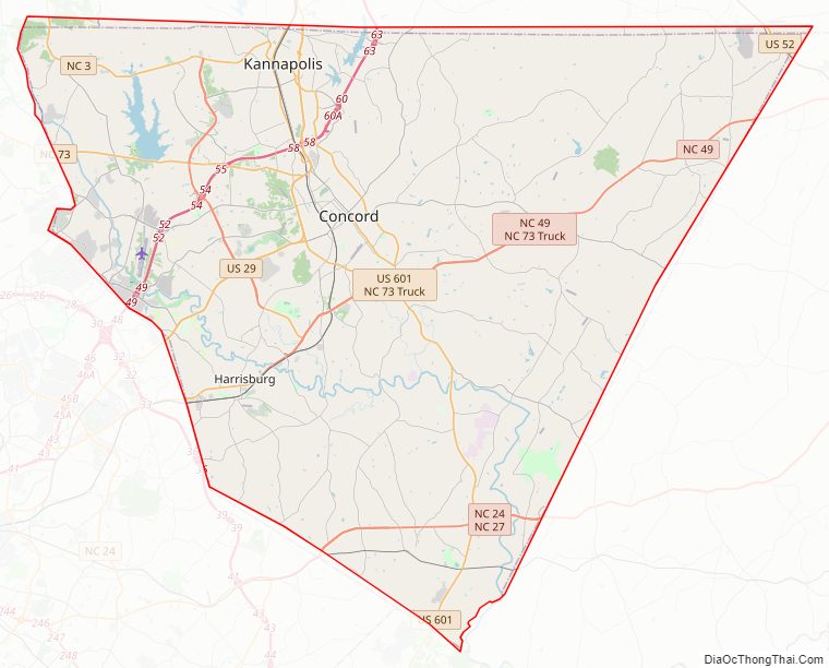
Cabarrus County Road Map
Geography
According to the U.S. Census Bureau, the county has a total area of 364 square miles (940 km), of which 362 square miles (940 km) is land and 2.7 square miles (7.0 km) (0.7%) is water.
Cabarrus County is situated in the gently rolling countryside of the Carolina Piedmont There are no significantly high peaks or points, although the eastern half of the county contains the westernmost foothills of the Uwharrie Mountains. Altitude ranges from approximately 500–800 feet above sea level. No large or navigable rivers flow through the county; the nearest navigable waterway is the Yadkin River in nearby Rowan County. Land slope is generally toward the southeast. The longest waterway within the county is Rocky River, which rises in Iredell County and empties into the Pee Dee below Norwood in Stanly County. Weather is temperate with hot summers and mild to chilly winters. Severe weather occurs occasionally, with thunderstorms in the warmer months of the year and ice storms and snowfalls occurring on occasion in winter. From zero to three accumulating snowfalls may be expected in an average winter. Snow generally melts between accumulating snowfalls, and there is no consistent snowpack. An average of four inches (102 mm) of snow and 46 inches (1,200 mm) of rain falls each year. At summer solstice, the length of day is approximately 14 hours and 33 minutes, with visible light lasting 15 hours and 32 minutes.
State and local protected areas/sites
- Buffalo Creek Preserve
- Reed Gold Mine
- Pharr Family Preserve Trail
Major water bodies
- Adams Creek (Dutch Buffalo Creek tributary)
- Back Creek (Rocky River tributary)
- Black Run Creek
- Black Run Reservoir
- Coddle Creek
- Don T. Howell Reservoir
- Dutch Buffalo Creek
- Jennie Wolf Creek
- Lake Concord
- Lake Fisher
- Little Buffalo Creek (Dutch Buffalo Creek tributary)
- Rocky River
Adjacent counties
- Rowan County – north
- Stanly County – east
- Union County – south
- Mecklenburg County – west-southwest
- Iredell County – north
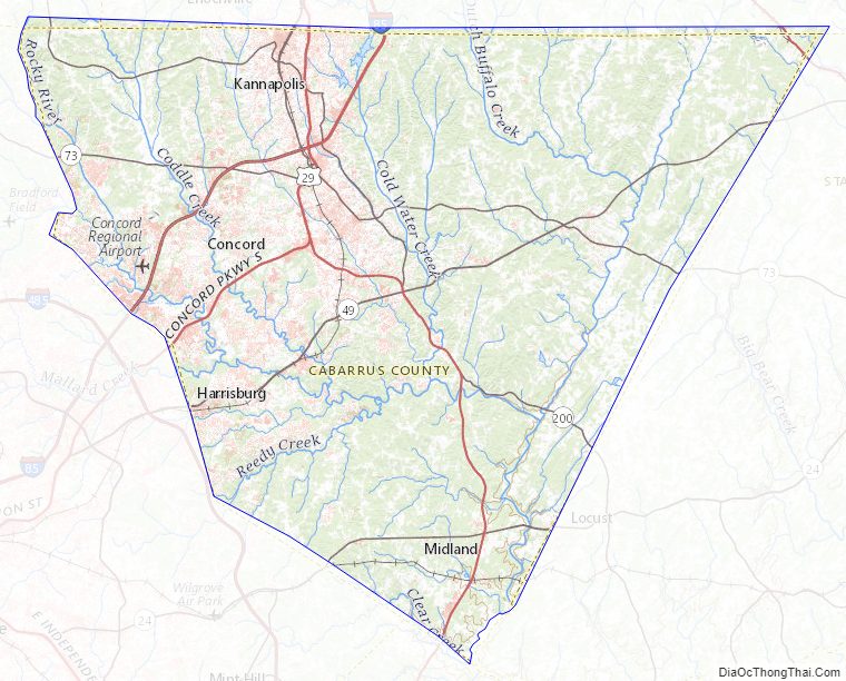
Cabarrus County Topographic Map
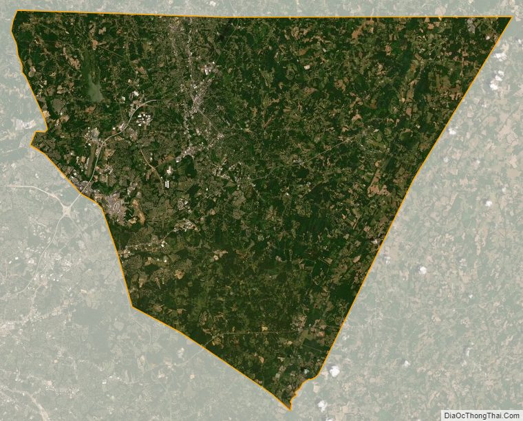
Cabarrus County Satellite Map
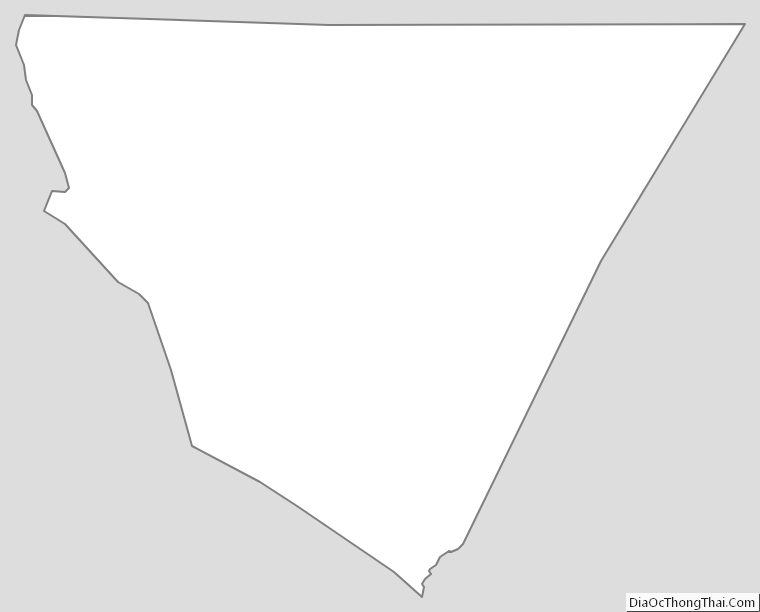
Cabarrus County Outline Map